
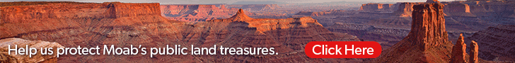
- Attractions
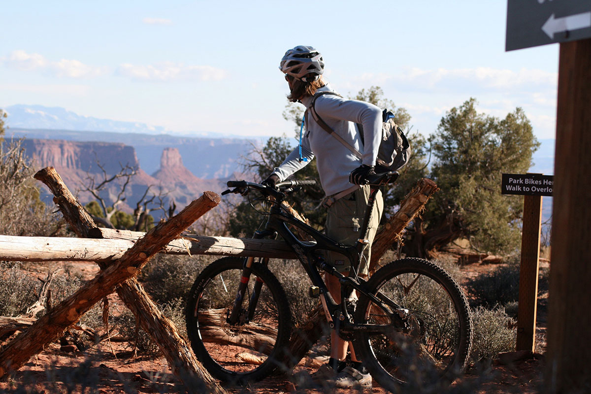
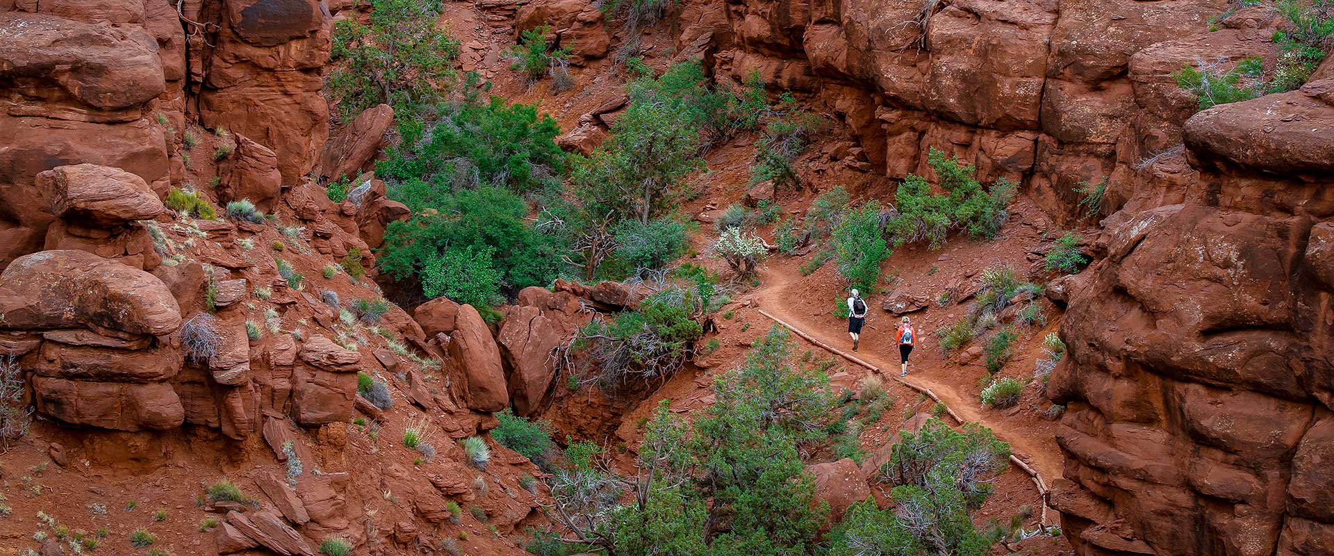
- Activities
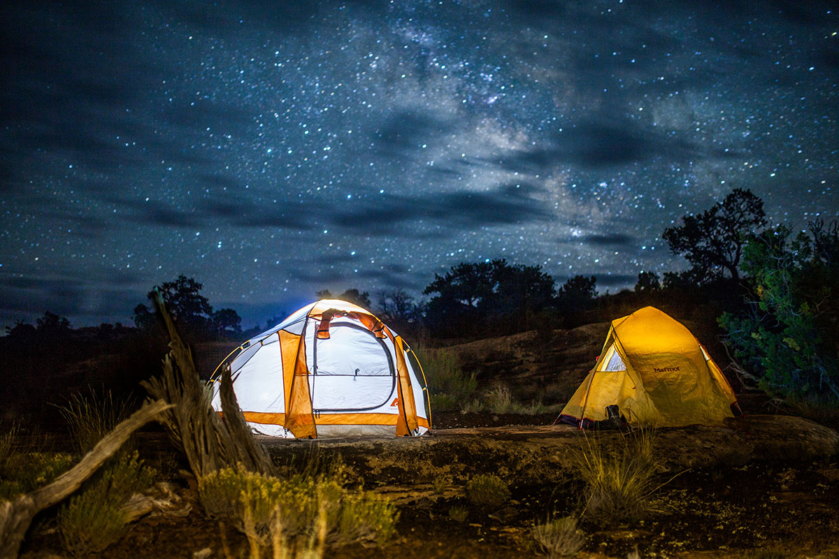
- Lodging + Campgrounds
- Area Info
- Services
- Transportation

Moab Information Center
Welcome to Moab
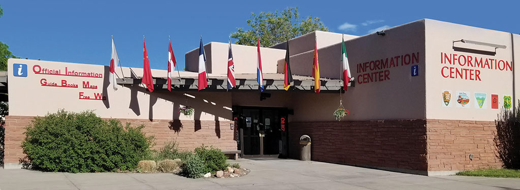
Once you arrive in Moab, your first stop should be the Moab Information Center (MIC). Conveniently located at the corner of Main and Center Street in Moab, the MIC offers information on recreational opportunities and visitor services throughout southeastern Utah. Allow some time for the interpretive displays and large gift shop featuring guide books, maps, videos, videos, postcards, and much more.
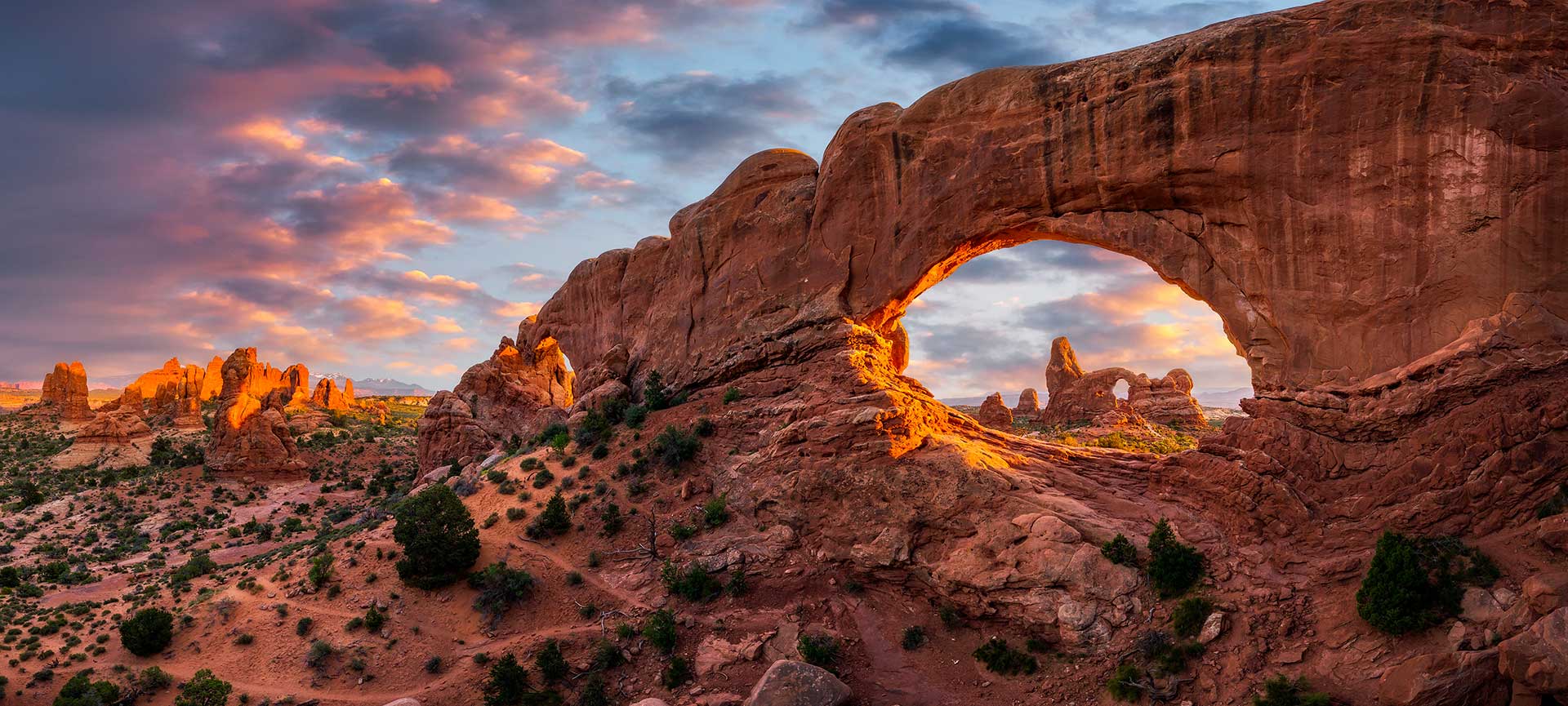
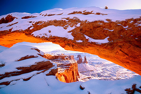
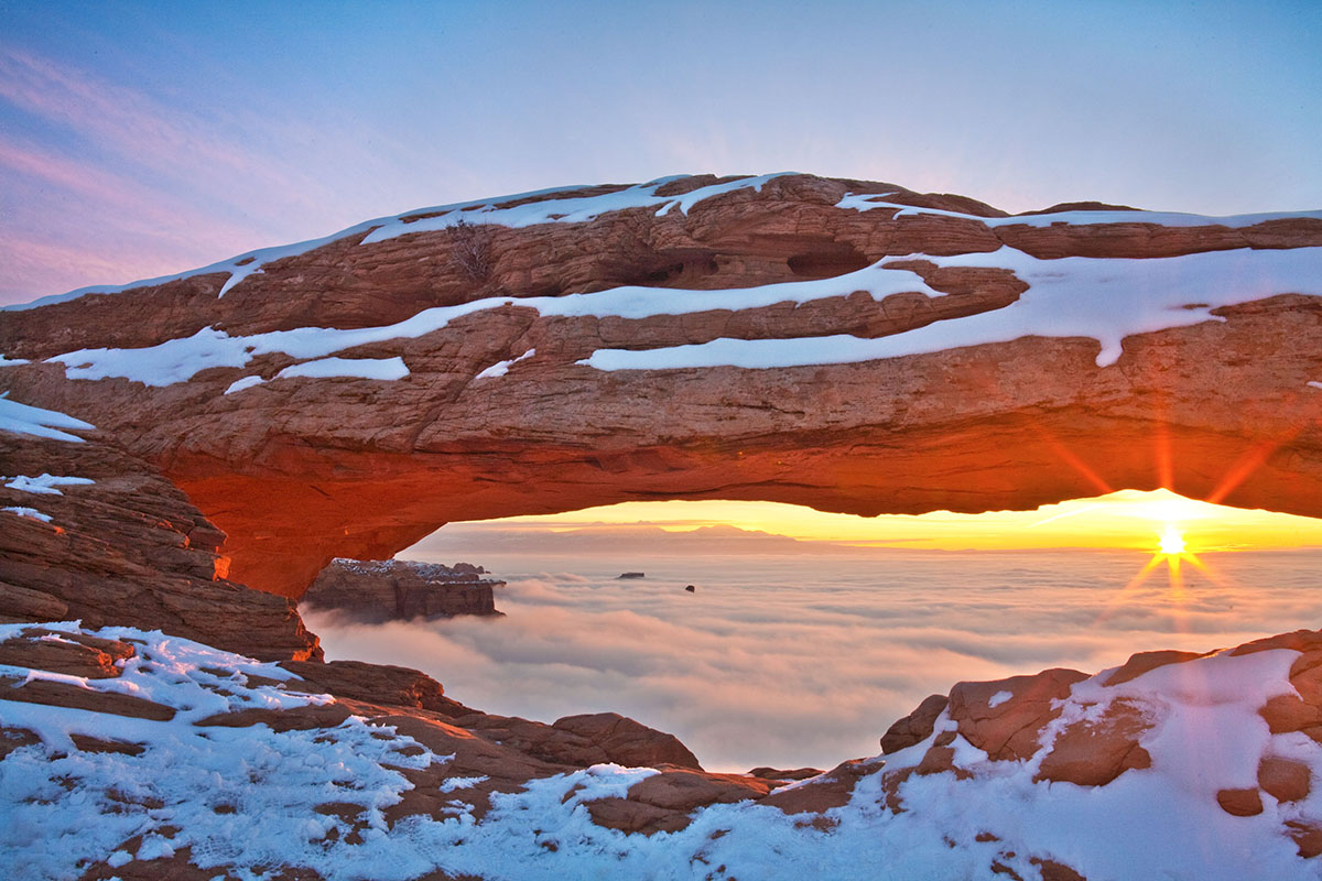
Arches National Park
The world’s largest concentration of natural sandstone arches.
Arches National Park’s Twitter page is a great source of up-to-the-minute park information. Check it out here.
Mailing Address
Arches National Park P.O. Box 907 Moab, UT 84532Visitors Center GPS Coordinates
38.616391, -109.620345Website
www.nps.gov/archMailing Address
Arches National Park P.O. Box 907 Moab, UT 84532Visitors Center GPS Coordinates
38.616391, -109.620345Websites
www.nps.gov/arch/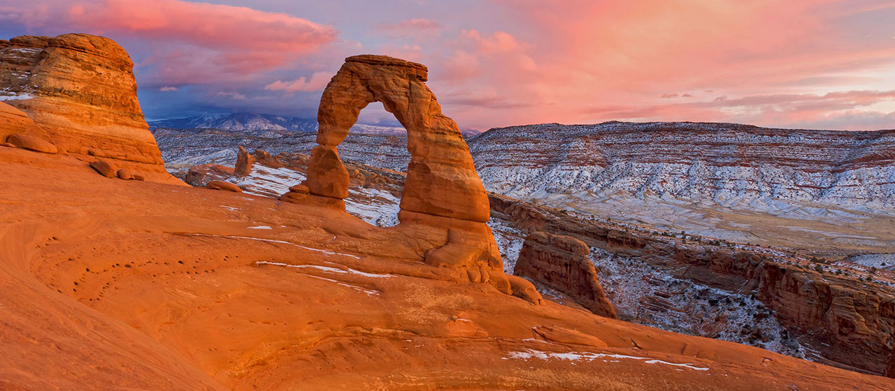

Please note that food is not available within the park. The closest restaurants are either in the town of Moab, at Dead Horse Point State Park, or at the dinosaur museum at the intersection of Highways 191 and 313 (entrance fee is not required to access the restaurant).
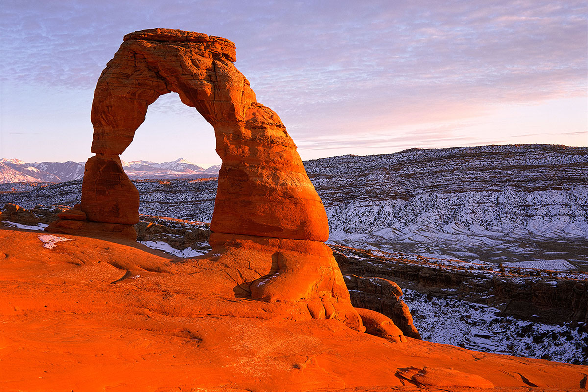
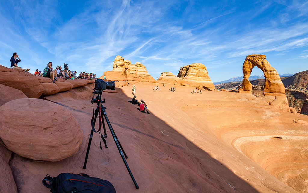
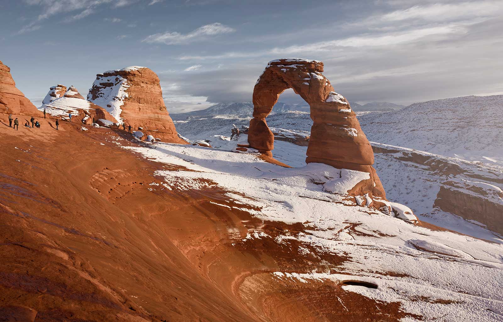
People come from all over the world to visit Arches National Park, and visiting Delicate Arch is on the top of many visitors’ to-do lists. In a park with over 2,000 stone arches, this particular free-standing arch has become a widely recognized symbol of the state of Utah and one of the most famous geologic features in the world. The light opening beneath the arch is 46 feet high and 32 feet wide, making it the largest free-standing arch in the park.
Learn More About Delicate Arch Hiking Trail
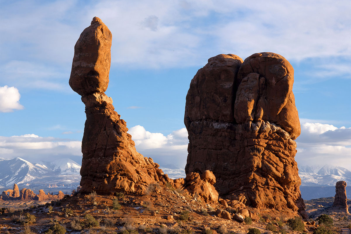
A short paved trail leads visitors to the base of Balanced Rock. The landform’s total height is 128 feet, with the huge balanced rock rising 55 feet above its base.
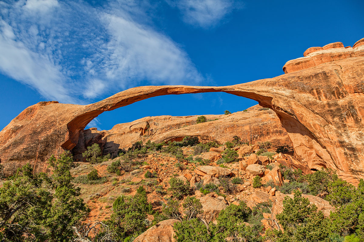
The longest natural rock span in the world, this arch’s opening is 306 feet wide – 6 feet longer than a football field. A nine story building would easily fit beneath this thin span. In 1991, a massive slab of rock fell from its underside, resulting in an even thinner ribbon of rock.
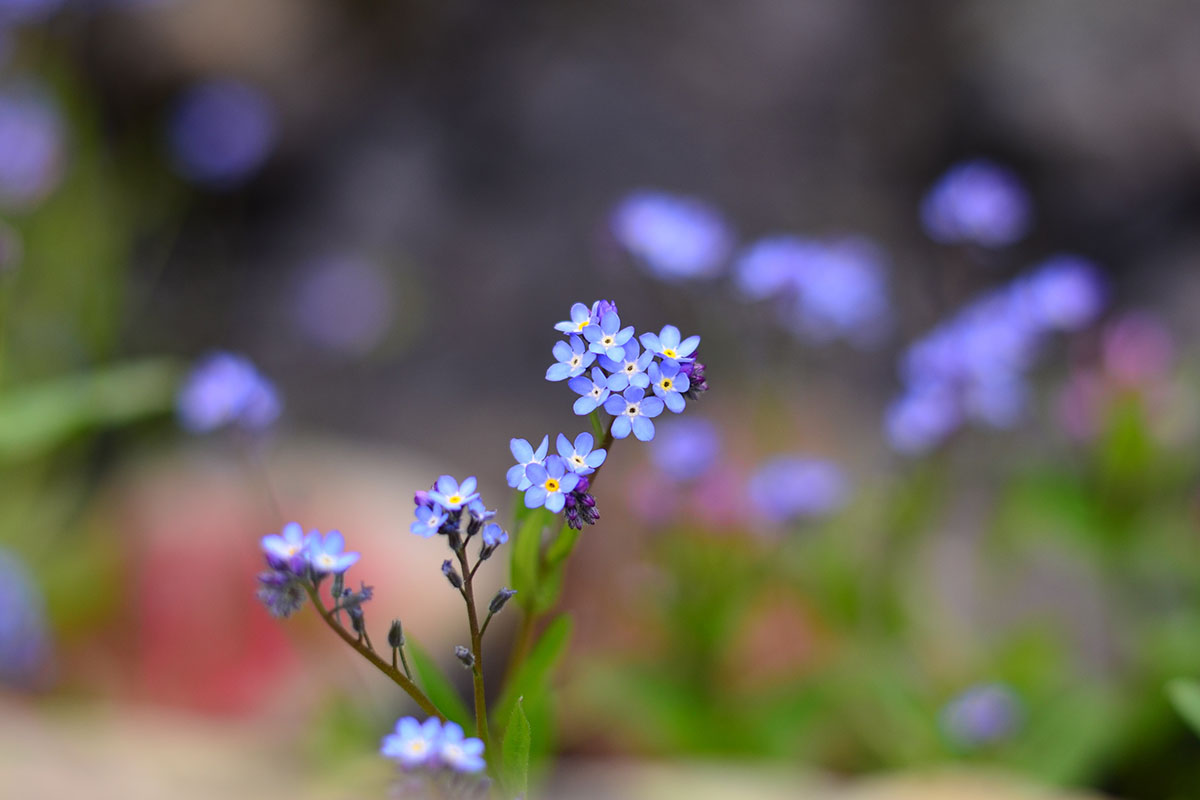
April and May bring a variety of desert wildflowers to Arches.
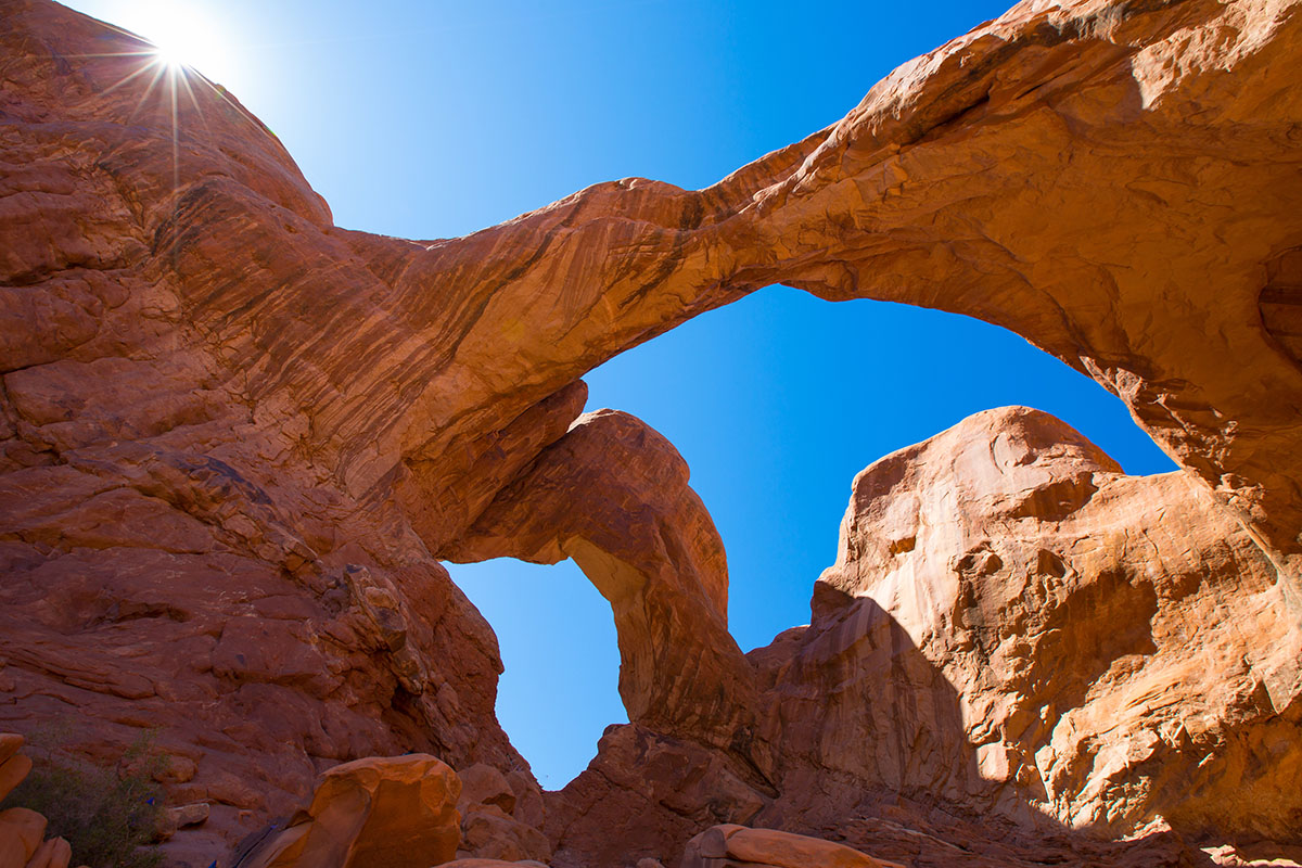
Located in the Windows Section of Arches National Park, Double Arch was used as a backdrop for portions of the 1988 movie “Indiana Jones and the Last Crusade”. Numerous other movies have been filmed in Arches National Park, including Thelma and Louise in 1991.
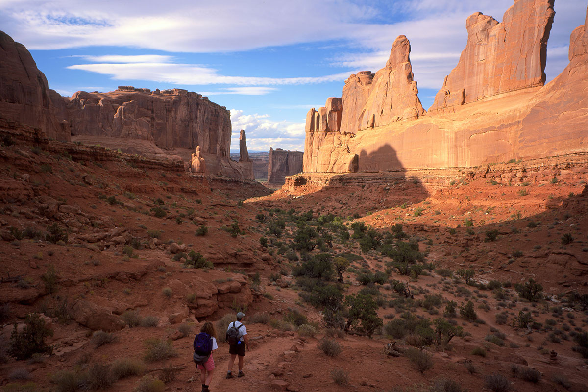
From Park Avenue parking area, the trail descends steeply into a spectacular canyon and continues down the wash to Courthouse Towers. If you have a shuttle driver, you can begin at one point and be picked up at the other. For round-trip hiking, retrace your steps along the trail rather than walk along the park road.
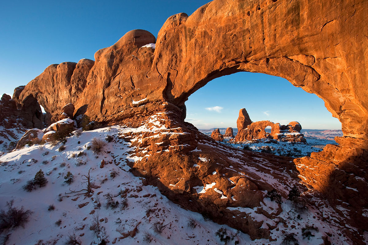
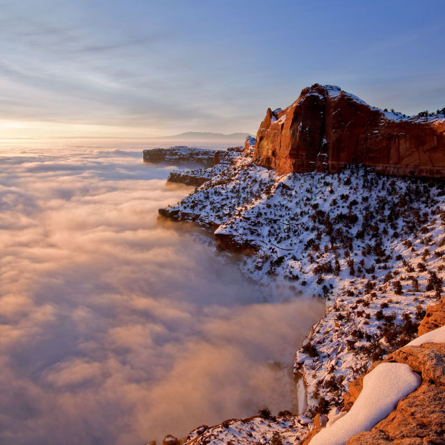
Winter brings a blanket of pristine snow to Arches, providing dramatic contrast to the surrounding red rocks.
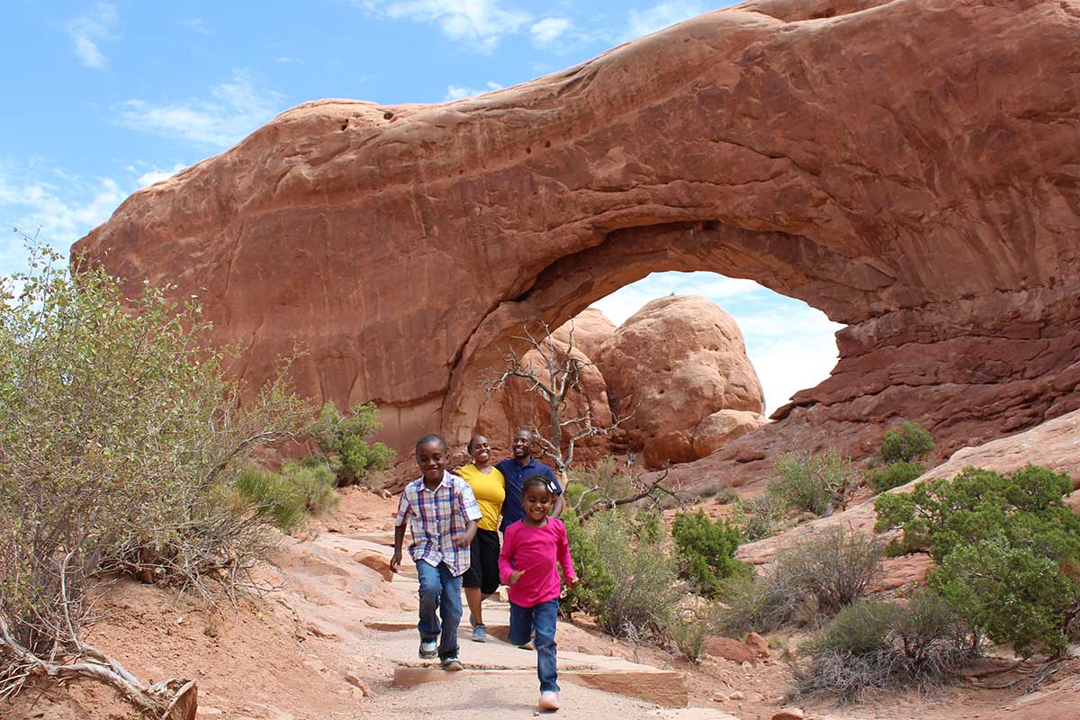
There are many family friendly hikes in Arches, including the hike to Turret Arch in the Windows Section.
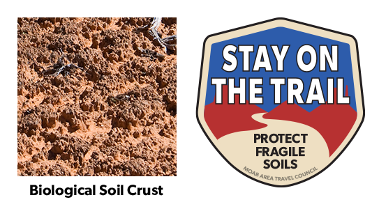
Your help is crucial in preserving our trails and protecting the fragile soil that sustains the desert ecosystem. The biological soil crust, also known as cryptobiotic soil, serves as the foundation for desert plant life. This unique black, knobby crust is composed of diverse living organisms and plays a vital role in maintaining the delicate balance of the desert environment.
However, this soil crust is exceptionally delicate and can take several decades to regenerate. Even a single footstep can cause irreparable damage that can persist for years, impacting the entire ecosystem. We urge you to stay on designated roads, routes, and trails to ensure the preservation of this fragile life. In areas where hiking trails are not established, it is advisable to hike on sandy washes or bare rock surfaces to minimize the impact on the soil.
By remaining vigilant and adhering to these guidelines, you contribute to the long-term sustainability of the desert ecosystem and help safeguard its natural beauty for generations to come. Let’s work together to keep all of our trails open and protect the invaluable biological soil crust.
Try not to limit your creativity by simply capturing images of iconic places using the same composition as countless photographers before you. Arches National Park contains thousands of arches and vast expanses of breathtaking scenery just waiting for you to introduce your own personal style and interpretation. For those seeking solitude, Arches has much to offer beyond its iconic places. For example, consider a hike to Double O Arch, returning via the Primitive Trail, for some of the most spectacular scenery in the park. Just remember to bring enough memory cards to capture all of the great views!
| Early Morning | Late Afternoon |
| Moab Fault | Park Avenue |
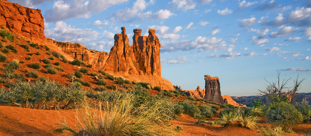
| The Three Gossips | Courthouse Towers |
| Sheep Rock | Petrified Dunes |
| The Great Wall | Balanced Rock |
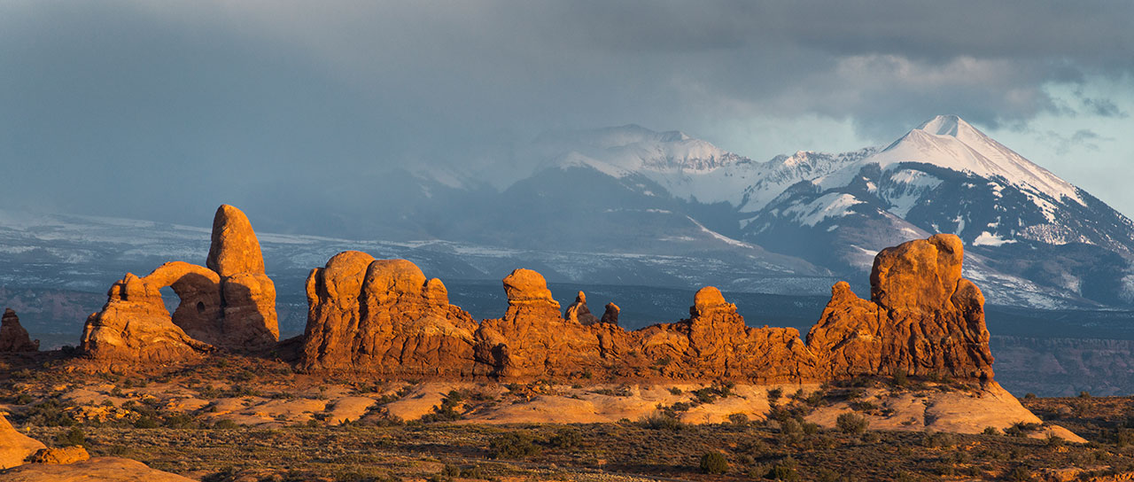
| Turret Arch | The Garden of Eden |
| The Spectacles | North and South Windows |
| Double Arch | Delicate Arch (at end of main trail) |
| Cache Valley | Fiery Furnace |
| Wolfe Ranch | Skyline Arch |
| Landscape Arch | Fins in Devil Garden |
| Double O Arch | Tower Arch |
Canyonlands Natural History Association
Canyonlands Natural History Association (CNHA) is a nonprofit organization assisting the National Park Service in its educational, interpretive and scientific programs throughout southeast Utah. Known as a "cooperating association," CNHA’s goals include enhancing visitors’ understanding and appreciation of public lands by providing a selection of quality, educational materials for sale in many vistor centers. Twenty percent of these sales is returned to the National Park Service and other federal land management agencies.
CNHA operates the bookstore at Arches Visitor Center.
Friends of Arches and Canyonlands Parks
The Friends of Arches and Canyonlands Parks: Bates Wilson Legacy Fund provides direct support to Arches and Canyonlands national parks and Natural Bridges and Hovenweep national monuments in order to enhance existing projects in these spectacular areas, and to conserve the land and its cultural treasures for present and future generations to enjoy.
This mission honors the legendary work of Superintendent Bates Wilson, who came to Arches in 1949, inspiring and leading the effort that resulted in the establishment of Canyonlands National Park in 1964. The Friends Group offices are in the Rock House behind Arches Visitor Center, where Bates once lived with his family.
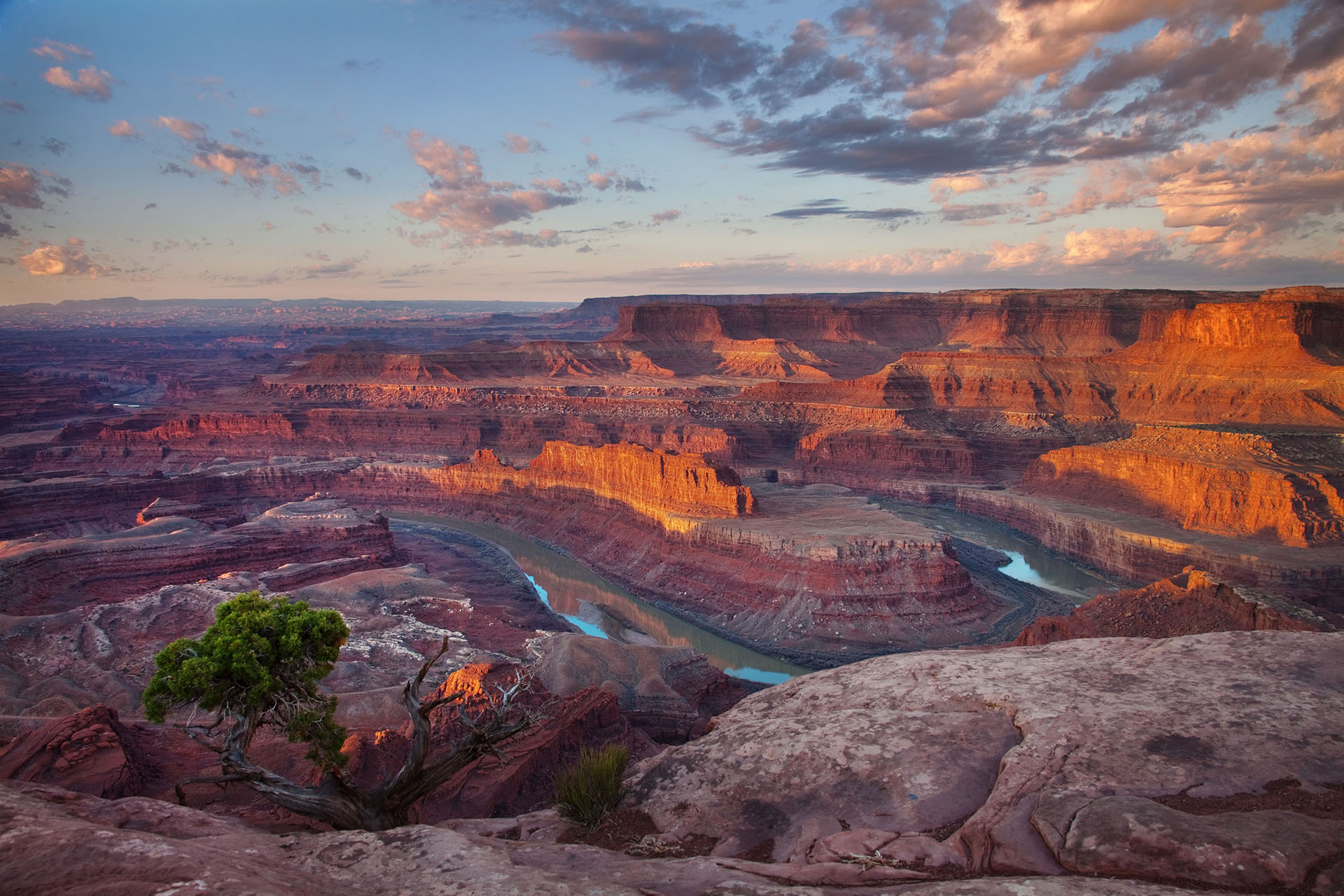
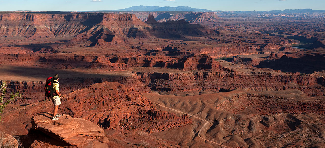
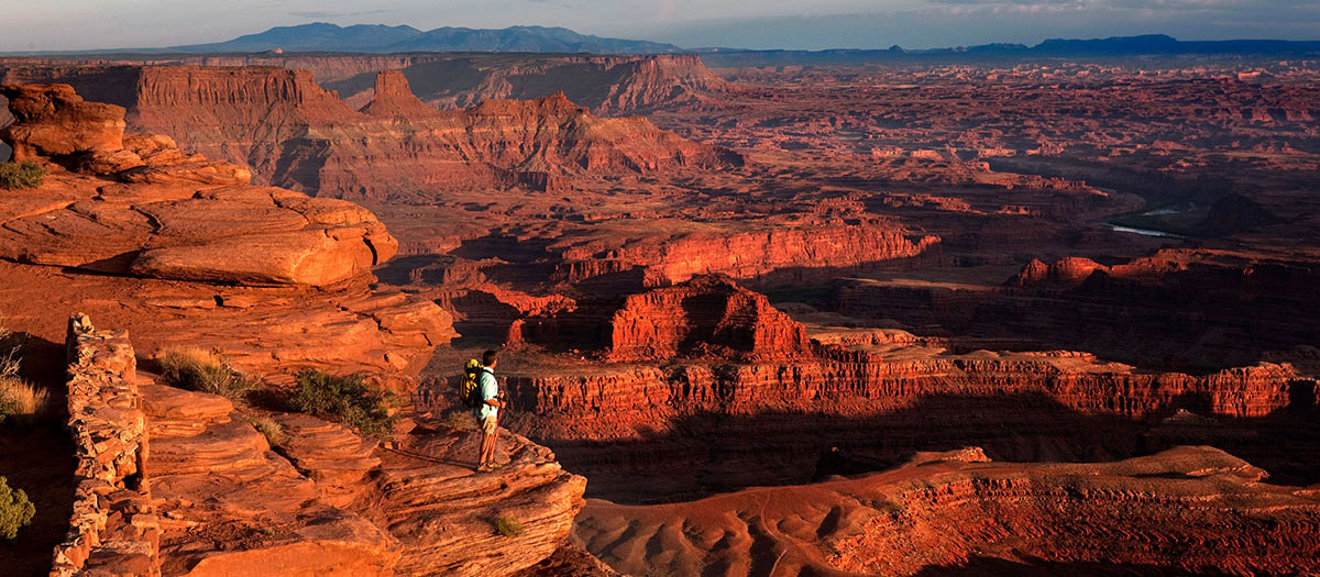
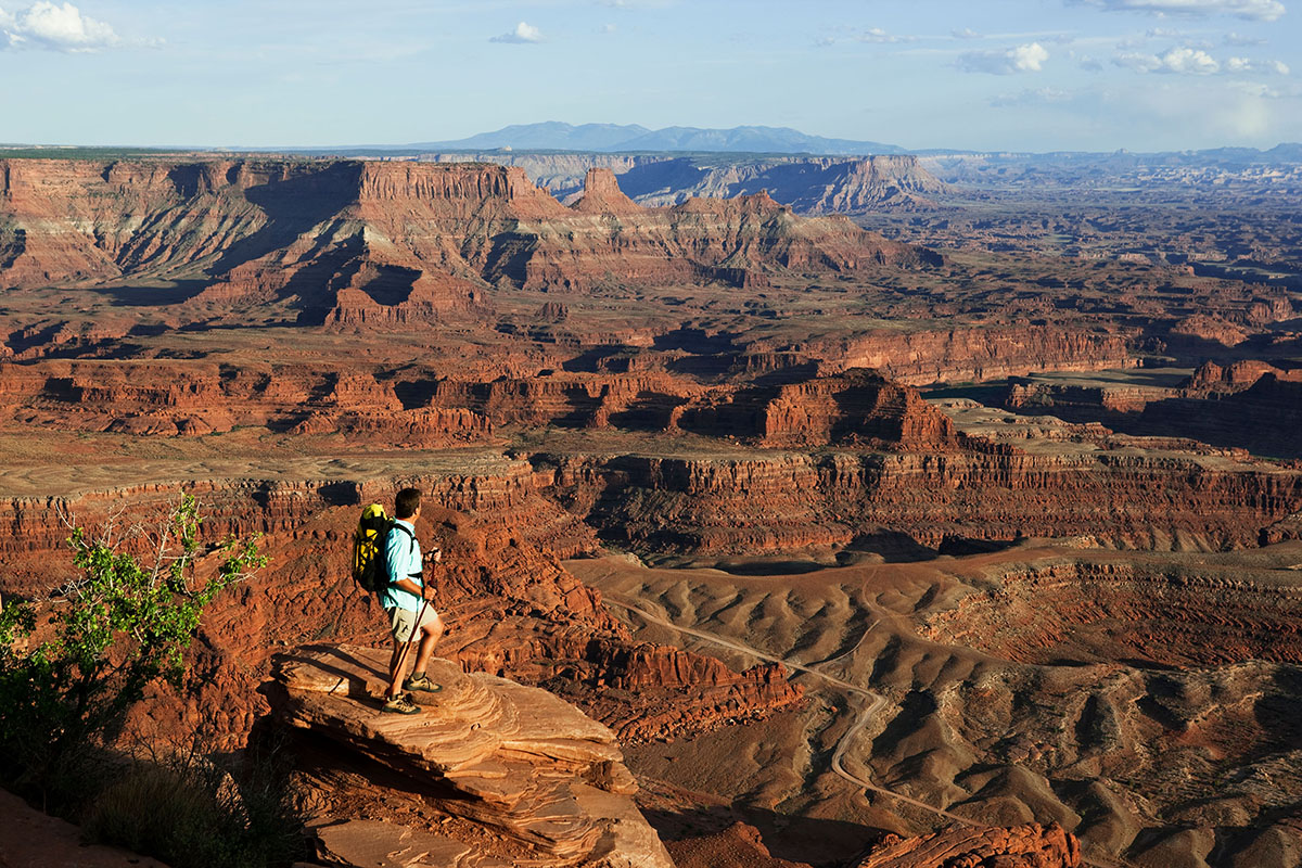
Dead Horse Point State Park
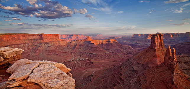
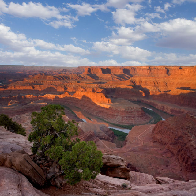
The view from Dead Horse Point is one of the most photographed scenic vistas in the world.
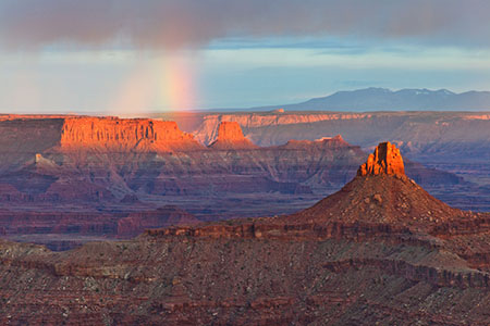
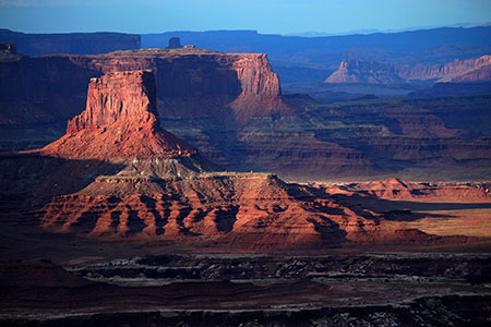
32 miles (51.5 km) from Moab, Dead Horse Point State Park is one of Utah’s most spectacular state parks. The view from Dead Horse Point is one of the most photographed scenic vistas in the world. Towering 2,000 feet above the Colorado River, the overlook provides a breathtaking panorama of Canyonlands’ sculpted pinnacles and buttes. Millions of years of geologic activity created the spectacular views from Dead Horse Point State Park. Deposition of sediments by ancient oceans, freshwater lakes, streams and wind blown sand dunes created the rock layers of canyon country. Igneous activity formed the high mountains that rise like cool blue islands from the desert below.
The legend of Dead Horse Point states that in the late 1800’s the point was used as a corral for wild mustangs roaming the mesa top. Cowboys herded them across the narrow neck of land and onto the point. The neck was then fenced off with branches and brush. One time, for some unknown reason, horses were left corralled on the waterless point where they died of thirst within view of the Colorado River 2,000 feet below.
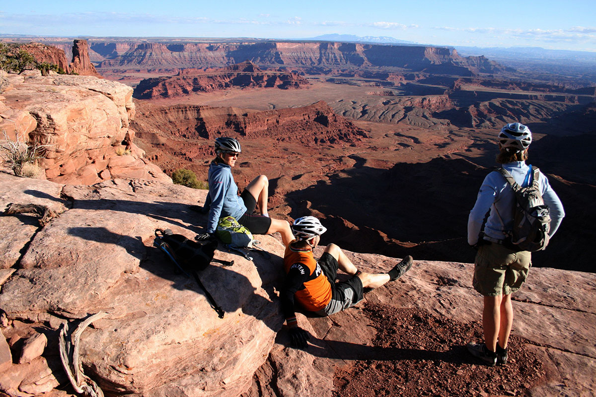
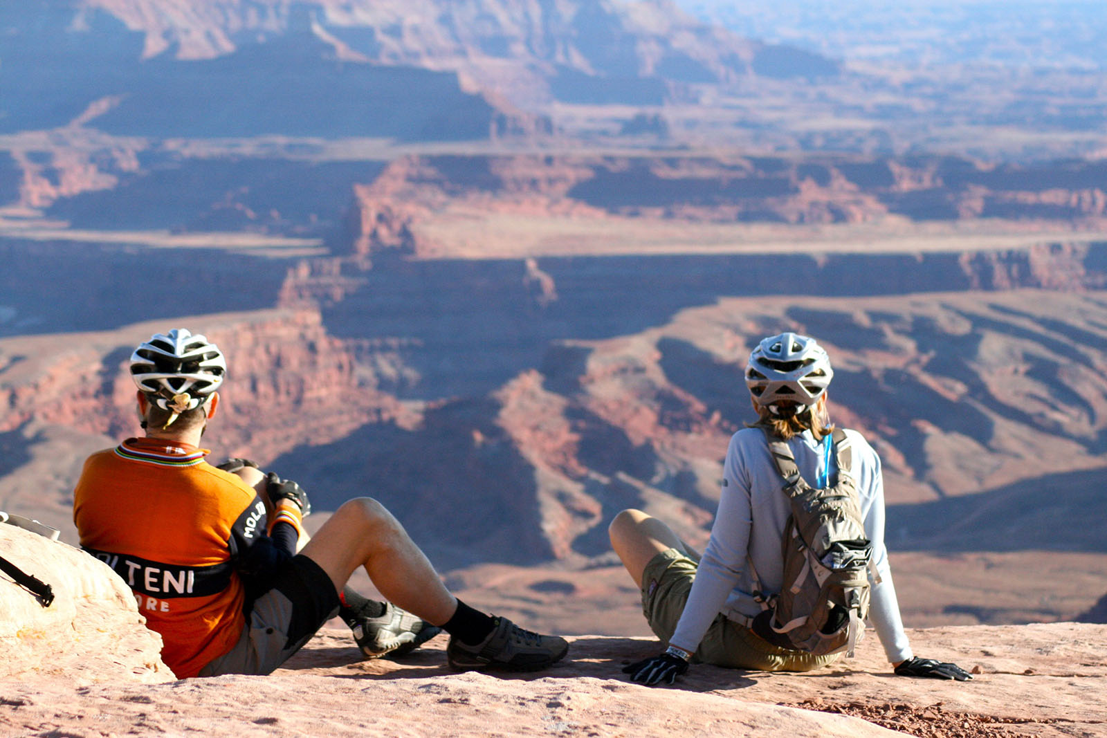
There are miles of pet-friendly developed hiking trails in the park, including a paved trail which provides easy access to some of the most scenic views. Mountain Bikers will love the new Intrepid Trail System at Dead Horse Point. With slickrock sections, looping singletrack, sandy washes, and incredible scenery, the Intrepid Trail System provides a great taste of what Moab mountain biking is all about. This is the perfect ride for families and offers spectacular views of the Colorado River and Canyonlands National Park.
Mailing Address
Dead Horse Point State Park
P.O. Box 609
Moab, UT 84532
Visitors Center GPS Coordinates
38.487767, -109.735997
Website
Mailing Address
Dead Horse Point State Park
P.O. Box 609
Moab, UT 84532
Visitors Center GPS Coordinates
38.487767, -109.735997
Website
Eight miles of pet friendly hiking trails in the park include two joining loops around the rim and several spurs to beautiful viewpoints.
The Intrepid Trail System has three hiking and biking loops ranging from one to nine miles with varying degrees of difficulty.
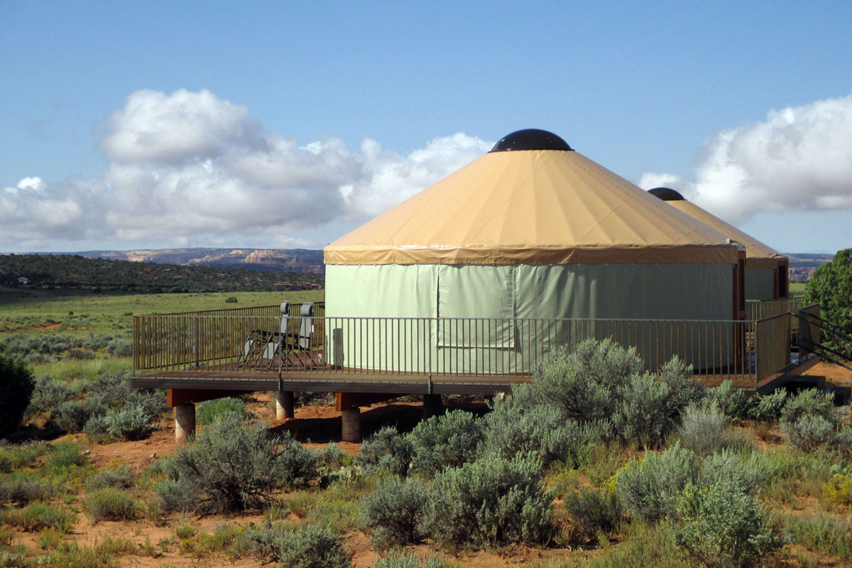
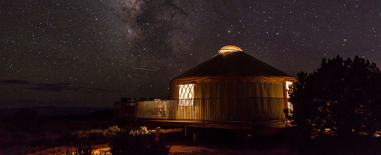
Nine yurts are available for overnight use and are available by reservation. Open year-round.
Dead Horse Point’s combination of breathtaking scenery and easy accessibility has made it a must-see for visitors to the Moab area.
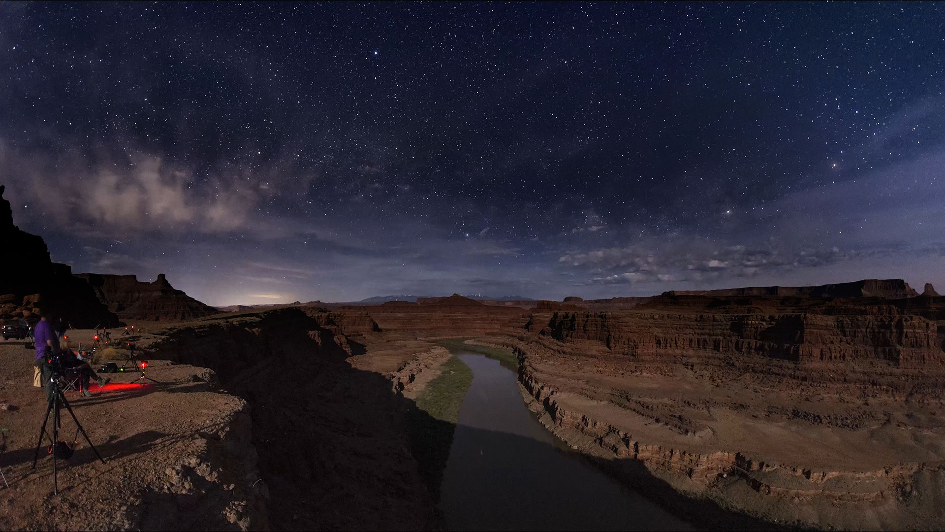
Dead Horse Point State Park, recognized as an International Dark Sky Park in 2016, is one of the most active and accessible areas to stargaze in the Moab area. Its high plateau location, mountains far in the distance and cities out of sight yields a nearly full view of celestial sphere. Park staff routinely provide programs celebrating the night sky, from walks under the full moon to gazing through telescopes at objects millions of light years away. Whether you want to enjoy by yourself or join a ranger, Dead Horse Point State Park is a premier spot to see the skies our ancestors wondered over and survived with.
Download Dead Horse Point State Park’s Dark Sky Brochure to learn more.
Your help is crucial in preserving our trails and protecting the fragile soil that sustains the desert ecosystem. The biological soil crust, also known as cryptobiotic soil, serves as the foundation for desert plant life. This unique black, knobby crust is composed of diverse living organisms and plays a vital role in maintaining the delicate balance of the desert environment.
However, this soil crust is exceptionally delicate and can take several decades to regenerate. Even a single footstep can cause irreparable damage that can persist for years, impacting the entire ecosystem. We urge you to stay on designated roads, routes, and trails to ensure the preservation of this fragile life. In areas where hiking trails are not established, it is advisable to hike on sandy washes or bare rock surfaces to minimize the impact on the soil.
By remaining vigilant and adhering to these guidelines, you contribute to the long-term sustainability of the desert ecosystem and help safeguard its natural beauty for generations to come. Let’s work together to keep all of our trails open and protect the invaluable biological soil crust.
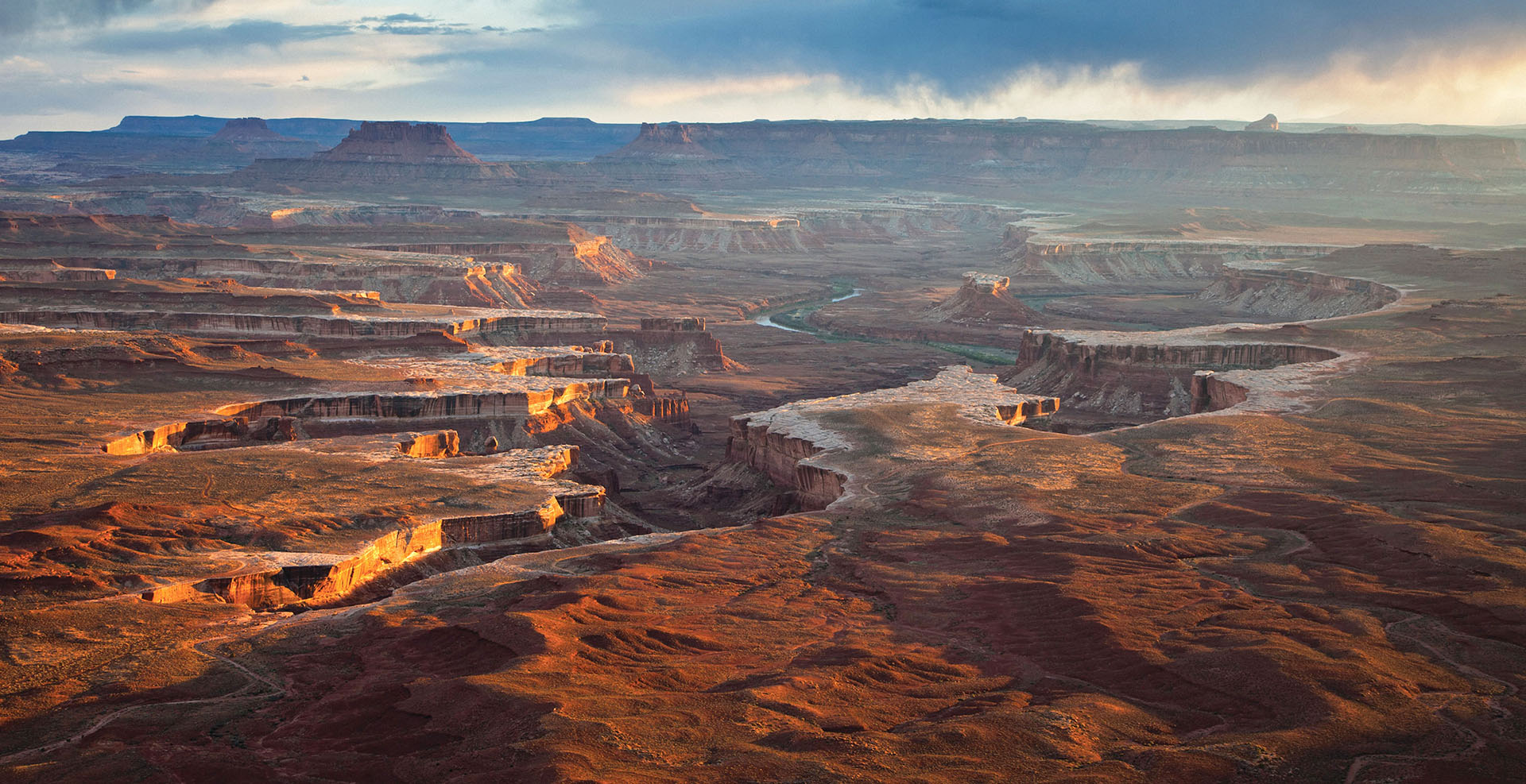
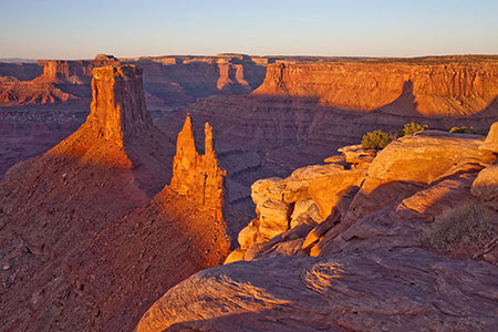
Canyonlands National Park
The largest national park in Utah, with diversity that staggers the imagination.
Phone: General Info
(435) 719-2313Backcountry Information
(435) 259-4351Mailing Address
Canyonlands National ParkDay-Use Permits
You must have a day-use permit for four-wheel-drive, motorcycle, and bicycle travel on:
Overnight Permits
River Permits
Horseback Riding, and Pack- and Stock-Use Permits
Phone: General Info
(435) 719-2313Backcountry Information
(435) 259-4351Mailing Address
Canyonlands National ParkNearby Campgrounds
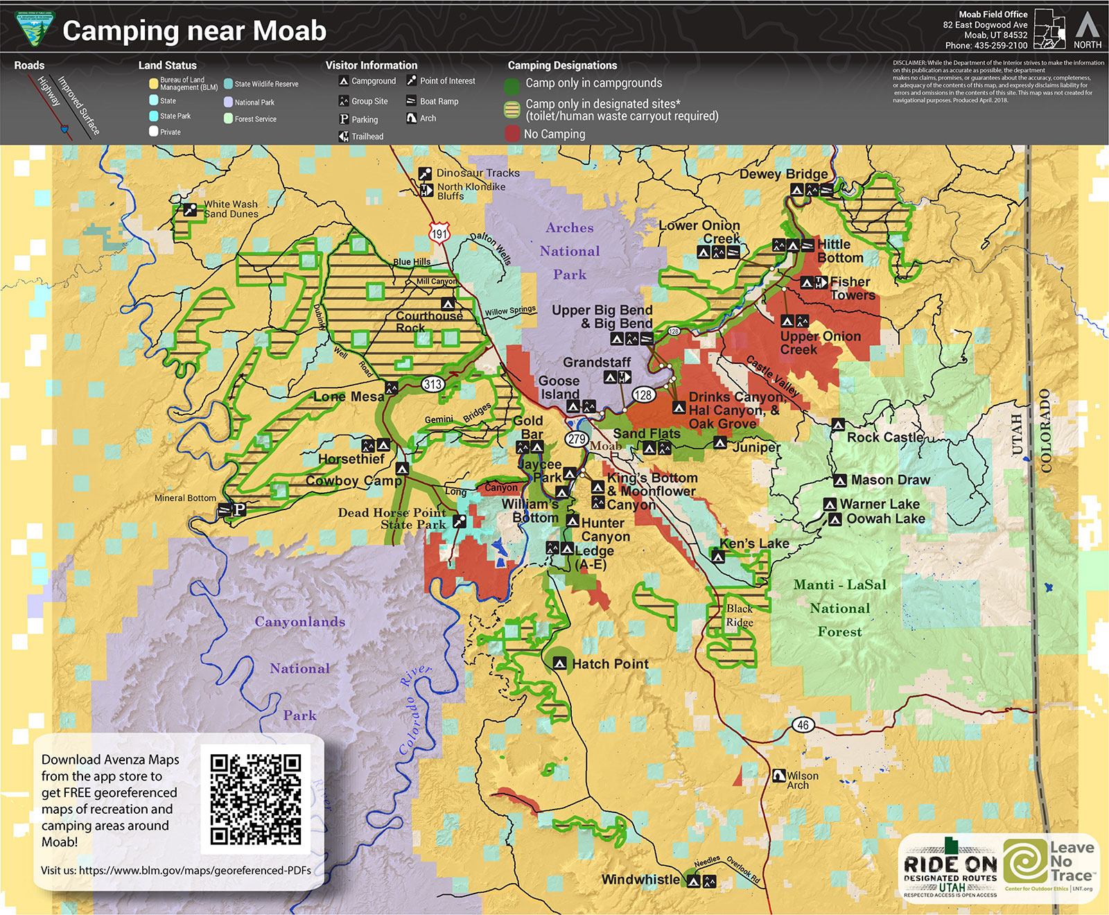
In addition to the campground located within the park, there is a great selection of additional campgrounds in the surrounding area. Moab has many commercial campgrounds with RV hookups in addition to a huge assortment of BLM public campgrounds in extremely scenic locations. Click here for a complete list of all the camping options available in the Moab area.
Where to Stay
No lodging is available within the park. The closest lodging is located within the town of Moab, just 5 miles south of the entrance to the park.
Moab has hotels & motels, bed & breakfasts, resorts and a large variety of guest houses and condos. Several property management companies can even take the hassle out of finding the right accommodations. Click here for a complete list of all the lodging options available in the Moab area.
Day-Use Permits
You must have a day-use permit for four-wheel-drive, motorcycle, and bicycle travel on:
Overnight Permits
River Permits
Horseback Riding, and Pack- and Stock-Use Permits
Please note that food is not available within the park. The closest restaurants are either in the town of Moab, at Dead Horse Point State Park, or at the dinosaur museum at the intersection of Highways 191 and 313 (entrance fee is not required to access the restaurant).
The Green River meanders beneath the Island in the Sky, as seen from the Green River Overlook. A paved walkway leads right up to the overlook.
A great hike for families with small children, the .5 mi (.8 km) round trip hike to Mesa Arch rewards visitors with a naturally framed view of canyon country.
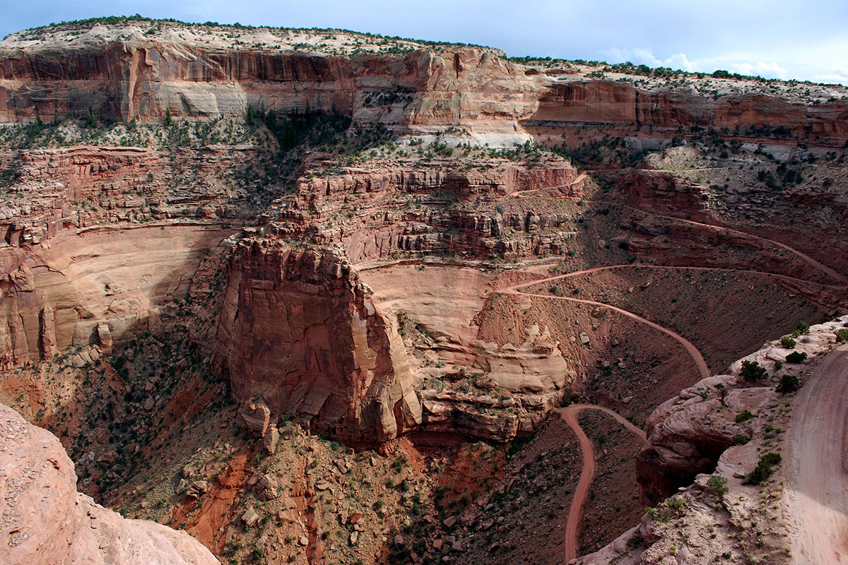
The Shafer Trail descends from the Island in the Sky to the White Rim. A high clearance vehicle is strongly recommended. For current conditions check at the visitor center or call 435-259-4351.
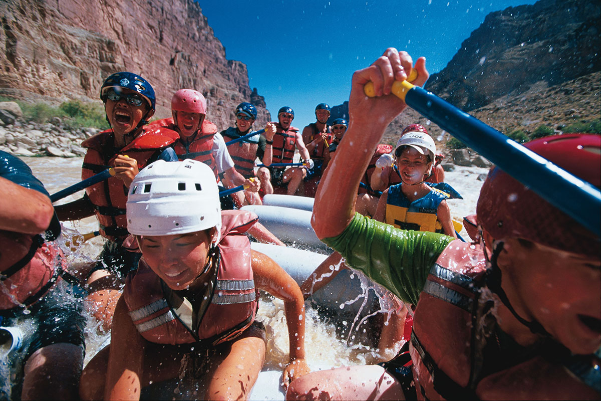
Located in Canyonlands National Park, Cataract Canyon contains fourteen miles of rapids ranging in difficulty up to Class V.
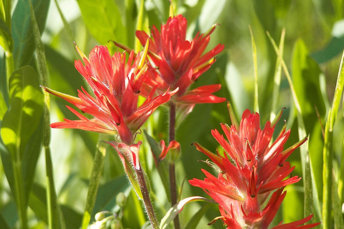
Indian Paintbrush are just one of the many wildflowers that populate the Island in the Sky in the Spring (April-June).
Canyonlands National Park, which contains some of the darkest night skies in North America, is a popular destination for stargazers. Click here for the latest sunrise/sunset and moon phase information for Moab.
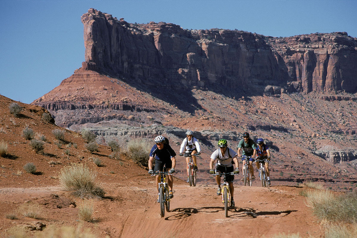
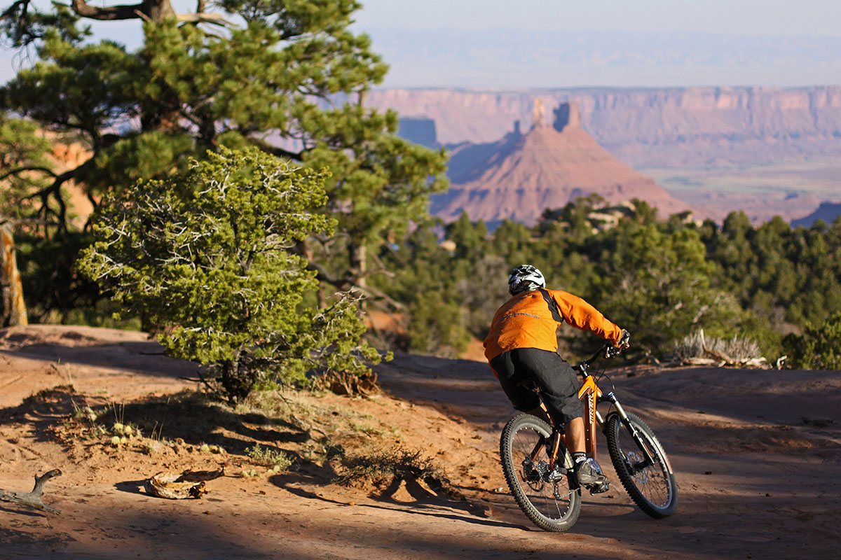
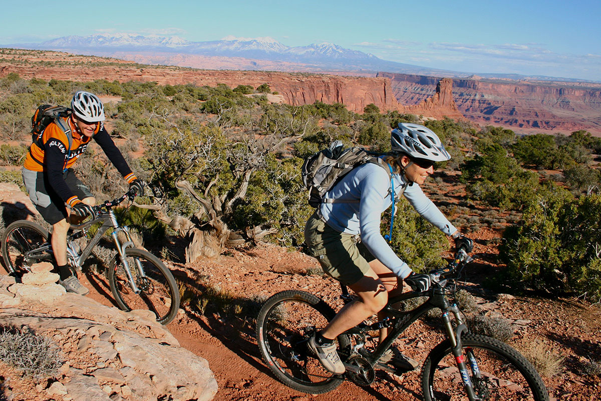
Canyonlands is famous for its mountain biking terrain, particularly for the 100-mile White Rim Road at the Island in the Sky. The Maze also offers some multi-day trip possibilities, though the logistics and roads are more difficult (for the support vehicles, not the bikes).
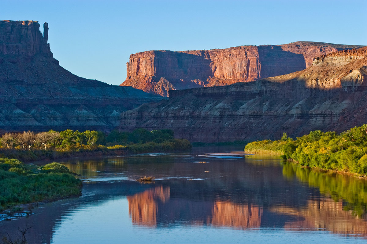
The Colorado and Green rivers wind through the heart of Canyonlands, cutting through layered sandstone to form two deep canyons. Both rivers are calm upstream of the Confluence, ideal for canoes, kayaks and other shallow water craft. Below the Confluence, the combined flow of both rivers spills down Cataract Canyon with remarkable speed and power, creating a world-class stretch of white water.
Your help is crucial in preserving our trails and protecting the fragile soil that sustains the desert ecosystem. The biological soil crust, also known as cryptobiotic soil, serves as the foundation for desert plant life. This unique black, knobby crust is composed of diverse living organisms and plays a vital role in maintaining the delicate balance of the desert environment.
However, this soil crust is exceptionally delicate and can take several decades to regenerate. Even a single footstep can cause irreparable damage that can persist for years, impacting the entire ecosystem. We urge you to stay on designated roads, routes, and trails to ensure the preservation of this fragile life. In areas where hiking trails are not established, it is advisable to hike on sandy washes or bare rock surfaces to minimize the impact on the soil.
By remaining vigilant and adhering to these guidelines, you contribute to the long-term sustainability of the desert ecosystem and help safeguard its natural beauty for generations to come. Let’s work together to keep all of our trails open and protect the invaluable biological soil crust.
With hundreds of miles of four-wheel-drive roads, Canyonlands offers ideal terrain for multi-night mountain bike trips. Most groups travel with vehicle support to haul water and gear since there are few reliable water sources along these roads. For the truly adventurous, self-supported trips with panniers and trailers are also possible. Bikes must remain on designated roads: there are no single-track trails in the park.
Things to Know
Where Can I Ride My Bike?
You can ride a bicycle on any public roadway in the park. Some roads are better for cycling than others. Check at visitor centers for recommendations and road conditions.
Paved Roads
You can ride on paved roads at the Island in the Sky. You must must ride single file. There are no road shoulders or bike lanes; please be aware of passing vehicles.
Backcountry Roads
Canyonlands is famous for its mountain biking terrain, particularly for the 100-mile White Rim Road at Island in the Sky. The 100-mile White Rim Road loops around and below the Island in the Sky mesa top and provides expansive views of the surrounding area. Bicycle trips usually take three to four days. Overnight and day-use permits are required.
Do I Need a Permit?
During the spring and fall, demand for permits frequently exceeds the number available. If you plan to visit Canyonlands during peak season, especially to bike and camp along the White Rim Road, we recommend making reservations well in advance. You can reserve overnight permits up to four months in advance of the start of your trip. Day-use permits are available up to 24 hours in advance of your trip.
Mountain bike groups must travel single-file, remain on established roads, and camp in designated sites. There is no single-track riding in the park. We recommend a support vehicle for all multi-day bike trips: there are no water sources along most of the roads. Guided trips are available for many destinations within Canyonlands.
On August 30, 2019 the National Park Service announced a new electric bicycle (e-bike) policy for national parks, expanding recreational opportunities and accessibility. The policy supports Secretary’s Order 3376, signed by U.S. Secretary of the Interior David Bernhardt on August 29, 2019, that directs Department of the Interior (DOI) bureaus to create a clear and consistent e-bike policy on all federal lands managed by the Department.
Beginning October 1, 2019, visitors to Southeast Utah Group parks (Arches and Canyonlands national parks and Hovenweep and Natural Bridges national monuments) will be allowed to use e-bikes where traditional bicycles are allowed. Bicycles and e-bikes are allowed on paved and unpaved roads that are open to the public. Bicycles and e-bikes are not allowed on any trails in the parks.
There are no charging stations in the parks. Generators are not allowed in the backcountry. This change in e-bike policy applies to private and commercial use in the parks.
The National Park Service announcement and the agency’s new e-bike policy are available online at www.nps.gov/orgs/1207/ebikepolicy.htm.
Canyonlands is a paradise for photographers. Under conditions of constantly changing light, the varicolored landscape provides limitless photographic opportunities. Often, the difference between an average photograph and an exceptional photograph is good lighting. Low sun angles at sunrise and sunset can add brilliant color to the rock. Scattered clouds can also add depth to an image and a passing storm can provide extremely dramatic lighting.
Canyonlands Natural History Association
Canyonlands Natural History Association (CNHA) is a nonprofit organization assisting the National Park Service in its educational, interpretive and scientific programs throughout southeast Utah. Known as a "cooperating association," CNHA’s goals include enhancing visitors’ understanding and appreciation of public lands by providing a selection of quality, educational materials for sale in many vistor centers. Twenty percent of these sales is returned to the National Park Service and other federal land management agencies.
CNHA operates the bookstore at Arches Visitor Center.
Friends of Arches and Canyonlands Parks
The Friends of Arches and Canyonlands Parks: Bates Wilson Legacy Fund provides direct support to Arches and Canyonlands national parks and Natural Bridges and Hovenweep national monuments in order to enhance existing projects in these spectacular areas, and to conserve the land and its cultural treasures for present and future generations to enjoy.
This mission honors the legendary work of Superintendent Bates Wilson, who came to Arches in 1949, inspiring and leading the effort that resulted in the establishment of Canyonlands National Park in 1964. The Friends Group offices are in the Rock House behind Arches Visitor Center, where Bates once lived with his family.
For your next visit consider flying directly into Moab’s Canyonlands Regional Airport (CNY).
Our Moab Outdoor Adventure Guide is available for free at the Moab Information Center (corner of Main & Center Streets in Moab). The eBook version is available for download by clicking below. This is the most comprehensive guide to activities available on the public lands surrounding Moab that we have ever published.
![]() Discover Our National & State Parks
Discover Our National & State Parks ![]()


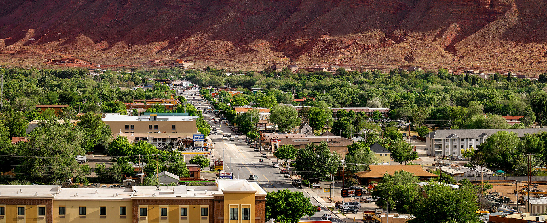
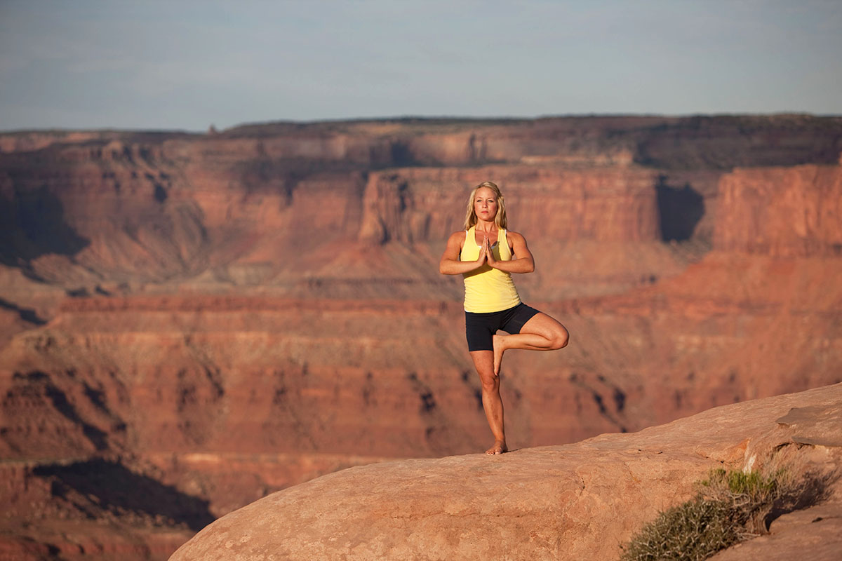
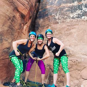
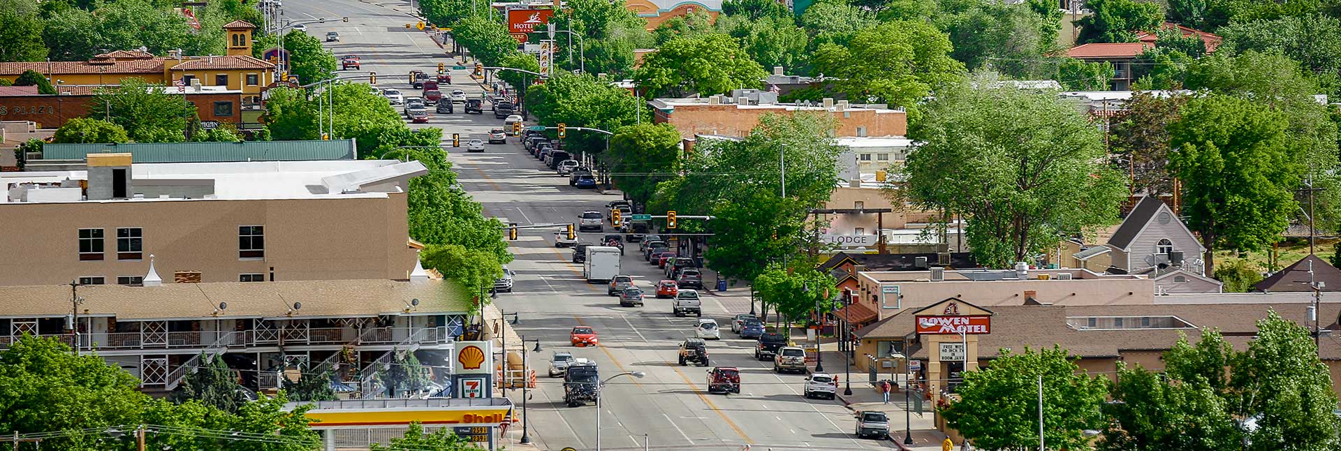
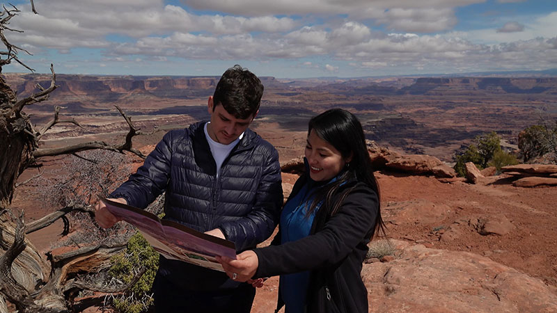
Welcome to Moab, Utah, where Arches and Canyonlands National Parks are just a part of the breathtaking red rock landscapes that surround this stunning destination. Combining small-town hospitality with unparalleled natural beauty and the cool waters of the Colorado River, Moab has become one of the most sought-after destinations in the American Southwest.
As you explore the unique scenery of Moab, take time to relax and enjoy the welcoming hospitality of this charming resort town. Thanks to its perfect climate, Moab attracts year-round outdoor events and festivals, while the downtown business district has responded with an array of restaurants, microbreweries, shops, and galleries. Whether you’re in the mood for regional southwestern cuisine or world-class gourmet fare, Moab’s diverse culinary scene is sure to satisfy any palate. And for those looking for a souvenir to remember their visit, the downtown shops offer a great selection of southwestern arts and jewelry, t-shirts, and much more to browse through at your leisure.
 Exploring St. Patrick’s Day in the Red Rock Wonderland of Moab, Utah
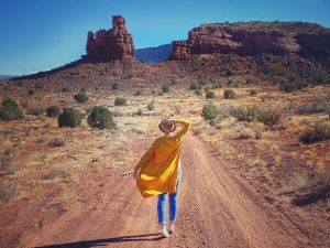 Springtime Splendor in Moab, Utah!
 98 Center Relaunches in Moab!
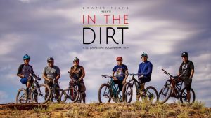 In The Dirt Film Screening in Moab
 First Annual Moab Spring Spruce-Up: April 12-13
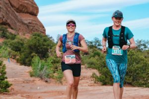 The Season Starts in Moab!
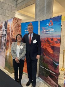 Tourism Day on the Hill 2024
Discover Nature’s Masterpiece
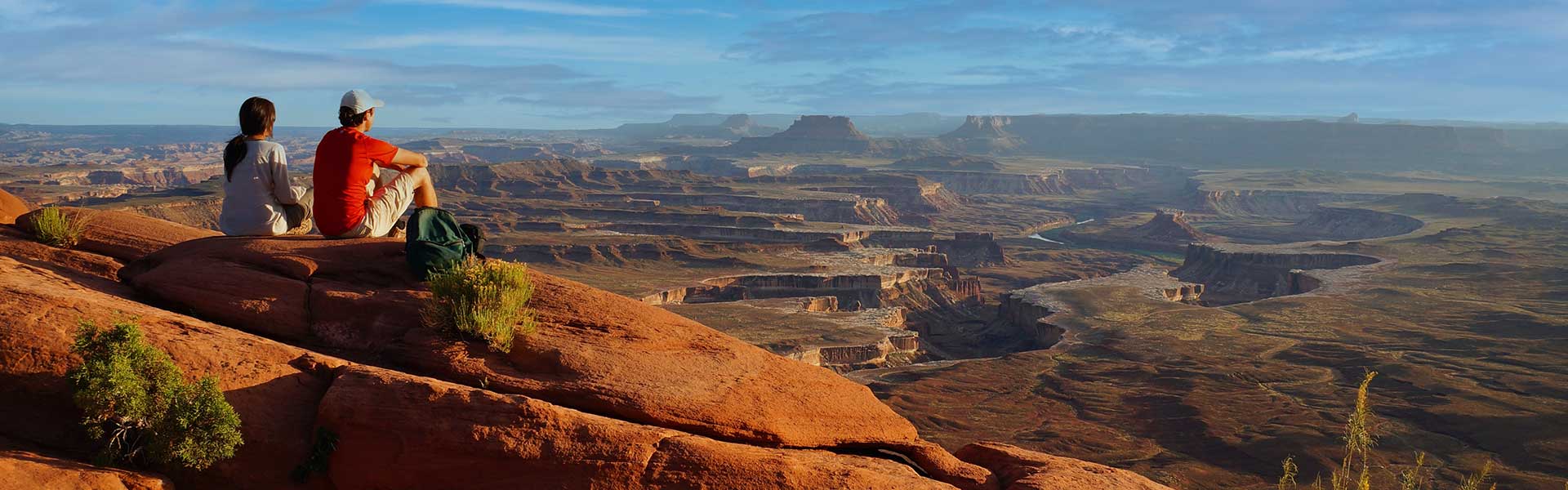
Moab’s iconic national parks, Arches and Canyonlands, are just the beginning. Surrounding the town are diverse natural wonders—rivers, forests, and Bureau of Land Management land—all waiting to be explored. Even the smallest desert pothole in Moab is home to unique creatures vital to the ecosystem. Pause to reflect on the intricate balance of life during your exploration. Whether you’re a naturalist or an outdoor enthusiast, there’s always more to discover in Moab’s desert ecosystem. Immerse yourself in its wonders, taking a deep breath and appreciating Nature’s Masterpiece.
We invite you to check out our constantly expanding series of science and nature videos, which showcase the fragile beauty of Moab’s desert landscape and lesser-known experiences.
Moab Information Center
Moab Information Center
25 E Center St (Corner of Main and Center Streets)
7 Days/Week
9:00 am – 4:00 pm
Closed Thanksgiving and Christmas
Once you arrive in Moab, your first stop should be the Moab Information Center (MIC). Conveniently located at the corner of Main and Center Street in Moab, the MIC offers information on recreational opportunities and visitor services throughout southeastern Utah. Allow some time for the interpretive displays and large gift shop featuring guide books, maps, videos, videos, postcards, and much more.
Moab to Monument Valley Film Commission
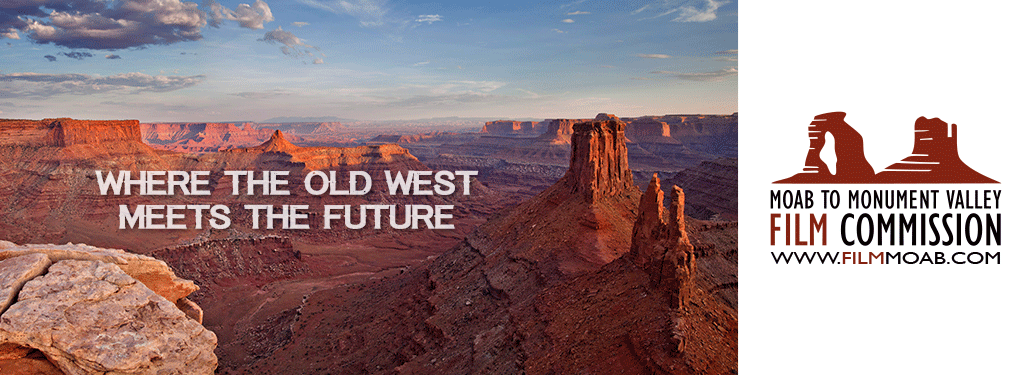
Become a part of southeastern Utah’s rich film history and choose this stunning location for your next project!
The Moab to Monument Valley Film Commission holds the title of the longest running film commission in the world. Established 1949. We are here to facilitate whatever your production needs may be!
Utah’s competitive incentive program offers a fully refundable tax credit of up to 25% on in-state spend, which helps you cut production costs without sacrificing quality.
Join us at the Moab Museum on Saturday, February 17th for the free public exhibition opening of A Moab Prison Camp: Japanese American Incarceration in Grand County. From 10 am-2 pm, we will be hosting a Scan and Share event in the Museum gallery. Staff from the Utah Historical Society will be here in the Museum’s galleries to help gather stories or artifacts related to the Moab Isolation Center at Dalton Wells where Japanese Americans were incarcerated during WWII.
About the Exhibition:
A Moab Prison Camp: Japanese American Incarceration in Grand County introduces the local and national story of Japanese American incarceration during WWII. Following the bombing of Pearl Harbor in 1941, President Franklin D. Roosevelt signed Executive Order 9066 authorizing the wartime incarceration of over 120,000 Japanese Americans, a majority of whom were US Citizens, in detention facilities across the country. The Moab Isolation Center, located north of Moab at Dalton Wells, played a brief but significant role in the web of Japanese American incarceration facilities: a former Civilian Conservation Corps camp was transformed into a temporary prison camp for so-called “troublemakers” from other camps. In this exhibit, a tale of injustice and resilience unfolds via stories and objects, introducing the national context with Smithsonian’s Righting a Wrong poster exhibition and research conducted by Utah State Parks.
This exhibit unpacks the nuanced terminology used during that era and following, inviting visitors to confront the usage of words like “relocation” versus “incarceration” and wrestle with the gravity of terms such as “concentration camp.” Through compelling narratives curated collaboratively with descendants and partners, A Moab Prison Camp illuminates the resilience and resistance exhibited by those imprisoned in Moab. It offers a broader exploration of the Japanese-American experience during this tumultuous period in US history.
Join Museum staff & Utah State Parks staff to mark the opening of “A Moab Prison Camp: Japanese American Incarceration in Grand County” a new temporary exhibition at the Moab Museum. Doors open at 7 pm and Megan Blackwelder, Vice President of the Moab Museum Board of Trustees and Southeast Utah Regional Manager for the Utah Division of State Parks, will introduce the exhibit. About the Exhibition:
A Moab Prison Camp: Japanese American Incarceration in Grand County introduces the local and national story of Japanese American incarceration during WWII. Following the bombing of Pearl Harbor in 1941, President Franklin D. Roosevelt signed Executive Order 9066 authorizing the wartime incarceration of over 120,000 Japanese Americans, a majority of whom were US Citizens, in detention facilities across the country. The Moab Isolation Center, located north of Moab at Dalton Wells, played a brief but significant role in the web of Japanese-American incarceration facilities: a former Civilian Conservation Corps camp was transformed into a temporary prison camp for so-called “troublemakers” from other camps. In this exhibit, a tale of injustice and resilience unfolds via stories and objects, introducing the national context with the Smithsonian’s Righting a Wrong poster exhibition and research conducted by Utah State Parks.
This exhibit unpacks the nuanced terminology used during that era and following, inviting visitors to confront the usage of words like “relocation” versus “incarceration” and wrestle with the gravity of terms such as “concentration camp.” Through compelling narratives curated collaboratively with descendants and partners, A Moab Prison Camp illuminates the resilience and resistance exhibited by those imprisoned in Moab. It offers a broader exploration of the Japanese-American experience during this tumultuous period in US history.

Responsible Recreation Training for Moab Businesses
Grand County Economic Development is partnering with local businesses to help educate visitors about responsible recreation practices in the Moab area. From our iconic national parks, Arches and Canyonlands, to the vast expanse of public lands that extends well beyond these borders, the Moab area stands as a testament to the magnificence of Nature’s Masterpiece. Our rugged landscapes are a true treasure, yet they also reveal a surprising vulnerability. Even unassuming desert potholes cradle a vibrant array of creatures, each as exceptional as the grand landscape that envelopes them. The living biocrust that delicately covers our desert terrain stands as a cornerstone of a thriving ecosystem, deserving of our utmost care.
At the heart of the Moab Steward Business Training Program lies a mission to educate front-facing personnel about responsible and respectful recreation practices, and to empower them to impart this wisdom to the public. The program’s unwavering dedication to safeguarding our environment resonates strongly. They firmly believe that every individual possesses the capacity to contribute to a sustainable future for our planet. In this rallying call, they extend an open invitation to all Moab businesses, urging them to unite in the shared endeavor of preserving these natural marvels for generations to come.
Partnering businesses will receive:
Moab businesses can participate by:
For more information contact Anna Sprout at asprout@grandcountyutah.net.
Moab Area Transit
Moab’s New Fare-Free Transit System
The Moab Area Transit (MAT) pilot program is a new, fare-free, transit service in Moab. MAT provides residents and visitors with more options for day-to-day transportation in Moab. Transportation will be provided using comfortable MAT-branded 13-passenger vans.
MAT includes an on-demand microtransit service providing door-to-door transportation to and from any location within the broader service area. Download the MAT app on your phone to schedule rides.
March 16 – October 15
9 a.m. to 9 p.m. daily
October 16 – March 15
9 a.m. to 5 p.m. daily
MAT also includes a fixed-route service that will bring riders to predetermined destinations along Main Street. This route will provide regular stops between the Fairfield Inn north of town to the Utah State University Moab campus at Aggie Boulevard.
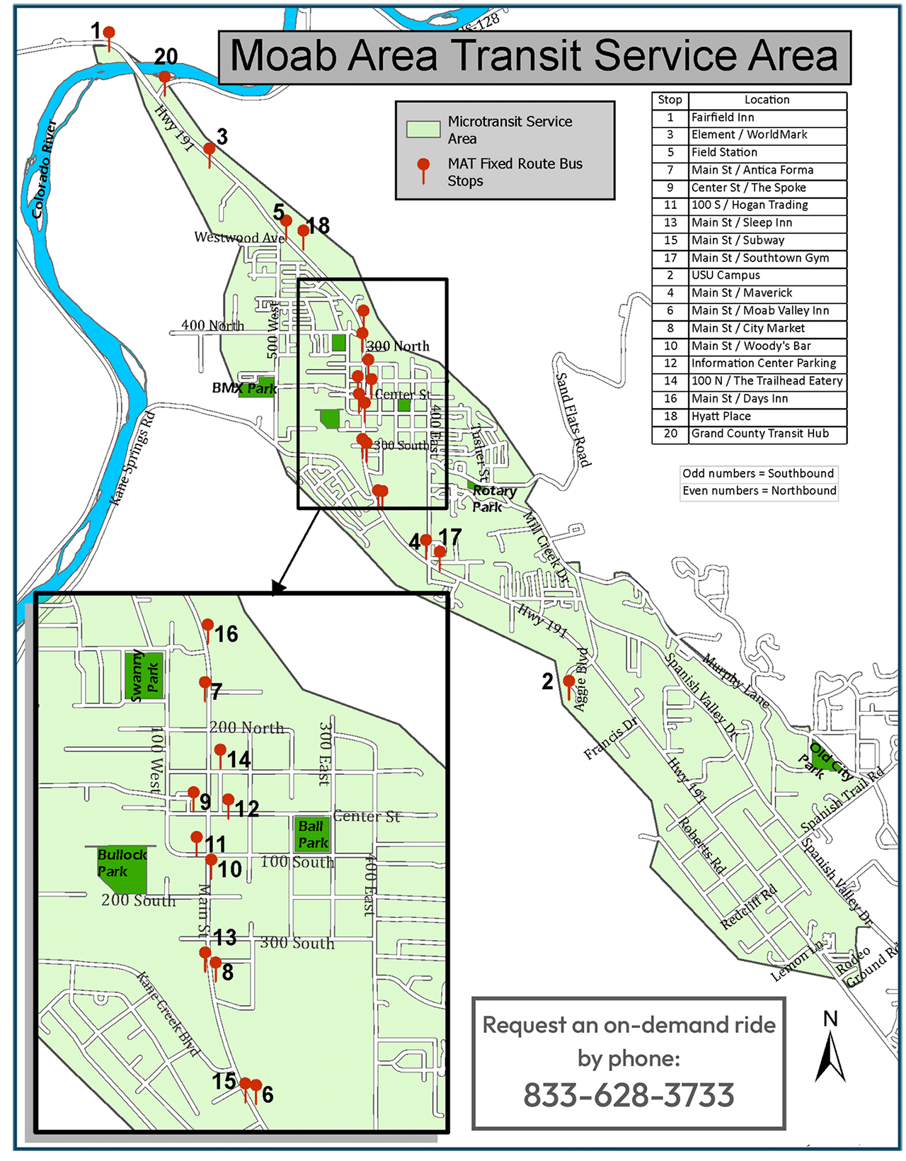

One goal of the fixed route is to reduce downtown traffic congestion by providing a transportation option that encourages visitors to leave their vehicles at their hotels and instead travel downtown for shopping and dining via the MAT 13-passenger vans. Residents are also invited to take advantage of the fixed-route service for quick travel along Moab’s Main Street.
March 16 – October 15
9 a.m. to 9 p.m. daily
October 16 – March 15
No fixed-route service

Download the MAT App by visiting your favorite app store or by scanning the QR Code above.
For more info or to request a ride by phone call 1-833-628-3733.
Be Prepared For Moab
Preparation Is The Key! If you would like to minimize your chances of requiring emergency assistance, here are a few things you can do.
Take clothing layers for extreme temperature changes
Be prepared for temperature extremes. At certain times of the year, it can get cold almost instantly at sunset. Even if you do not plan to be out after dark, take insulating clothing and gear that will help you survive in case you happen to get off the trail or are delayed for any reason. In colder months, take a jacket and/or windbreaker, a hat, gloves, proper footwear, a reflective emergency blanket, etc. Clothing is just as important during the hotter months. A lightweight, long-sleeve shirt and a hat can help you stay cool. Carry sunglasses and sunscreen too.
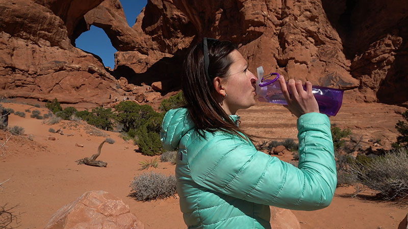
Take LOTS of water
If you think you have enough water, you probably don’t. Take more. A basic rule of thumb is a gallon per person per day. You may need even more, depending on the time of year. You may only plan to be out for a few hours, but plan on the unplanned. Take extra water. Electrolyte replacement is also essential, so take powdered or liquid electrolytes or something salty.
Take food
Adventure requires energy. Maintain your energy levels with adequate food. Salty foods such as trail mix or energy bars are good choices.
Tell someone where you are going and when you expect to be back
Do not change your itinerary without updating this person. The first place we will look if you are reported overdue is on the trail that you are supposed to be on.
Know your location
Research and study your planned route. Know how to navigate with a good map and compass and/or a GPS. Practice with each. Do not rely on cell phone or tablet navigation apps that require cell service to function. Cell service is notoriously bad in many areas of Grand County. If you do become lost or disoriented, don’t compound the problem by trying to get un-lost. Stay where you are.
Know your skill and fitness level
Check guidebooks for typical riding and hiking times. Then to be safe, double those times. While some experts may be able to do a certain trail in 3 hours, most people might require 6 or 7 hours to do the same trail. Be honest in assessing your skill and fitness levels. Some of Grand County’s trails can be extremely difficult, even for experts.
Take a light
Even if you plan to be back well before dark, take a headlamp or flashlight and extra batteries. Once it gets dark, do not attempt to travel without illumination. The consequences could be deadly.
Take a fire starter
Carry the means to start and sustain an emergency fire. There are many ways to start a fire. Carry a lighter, waterproof matches, or some type of fire starting kit. A knife can aid in carving kindling.
Take a cell phone
Even though cell service is a hit-and-miss proposition in this area, cell phones have helped Grand County Search and Rescue (GCSAR) save numerous lives. Make sure your battery is fully charged and leave the phone off unless absolutely necessary. If you call 911, we should automatically get coordinates for your location if you stay on the phone for about a minute. Sometimes, texting can work in areas where voice service does not. If you are unable to connect via 911, try texting a friend to call 911. Cell phones usually work if you are up on a mesa, but do not work well down in the canyons.
Carry first aid supplies
Accidents happen. Be prepared with at least a basic first aid kit that contains different types of bandages and gauze, adhesive tape, and a method to cleanse a wound.
Know the Weather
Check the forecast before you go out. Pay attention to the weather during the day. In summer months, recreate during the cooler hours earlier or later in the day. Watch for lightning and listen for thunder, especially during Monsoon Season (July through September.) Avoid slot canyons and drainages when thunderstorms are in the area or even miles up the drainage. If you hear thunder, lightning is close enough to strike you. During the winter, avalanche danger in the La Sal Mountains can be extreme. Check the forecast before venturing out: utahavalanchecenter.org/advisory/moab
Wear a Life Jacket
If you are swimming or boating, wear a Personal Flotation Device (PFD). The Colorado and Green Rivers can appear deceptively calm. Visitors have been caught in strong and invisible undercurrents near shorelines and pulled farther out into the river than they originally planned to swim. NEVER try to swim across the river without a PFD. It’s wider than it looks.
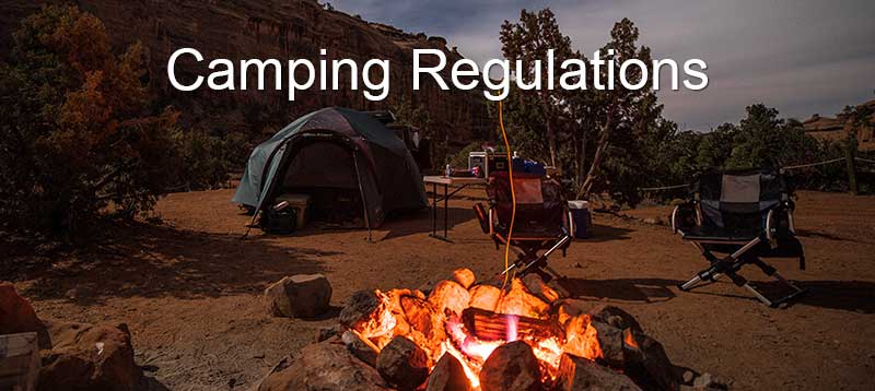
Know Local Camping Regulations
Within 20 miles of Moab, camping is only allowed in developed campgrounds. A list of developed campgrounds is available here.
Dispersed (Primitive) camping is available in a few areas outside of Moab. Click here for a map of allowed areas. The following regulations apply to all primitive sites:

