Spend Your Summer on the Water

When it comes to the red rock desert of Moab, water recreation may not be the first thing that comes to mind. But the same rivers that carve the epic landscapes and canyons also provide a wide variety of water activities and a great way to keep cool during hot summer months. From easy floats to intense paddles, read on to find out more about all the ways to enjoy the Colorado River and beyond.
Rafting
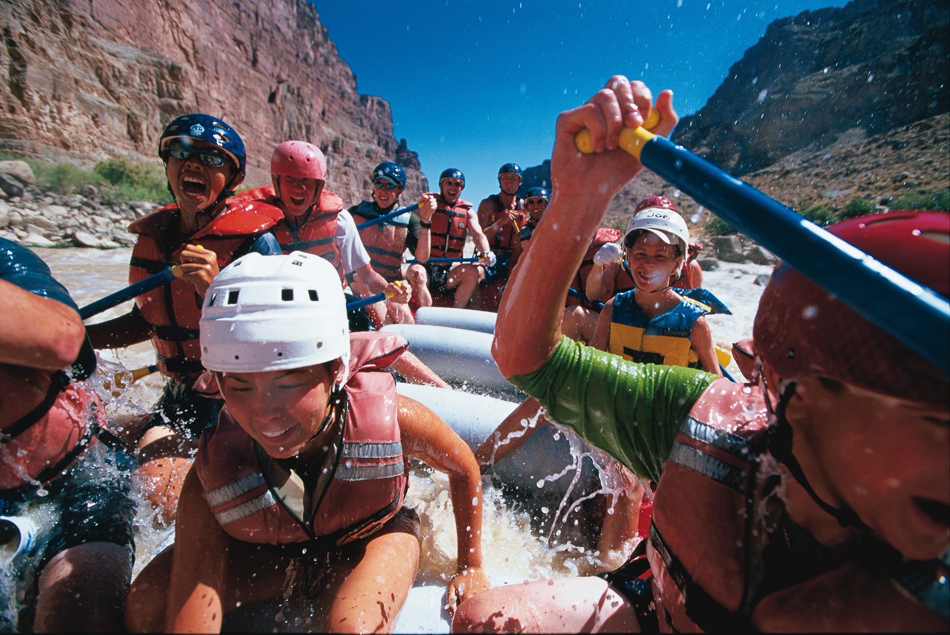
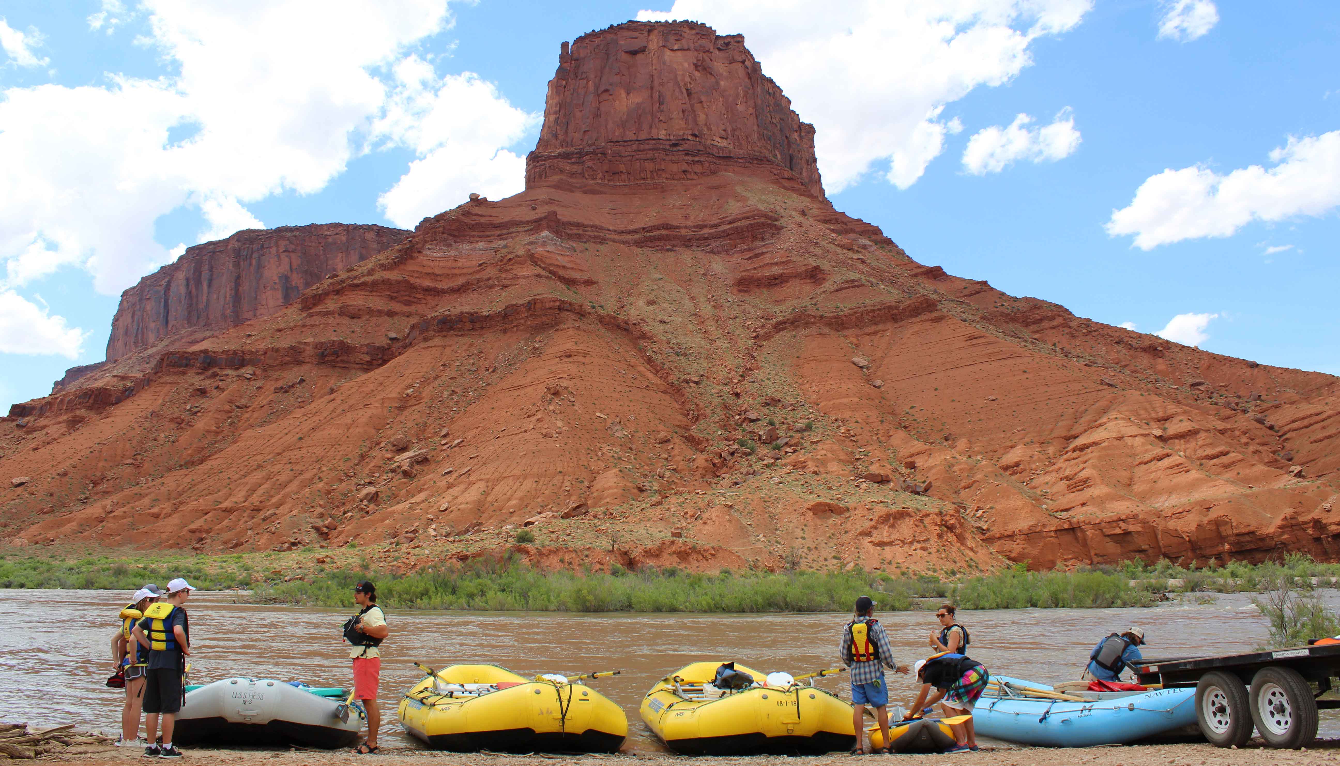
Whether you’re looking for family-friendly raft trips or wilder multi-day whitewater adventures, there’s something for everyone on Moab’s red rock-lined waters. You’ll find calmer floats in the Fisher Towers section of the Colorado River, while Westwater and Cataract Canyons contain faster-moving rapids. Here’s a quick overview of Moab whitewater rafting options for both families and thrill seekers:
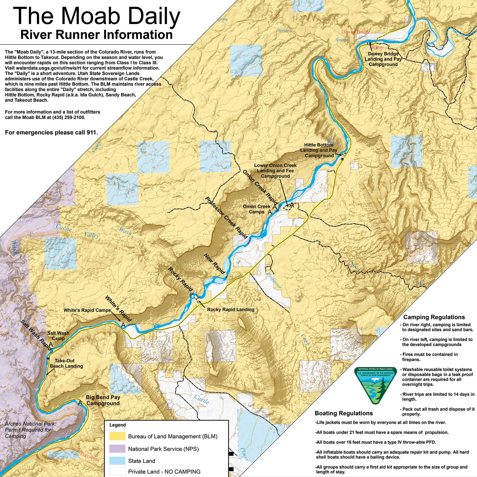
- Mild – Moab Daily Section (Class I – III Rapids)
A morning or afternoon trip on the popular 13-mile Moab Daily section of the Colorado River offers a mild rafting experience suitable for everyone from children to seniors willing to get their feet wet. These relaxing trips are perfect for photographers and families looking to move at a slower pace and take in the surrounding sights. This stretch features easy boater access, close proximity to Moab, alternating calm water and moderate rapids, and wonderful scenery. Depending on water levels, rapids on this section range from Class I to Class III.
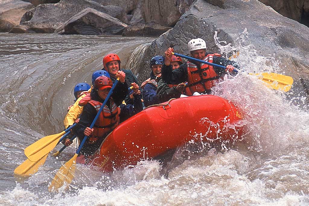
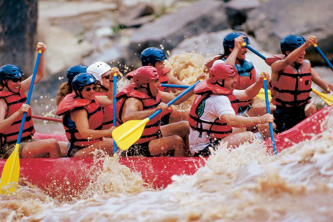
- Extreme – Cataract Canyon (Up to Class V Rapids)
If you’re looking to spend a couple days on the water and up for a truly intense adventure, head to Cataract Canyon. Cataract Canyon begins south of Moab, where the Green and Colorado Rivers meet. Bolstered by the Green River, the Colorado River doubles its force as it carves a deep 100-mile-long chasm through Canyonlands National Park. Cataract Canyon contains 14 miles of rapids ranging in difficulty up to Class V. It is particularly hazardous, isolated, and subject to extreme water level fluctuations. Because of the complex logistics, taking this trip with a local experienced river outfitter is strongly recommended.
- For further rafting opportunities in the surrounding area, check out one of Moab’s Guides and Outfitters to raft on the nearby San Juan River or in Desolation and Gray Canyons on the Green River.
While you can go on self-guided trips (note that some areas require permits), there are many reasons a guided trip is the best way to experience the Colorado River. In addition to their excellent navigation skills and emphasis on personal safety, the rafting company will supply all the equipment for your trip and point out some of the best hidden treasures along the river. Going with a guide can give you a far greater appreciation for the river and natural environment you’ll be traveling through.
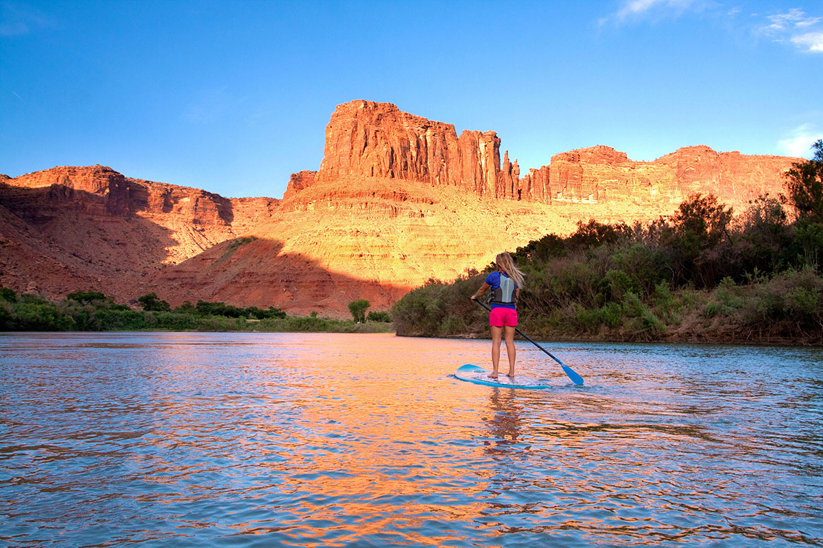
Paddling
For a calmer approach to the Colorado River, canoes, kayaks, and paddle boards are the perfect way to explore. There are several ideal flatter stretches of water, particularly along the previously mentioned Moab Daily section, varying based on your preferred trip length. With numerous boat ramps along the way, you’ll have the flexibility to make your trip as long or short as you like. So, go at your own pace and pack a picnic lunch to enjoy along the banks. If you need a shuttle to or from your boat launch, local shuttle services have you covered.
- Short Trip: Big Bend Campground to Moab Boat Ramp: 7 miles
- Longer Trips: Moab Boat Ramp to Goldbar Campground: 10 miles or Moab Boat Ramp to Potash Boat Ramp: 17 miles
Go for a Ride
If you’re looking to sit back, relax, and just go with the flow, there are also several opportunities for you to get out on the water without having to pilot your own boat. You can find a list of tour companies here.
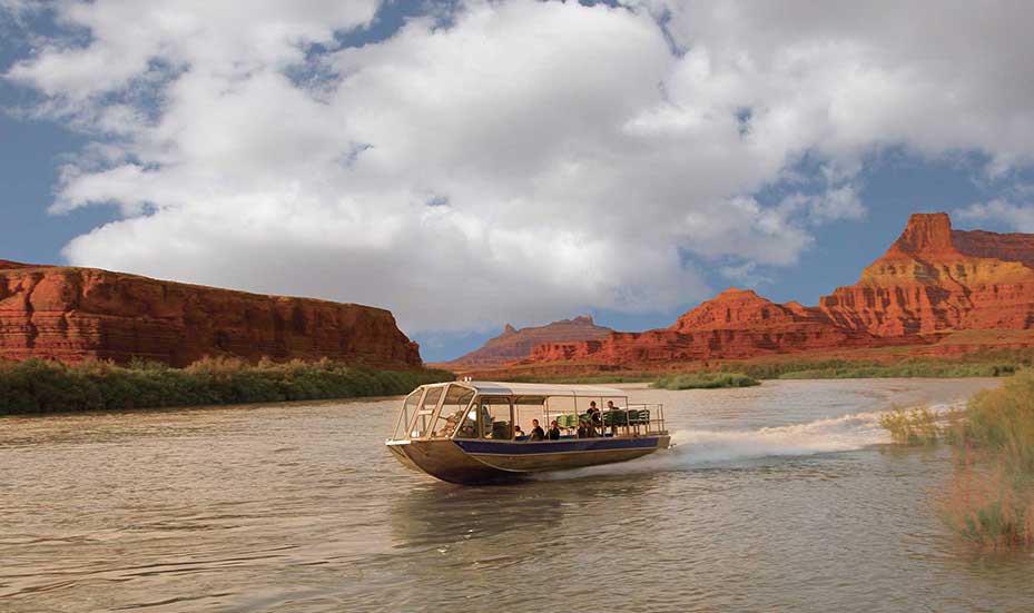
Jet Boat
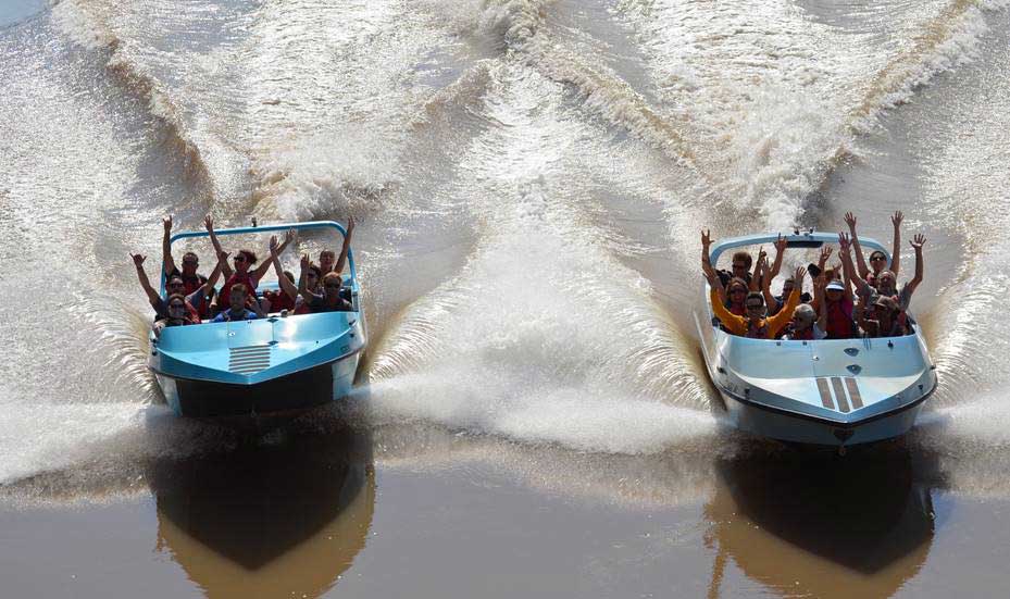
High Speed Jet Boat
- Jet boat tours take you down a calm stretch of the Colorado River south of Moab. Explore the scenery around each river bend as your guide explains the geology and history of the area. The calm nature of these tours makes them perfect for photography.
- Several companies also offer high speed jet boat tours. These exhilarating rides spin and splash through scenic sections of the river; be prepared to get splashed!
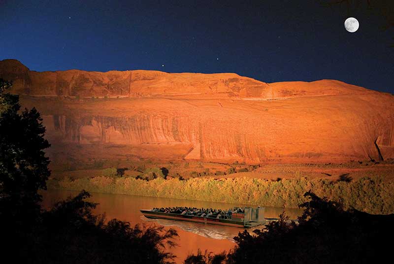
- The Canyonlands by Night and Day Sound and Light Show is a unique experience and a great end to a perfect day in Moab. After a cowboy-style dinner on the shore, you’ll head up river on a flat-bottomed boat. Once darkness falls, natural lights illuminate the canyon walls, while music and narration bring the stories of the canyon’s formation to life.
Best Time for Water Activities
Depending on the time of year you visit, and the time of day you start your activity, you can generally enjoy the Colorado River from March–October. The Colorado River flow rate can greatly affect the type of experience you’ll have on the water. Note that flow rates can vary immensely from month to month, depending on mountain snowpack and current precipitation. You can check the current flow rate here.
Sustainable Recreation
No matter how you choose to enjoy the wonderful waterways Moab has to offer, please do so responsibly. Make sure you understand and follow river use ethics and regulations and practice leave no trace principles to keep these delicate desert ecosystems a beautiful place to visit for generations to come.
River Use Ethics
Please exercise the utmost level of care and caution when visiting desert rivers. The following principles should be adhered to during your visit:
- Respect wildlife encountered along the river
- Camp in previously hardened sites or on beaches
- Pack out all trash (including fire ash, charcoal, and food waste)
- Urinate directly in the river
- Carry and use a portable toilet for solid human waste
- Dispose of human waste in approved facilities
River Use Regulations
- It is required by law that all people wear Personal Flotation Devices at all times on board the watercraft and during transitions at the water’s edge. Personal Flotation Devices are also made for dogs.
- Carry and use a leak-proof portable toilet for solid human waste. Recommended for day use; mandatory of overnight trips.
- Respect wildlife encountered along the river.
- Carry a first aid kit, a repair kit and an air pump. Rafts, dories and canoes must carry an extra oar, paddle or motor capable of maneuvering the vessel, a bail bucket or bilge pump (does not apply to self-bailing boat, kayak or paddle boards). Kayaks, inflatable kayaks, and stand up paddle boards (SUPs) must carry one spare paddle for every 3 low capacity vessels. Each boat 16’ or longer must carry a type IV throw-able device AND a commercially made throw bag with a minimum of 40’ of line. Each boat must have a whistle or horn.