
- Attractions
- Activities
- Lodging + Campgrounds
- Area Info
- Services
- Transportation

Motorcycle Road Touring
Moab and Motorcycle Touring…
An Amazing Combo
Sweeping curves, twisting turns, and scenery that takes your breath away. Could you ask for more? If so Moab, Utah will deliver with arches, canyons, red rock formations, the Colorado River Gorge, petrogylphs, dinosaur tracks, historical bridge, and the LaSal Mountains. Home to three National Scenic Byways, one Scenic Backway, two National Parks and one State Park, Moab is a perfect destination for a motorcycling vacation or a great “extra day” stop on your way to the next rally.
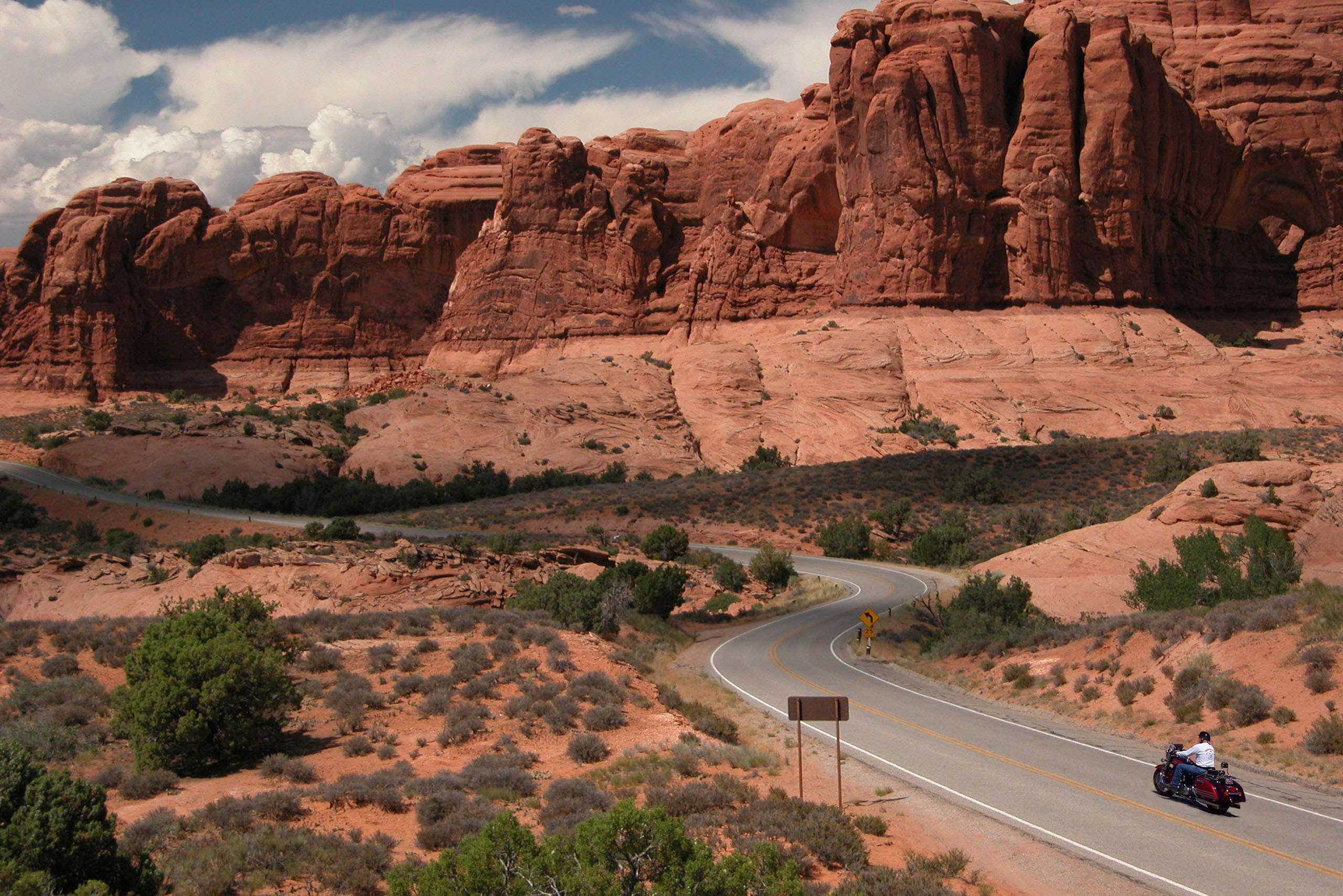
Upper Colorado River Scenic Byway (U-128) is the preferred route into Moab from Interstate 70. You start your journey across the open desert with a few sweeping curves, until you reach the Colorado river where considerably sharper turns will command your attention. The route crosses the mighty river near the historic Dewey Bridge. Built in 1916 and used until 1986, this suspension bridge is on the National Register of Historic places and is now only open to foot traffic. A nearby rest area, makes this a perfect stop to stretch your legs. Beyond the bridge, the byway continues to follow the Colorado River with more twists and turns, before giving way to a straight, but spectacularly scenic, section. Along this stretch, you will pass the majestic Fisher Towers and the famous Castle Rock, a finger-like spiral to the southwest, which was the location for many films and commercials, and can be seen just before the Castle Valley Junction.
Just past a ranch used in many John Wayne movies, you’ll want to focus on the road as it rejoins the river and the spectacular twisty curves return. Breath taking scenery is in abundance on this well-maintained paved two-lane road, that twist and turns as often as the river it follows through the steep canyons to highway 191 just 2 miles north of Moab. Definitely a “must do” route that can be worked into your itinerary, as an arrival or departure route, or just up to Dewey Bridge and back, for a quick fix. The tight curves can catch you off guard, and the beauty can be overwhelming, so watch out for on-coming traffic, as they may be distracted by the scenery and cross over. There are many turnouts along this 42-mile route offering beach access, restroom facilities, picnic tables and camping.
While in Moab, another “must do” is the Arches National Park. Although the 22 mile road is not challenging, it is enjoyable and the scenery is so spectacular it really doesn’t matter. An initial climb through some interesting hairpin curves gives way to a fairly straight road with an occasional gentle sweeping curve. You will pass nature-sculpted rock formations such as Balanced Rock, Sheep Rock, Parade of the Elephants, which leave no doubt how they received their names. The park is full of the arches it is famous for, as well as petrified dunes and amazing rock pinnacles. Many of the arches are visible from the road or by taking a short hike. The amazing thing about this ride is that although you return on the same road you entered the park on, the views are totally different. Make it a point to visit Arches in the late afternoon, as a sunset ride on the return trip is magnificent. This is one you won’t forget, a truly amazing ride.
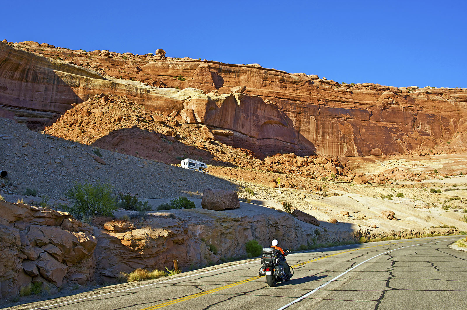
Out for a short after dinner ride? The Potash-Lower Colorado River Scenic Byway (U-279) takes you through a narrow canyon as you twist and turn with along the banks of the Colorado River through the Colorado River Portal. This scenic 17 mile route offers many opportunities to stretch your legs and enjoy sights such as Indian petroglyphs, dinosaur tracks, and arches. After passing Jug Handle Arch, the canyon walls open as you near the Moab Salt-Potash plant, above which the sheer cliffs of Dead Horse State Park can be seen. Taking this ride in the late afternoon rewards you with the sun setting on the red sandstone cliffs as you make the return trip.
The LaSal Mountain Loop Road is a 60-mile route, which follows Scenic Byway 128 to the Castle Valley Junction. At this point a right turn has you entering a series of sweeping curves before opening up into Castle Valley where the Priest and Nuns rock formations and Castle Rock are visible. Still another right turn onto the LaSal Mountain Loop and you immediately find yourself ascending in a series of hairpin turns that will grab your attention and demand full concentration. Therefore, make sure you stop at the many view points to take in the breath-taking vistas as the vegetation changes from pinyon and jupiter trees to large pines and towering aspen. Shortly after passing the turnoff to Warner Lake Campground, the road winds down into Mill Creek Canyon, over bubbling brooks and through towering trees, before climbing again for the final descent past Ken’s Lake Recreation Area and into Moab. A great summer ride when you want to beat the heat for a few hours.
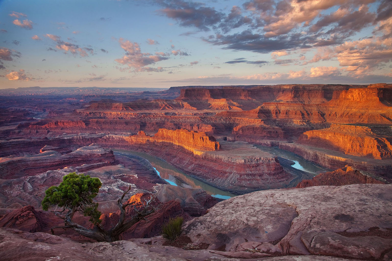
Dead Horse Point Mesa Scenic Byway (U-313), just 9 miles North of Moab on Highway 191, takes you through 14 miles of incredible red rock canyon country, before forking off to Dead Horse Point State Park. After a series of hairpin curves as you begin to ascend the plateau, the road mellows out allowing you to appreciate the scenery. The view from Dead Horse Point, a large mesa connected by a narrow neck of land, is one of the most photographed scenic vistas in the world and well worth a few miles of straight and scenic touring.
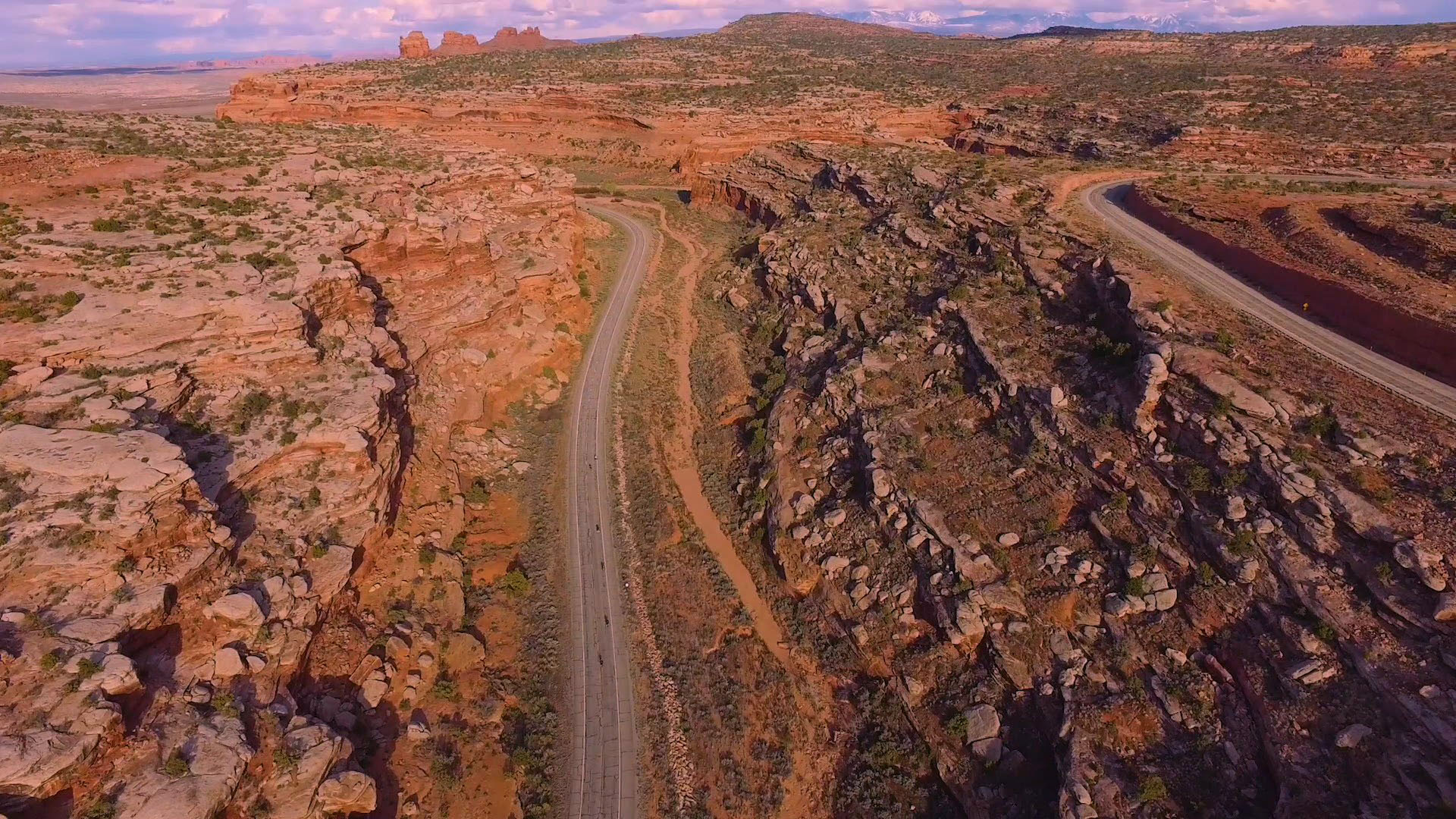
After leaving the State Park, backtrack to Highway 313, hang a left, and head toward to the Island in the Sky District of Canyonland’s National Park. Within the park there are several scenic loops, all of which offer numerous sweeping curves and tight twisty turns, making this a favorite ride for locals. One word of caution, the scenery is so spectacular, it can be distracting and often, a seemingly straight stretch of road suddenly becomes a hard corner. Stop at the numerous overlooks, or stretch your legs on one of many short walking trails, to get a closer look at the spectacular vistas. Since this is a loop, you can experience the sheer joy of the ride on the way back.
Need somewhere to to park your vehicle or trailer overnight? Although the city of Moab does not have any public long-term parking areas, these companies provide safe, secure storage.
For a more optimal web experience, please view our site on Microsoft's recommended browser, Edge. You can download it here.