
- Attractions
- Activities
- Lodging + Campgrounds
- Area Info
- Services
- Transportation

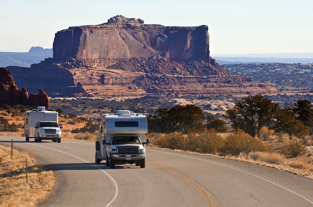
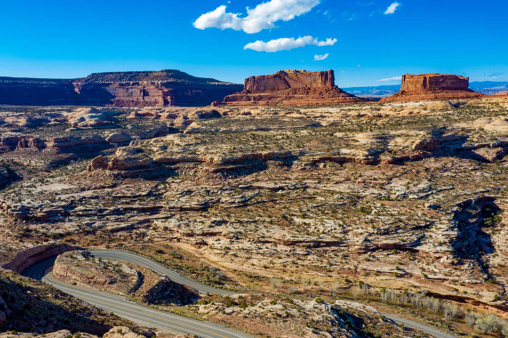
Scenic Byway U-313
Dead Horse Mesa Scenic Byway
U-313 is a 22.5 mile (36.2 km) long State highway that winds its way through Grand and San Juan Counties. The highway is the access road for Canyonlands National Park and Dead Horse Point State Park. U-313 was first built in 1975 in place of U-278.
Construction crew severely damaged the U-313 while constructing the road into what is now Canyonlands National Park. In 1988 the route was rebuilt from its original state of steep grades and blind switchbacks to its current state. The reconstruction of SR-313 was done at the same time as the access road into Canyonlands National Park.
U-313 is currently called the Dead Horse Mesa Scenic Byway. This Scenic byway leads you to one of the most photographed landscapes in the world. Dead Horse Point makes you feel as if you are on top of the world, with some of the most amazing 360-degree views.
At the highest viewpoint on a clear day, the La Sal Mountains can be viewed to the east, the Abajo Mountains to the South, The Henry Mountains to the west and the Bookcliffs to the north.
The intersection of SR-313 and Hwy 191: mile marker 136.8 on US 191 and 11 miles (17.7 km) north of downtown Moab, Utah, 20 miles – 32.2 km (south of Exit 180 on I-70. This is the beginning of your journey to what seems to be the ends of the earth.
Before starting your journey you may want to travel .3 miles (.5 km) north on Highway 191 to fill your tank at the gas station located there. This station was one of the iconic movie locations in the 1997 movie Breakdown, starring Kurt Russell and Kathleen Quinlan. The plot is basically about a man searching for his missing wife after his car breaks down in the middle of the desert.
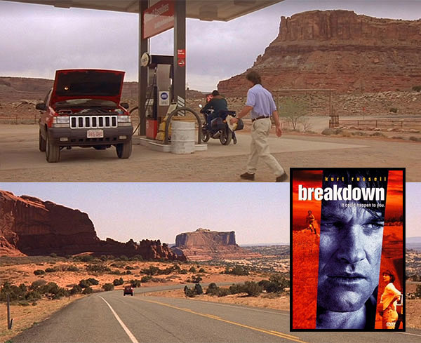
Kurt Russell gasses up his vehicle near the intersection of US-191 & U-313 in Breakdown.
Note: Don’t worry folks, reliable car service is just a phone call away in Moab.
Proceed back to the beginning of U-313 and set your trip odometer to 0.
This attraction has life size dinosaurs that walk the ground that they used to call home. https://moabgiants.com/
Moab Giants Dinosaur Park is the first of its kind world-wide. The perfect balance of adventure and science, Moab Giants has been the realization of a dream for both dinosaur park enthusiasts, and world renowned scientists. They have special expertise in the field of fossil footprints and a deep knowledge of the paleontology of the region.
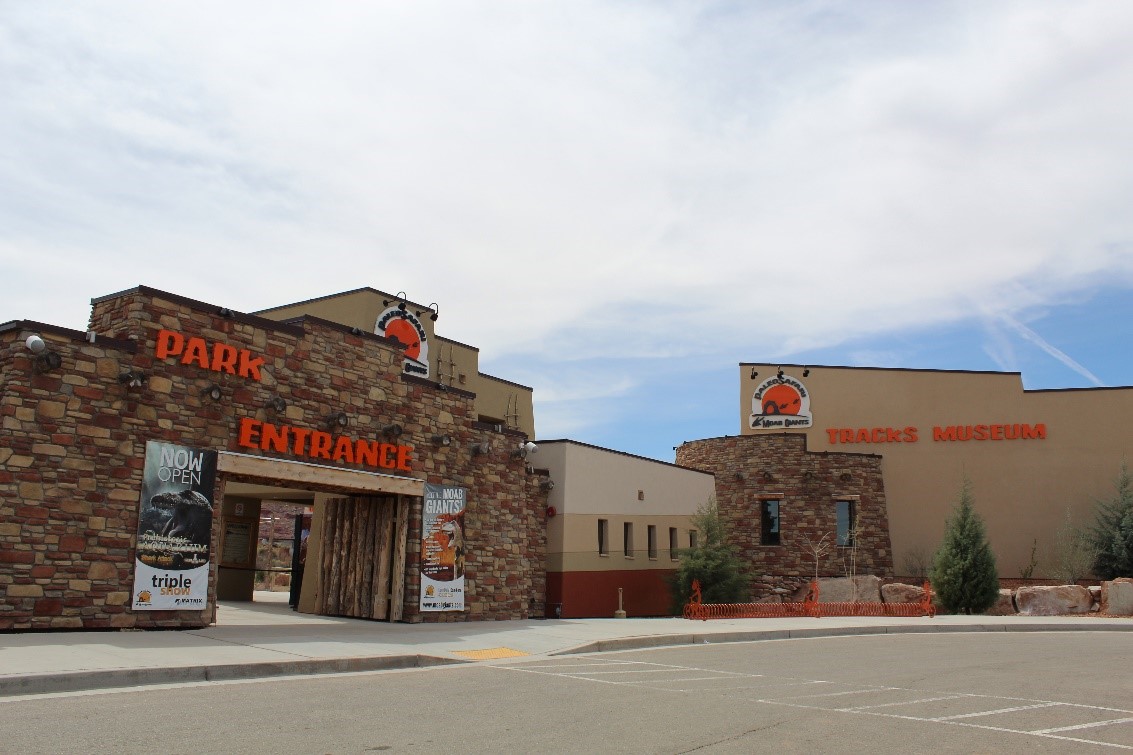
Not only is the park set among some of the world’s most breathtaking scenery, it is also a unique experience for all ages. Start your journey through time with a 3D cinema introducing you into the prehistoric world, and then venture outside and make your own tracks alongside over 100 state-of the art life-size dinosaurs. You will be roaming the extraordinary landscape dinosaurs once called home, as evidenced by the huge concentration of fossilized tracks found all around the area. The Tracks Museum is full of entertainment with interactive learning touch screens, games to play, and visually stunning exhibits that not only fascinate, but educate. The 5D Paleo-Aquarium gives you a realistic view into ancient life under the sea. Your time in the aquarium will end in the 5D room with an earth shattering experience you are sure not to forget!
Note: The Giant’s Cafe serves up a great selection of food items, and entrance into the park is not required. Stop in for lunch before starting your journey.
This roadside parking area contains information about Canyonlands National Park and Dead Horse Point State Park, along with information on travel and camping rules for the area. In addition to great views of the area’s geology, abandoned uranium mining activity is visible to the north on the cliffside.
On the left is a parking area through a gate. This canyon is closed to vehicle traffic about 2.2 miles (3.5 km) up but is open to horseback riders and hikers. Follow the wash up the main canyon. Along the main canyon walls, you may catch a glimpse of a few petroglyphs (these are tricky to find so keep an eye out). The canyon ends at a grotto that usually has water in a small pond (this is not for human consumption). 7.2 miles (11.6 km) round trip.
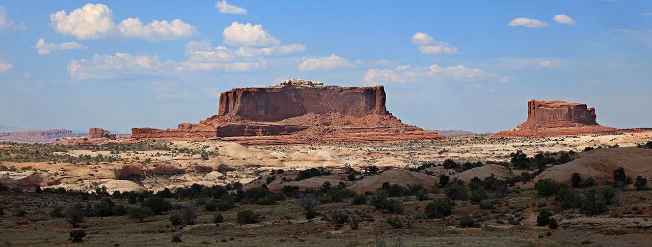
These two buttes were named for their resemblance to the Monitor and The Merrimack, two American Civil War steamships. Although Merrimac, the larger of the two buttes, looks large it is actually very thin at 200-600 feet wide and 1,600 feet long.
This parking area will give you access to a network of Mountain Biking trails. Navajo Rocks Chaco loop you can also access 7 up, Mag 7, and many other trails.
Views of the surrounding cliffs, along with the Monitor and Merrimac Buttes. This viewpoint is great for wildflowers in the spring.
This parking area is a great place to get some mountain biking, hiking and even four wheeling in. This parking area will give you access to some scenic easy four wheeling. This trailhead can take you up to a dramatic outcropping called determination towers. This is about an 8.8 mile up and back easy going scenic safari ride.
You can also access Monitor and Merrimac, Seven Mile Rim Safari Trail. Wipeout Hill Safari Trail.
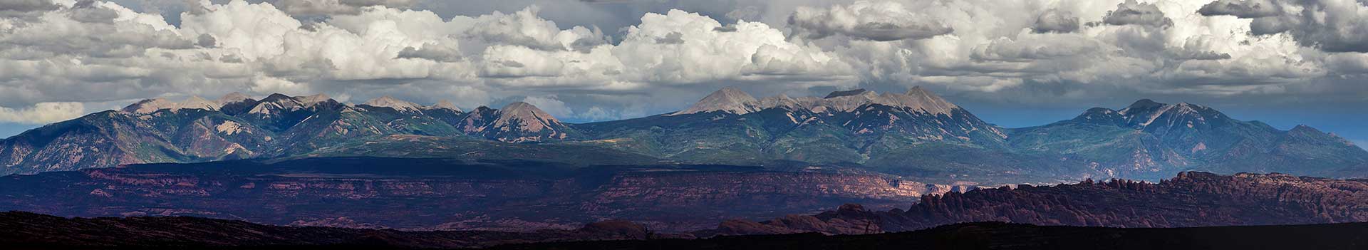
The roadside viewpoint has great views of the La Sal Mountains and the surrounding plateau country. The La Sal Mountains are part of the Manti-La Sal National Forest and the southern Rocky Mountains. The maximum elevation is at Mount Peale, reaching 12,721 feet (3,877 m) above sea level. The range contains three clusters of peaks separated by passes. The peaks span a distance of about 10 miles (16 km). The name of the range dates to Spanish times, when the Sierra La Sal (meaning the "Salt Mountains") were a prominent landmark on the Old Spanish Trail between Santa Fe and Los Angeles.
Continuing down Dubinky Well Road leads to many four-wheel drive roads that lead to canyons and vistas including:
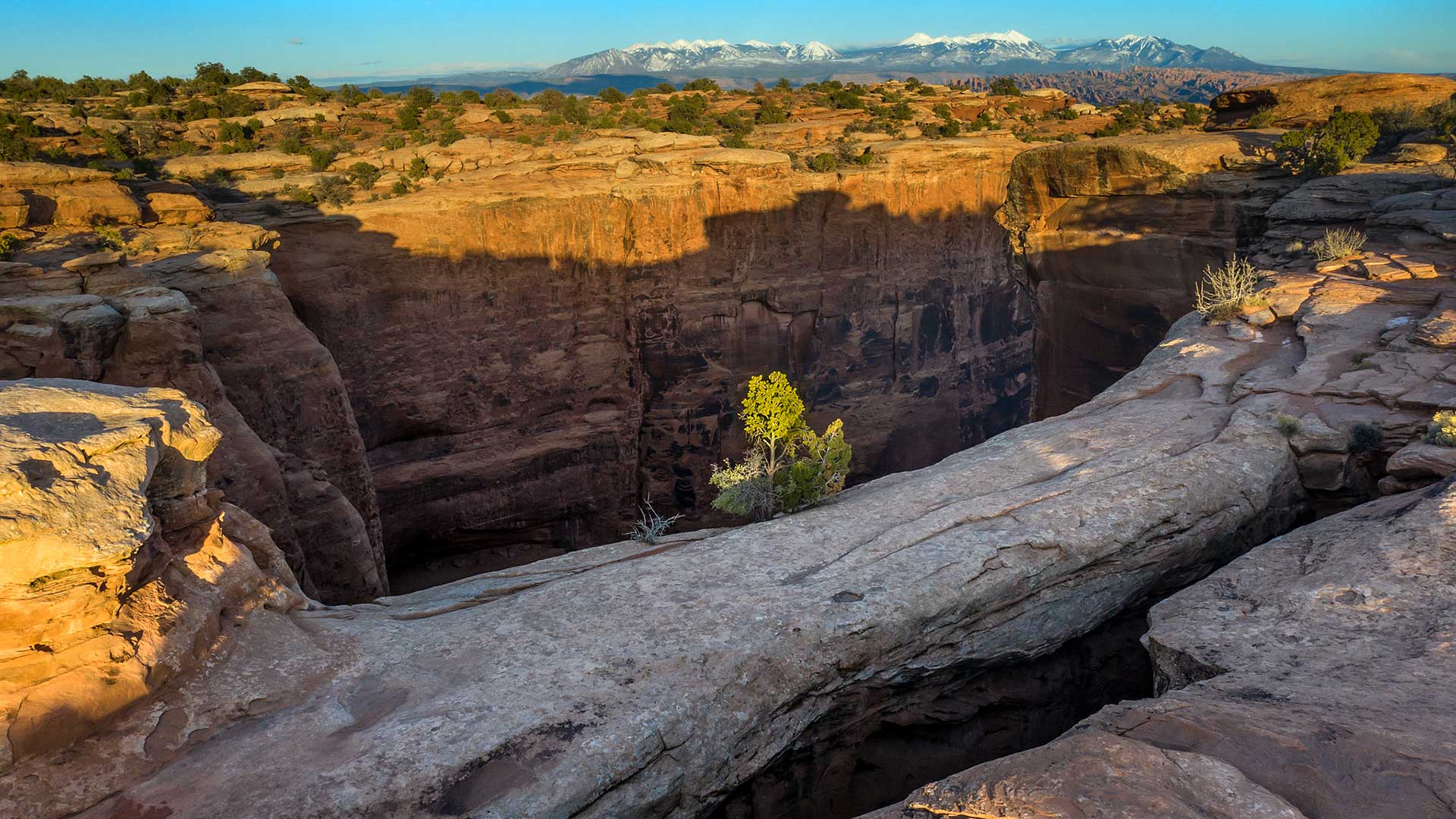
Turn right on an unimproved dirt road and continue to a parking lot in 1.3 miles (2.1 km). A high clearance vehicle may be required based on conditions. This trail offers spectacular views across Hell Roaring Canyon to a large natural arch. From the parking lot, the trail passes through a fence and follows a dirt road for about 0.1 miles (.16 km). The trail leaves the road and goes down several dry washes until it rejoins an old road (closed to vehicles). After a short distance, the trail leaves the old road, and follows a series of rock cairns near the edge of Hell Roaring Canyon (400 feet deep).
View of Hell Roaring Canyon on the trail to Jewel Tibbetts Arch
After a short distance, the trail follows a short spur onto a slickrock platform, from which spectacular views of the arch and the canyon below can be had. The trail returns to the parking lot across a blackbrush mesa, where it rejoins the road. The arch is named after Jewel Tibbetts, a Moab resident who lived about 10 miles’ (16.1 km) distance at the Horsethief Ranch in the 1950 and 1960’s with her husband Bill. They often took ranch visitors to see the arch. Note: Hikers should exercise caution on those sections of the trail which are close to the edge of Hell-Roaring Canyon. The trail can be very warm in summer. Neither mountain bikes nor motorized vehicles are allowed on this trail, except for the first 0.1 miles (.16 km) where the trail follows an existing road. Length of Hike: 2.1 miles (3.4 km), round-trip (semi-loop); allow about 2 hours round-trip.
Campsites are tucked in the pygmy pinyon-juniper forest on the mesas above Moab, yet offer great views. Individual sites are available on a first-come, first-served basis. One group site, Horsethief Group Site, is available for reservation through Recreation.gov. This campground is close to Canyonlands National Park and Dead Horse Point State Park.
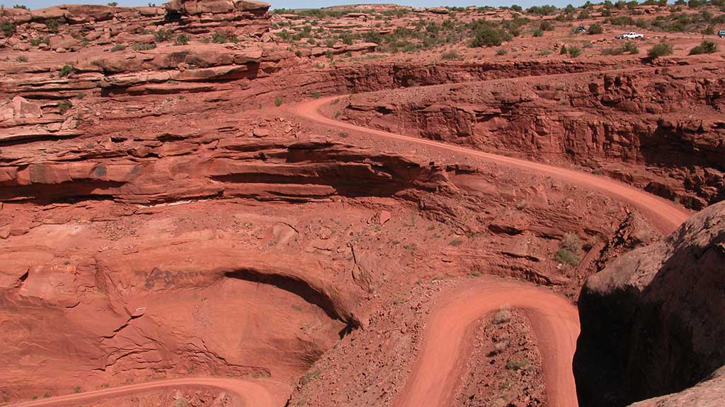
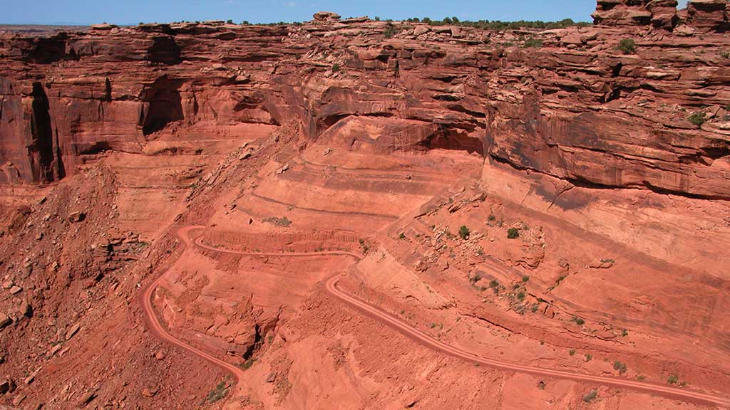
The road is well maintained and is rated as easy. It is about 13 miles (20.9 km) to the switchbacks that lead you down to the White Rim Trail and the Green River. The steep switchbacks are scenic and easy as you descend about 500′ to the bottom. Although the road is suitable for high-clearance two-wheel-drive vehicles when dry, the unpaved sections of the road can be impassable when wet. In any case, driving 4WD is recommended due to uneven surface. Once on the bottom, turning right will lead you to a dead end at Mineral Bottom, where rafting boats are launched. If you turn left you are on the White Rim Trail in Canyonlands National Park. (A permit is required for the White Rim: https://www.nps.gov/cany/planyourvisit/dayusepermits.htm)
Gemini Bridges is one of the most popular spots in Moab. The Gemini Bridges Trail is well known to local mountain bike riders for its scenery and long descents. Starting from U-313, the trail is nearly all downhill back to US-191. Approximately 5.5 miles from U-313, the spur route to Gemini Bridges is encountered. This route is a hiking route only and is a short 0.2 mile walk. After viewing the bridges, enjoy the rest of the marked trail down to Highway 191. This bike route utilizes a county road and is shared with jeeps, ATV/UTVs, and dirt bikes.
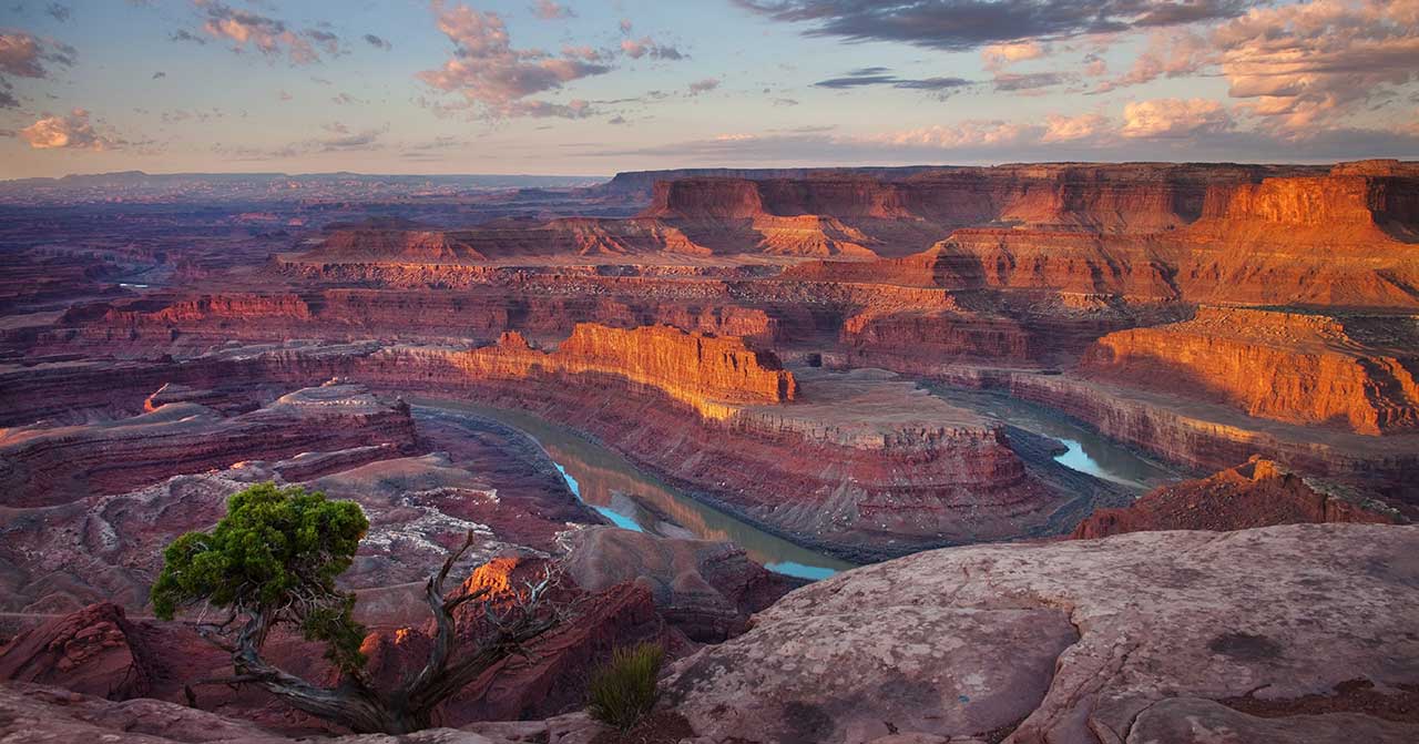
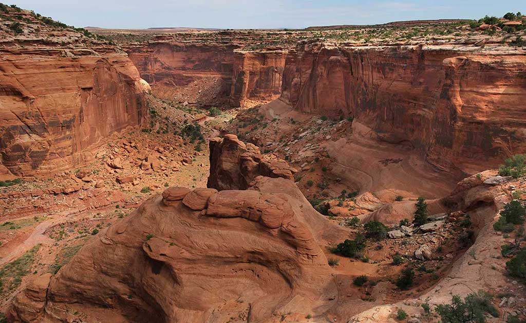
From the prominence of Dead Horse Point, 2,000 feet above a gooseneck in the Colorado River, an ever-changing landscape unfurls. Immense vertical cliffs meet with canyons carved by ice, water, and wind creating a visual masterpiece.
Millions of years of geologic activity created the spectacular views from Dead Horse Point State Park. Deposition of sediments by ancient oceans, freshwater lakes, streams and wind blown sand dunes created the rock layers of canyon country. Igneous activity formed the high mountains that rise like cool blue islands out of the hot, dry desert.
An entrance fee is required.
A perfect location for experiencing sunrise, sunset and a bit of seclusion, the Moenkopi Yurts offer a glorious camping experience up at Dead Horse Point State Park. With sweeping views and a private spur to the Intrepid Trail System this yurt site can be your quiet spot of heaven while enjoying the Moab area. These Yurts can be reserved at https://www.reserveamerica.com/explore/dead-horse-point-state-park/UT/344161/overview
A gift shop is located inside the visitor center and offers park visitors a variety of quality souvenirs including shirts, hats, postcards, cups, handmade knives, magnets, art work, pottery, snacks, etc.
On the road, about a quarter of a mile from the lookout point, you’ll pass the bottleneck which is only about 30 feet wide. Here, once the horses would be herded in, a fence and gate were placed trapping the horses. The cowboys could then pick out the wild horses they wished to keep. Unfortunately, as the story goes, once the cowboys picked the horses they wanted, they opened the gate at the bottleneck and left. It was said that the wild horses were so spooked that many didn’t leave the point, even though the gate was open, and being on top of a mesa, with no shade and no water, they died of thirst.
This is the main attraction of Dead Horse Point State Park. From the overlook parking lot, a short paved pathway leads to breathtaking views of the Colorado River and adjacent canyon country some 2,000 feet below. A large shelter at the overlook provides relief from both foul weather and summer heat. Paved pathways lead out in both directions from the shelter, providing additional viewpoints while linking up with both the East and West Rim trail systems.
Although the primary overlook and shade shelter are accessible, the eastern and western spur trails contain steeper inclines and short sections of slick rock interspersed with the pavement.
For a more optimal web experience, please view our site on Microsoft's recommended browser, Edge. You can download it here.