×
attractions activities lodging + campgrounds area info services transportation events submit an event blog contact search Covid-19 Info Visit Utah

Canyonlands National Park

The largest national park in Utah, with diversity that staggers the imagination.


Help us Protect Moab's Public Land Treasures

Introduction

Canyonlands is the largest national park in Utah, and its diversity staggers the imagination. The easiest way to see the park is with a visit to the Island in the Sky district, only 32 miles (51.5 km) from Moab. The Island in the Sky offers many pullouts with spectacular views along the paved scenic drive. Hiking trails and four-wheel-drive roads access backcountry areas for day or overnight trips.

The Island in the Sky sits atop a massive 1500 foot mesa, quite literally an Island in the Sky. Twenty miles (32.2 km) of paved roads lead to many of the most spectacular views in Canyon Country. From these lofty viewpoints visitors can often see over 100 miles (161 km) in any given direction, resulting in panoramic views that encompass thousands of square miles of canyon country. Take a short day-hike or spend a relaxing late afternoon enjoying the sunset. Whether you have a few hours to spend or a few days, the Island in the Sky provides an unforgettable Canyon Country experience for the entire family.

Distance from Moab
32 miles (51.5km)
Directions from Moab
Take Highway 191 10 miles (16 km) north to Highway 313, and then drive southwest 22 miles (35 km). Driving time to the visitor center from Moab is roughly 40 minutes.
Park Hours
Canyonlands National Park is normally open year-round, 24 hours a day.
Entrance Fee
$30/vehicle – Good for 7 days (Subject to change.)
Visitor Center & Hours

Canyonlands is open year-round, 24 hours a day, however the park visitor centers close for the winter. Call (435) 719-2313 for park information.

MAP

PARK WEBCAM

Camping

Island in the Sky Campground (Willow Flat) has 12 sites, first-come, first-served. The campground is open year-round. The spectacular Green River Overlook is nearby. Nightly camping fee is $15 per site. Sites fill quickly spring through fall. There are toilets, picnic tables, and fire rings in the campground. There are no hookups for RVs and no water at the campground. You can get drinking water outside the visitor center spring through fall.

In addition to the campground located within the park, there is a great selection of additional campgrounds in the surrounding area. Moab has many commercial campgrounds with RV hookups in addition to a huge assortment of BLM public campgrounds in extremely scenic locations. Click here for a complete list of all the camping options available in the Moab area.

Suggested Activities

A Few Hours
Drive the park’s 20 miles (32.2 km) of paved roads and enjoy the spectacular views. Sunrise and sunset are particularly beautiful times of day to enjoy these lofty panoramic views of canyon country.
1/2 Day
Drive the paved scenic drive and hike some of the shorter trails, such as the Mesa Arch or Upheaval Dome Trails. A recent theory suggests that Upheaval Dome was created by a meteor impact.
Full Day
Drive the paved scenic drive and hike some of the longer trails in the park, such as the 5 mile (8 km) round trip Neck Spring Trail. Those with high clearance/4WD vehicles can drive down the Shafer Trail to the White Rim and explore Musselman Arch, or drive all the way down to the Colorado River via Lathrop Canyon. Note that a Day Use Permit is required.
Several Days
Backpackers can experience the solitude of Canyonlands by hiking some of the trails from the mesa top to the White Rim (steep & strenuous) and spend the night in the backcountry. 4-wheel drive enthusiasts or mountain bikers may want to travel the 100 mile “White Rim Trail” which loops below the Island in the Sky mesa. Reservations for White Rim campsites and a Backcountry Permit is required.

Food

Please note that food is not available within the park. The closest restaurants are either in the town of Moab, at Dead Horse Point State Park, or at the dinosaur museum at the intersection of Highways 191 and 313 (entrance fee is not required to access the restaurant).

Park Highlights

Green River Overlook

Green River Overlook

The Green River meanders beneath the Island in the Sky, as seen from the Green River Overlook. A paved walkway leads right up to the overlook.

Mesa Arch

Mesa Arch

A great hike for families with small children, the .5 mi (.8 km) round trip hike to Mesa Arch rewards visitors with a naturally framed view of canyon country.

Shafer Trail

Shafer Trail

The Shafer Trail descends from the Island in the Sky to the White Rim. A high clearance vehicle is strongly recommended. For current conditions check at the visitor center or call 435-259-4351.

Cataract Canyon

Cataract Canyon

Located in Canyonlands National Park, Cataract Canyon contains fourteen miles of rapids ranging in difficulty up to Class V.

Spring Wildflowers

Spring Wildflowers

Indian Paintbrush are just one of the many wildflowers that populate the Island in the Sky in the Spring (April-June).

Night Sky

Night Sky

Canyonlands National Park, which contains some of the darkest night skies in North America, is a popular destination for stargazers. Click here for the latest sunrise/sunset and moon phase information for Moab.

Biking

Biking

Canyonlands is famous for its mountain biking terrain, particularly for the 100-mile White Rim Road at the Island in the Sky. The Maze also offers some multi-day trip possibilities, though the logistics and roads are more difficult (for the support vehicles, not the bikes).

The Rivers

The Rivers

The Colorado and Green rivers wind through the heart of Canyonlands, cutting through layered sandstone to form two deep canyons. Both rivers are calm upstream of the Confluence, ideal for canoes, kayaks and other shallow water craft. Below the Confluence, the combined flow of both rivers spills down Cataract Canyon with remarkable speed and power, creating a world-class stretch of white water.

Biological Soil Crust

Help to keep all of our trails open. Protect this fragile, but crucial, soil by remaining on designated roads, routes and trails at all times.

Biological soil crust, also known as cryptobiotic soil, is the foundation of desert plant life. This black, knobby crust is made up of many different living organisms and plays a vital role in maintaining the desert ecosystem. However, this sensitive soil is extremely fragile and can take decades to grow. Even a footstep can damage the crust for decades, having lasting impacts on the desert environment. Please stay on the trials. Help to protect this fragile life by remaining on designated roads, routes, and trails at all times. Where hiking trails are not established, hike in sandy washes or on bare rock.

Hiking

The Island in the Sky offers a wide variety of hiking trails ranging from short 30 minute walks on the mesa top, to overnight expeditions all the way down to the Colorado River.

Trails are marked with cairns (small rock piles). Please do not disturb existing cairns or build new ones. Signs are located at trailheads and intersections. All trails leading below the Mesa Top are primitive and rough; carry and know how to use a topographic map. No potable water is available along any of the hiking trails. During the warmest months always carry at least one gallon of water per person, per day.

Mesa Top – Easy Trails

Trail

Distance

Time

Elev. Change

Mesa Arch

0.5mi / 0.8km

30 minutes

100ft / 30m

Mornings are best – Beautiful Arch on cliff edge.

Murphy Point

1.3mi / 1.9km

1 hour

100ft / 30m

Panoramic view with Henry Mountains.

White Rim Overlook

1.5mi / 2.0km

1 hour

25ft / 8m

View of potholes & White Rim Road.

Grand View Point

2.0mi / 3.0km

1.5 hours

50ft / 15m

Panoramic view along cliff edge.

Mesa Top – Moderate Trails

Trail

Distance

Time

Elev. Change

Neck Spring

5.0mi / 8.0km

3 – 4 hours

300ft / 91m

Springs – Evidence of ranching

Aztec Butte

2.0mi / 3.0km

1.5 hours

225ft / 69m

Steep slickrock to top – Granaries.

Whale Rock

1.0mi / 1.5km

1 hour

100ft / 30m

Bare slickrock – Good views.

Upheaval Dome to Main Overlook

1.0mi / 1.5km

30 minutes

50ft / 15m

View into crater

Upheaval Dome to Second Overlook

2.0mi / 3.0km

45 minutes

200ft / 61m

View of crater & upheaval canyon

Mesa Top to White Rim – Steep & Strenuous Trails

Trail

Distance

Time

Elev. Change

Lathrop to White Rim Road

10mi / 16km

5- 7 hours

1600ft / 488m

Views of Colorado River & La Sal Mountains

Lathrop to Colorado River

17mi / 27km

Overnight

2000ft / 610m

River access – Cottonwoods

Murphy Loop

9mi / 14km

5 – 7 hours

1400ft / 427m

Panoramic view from hogback.

Gooseberry

6mi / 10km

4-6 Hours

1400ft/427m

Views of cliffs & La Sal Mountains.

Wilhite

10mi / 16km

6 – 8 hours

1600ft / 488m

Slot canyon across White Rim Road.

Alcove Spring

10mi / 16km

6 – 7 hours

1300ft / 396m

Large alcove, views of Taylor Canyon.

Syncline Loop

8mi / 13km

5 – 7 hours

1300ft / 396m

Canyon hiking – some shade.

Syncline Loop: Upheaval Crater Spur

3mi / 4km

2 hours

350ft / 107m

Some scrambling over rocks.

Syncline Loop: Upheaval Canyon Spur

6mi / 10km

2 – 3 hours

400ft / 122m

Sandy hike along wash bottom.

Biking

With hundreds of miles of four-wheel-drive roads, Canyonlands offers ideal terrain for multi-night mountain bike trips. Most groups travel with vehicle support to haul water and gear since there are few reliable water sources along these roads. For the truly adventurous, self-supported trips with panniers and trailers are also possible. Bikes must remain on designated roads: there are no single-track trails in the park.

Things to Know

  • Overnight Trips: You must have a permit for all overnight trips.
  • Day Trips: You must have a permit for day trips on White Rim, Elephant Hill, Lavender Canyon, and Peekaboo/Horse Canyon roads.
    Groups must camp in designated sites.
  • Reservations for White Rim campsites are very competitive. You may have to make a reservation up to four months in advance.
  • There are no shoulders or bike lanes. Be aware of passing vehicles.

Where Can I Ride My Bike?

You can ride a bicycle on any public roadway in the park. Some roads are better for cycling than others. Check at visitor centers for recommendations and road conditions.

Paved Roads

You can ride on paved roads at the Island in the Sky. You must must ride single file. There are no road shoulders or bike lanes; please be aware of passing vehicles.

Backcountry Roads

Canyonlands is famous for its mountain biking terrain, particularly for the 100-mile White Rim Road at Island in the Sky. The 100-mile White Rim Road loops around and below the Island in the Sky mesa top and provides expansive views of the surrounding area. Bicycle trips usually take three to four days. Overnight and day-use permits are required.

Do I Need a Permit?

  • Day Use: If you’re taking a day trip on the White Rim, Elephant Hill, Lavender Canyon, or Peekaboo/Horse Canyon roads, you need a day-use permit.
  • Overnight: If you’re going on an overnight trip, you need an overnight permit.

During the spring and fall, demand for permits frequently exceeds the number available. If you plan to visit Canyonlands during peak season, especially to bike and camp along the White Rim Road, we recommend making reservations well in advance. You can reserve overnight permits up to four months in advance of the start of your trip. Day-use permits are available up to 24 hours in advance of your trip.

Mountain bike groups must travel single-file, remain on established roads, and camp in designated sites. There is no single-track riding in the park. We recommend a support vehicle for all multi-day bike trips: there are no water sources along most of the roads. Guided trips are available for many destinations within Canyonlands.

Electronic Bicycles (e-bikes)

On August 30, 2019 the National Park Service announced a new electric bicycle (e-bike) policy for national parks, expanding recreational opportunities and accessibility. The policy supports Secretary’s Order 3376, signed by U.S. Secretary of the Interior David Bernhardt on August 29, 2019, that directs Department of the Interior (DOI) bureaus to create a clear and consistent e-bike policy on all federal lands managed by the Department.

Beginning October 1, 2019, visitors to Southeast Utah Group parks (Arches and Canyonlands national parks and Hovenweep and Natural Bridges national monuments) will be allowed to use e-bikes where traditional bicycles are allowed. Bicycles and e-bikes are allowed on paved and unpaved roads that are open to the public. Bicycles and e-bikes are not allowed on any trails in the parks.

There are no charging stations in the parks. Generators are not allowed in the backcountry. This change in e-bike policy applies to private and commercial use in the parks.

The National Park Service announcement and the agency’s new e-bike policy are available online at www.nps.gov/orgs/1207/ebikepolicy.htm.

Photography

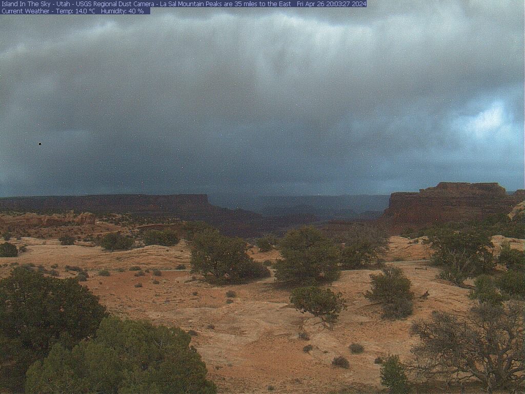
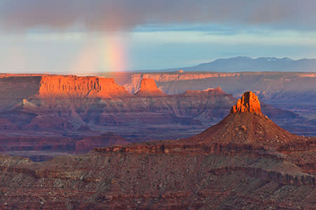
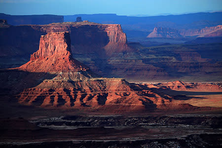
Canyonlands is a paradise for photographers. Under conditions of constantly changing light, the varicolored landscape provides limitless photographic opportunities. Often, the difference between an average photograph and an exceptional photograph is good lighting. Low sun angles at sunrise and sunset can add brilliant color to the rock. Scattered clouds can also add depth to an image and a passing storm can provide extremely dramatic lighting.

For a more optimal web experience, please view our site on Microsoft's recommended browser, Edge. You can download it here.