
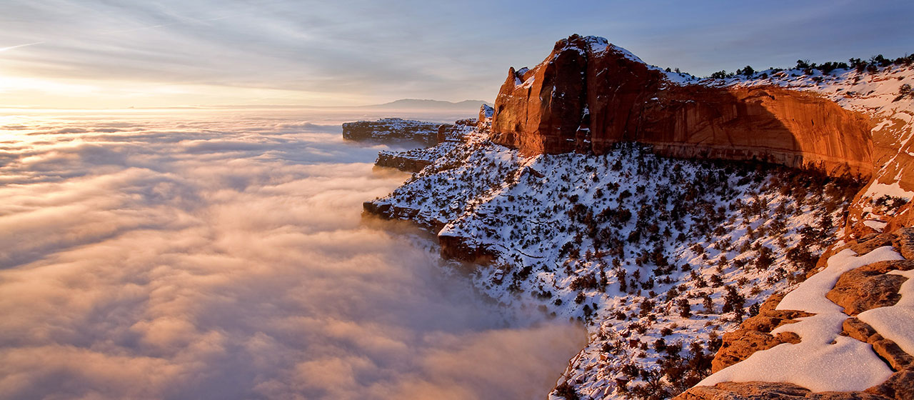
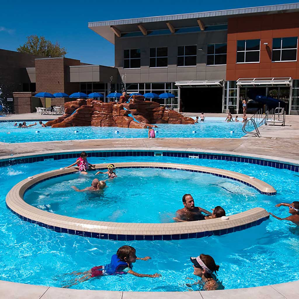
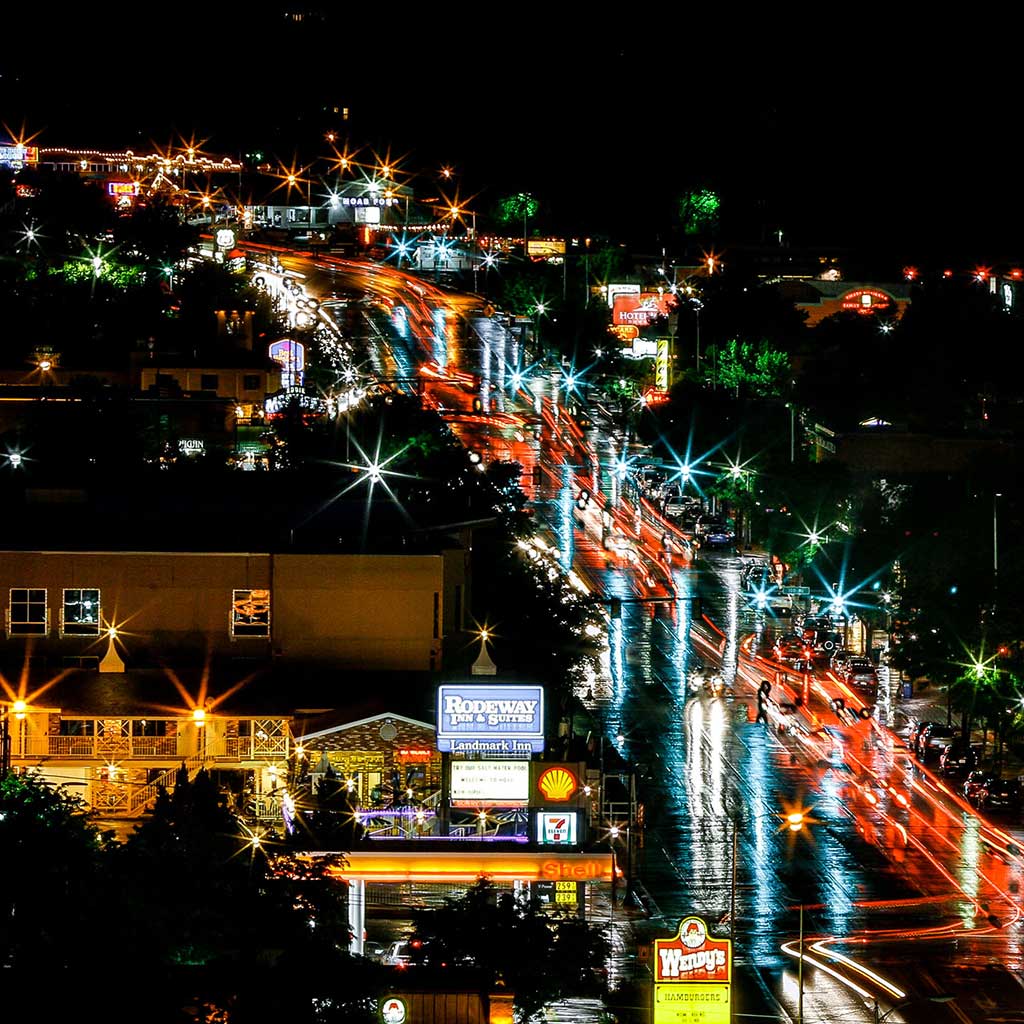
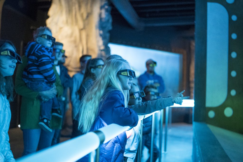
- Attractions
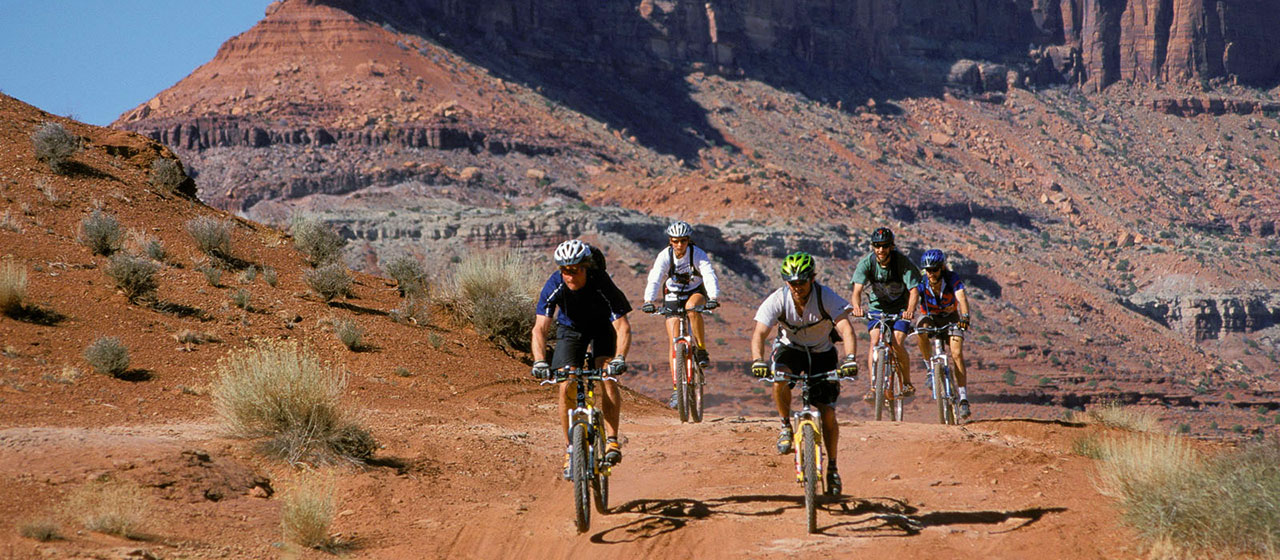
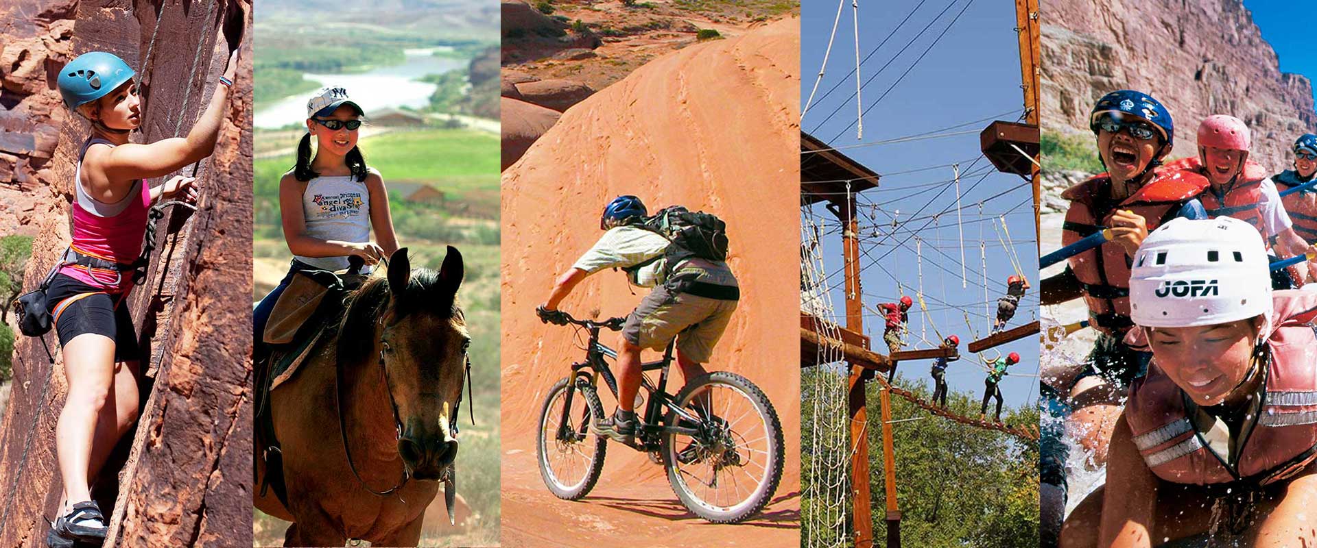
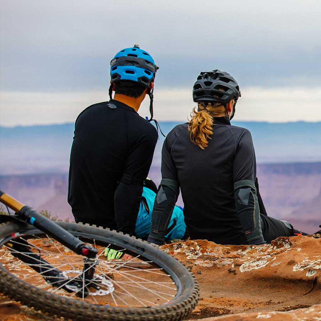
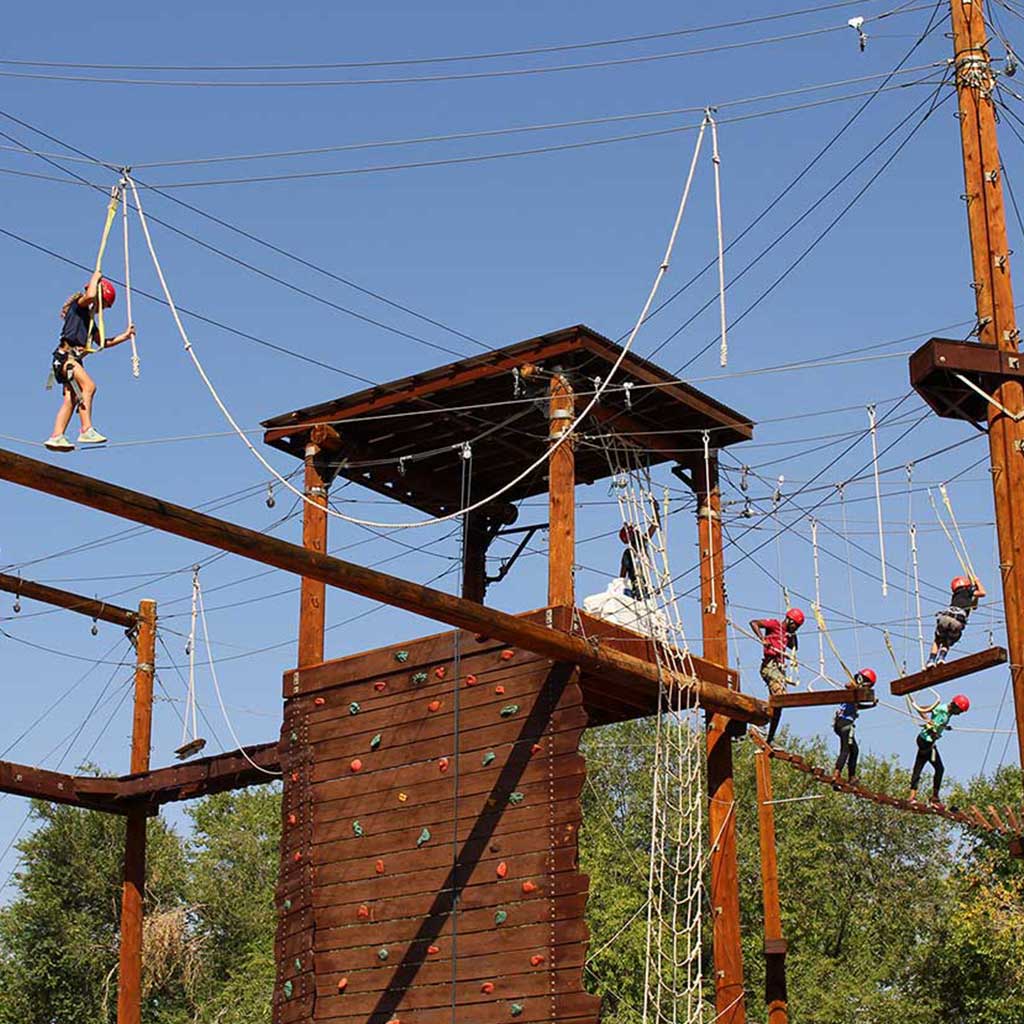
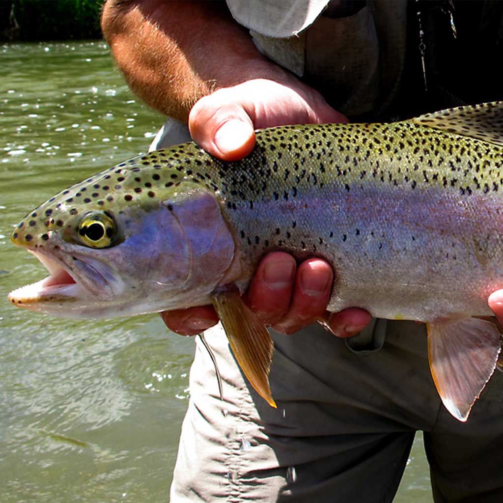
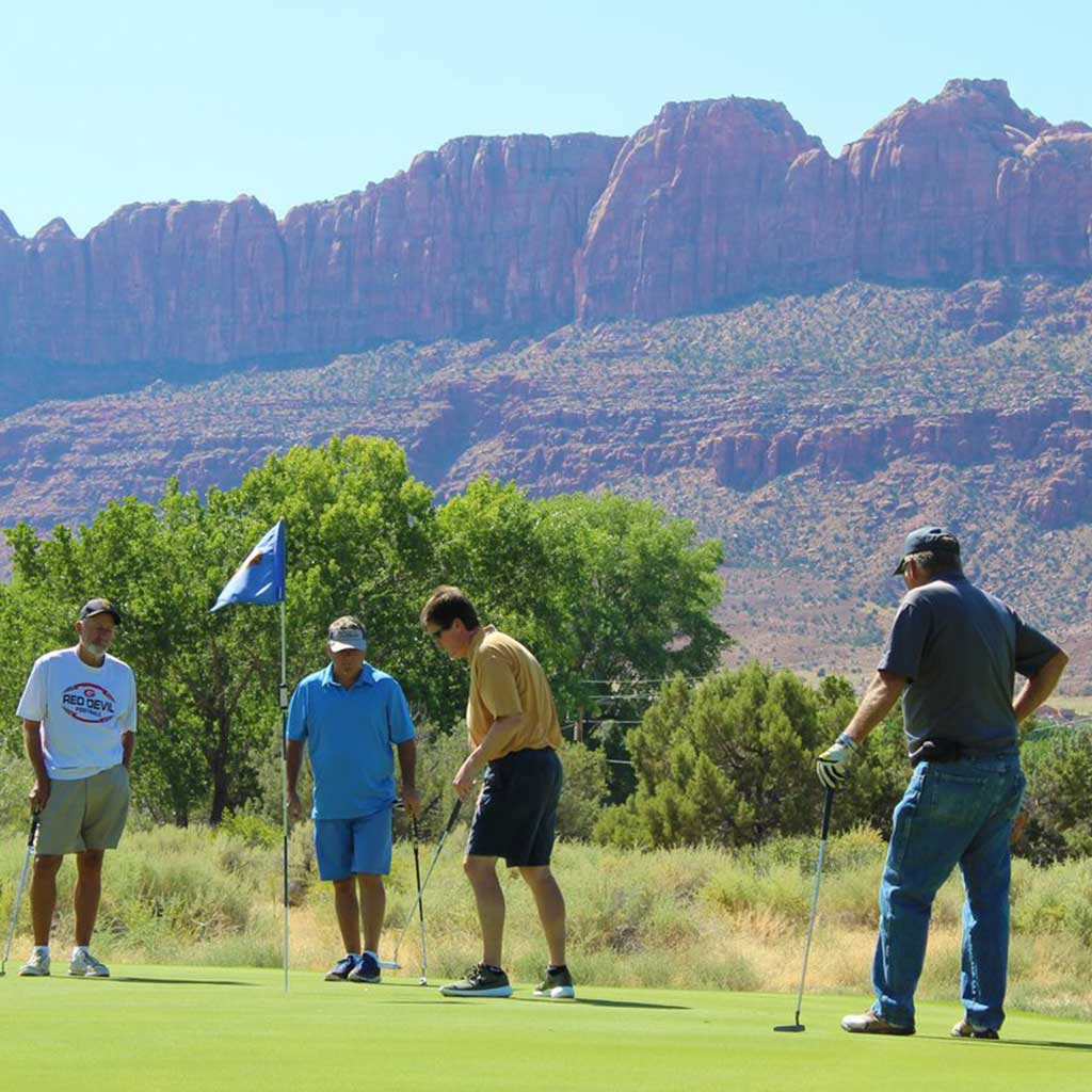
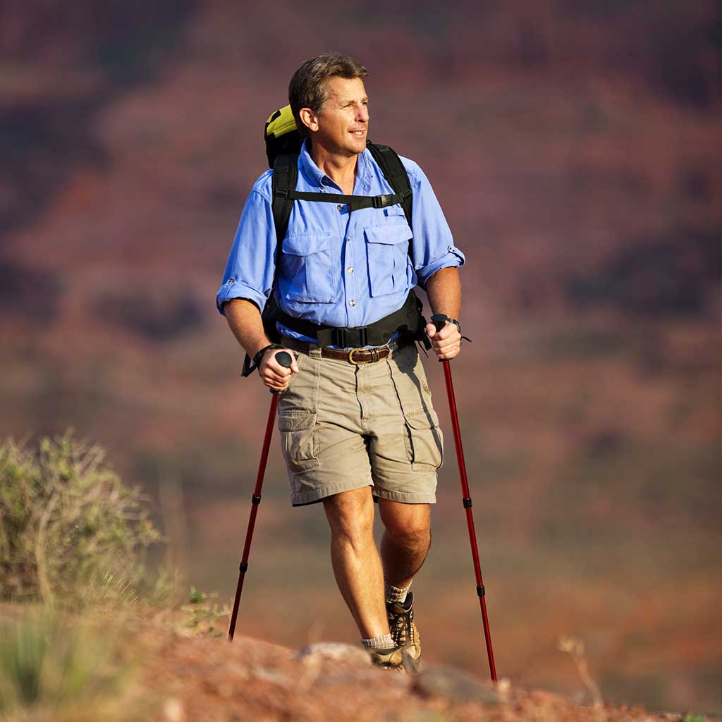
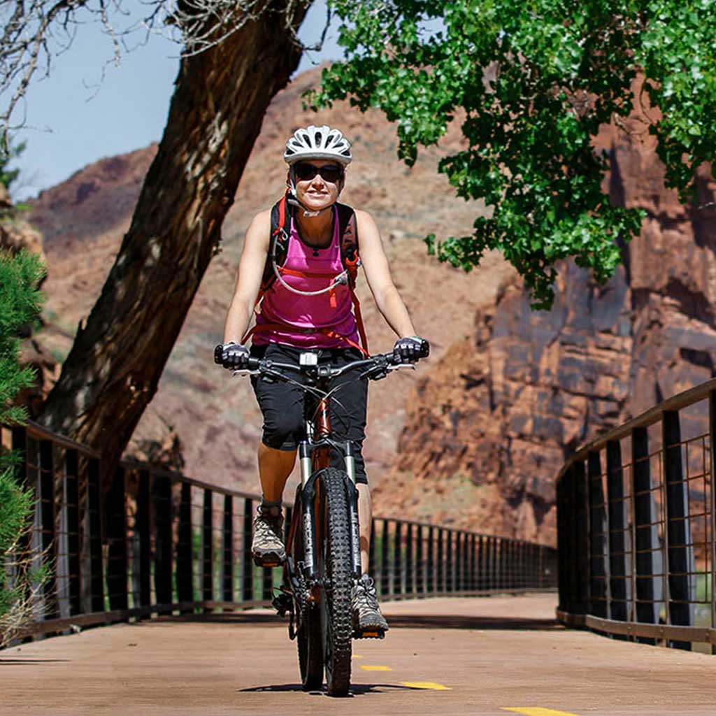
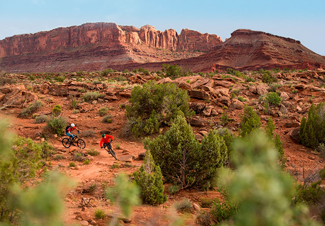
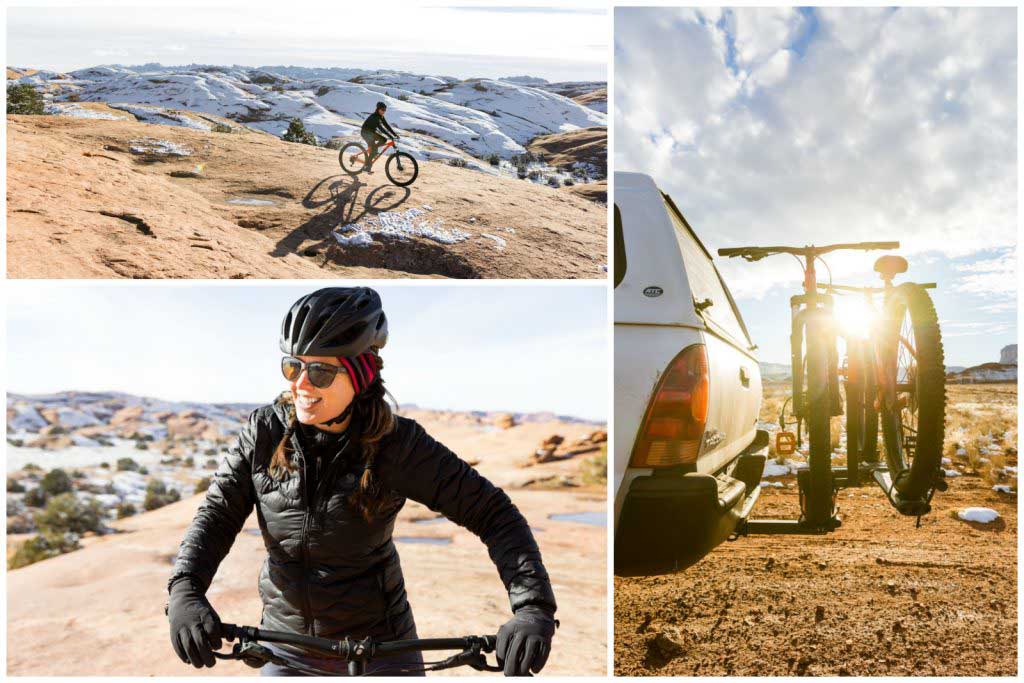
- Activities
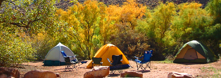
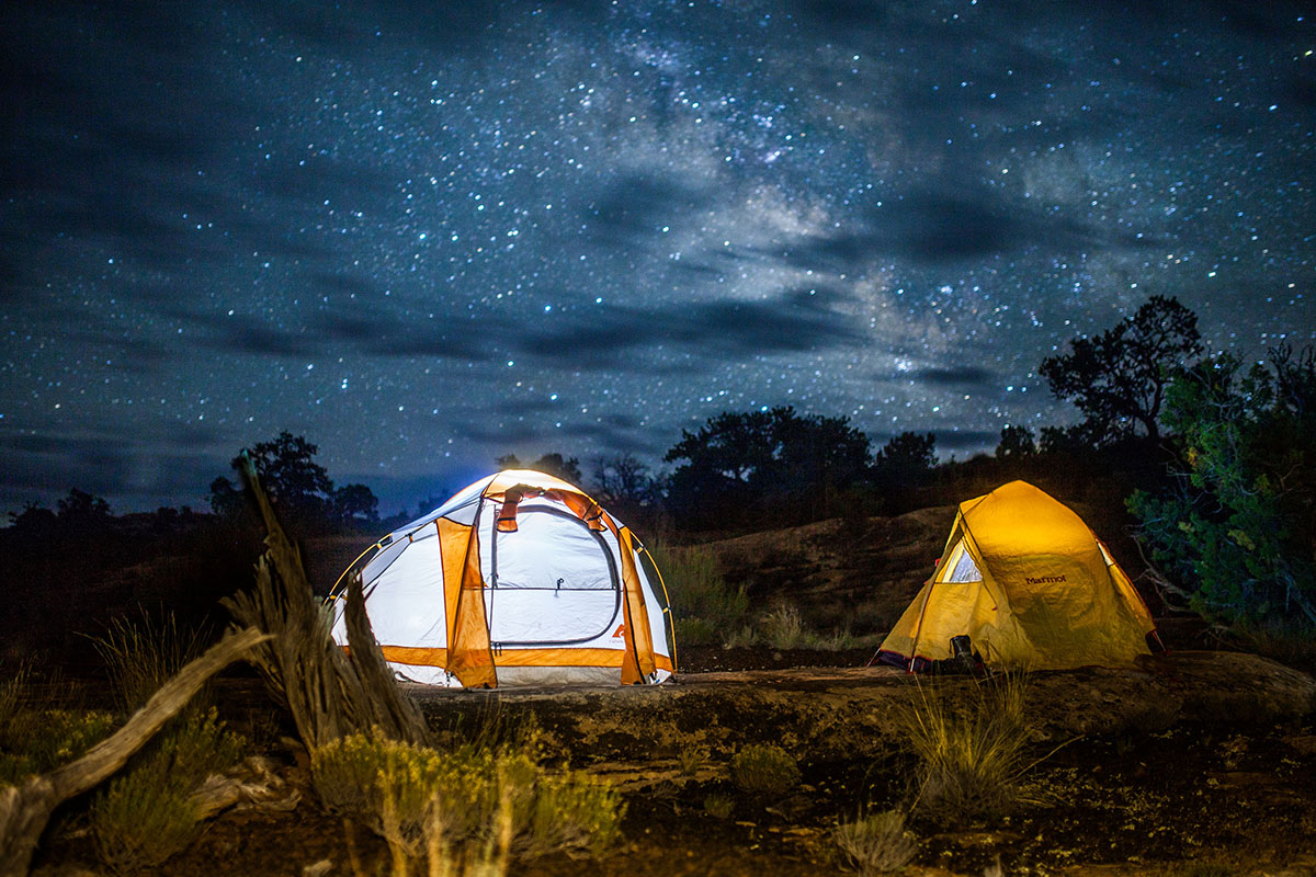
- Lodging + Campgrounds
- Area Info
- Services
- Transportation

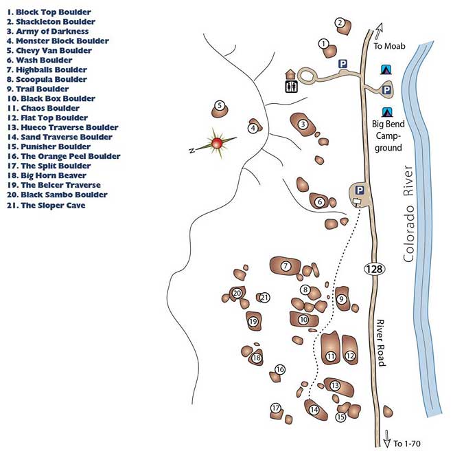
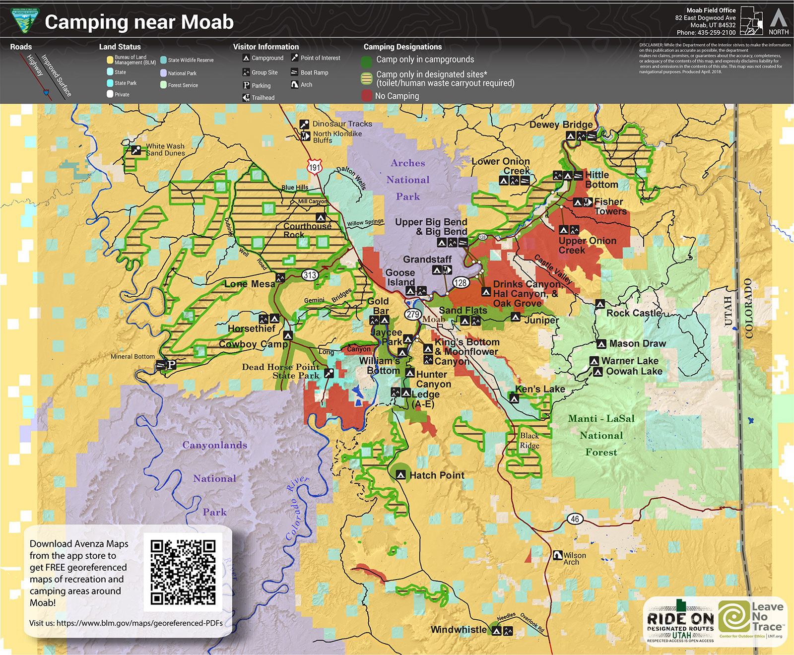
Bureau of Land Management Campgrounds

Elevation
Sites
RV Length
Group Sites
Picnic Tables
Boat Launch
Horse Corral
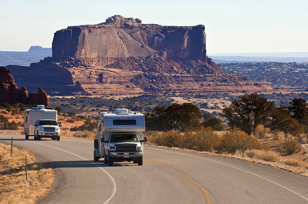
Hwy 128, 6.2 miles from Hwy 191 – Payment by cash, check or Credit Card ROK at Big Bend Campground.
Hwy 128, 6.6 miles from Hwy 191 – Payment by cash, check or Credit Card ROK at Big Bend Campground.
Hwy 128, 6.9 miles from Hwy 191 – Payment by cash, check or Credit Card ROK at Big Bend Campground.
Hwy 128, 7.4 miles from Hwy 191 – Payment by cash, check or Credit Card ROK at Big Bend Campground.
Hwy 128, 8.1 miles from Hwy 191 – Payment by cash, check or Credit Card ROK at Big Bend Campground.
Hwy 128, 21 miles from Hwy 191, then 0.7 miles southeast on gravel road. Has corral for up to 8 horses. Payment by cash, check or Credit Card ROK at Hittle Bottom Campground.
Hwy 128, 21.5 miles from Hwy 191 then 1 mile northwest on graded road. Payment by cash, check or Credit Card ROK at Hittle Bottom Campground.
Hwy 128, 21.5 miles from Hwy 191 – Dirt Road access. Payment by cash, check or Credit Card ROK at Hittle Bottom Campground.
Hwy 128, 22.5 miles from Hwy 191 – Payment by cash, check or Credit Card ROK.
Hwy 128, 28.7 miles from Hwy 191 – Payment by cash, check or Credit Card ROK at Hittle Bottom Campground.
Utah 313, 12 miles from Hwy 191 – Payment by cash, check or Credit Card ROK.
Kane Creek Rd, 2.8 miles from Hwy 191 – Payment by cash or check.
Kane Creek Rd, 7.8 miles from Hwy 191 – Dirt road access. Reservable only through Recreation.gov.
The Ledge A, B, C, D, & E Campgrounds
Kane Creek Rd, 10 miles from Hwy 191 – Access to the Ledge Campground is down a tight, steep switchback and over several creek crossings on a gravel/dirt road. It is not recommended for vehicles over 22′ or vehicles pulling long trailers. – Payment by cash or check.
8.5 miles south of Moab off Hwy 191, then follow signs south on Spanish Valley Drive. Ken’s Lake Campground is now reservable via Recreation.gov.
16 mi north of Moab on Hwy 191, then approximately 1 mi on the graveled Mill Canyon Road (turn left at first “Y” on road). Large graveled parking area suitable for large RVs and/or trailers. Campsites 1-4 and 7-10 cash, check, scan and pay. Campsites 5 and 6 reservation only through Recreation.gov.
22 mi north of Moab on SR 191, take the graveled Road 143 and past the metal toilet (stay left at first “Y” on road). This campground also has the option to pay using the Recreation.gov mobile app.

Within 20 miles of Moab, camping is only allowed in developed campgrounds.
Primitive camping is available in certain areas outside of Moab (see map & legend below): These regulations apply to all primitive sites:

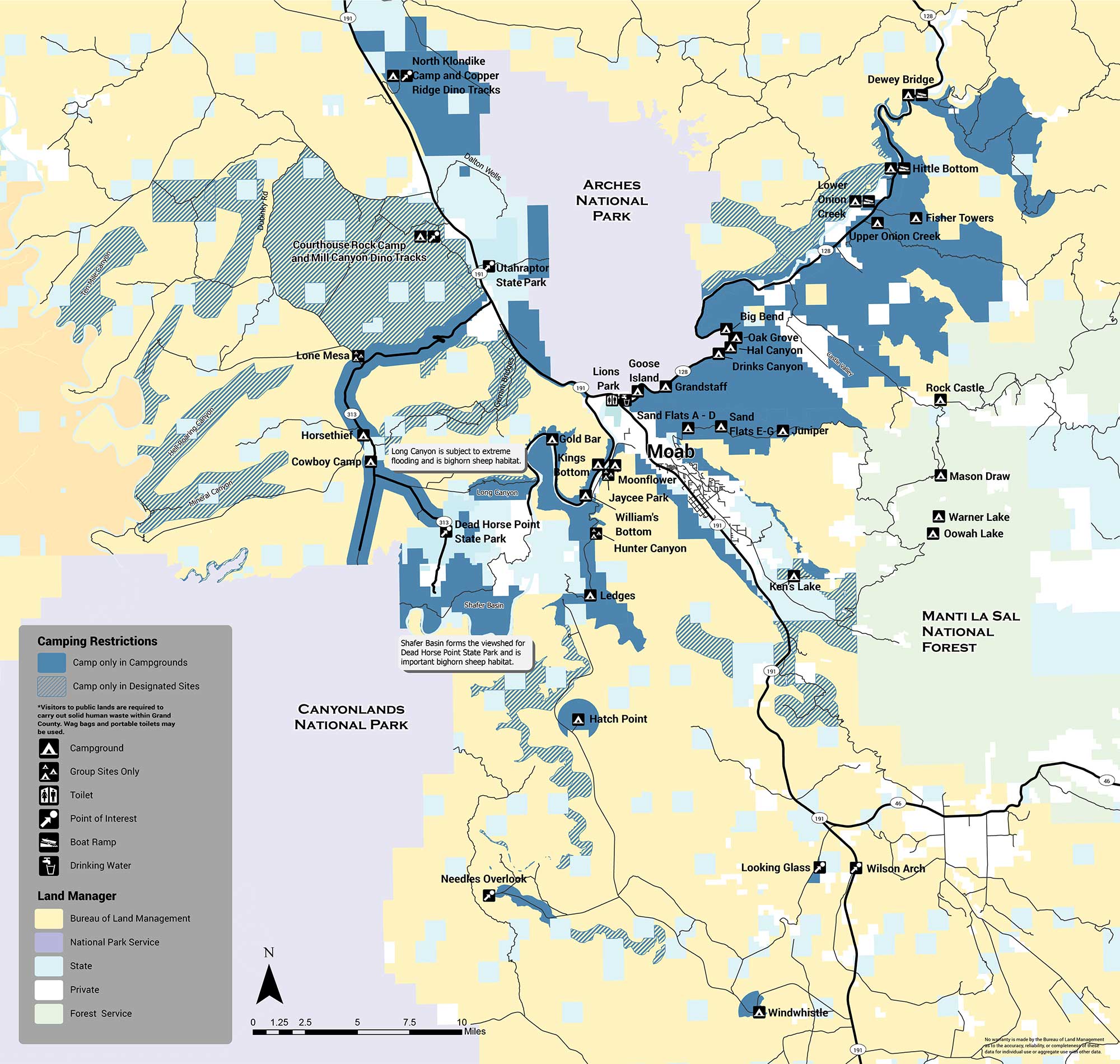
The areas with designated sites (marked with green hatch lines) are summarized below:
There are several areas in which no sites are designated and camping is not allowed (orange). The Shafer Basin, which forms the viewshed of Dead Horse Point State Park and is important bighorn sheep habitat, has no sites. Long Canyon, which is subject to extreme flooding and is also important bighorn habitat, has no sites. No camping is allowed in the Mill Creek area immediately east of the city of Moab, or on the west side of Spanish Valley. No camping is allowed within one mile of developed recreation sites in the Canyon Rims Recreation Area. If you have any questions about primitive camping restrictions please contact the Moab BLM Office at (435) 259-2100.
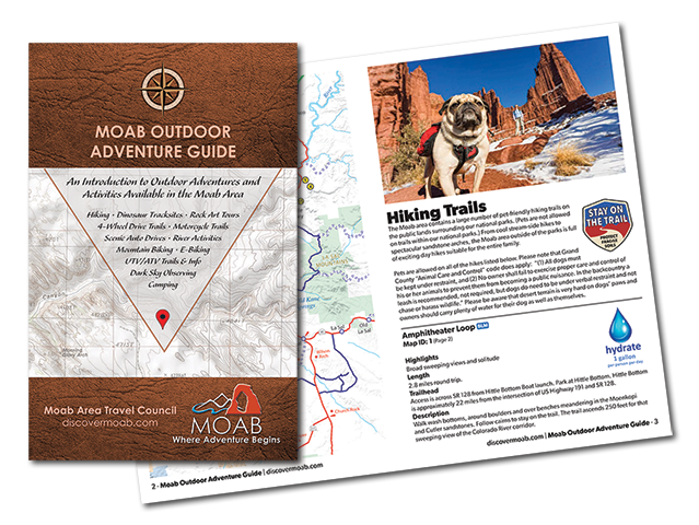
Introducing the Moab Outdoor Adventure Guide—a comprehensive resource showcasing the diverse range of adventures and activities awaiting you on the public lands surrounding Moab. Whether you’re drawn to hiking, off-road driving, river activities, scenic byways, dark sky observing, mountain biking, e-biking, rock art tours, camping, dinosaur trails, or exploring with your furry companions, this guide is your ultimate companion.
The Moab Outdoor Adventure Guide is now available, free of charge, at the Moab Information Center located at the corner of Main and Center Streets in Moab. For your convenience, an ebook version is also available for download. To access the guide online and embark on your virtual exploration, simply Click here.
This comprehensive guide is designed to lead you on the right path, ensuring you make the most of your Moab adventure. Discover the countless possibilities and make memories that will last a lifetime. Get your copy of the Moab Outdoor Adventure Guide today and let the excitement begin!
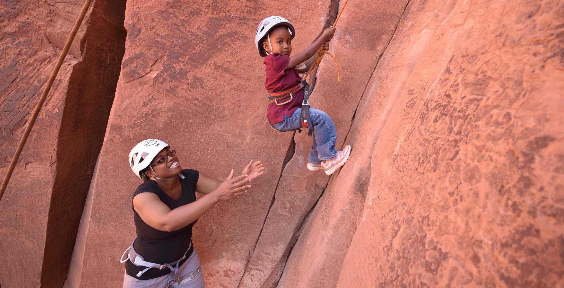
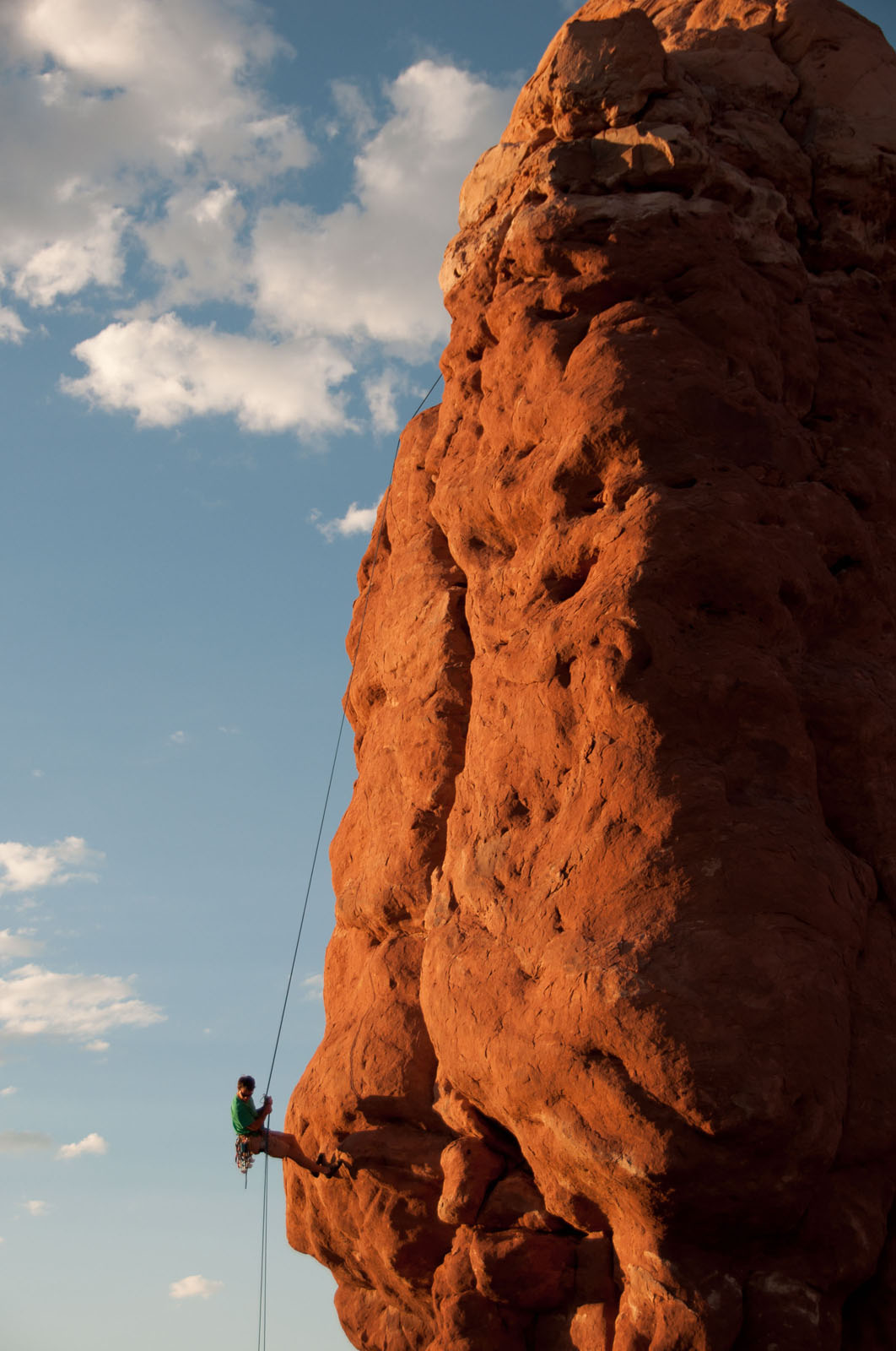
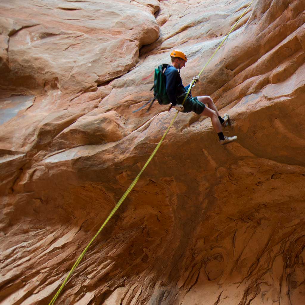
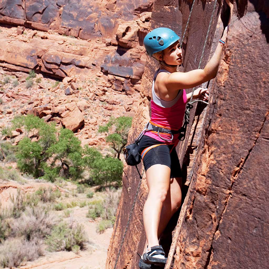
Rock Climbing and Canyoneering
Discover why people from around the world come to experience rock climbing and canyoneering in Moab, Utah. Moab has many professional guides and outfitters to help you find the perfect trip to match your pace and skills. Moab rock climbing and canyoneering are one-of-a-kind adventures you don’t want to miss!
Moab’s beautiful water carved canyons, inaccessible without technical skills, await your discovery. Moab’s experienced canyoneering guides will teach you the skills required for adventurous hikers to explore Utah’s remote red rock canyons. No previous climbing or rappelling experience is required. Anyone who is reasonably fit can experience the adventure of a lifetime. Hire a local guide to expedite an introduction to Moab’s canyoneering areas. A complete list can be found on our Guides & Outfitters page.

The Bureau of Land Management recommends not utilizing the Granary Canyon route from April through August due to Big Horn Sheep in area. (All commercial permits are restricted from utilizing this route from April through the end of August to allow wildlife room to roam.)
With easy access to thousands of routes on hard, high quality sandstone—not to mention soaring red cliffs, out-of-this-world rock formations, and enough variety to keep all levels of climbers engaged, Moab is a must-visit destination on your climbing bucket list. Several of the best-loved climbing areas in the West are just a stone’s throw from downtown Moab. Whether your specialty is splitter cracks, clipping bolts, or desert towers, there’s something in the Moab area for you.
Wall Street
Located along Hwy 279
Loca
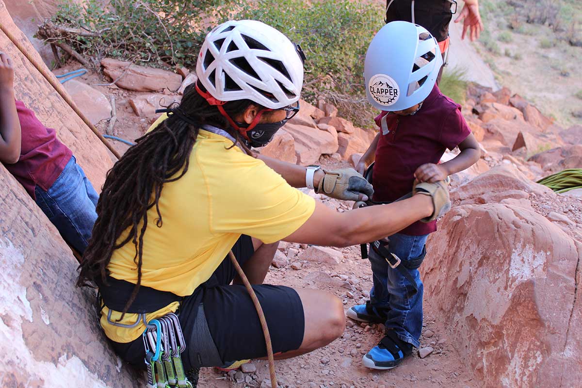
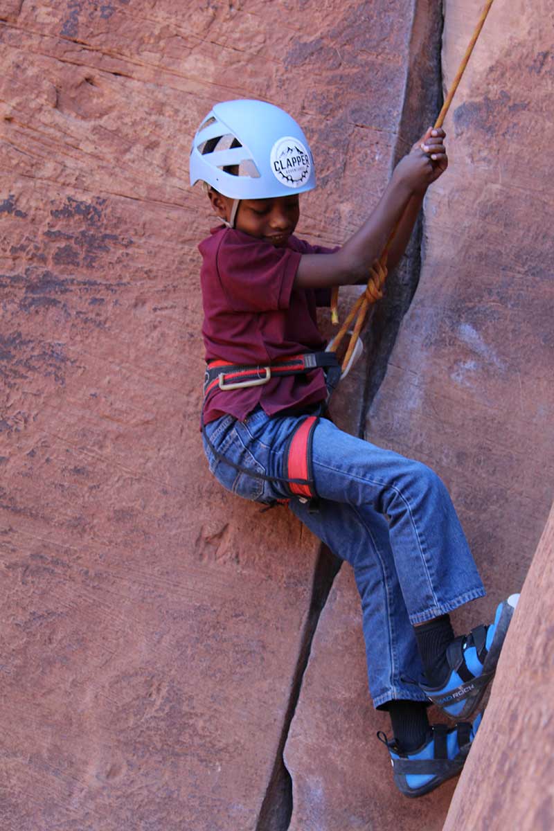
Proficiency is paramount supervising children in climbing. Do not expect to climb at adult limits with children. Moab has terrific climbing companies and their familiarity with the region is worth the investment.
Located on Hwy 279 in the Wall Street vicinity
Located on Kane Springs Road
Located 2 miles from Hwy 191 on Hwy 313
Two anchors are set 80 ft up and can be walked to from the left.
Bureau of Land Management sites Jaycee Park and Williams Bottom Campgrounds are close by on Hwy 279.
Bureau of Land Management sites Goose Island and Granstaff campgrounds are close by on Hwy 128.
Canyoneering and rock climbing activities in Arches National Park will be actively managed and monitored according to the “August 2013 resulting Climbing and Canyoneering Management Plan”. It is the responsibility of the visitor to be aware of new regulations and updated Superintendent compendiums.
While establishment of new routes will be allowed, installation of new fixed gear on new and existing routes will require a free special use permit. In order to minimize resource impacts, the park will actively seek input and assistance from the climbing and canyoneering community in assessing the suitability and quality of new fixed gear placement proposals, and replacement of existing fixed gear.
For details about group limits, obtaining required permits and regulations use the following links.
Island in the Sky District of Canyonlands National Park has the best quality rock and some established climbing routes. Permits are only required when staying overnight in the backcountry.
Climbing is prohibited into cultural resources, on arches or natural bridges of Canyonlands or the Orange Cliffs Unit adjacent to the MAZE District of Canyonlands. No altering rock by any means. Power tools are prohibited. Colored or Non Marking Chalk is required in the Parks. Be familiar with Regulations and exceptions.
Map courtesy of Sharp End Publishing
Caution: Extreme weather, becoming lost, and falls are among the possible mishaps. Anticipate these dangers with thorough planning and realistic evaluation of abilities and personal limits.
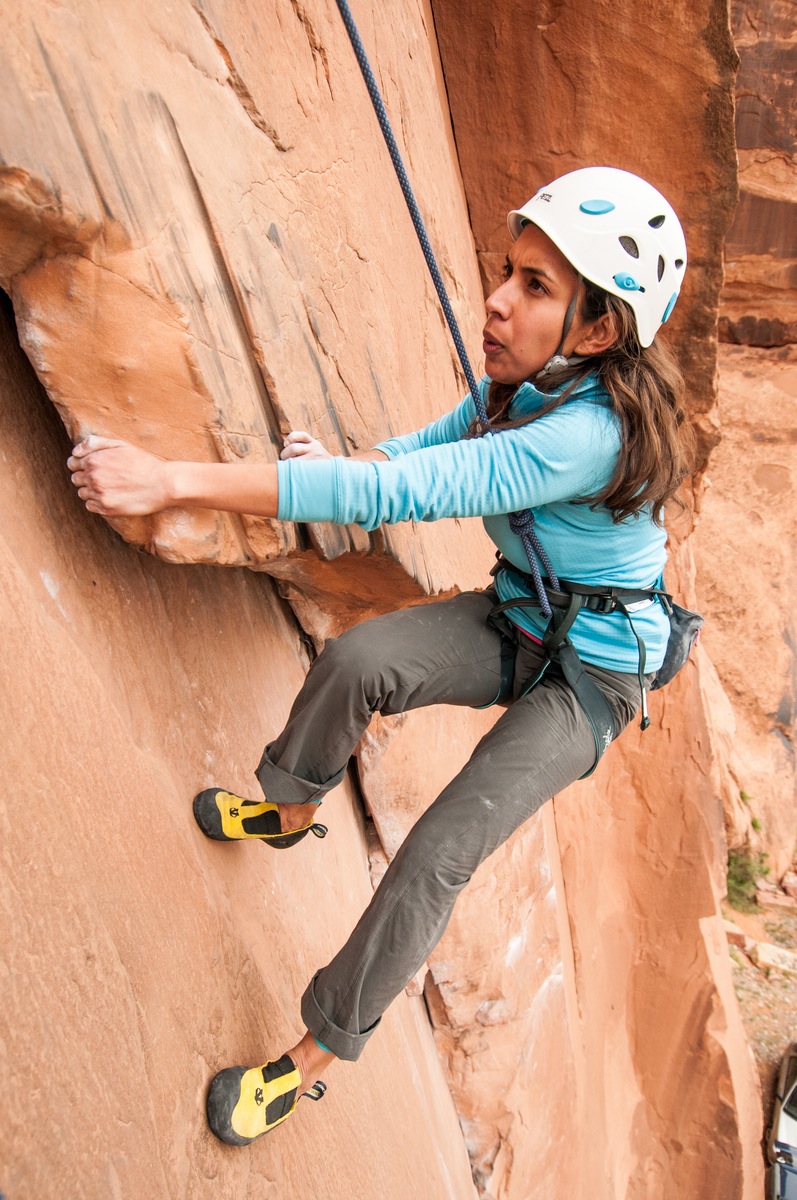
Photo courtesy of Hunter Imagery & Moab BASE Adventures
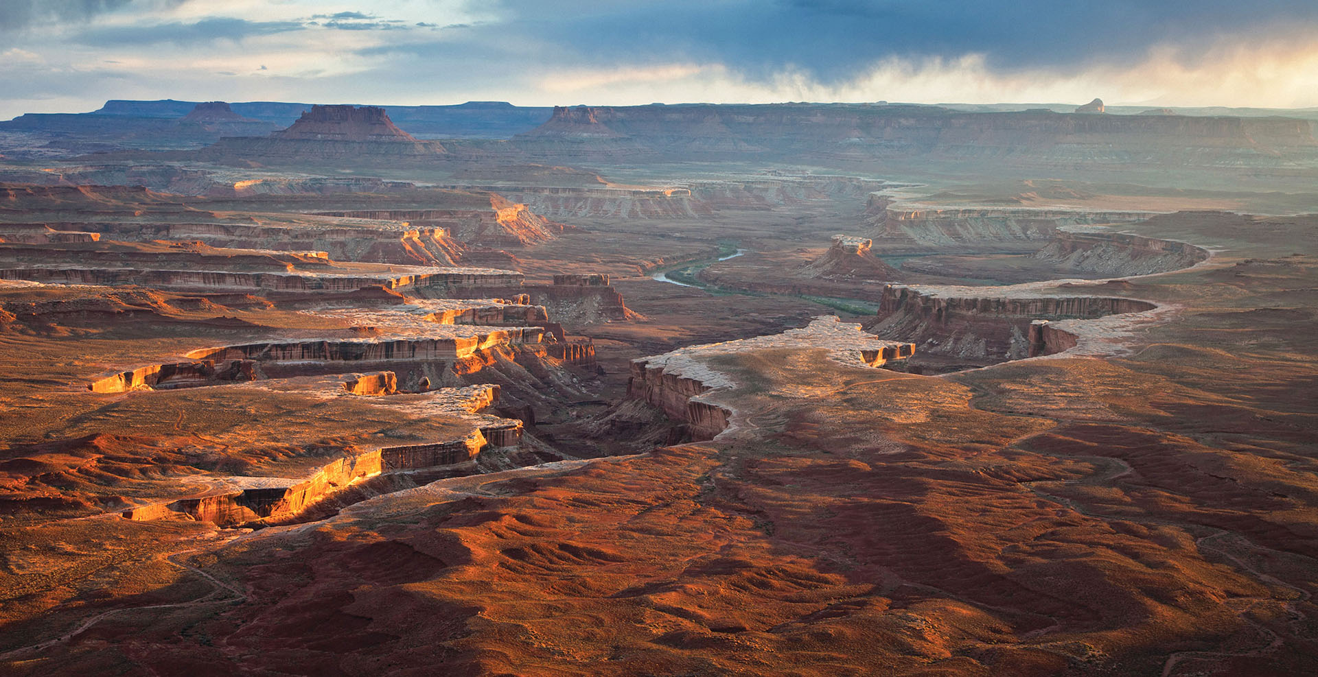
Canyonlands National Park
The largest national park in Utah, with diversity that staggers the imagination.
Phone: General Info
(435) 719-2313Backcountry Information
(435) 259-4351Mailing Address
Canyonlands National ParkDay-Use Permits
You must have a day-use permit for four-wheel-drive, motorcycle, and bicycle travel on:
Overnight Permits
River Permits
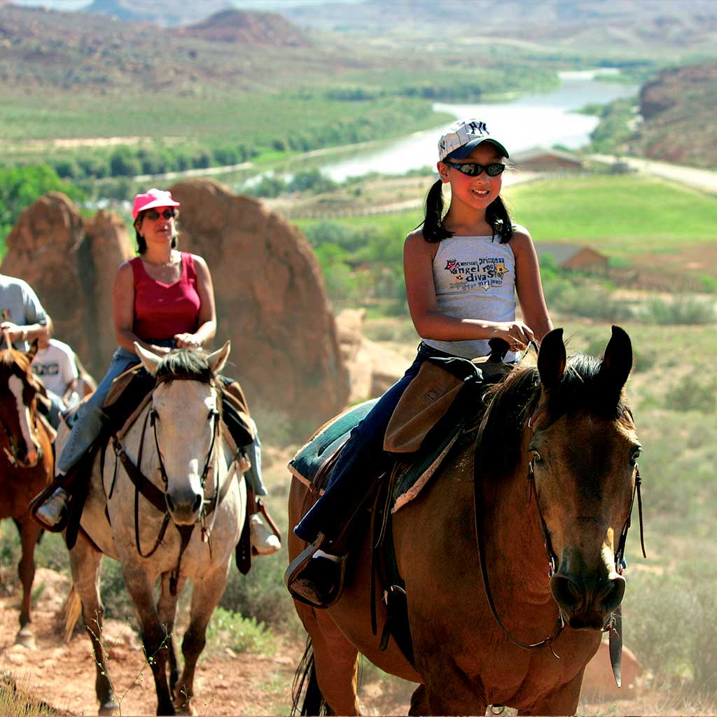
Horseback Riding, and Pack- and Stock-Use Permits
Phone: General Info
(435) 719-2313Backcountry Information
(435) 259-4351Mailing Address
Canyonlands National ParkNearby Campgrounds
In addition to the campground located within the park, there is a great selection of additional campgrounds in the surrounding area. Moab has many commercial campgrounds with RV hookups in addition to a huge assortment of BLM public campgrounds in extremely scenic locations. Click here for a complete list of all the camping options available in the Moab area.
Where to Stay
No lodging is available within the park. The closest lodging is located within the town of Moab, just 5 miles south of the entrance to the park.
Moab has hotels & motels, bed & breakfasts, resorts and a large variety of guest houses and condos. Several property management companies can even take the hassle out of finding the right accommodations. Click here for a complete list of all the lodging options available in the Moab area.
Day-Use Permits
You must have a day-use permit for four-wheel-drive, motorcycle, and bicycle travel on:
Overnight Permits
River Permits
Horseback Riding, and Pack- and Stock-Use Permits
Please note that food is not available within the park. The closest restaurants are either in the town of Moab, at Dead Horse Point State Park, or at the dinosaur museum at the intersection of Highways 191 and 313 (entrance fee is not required to access the restaurant).
The Green River meanders beneath the Island in the Sky, as seen from the Green River Overlook. A paved walkway leads right up to the overlook.
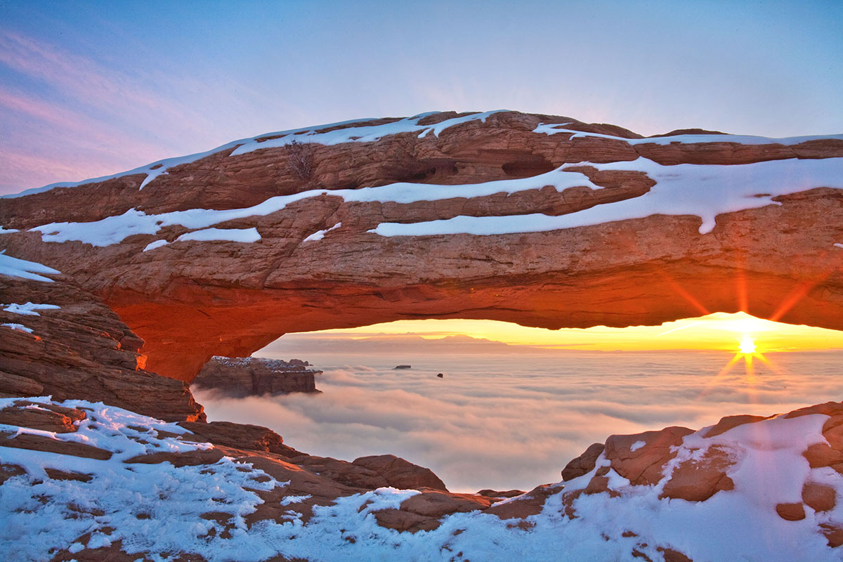
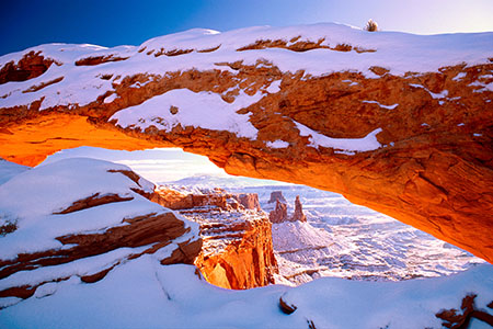
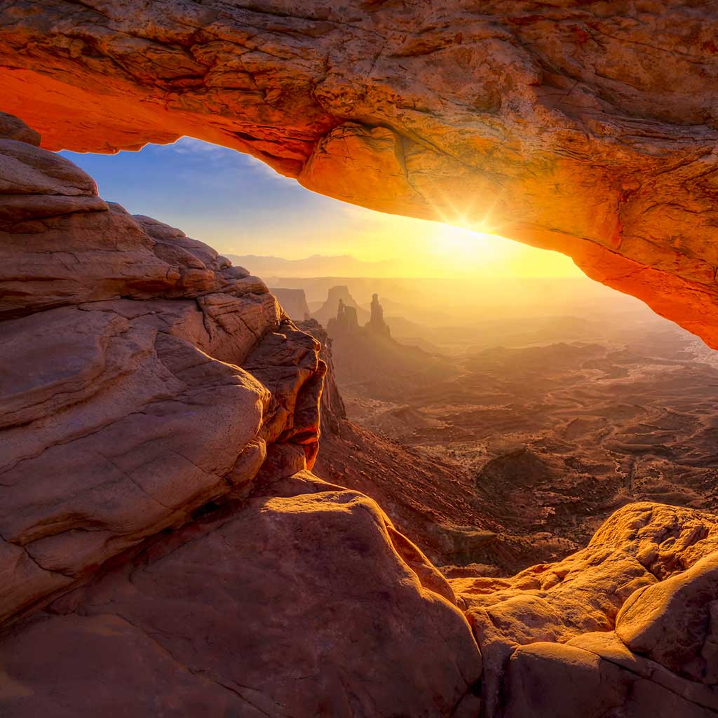
A great hike for families with small children, the .5 mi (.8 km) round trip hike to Mesa Arch rewards visitors with a naturally framed view of canyon country.
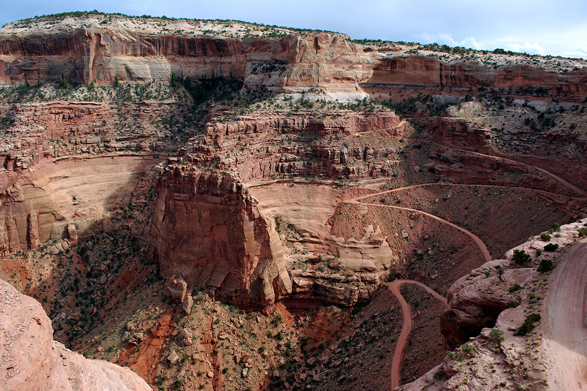
The Shafer Trail descends from the Island in the Sky to the White Rim. A high clearance vehicle is strongly recommended. For current conditions check at the visitor center or call 435-259-4351.
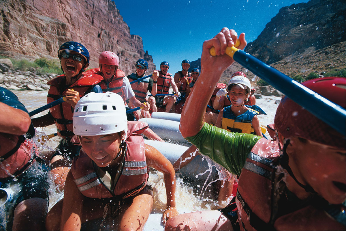
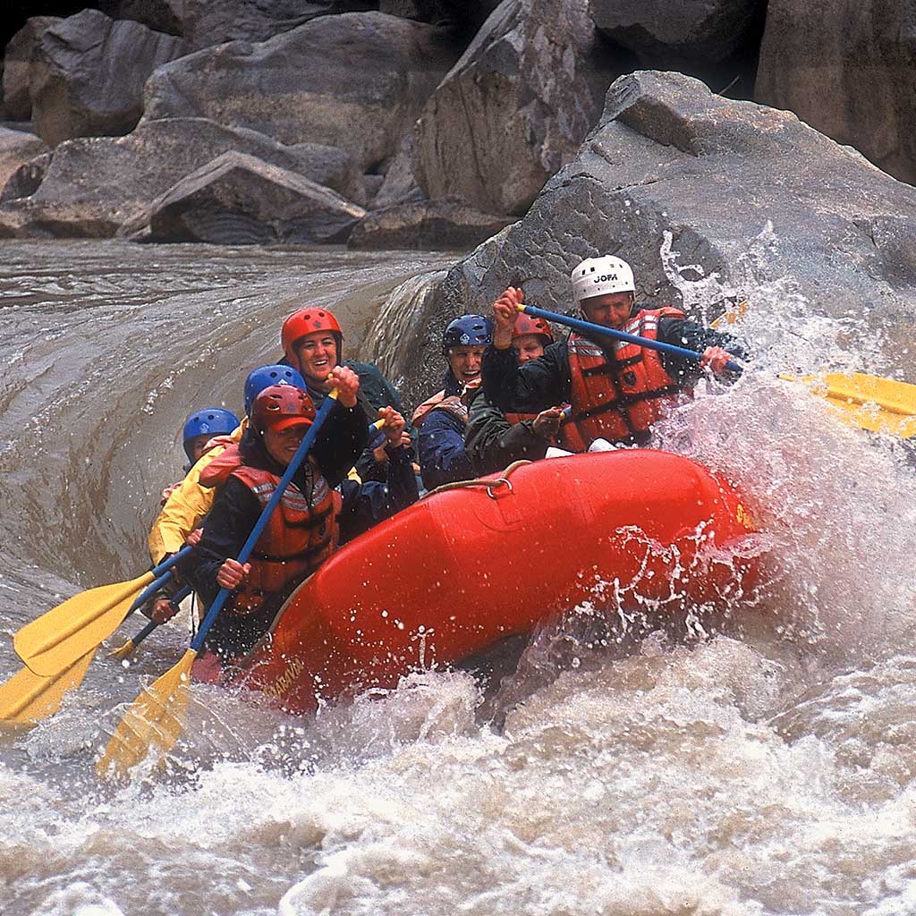
Located in Canyonlands National Park, Cataract Canyon contains fourteen miles of rapids ranging in difficulty up to Class V.
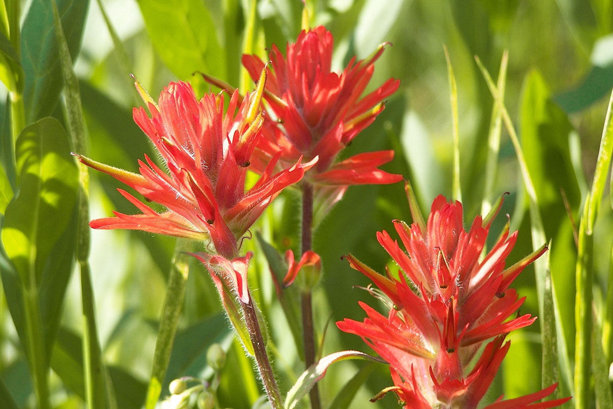
Indian Paintbrush are just one of the many wildflowers that populate the Island in the Sky in the Spring (April-June).
Canyonlands National Park, which contains some of the darkest night skies in North America, is a popular destination for stargazers. Click here for the latest sunrise/sunset and moon phase information for Moab.
Canyonlands is famous for its mountain biking terrain, particularly for the 100-mile White Rim Road at the Island in the Sky. The Maze also offers some multi-day trip possibilities, though the logistics and roads are more difficult (for the support vehicles, not the bikes).
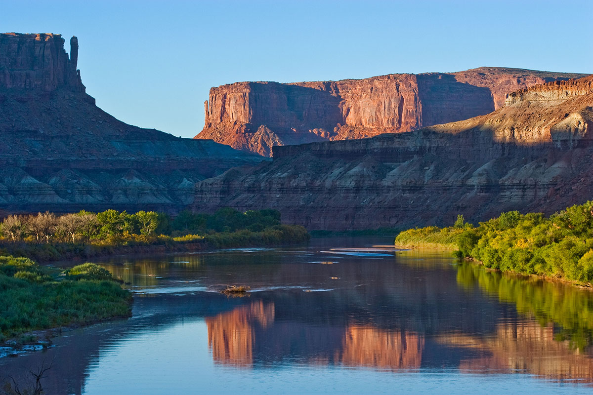
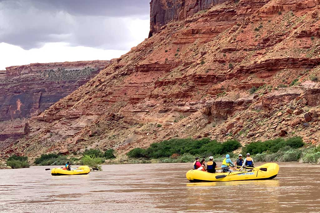
The Colorado and Green rivers wind through the heart of Canyonlands, cutting through layered sandstone to form two deep canyons. Both rivers are calm upstream of the Confluence, ideal for canoes, kayaks and other shallow water craft. Below the Confluence, the combined flow of both rivers spills down Cataract Canyon with remarkable speed and power, creating a world-class stretch of white water.
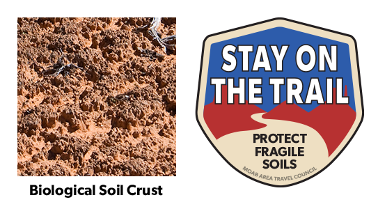
Your help is crucial in preserving our trails and protecting the fragile soil that sustains the desert ecosystem. The biological soil crust, also known as cryptobiotic soil, serves as the foundation for desert plant life. This unique black, knobby crust is composed of diverse living organisms and plays a vital role in maintaining the delicate balance of the desert environment.
However, this soil crust is exceptionally delicate and can take several decades to regenerate. Even a single footstep can cause irreparable damage that can persist for years, impacting the entire ecosystem. We urge you to stay on designated roads, routes, and trails to ensure the preservation of this fragile life. In areas where hiking trails are not established, it is advisable to hike on sandy washes or bare rock surfaces to minimize the impact on the soil.
By remaining vigilant and adhering to these guidelines, you contribute to the long-term sustainability of the desert ecosystem and help safeguard its natural beauty for generations to come. Let’s work together to keep all of our trails open and protect the invaluable biological soil crust.
With hundreds of miles of four-wheel-drive roads, Canyonlands offers ideal terrain for multi-night mountain bike trips. Most groups travel with vehicle support to haul water and gear since there are few reliable water sources along these roads. For the truly adventurous, self-supported trips with panniers and trailers are also possible. Bikes must remain on designated roads: there are no single-track trails in the park.
Things to Know
Where Can I Ride My Bike?
You can ride a bicycle on any public roadway in the park. Some roads are better for cycling than others. Check at visitor centers for recommendations and road conditions.
Paved Roads
You can ride on paved roads at the Island in the Sky. You must must ride single file. There are no road shoulders or bike lanes; please be aware of passing vehicles.
Backcountry Roads
Canyonlands is famous for its mountain biking terrain, particularly for the 100-mile White Rim Road at Island in the Sky. The 100-mile White Rim Road loops around and below the Island in the Sky mesa top and provides expansive views of the surrounding area. Bicycle trips usually take three to four days. Overnight and day-use permits are required.
Do I Need a Permit?
During the spring and fall, demand for permits frequently exceeds the number available. If you plan to visit Canyonlands during peak season, especially to bike and camp along the White Rim Road, we recommend making reservations well in advance. You can reserve overnight permits up to four months in advance of the start of your trip. Day-use permits are available up to 24 hours in advance of your trip.
Mountain bike groups must travel single-file, remain on established roads, and camp in designated sites. There is no single-track riding in the park. We recommend a support vehicle for all multi-day bike trips: there are no water sources along most of the roads. Guided trips are available for many destinations within Canyonlands.
On August 30, 2019 the National Park Service announced a new electric bicycle (e-bike) policy for national parks, expanding recreational opportunities and accessibility. The policy supports Secretary’s Order 3376, signed by U.S. Secretary of the Interior David Bernhardt on August 29, 2019, that directs Department of the Interior (DOI) bureaus to create a clear and consistent e-bike policy on all federal lands managed by the Department.
Beginning October 1, 2019, visitors to Southeast Utah Group parks (Arches and Canyonlands national parks and Hovenweep and Natural Bridges national monuments) will be allowed to use e-bikes where traditional bicycles are allowed. Bicycles and e-bikes are allowed on paved and unpaved roads that are open to the public. Bicycles and e-bikes are not allowed on any trails in the parks.
There are no charging stations in the parks. Generators are not allowed in the backcountry. This change in e-bike policy applies to private and commercial use in the parks.
The National Park Service announcement and the agency’s new e-bike policy are available online at www.nps.gov/orgs/1207/ebikepolicy.htm.
Canyonlands is a paradise for photographers. Under conditions of constantly changing light, the varicolored landscape provides limitless photographic opportunities. Often, the difference between an average photograph and an exceptional photograph is good lighting. Low sun angles at sunrise and sunset can add brilliant color to the rock. Scattered clouds can also add depth to an image and a passing storm can provide extremely dramatic lighting.
Canyonlands Natural History Association
Canyonlands Natural History Association (CNHA) is a nonprofit organization assisting the National Park Service in its educational, interpretive and scientific programs throughout southeast Utah. Known as a "cooperating association," CNHA’s goals include enhancing visitors’ understanding and appreciation of public lands by providing a selection of quality, educational materials for sale in many vistor centers. Twenty percent of these sales is returned to the National Park Service and other federal land management agencies.
CNHA operates the bookstore at Arches Visitor Center.
Friends of Arches and Canyonlands Parks
The Friends of Arches and Canyonlands Parks: Bates Wilson Legacy Fund provides direct support to Arches and Canyonlands national parks and Natural Bridges and Hovenweep national monuments in order to enhance existing projects in these spectacular areas, and to conserve the land and its cultural treasures for present and future generations to enjoy.
This mission honors the legendary work of Superintendent Bates Wilson, who came to Arches in 1949, inspiring and leading the effort that resulted in the establishment of Canyonlands National Park in 1964. The Friends Group offices are in the Rock House behind Arches Visitor Center, where Bates once lived with his family.
Be Prepared For Moab
Preparation Is The Key! If you would like to minimize your chances of requiring emergency assistance, here are a few things you can do.
Take clothing layers for extreme temperature changes
Be prepared for temperature extremes. At certain times of the year, it can get cold almost instantly at sunset. Even if you do not plan to be out after dark, take insulating clothing and gear that will help you survive in case you happen to get off the trail or are delayed for any reason. In colder months, take a jacket and/or windbreaker, a hat, gloves, proper footwear, a reflective emergency blanket, etc. Clothing is just as important during the hotter months. A lightweight, long-sleeve shirt and a hat can help you stay cool. Carry sunglasses and sunscreen too.
Take LOTS of water
If you think you have enough water, you probably don’t. Take more. A basic rule of thumb is a gallon per person per day. You may need even more, depending on the time of year. You may only plan to be out for a few hours, but plan on the unplanned. Take extra water. Electrolyte replacement is also essential, so take powdered or liquid electrolytes or something salty.
Take food
Adventure requires energy. Maintain your energy levels with adequate food. Salty foods such as trail mix or energy bars are good choices.
Tell someone where you are going and when you expect to be back
Do not change your itinerary without updating this person. The first place we will look if you are reported overdue is on the trail that you are supposed to be on.
Know your location
Research and study your planned route. Know how to navigate with a good map and compass and/or a GPS. Practice with each. Do not rely on cell phone or tablet navigation apps that require cell service to function. Cell service is notoriously bad in many areas of Grand County. If you do become lost or disoriented, don’t compound the problem by trying to get un-lost. Stay where you are.
Know your skill and fitness level
Check guidebooks for typical riding and hiking times. Then to be safe, double those times. While some experts may be able to do a certain trail in 3 hours, most people might require 6 or 7 hours to do the same trail. Be honest in assessing your skill and fitness levels. Some of Grand County’s trails can be extremely difficult, even for experts.
Take a light
Even if you plan to be back well before dark, take a headlamp or flashlight and extra batteries. Once it gets dark, do not attempt to travel without illumination. The consequences could be deadly.
Take a fire starter
Carry the means to start and sustain an emergency fire. There are many ways to start a fire. Carry a lighter, waterproof matches, or some type of fire starting kit. A knife can aid in carving kindling.
Take a cell phone
Even though cell service is a hit-and-miss proposition in this area, cell phones have helped Grand County Search and Rescue (GCSAR) save numerous lives. Make sure your battery is fully charged and leave the phone off unless absolutely necessary. If you call 911, we should automatically get coordinates for your location if you stay on the phone for about a minute. Sometimes, texting can work in areas where voice service does not. If you are unable to connect via 911, try texting a friend to call 911. Cell phones usually work if you are up on a mesa, but do not work well down in the canyons.
Carry first aid supplies
Accidents happen. Be prepared with at least a basic first aid kit that contains different types of bandages and gauze, adhesive tape, and a method to cleanse a wound.
Know the Weather
Check the forecast before you go out. Pay attention to the weather during the day. In summer months, recreate during the cooler hours earlier or later in the day. Watch for lightning and listen for thunder, especially during Monsoon Season (July through September.) Avoid slot canyons and drainages when thunderstorms are in the area or even miles up the drainage. If you hear thunder, lightning is close enough to strike you. During the winter, avalanche danger in the La Sal Mountains can be extreme. Check the forecast before venturing out: utahavalanchecenter.org/advisory/moab
Wear a Life Jacket
If you are swimming or boating, wear a Personal Flotation Device (PFD). The Colorado and Green Rivers can appear deceptively calm. Visitors have been caught in strong and invisible undercurrents near shorelines and pulled farther out into the river than they originally planned to swim. NEVER try to swim across the river without a PFD. It’s wider than it looks.
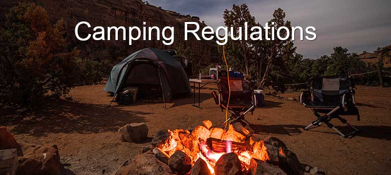
Know Local Camping Regulations
Within 20 miles of Moab, camping is only allowed in developed campgrounds. A list of developed campgrounds is available here.
Dispersed (Primitive) camping is available in a few areas outside of Moab. Click here for a map of allowed areas. The following regulations apply to all primitive sites:
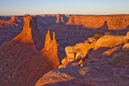
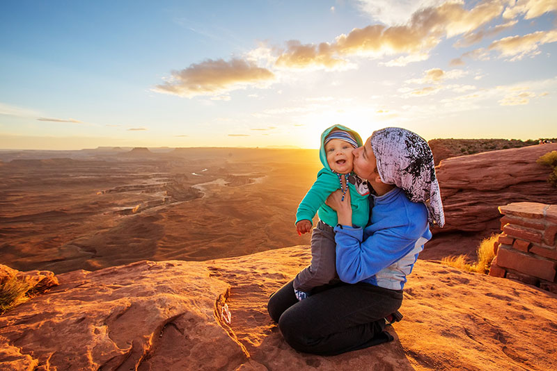
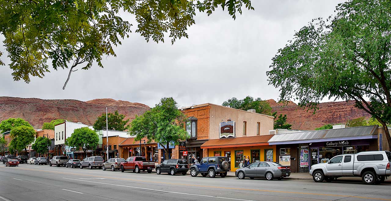
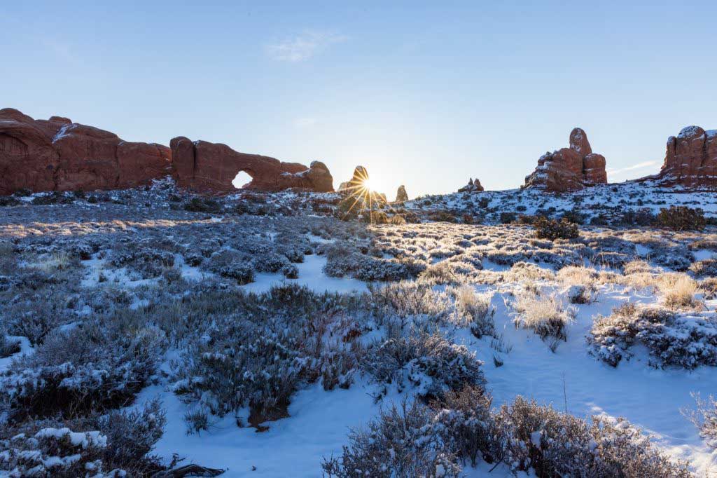
Moab Attractions

In Moab, hikers set beneath a sandstone arch to watch the sunrise illuminate the sandstone desert. Mountain bikers ride out of town on pathways leading to some of the world’s greatest trail networks, river runners raft the world-renowned stretch of the Colorado River near Moab, and artists lay eyes upon some of Mother Nature’s greatest gifts. No matter what brings you to Moab, adventure awaits.
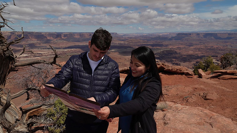
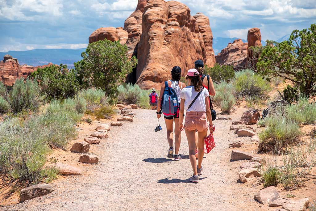
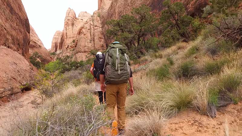
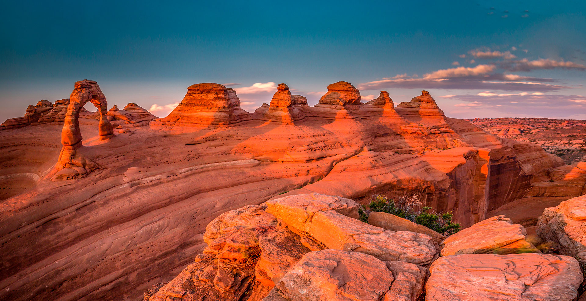
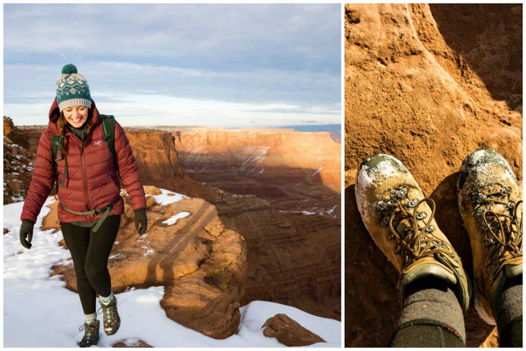
Surrounded by two national parks, a state park, and seemingly endless stretches of public land, Moab has no shortage of hiking trails. Some wind through patches of light sand and sagebrush, some are a slickrock scramble, and others follow a river or creek beneath towering canyon walls. Depending on which trail calls to you, you may end up at the base of a famous landmark like Delicate Arch, or you may find solitude in some of the biggest stretches of undeveloped land anywhere in the U.S.
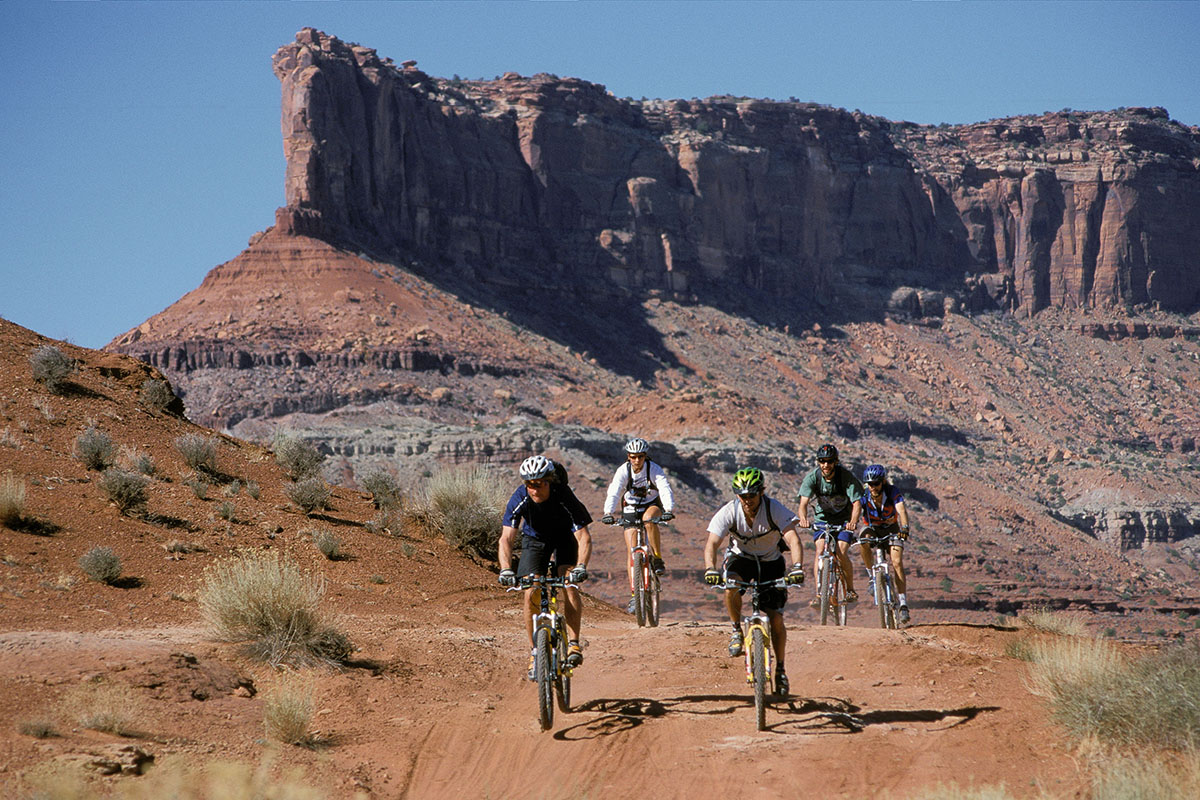
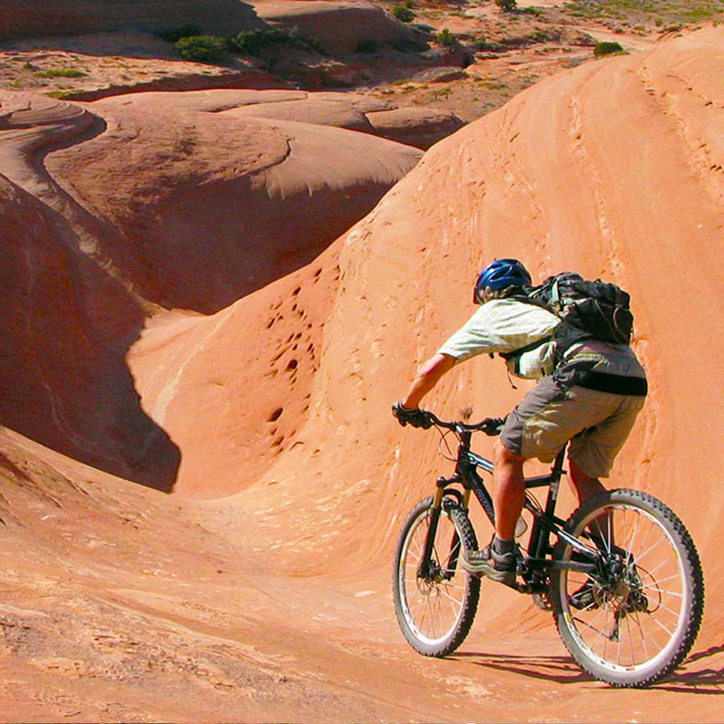
In 1969 Richard Wilson designed a route that would lead motorcyclists along a 10 mile loop through valleys of slickrock and up short, punchy climbs. It didn’t take long for mountain bikers to venture out on the Slickrock Loop, which is now one of the most popular trails in the area. Since then, thanks to an ever growing network of trails that wind through some of the most unique mountain biking terrain anywhere in the world, Moab has become a bucket-list destination for mountain bikers.
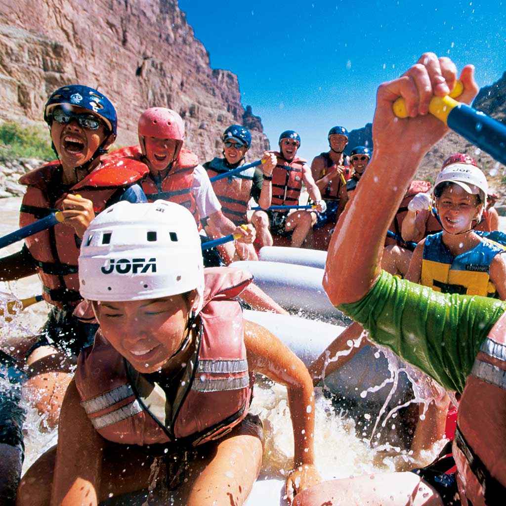
If you plan to visit Moab during the warmer months, river rafting should be near the top of your to-do list. The winding Colorado River has everything from sections of calm, paddle board friendly water to Class V rapids where the Colorado meets the Green River in Canyonlands National Park. There are quick, one-day routes like The Moab Daily, or multi-day ventures like a 5-day excursion through Desolation Canyon. To start planning your trip, get in touch with one of Moab’s local river rafting guides.
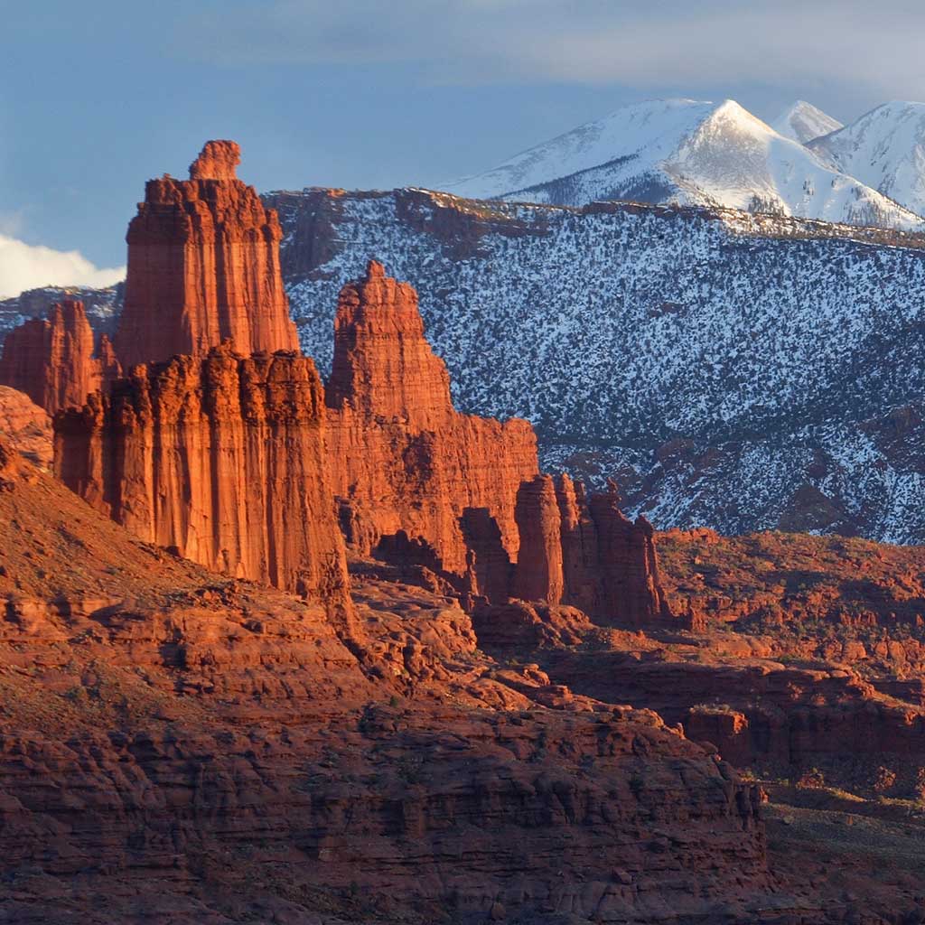
Arches National Park, Canyonlands National Park, and Dead Horse Point State Park are all only about half an hour outside of downtown Moab. That means in a few days time you can explore the largest concentration of natural arches in the world, gaze upon the desolate Maze district, and visit one of the most photographed scenic vistas in the U.S. Even though the parks are all accessible in a day’s time, you could spend countless trips seeing all that the parks have to offer.
More on Arches National Park…
More on Canyonlands National Park…
More on Dead Horse Point State Park…
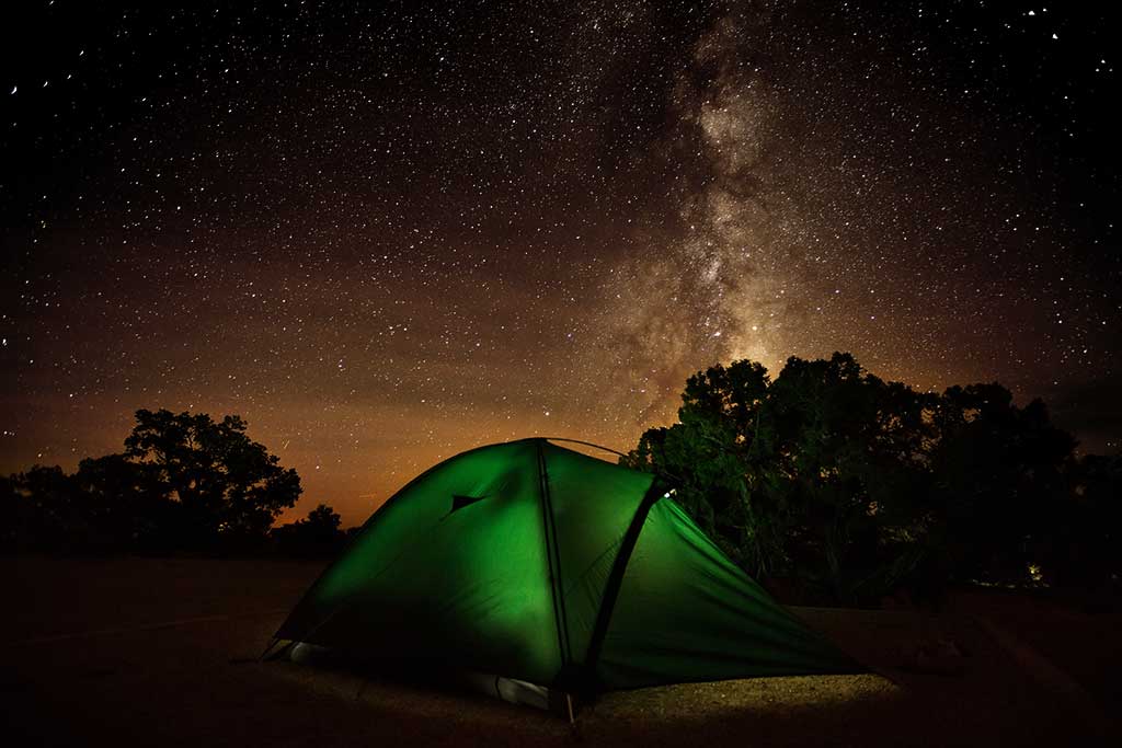
For many, Moab is a natural oasis. One where travelers can look upwards from their camp to clear dark skies where stars are not hidden behind the polluting light of nearby development. It’s a place where your family can gather around a campfire and share stories at a glamping resort. There are plenty of ways, and places, to camp in Moab. Set up a basecamp in either of the national parks for early access to the trails and overlooks, book a night at one of the many camping resorts, or find your own site in the surrounding BLM land.
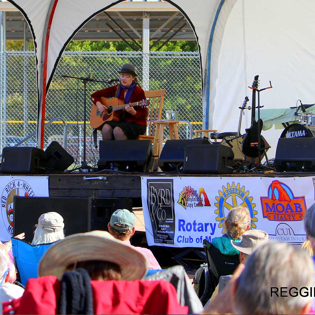
After an evening spent in town it’s apparent how inspired, artistic, and passionate the locals of Moab are. Outdoor art exhibits are shown at nearly every street corner, and concerts, festivals and other events are almost always within reach. Yearly events like the Moab Folk Festival and Scots on the Rocks are a great way to experience Moab’s strong sense of community, a community that knows the importance of protecting their home so everyone can enjoy it for years to come. So, during your next vacation plan to save an evening for an art stroll or an event, and remember to Do It Like a Local.
Upcoming Events…
More on Arts…
Moab is one of the most beautiful destinations on the planet. From deep canyons to towering mountains, from breathtaking red rock landscapes to raging rivers, it guarantees astonishing vistas at every turn. Protecting and preserving this precious area for future generations is essential. When visiting, always stay on the trails, leave historic sites and rock art untouched, respect wildlife and always pack out what you pack in.


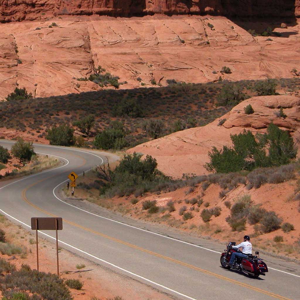


Scenic Byway U-313
Dead Horse Mesa Scenic Byway
U-313 is a 22.5 mile (36.2 km) long State highway that winds its way through Grand and San Juan Counties. The highway is the access road for Canyonlands National Park and Dead Horse Point State Park. U-313 was first built in 1975 in place of U-278.
Construction crew severely damaged the U-313 while constructing the road into what is now Canyonlands National Park. In 1988 the route was rebuilt from its original state of steep grades and blind switchbacks to its current state. The reconstruction of SR-313 was done at the same time as the access road into Canyonlands National Park.
U-313 is currently called the Dead Horse Mesa Scenic Byway. This Scenic byway leads you to one of the most photographed landscapes in the world. Dead Horse Point makes you feel as if you are on top of the world, with some of the most amazing 360-degree views.
At the highest viewpoint on a clear day, the La Sal Mountains can be viewed to the east, the Abajo Mountains to the South, The Henry Mountains to the west and the Bookcliffs to the north.
The intersection of SR-313 and Hwy 191: mile marker 136.8 on US 191 and 11 miles (17.7 km) north of downtown Moab, Utah, 20 miles – 32.2 km (south of Exit 180 on I-70. This is the beginning of your journey to what seems to be the ends of the earth.
Before starting your journey you may want to travel .3 miles (.5 km) north on Highway 191 to fill your tank at the gas station located there. This station was one of the iconic movie locations in the 1997 movie Breakdown, starring Kurt Russell and Kathleen Quinlan. The plot is basically about a man searching for his missing wife after his car breaks down in the middle of the desert.
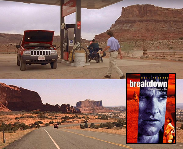
Kurt Russell gasses up his vehicle near the intersection of US-191 & U-313 in Breakdown.
Note: Don’t worry folks, reliable car service is just a phone call away in Moab.
Proceed back to the beginning of U-313 and set your trip odometer to 0.
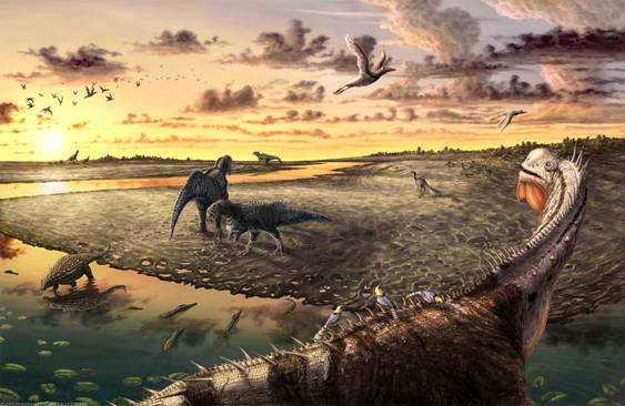
This attraction has life size dinosaurs that walk the ground that they used to call home. https://moabgiants.com/
Moab Giants Dinosaur Park is the first of its kind world-wide. The perfect balance of adventure and science, Moab Giants has been the realization of a dream for both dinosaur park enthusiasts, and world renowned scientists. They have special expertise in the field of fossil footprints and a deep knowledge of the paleontology of the region.
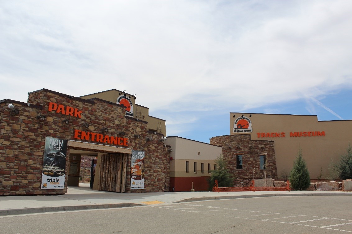
Not only is the park set among some of the world’s most breathtaking scenery, it is also a unique experience for all ages. Start your journey through time with a 3D cinema introducing you into the prehistoric world, and then venture outside and make your own tracks alongside over 100 state-of the art life-size dinosaurs. You will be roaming the extraordinary landscape dinosaurs once called home, as evidenced by the huge concentration of fossilized tracks found all around the area. The Tracks Museum is full of entertainment with interactive learning touch screens, games to play, and visually stunning exhibits that not only fascinate, but educate. The 5D Paleo-Aquarium gives you a realistic view into ancient life under the sea. Your time in the aquarium will end in the 5D room with an earth shattering experience you are sure not to forget!
Note: The Giant’s Cafe serves up a great selection of food items, and entrance into the park is not required. Stop in for lunch before starting your journey.
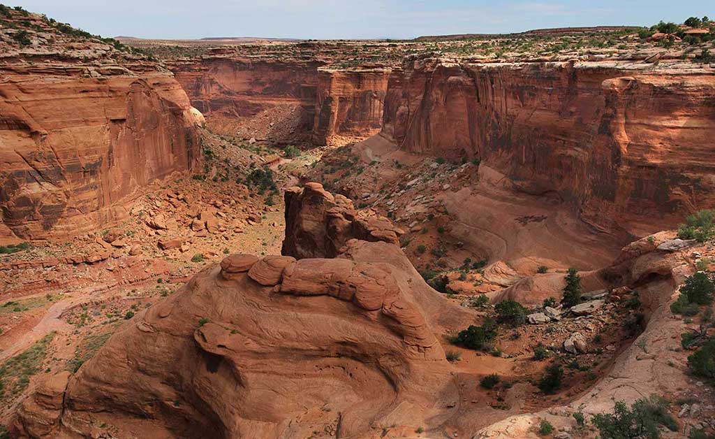
This roadside parking area contains information about Canyonlands National Park and Dead Horse Point State Park, along with information on travel and camping rules for the area. In addition to great views of the area’s geology, abandoned uranium mining activity is visible to the north on the cliffside.
On the left is a parking area through a gate. This canyon is closed to vehicle traffic about 2.2 miles (3.5 km) up but is open to horseback riders and hikers. Follow the wash up the main canyon. Along the main canyon walls, you may catch a glimpse of a few petroglyphs (these are tricky to find so keep an eye out). The canyon ends at a grotto that usually has water in a small pond (this is not for human consumption). 7.2 miles (11.6 km) round trip.
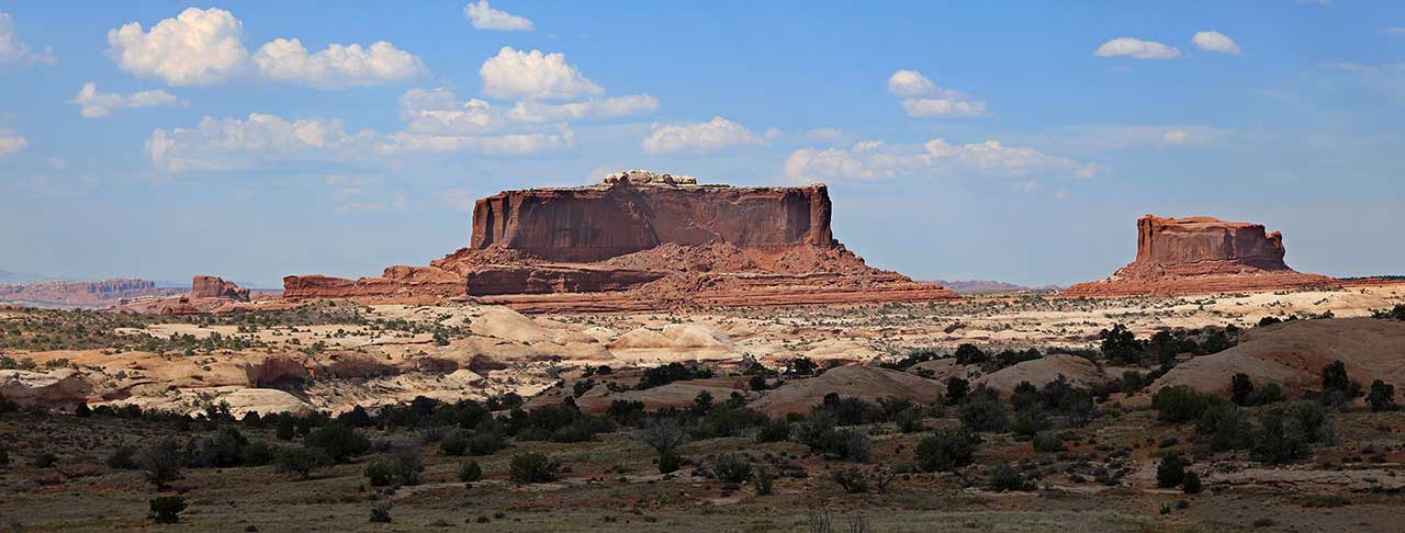
These two buttes were named for their resemblance to the Monitor and The Merrimack, two American Civil War steamships. Although Merrimac, the larger of the two buttes, looks large it is actually very thin at 200-600 feet wide and 1,600 feet long.
This parking area will give you access to a network of Mountain Biking trails. Navajo Rocks Chaco loop you can also access 7 up, Mag 7, and many other trails.
Views of the surrounding cliffs, along with the Monitor and Merrimac Buttes. This viewpoint is great for wildflowers in the spring.
This parking area is a great place to get some mountain biking, hiking and even four wheeling in. This parking area will give you access to some scenic easy four wheeling. This trailhead can take you up to a dramatic outcropping called determination towers. This is about an 8.8 mile up and back easy going scenic safari ride.
You can also access Monitor and Merrimac, Seven Mile Rim Safari Trail. Wipeout Hill Safari Trail.
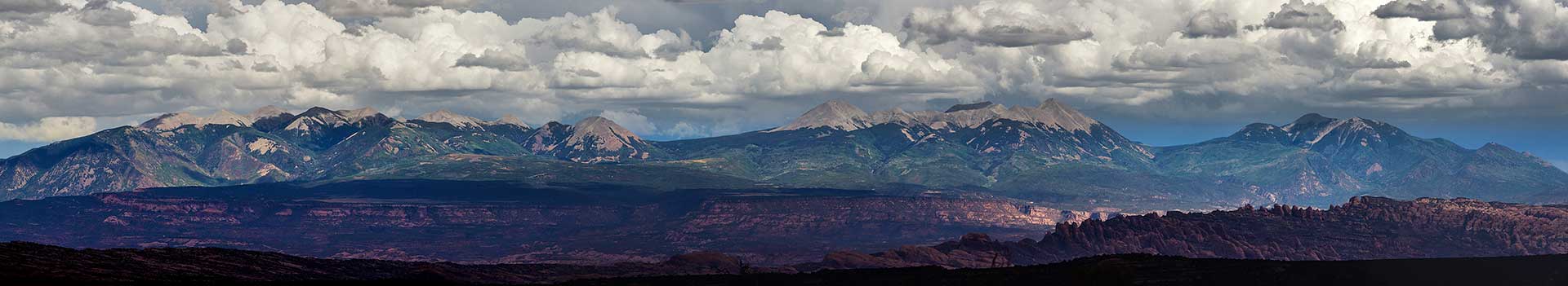
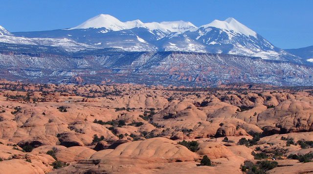
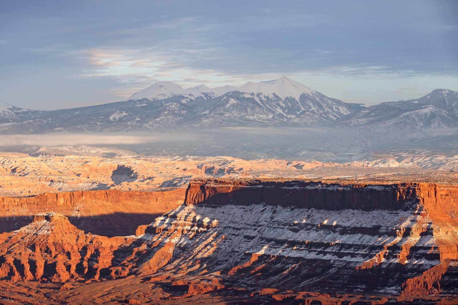
The roadside viewpoint has great views of the La Sal Mountains and the surrounding plateau country. The La Sal Mountains are part of the Manti-La Sal National Forest and the southern Rocky Mountains. The maximum elevation is at Mount Peale, reaching 12,721 feet (3,877 m) above sea level. The range contains three clusters of peaks separated by passes. The peaks span a distance of about 10 miles (16 km). The name of the range dates to Spanish times, when the Sierra La Sal (meaning the "Salt Mountains") were a prominent landmark on the Old Spanish Trail between Santa Fe and Los Angeles.
Continuing down Dubinky Well Road leads to many four-wheel drive roads that lead to canyons and vistas including:
Turn right on an unimproved dirt road and continue to a parking lot in 1.3 miles (2.1 km). A high clearance vehicle may be required based on conditions. This trail offers spectacular views across Hell Roaring Canyon to a large natural arch. From the parking lot, the trail passes through a fence and follows a dirt road for about 0.1 miles (.16 km). The trail leaves the road and goes down several dry washes until it rejoins an old road (closed to vehicles). After a short distance, the trail leaves the old road, and follows a series of rock cairns near the edge of Hell Roaring Canyon (400 feet deep).
View of Hell Roaring Canyon on the trail to Jewel Tibbetts Arch
After a short distance, the trail follows a short spur onto a slickrock platform, from which spectacular views of the arch and the canyon below can be had. The trail returns to the parking lot across a blackbrush mesa, where it rejoins the road. The arch is named after Jewel Tibbetts, a Moab resident who lived about 10 miles’ (16.1 km) distance at the Horsethief Ranch in the 1950 and 1960’s with her husband Bill. They often took ranch visitors to see the arch. Note: Hikers should exercise caution on those sections of the trail which are close to the edge of Hell-Roaring Canyon. The trail can be very warm in summer. Neither mountain bikes nor motorized vehicles are allowed on this trail, except for the first 0.1 miles (.16 km) where the trail follows an existing road. Length of Hike: 2.1 miles (3.4 km), round-trip (semi-loop); allow about 2 hours round-trip.
Campsites are tucked in the pygmy pinyon-juniper forest on the mesas above Moab, yet offer great views. Individual sites are available on a first-come, first-served basis. One group site, Horsethief Group Site, is available for reservation through Recreation.gov. This campground is close to Canyonlands National Park and Dead Horse Point State Park.
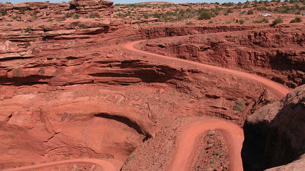
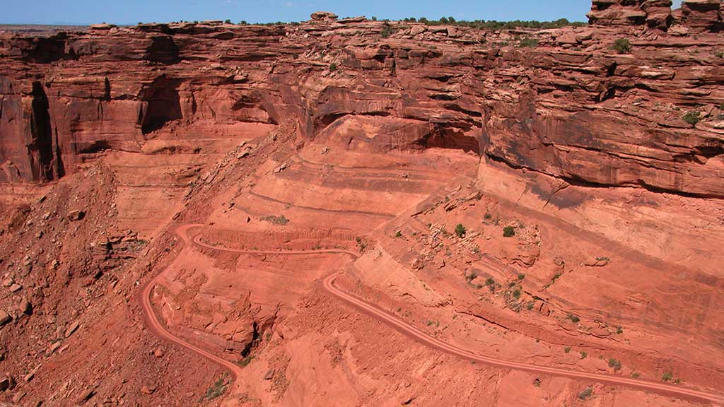
The road is well maintained and is rated as easy. It is about 13 miles (20.9 km) to the switchbacks that lead you down to the White Rim Trail and the Green River. The steep switchbacks are scenic and easy as you descend about 500′ to the bottom. Although the road is suitable for high-clearance two-wheel-drive vehicles when dry, the unpaved sections of the road can be impassable when wet. In any case, driving 4WD is recommended due to uneven surface. Once on the bottom, turning right will lead you to a dead end at Mineral Bottom, where rafting boats are launched. If you turn left you are on the White Rim Trail in Canyonlands National Park. (A permit is required for the White Rim: https://www.nps.gov/cany/planyourvisit/dayusepermits.htm)
Gemini Bridges is one of the most popular spots in Moab. The Gemini Bridges Trail is well known to local mountain bike riders for its scenery and long descents. Starting from U-313, the trail is nearly all downhill back to US-191. Approximately 5.5 miles from U-313, the spur route to Gemini Bridges is encountered. This route is a hiking route only and is a short 0.2 mile walk. After viewing the bridges, enjoy the rest of the marked trail down to Highway 191. This bike route utilizes a county road and is shared with jeeps, ATV/UTVs, and dirt bikes.
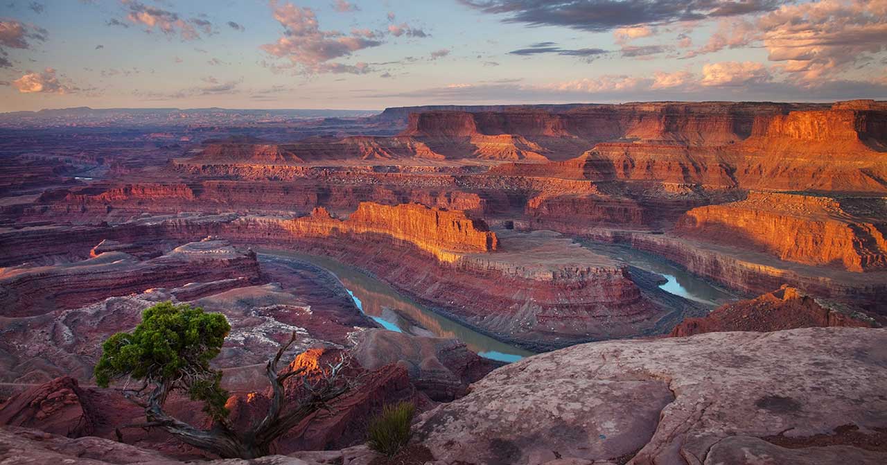
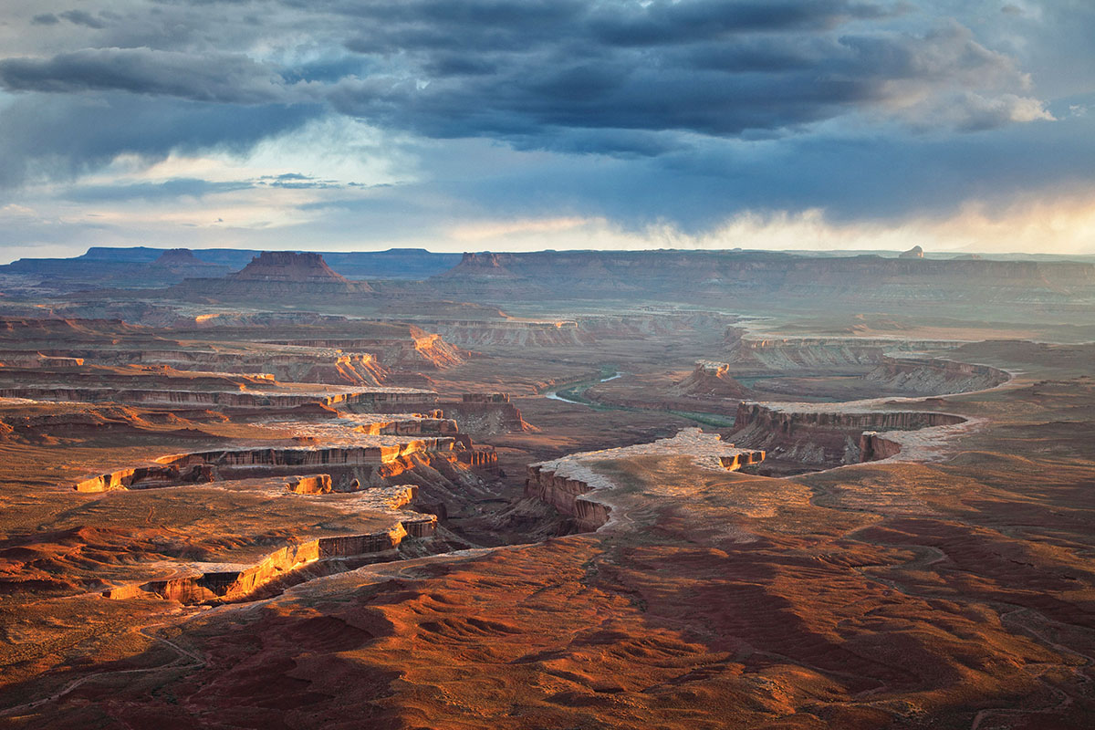
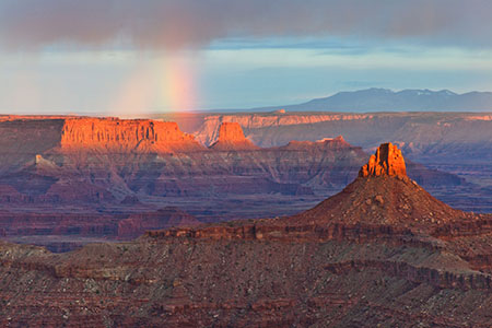
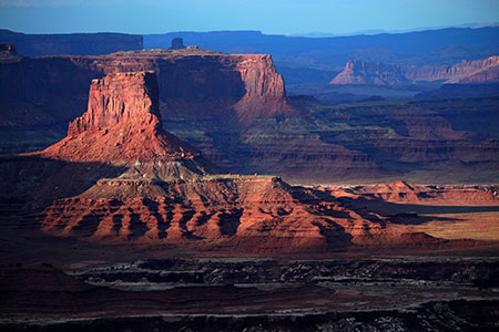
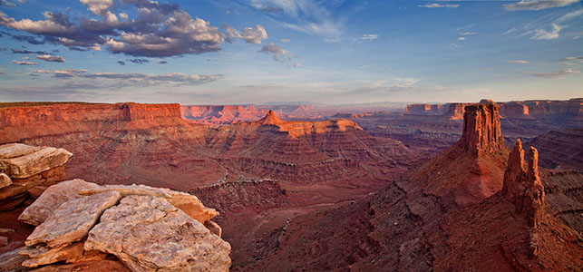
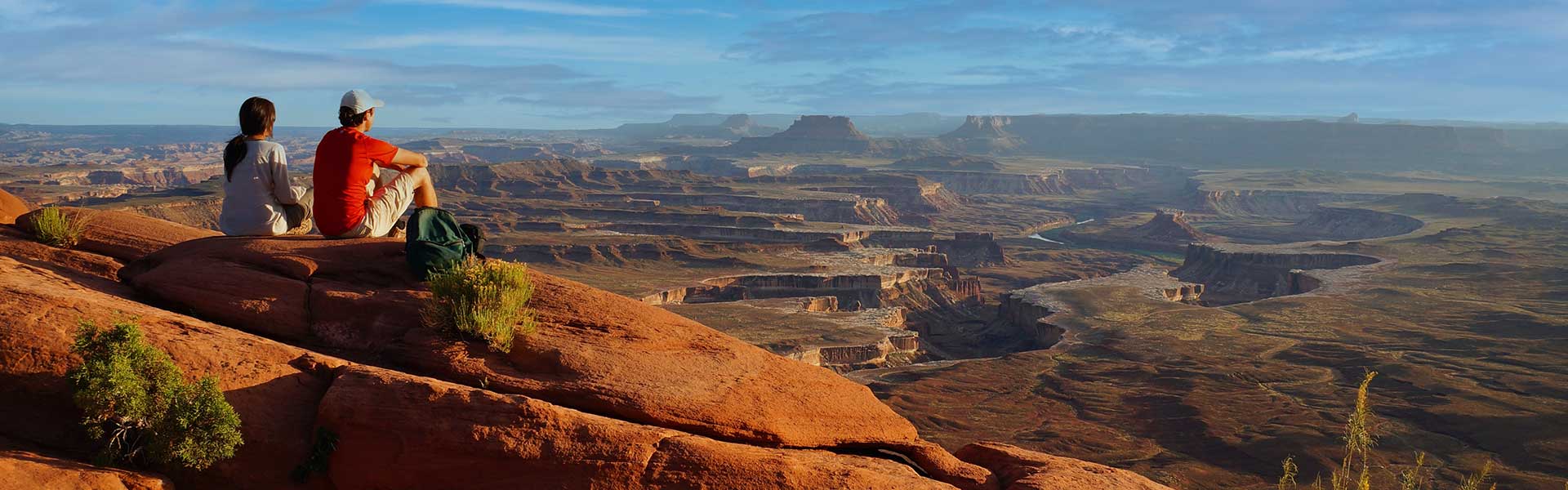
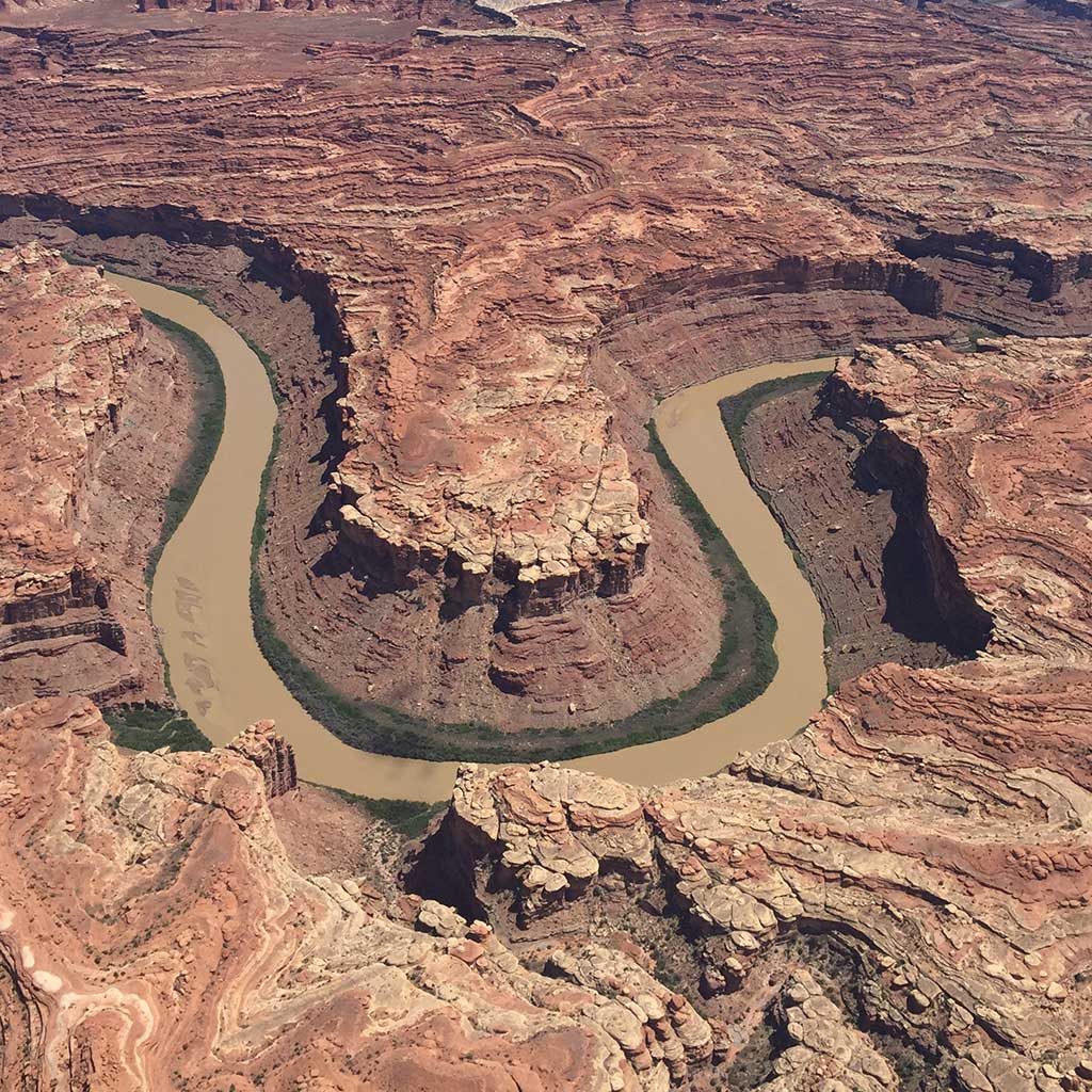
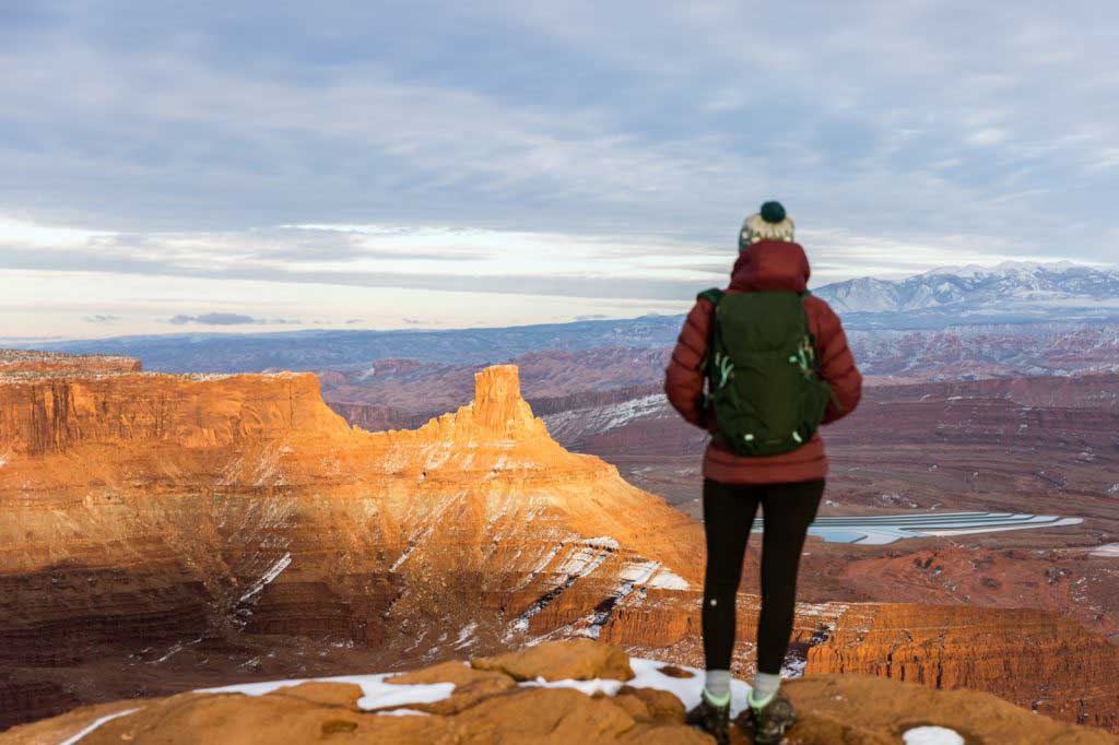
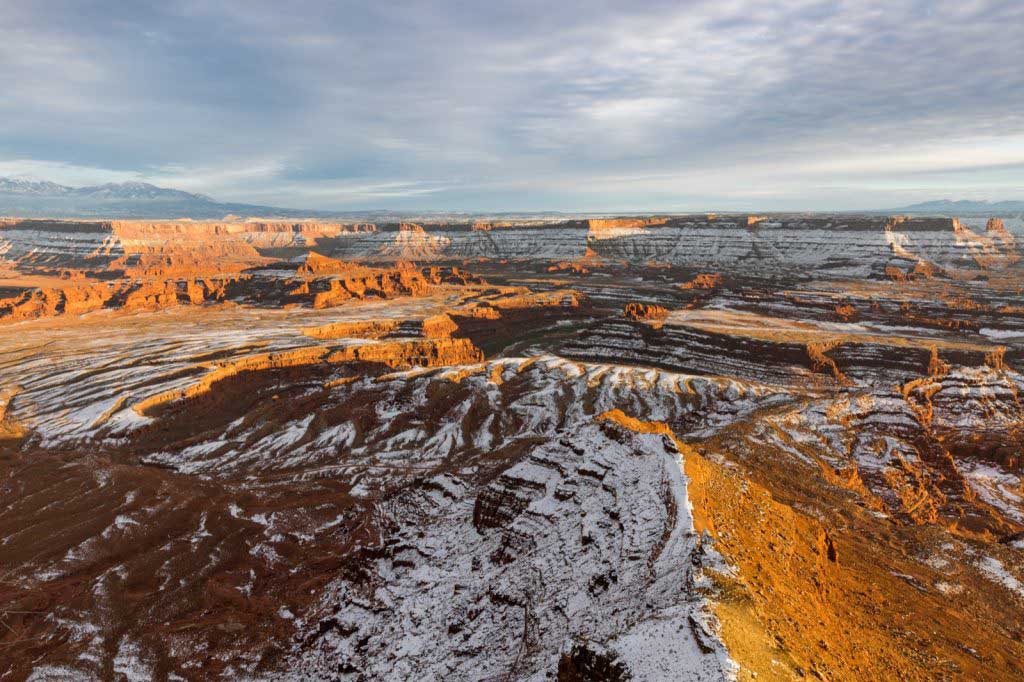
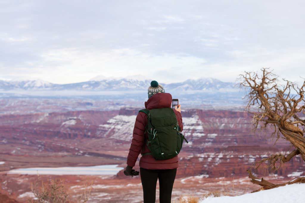
From the prominence of Dead Horse Point, 2,000 feet above a gooseneck in the Colorado River, an ever-changing landscape unfurls. Immense vertical cliffs meet with canyons carved by ice, water, and wind creating a visual masterpiece.
Millions of years of geologic activity created the spectacular views from Dead Horse Point State Park. Deposition of sediments by ancient oceans, freshwater lakes, streams and wind blown sand dunes created the rock layers of canyon country. Igneous activity formed the high mountains that rise like cool blue islands out of the hot, dry desert.
An entrance fee is required.
A perfect location for experiencing sunrise, sunset and a bit of seclusion, the Moenkopi Yurts offer a glorious camping experience up at Dead Horse Point State Park. With sweeping views and a private spur to the Intrepid Trail System this yurt site can be your quiet spot of heaven while enjoying the Moab area. These Yurts can be reserved at https://www.reserveamerica.com/explore/dead-horse-point-state-park/UT/344161/overview
A gift shop is located inside the visitor center and offers park visitors a variety of quality souvenirs including shirts, hats, postcards, cups, handmade knives, magnets, art work, pottery, snacks, etc.
On the road, about a quarter of a mile from the lookout point, you’ll pass the bottleneck which is only about 30 feet wide. Here, once the horses would be herded in, a fence and gate were placed trapping the horses. The cowboys could then pick out the wild horses they wished to keep. Unfortunately, as the story goes, once the cowboys picked the horses they wanted, they opened the gate at the bottleneck and left. It was said that the wild horses were so spooked that many didn’t leave the point, even though the gate was open, and being on top of a mesa, with no shade and no water, they died of thirst.
This is the main attraction of Dead Horse Point State Park. From the overlook parking lot, a short paved pathway leads to breathtaking views of the Colorado River and adjacent canyon country some 2,000 feet below. A large shelter at the overlook provides relief from both foul weather and summer heat. Paved pathways lead out in both directions from the shelter, providing additional viewpoints while linking up with both the East and West Rim trail systems.
Although the primary overlook and shade shelter are accessible, the eastern and western spur trails contain steeper inclines and short sections of slick rock interspersed with the pavement.
Moab locals have it figured out. They know the best rides, the best routes, the best places to hike and camp and eat—and a few other important things about the right way to enjoy the desert. While the Utah desert seems like a rugged place, you might be surprised to learn its environment is more sensitive than you might expect. To make sure everybody has the chance to enjoy our little slice of paradise for generations to come, residents of Moab are taking steps toward sustainability with the Moab First Sustainable Tourism Program. When you visit Moab, do it like a local by keeping the following tips in mind.
Stay on the Trail
While the desert soil may look unassuming, it’s actually teeming with life. Biological soil crust (also known as cryptobiotic soil) is a major part of the desert ecosystem, and helps prevent erosion as well as trap nitrogen and other plant-friendly nutrients in the soil. Cryptobiotic soil is also incredibly sensitive, and can take decades to recover from even a few footsteps breaking through the crust. When you visit Moab, make sure to stay on established trails and roads—and if established routes aren’t available, do your best to walk through dry creek beds or on bare rock.
Leave No Trace
Most people with a conscience already know not to litter up the great outdoors, but there’s more to Leave No Trace than just packing out all your trash and recyclables. Due to high use, human waste is a serious health issue at dispersed camping sites. All solid waste must be packed out in approved waste bags or portable toilet systems. These may be purchased at the Moab Information Center and local outdoor retailers. When picking a campsite, use a pre-existing spot rather than placing your tent on top of vegetation, and make sure to stay at least 300 feet from water to avoid scaring animals away from critical sources of hydration. And speaking of wildlife, make sure to give them plenty of room in general—keep pets leashed, and teach children never to chase, approach, or pick up wild animals.
Respect the Rocks
Moab and the surrounding areas are home to an incredible number of ruins, artifacts, and ancient rock art. While it can be tempting to get up close and personal, make sure to admire from a distance—and look, but don’t touch. We want to keep these pieces of ancient history around for many years to come—so stay out of ruins, leave any artifacts you find in place, and encourage others to do the same, so everyone can appreciate the wonder of ancient civilizations well into the future.
Bring Your Own Bags
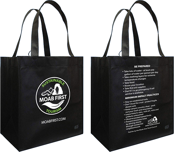
Starting in January 2019, the city of Moab enacted a ban on single-use plastic bags. It’s part of Moab’s efforts to help curb the use of disposable plastic products. Besides being a major litter problem, plastic bags also tend to make their way into waterways and oceans where they can harm animals, as the plastic bits don’t biodegrade even as they become divided into tiny pieces. Remember to bring your own reusable bags for any grocery or souvenir shopping, or pick one up at a local shop.
Drive Electric
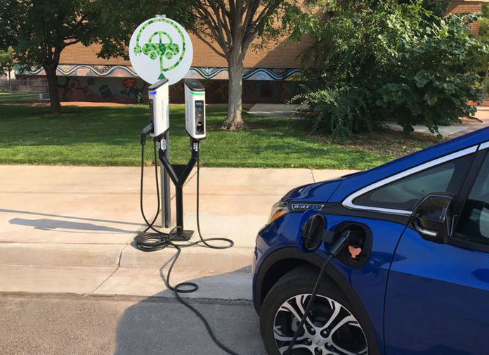
As part of its new sustainability strategy, Moab now features 10 electric-vehicle charging stations located throughout the city, as well as four additional Tesla supercharging stations that can charge Tesla vehicles halfway in about 20 minutes. A recent study by the Utah Department of Transportation estimates an average of 13,000 vehicles at the intersection of Moab’s Main and Center streets—if even a small fraction of those cars were electric, we could save hundreds of thousands of pounds of air pollution every year.
Eat & Shop Local
Another great way to visit Moab like a local is supporting local businesses that have made a commitment to sustainability. Keep an eye out for businesses with a Green to Gold sign—the Green to Gold program is a city-sponsored initiative encouraging establishments to take simple steps to reduce their environmental impact. In the summer of 2018 alone, Green to Gold businesses in Moab saved over 850,000 kWh—the same amount of energy used by 136 cars over the course of an entire year, or the annual CO2 emissions from 68 homes.
With these six tips in mind, you’ll be helping the cause of keeping Moab an amazing destination (and an amazing place to live) for years to come. For more helpful Moab insider info or to start planning your trip, visit doitlikealocalmoab.com
Memorial Day Weekend
Tips for an enjoyable visit.
Visitors can expect long lines at park entrance gates during Memorial Day weekend.
Arches and Canyonlands national parks are preparing for a busy Memorial Day weekend, and are advising visitors to expect heavy traffic, crowded trails, and limited parking.
“Memorial Day weekend is typically our busiest weekend of the year,” said Superintendent Kate Cannon. “We recommend patience and flexibility for visitors planning a trip to the parks.”
Visitors arriving at the parks between 9:00 a.m. and 2:00 p.m. should expect long lines at park entrance gates that could last up to an hour. Parking lots and trails inside the parks will be very crowded. If the parks become full, staff may delay vehicles from entering the park until space opens to accommodate more people and vehicles.
“We want these entry delays to be as short as possible. To avoid being caught in a delay, we recommend people come to the parks early in the morning or late in the afternoon,” Cannon said.
Park rangers ask that vehicles waiting in line at the entrance gate keep pace with traffic in the line and have payment ready. Credit cards are preferred. Current pass holders and returning visitors should have passes and identification ready. There are no toilet facilities or drinking water along park entrance roads.
When the park is full, we may temporarily delay entry into the park. These delayed entries would likely occur late morning or early afternoon. We may need two or three hours until conditions ease before we resume normal operations. During the peak time of the day, consider visiting one of the many nearby attractions in the Moab area (see below).
Visitors should plan for their safety by packing water and snacks and wearing sturdy shoes and sun protection.
Visitors are encouraged to check the parks’ websites or Twitter accounts for current entrance gate information and road conditions prior to leaving for their visit.
Arches:
Canyonlands:
The webcams below provide views from either end of the Arches National Park entrance road. Traffic may back up between the entrance station and US 191 causing delays of up to an hour.
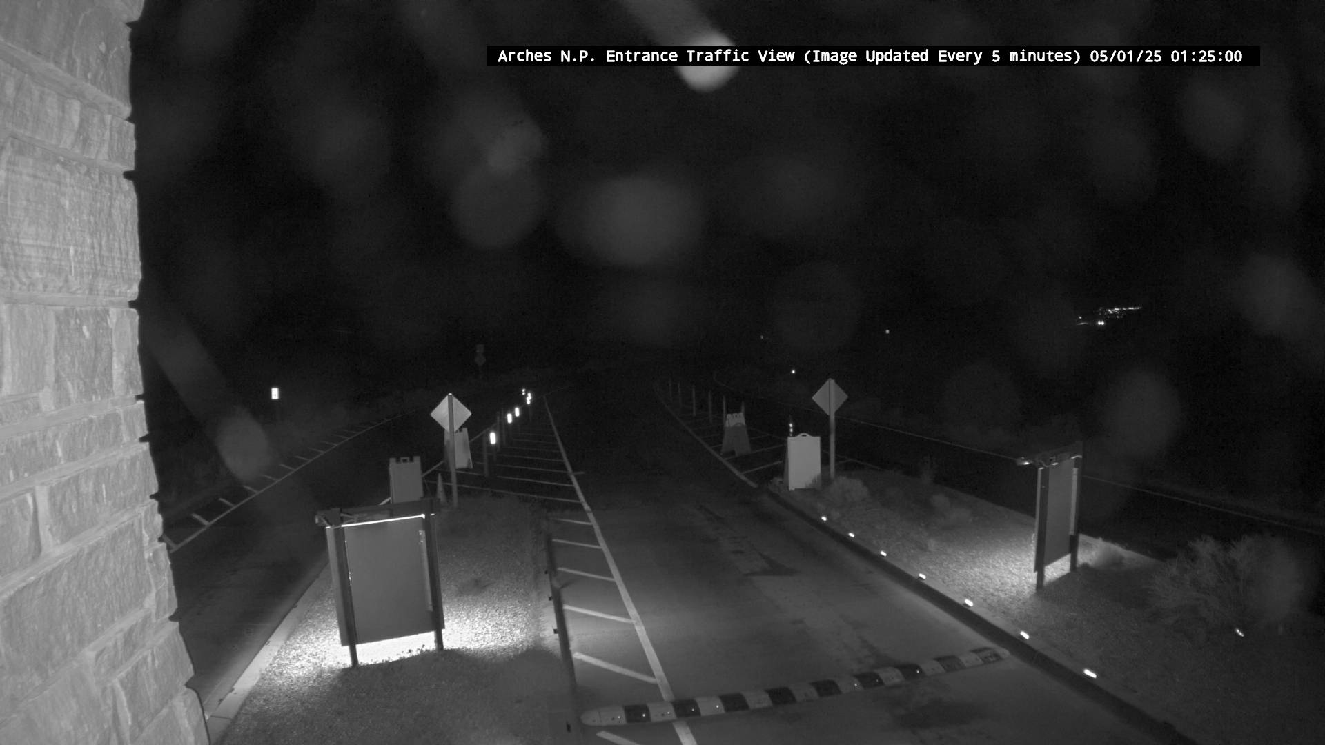
Arches National Park Entrance Road

Highway 191 near Arches National Park Entrance Road.
The Corona Arch trail leads to one of the most impressive arches in the entire Moab area.
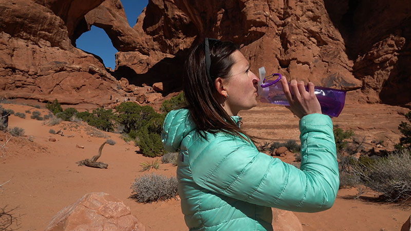
The Moab area contains a large number of pet friendly trails on public lands to suit any experience level. From cool stream-side hikes to spectacular sandstone arches, the Moab area is full of exciting day-hikes suitable for the entire family. What follows is just a taste of what Moab has to offer.
Dinosaurs contemplate mountain biking in Moab.
With so many dinosaur resources in one place, Moab is the perfect place to design your own Family Dinosaur Field Trip!
Start your Dinosaur Field Trip in downtown Moab, at the Museum of Moab. Check out a full cast skeleton of Gastonia one of the armored dinosaurs that lived in this area during the Early Cretaceous. The museum also features numerous dinosaur displays, including a cast of the leg of the terrifying Utahraptor.
Continue your journey at Paleosafari Moab Giants, where you can journey back through time with a 3D cinema introducing you to the prehistoric world of dinosaurs. You can also make your own tracks on a half mile hiking trail populated with state-of the art life-size dinosaurs! The Tracks Museum features interactive learning touch screens, games to play, and visually stunning exhibits that not only fascinate, but educate.
After learning about the dinosaur species that once walked these lands, continue north of Moab to one or more of the Moab Dinosaur Sites. A variety of hiking trails will take you to some of the best preserved dinosaur tracks and bones in the country.
Birthing Scene
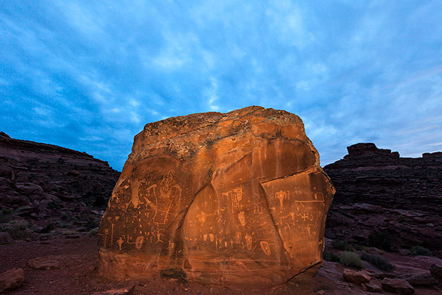
The Moab area has numerous examples of Indian rock art to enjoy. This page briefly discusses some types, dates, the artists and their cultures and how to take care of these irreplaceable sites. Directions are included to a number of sites which allow you to sample some of the easily accessible ancient rock art in the Moab area. All sites are accessible with a passenger car and a short walk!
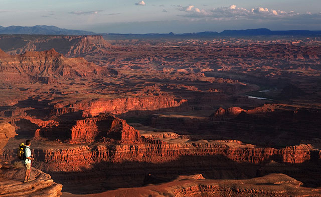
Dead Horse Point provides the same type of views you would experience in Canyonlands National Park.
32 miles (51.5 km) from Moab, Dead Horse Point State Park is one of Utah’s most spectacular state parks. The view from Dead Horse Point is one of the most photographed scenic vistas in the world. Towering 2,000 feet above the Colorado River, the overlook provides a breathtaking panorama of Canyonlands’ sculpted pinnacles and buttes. Millions of years of geologic activity created the spectacular views from Dead Horse Point State Park. Deposition of sediments by ancient oceans, freshwater lakes, streams and wind blown sand dunes created the rock layers of canyon country. Igneous activity formed the high mountains that rise like cool blue islands from the desert below.
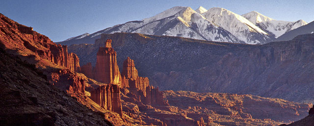
View of Fisher Towers from along Upper Colorado River Scenic Byway (U-128)
The Moab area is blessed with three State Scenic Byways. State Scenic Byways help recognize, preserve and enhance selected roads throughout the United States based on their archeological, cultural, historic, natural, recreational and scenic qualities. Every trip to Moab should include a drive along at least one byway, although driving all three is great way to spend a relaxing day.
Moab Brands Focus Area
Welcome to the home of the greatest mountain biking on the planet! Moab offers a huge variety of trails for mountain bikers of any experience level, from beginners looking for a scenic ride through beautiful canyons and mesa tops, to seasoned bikers looking for the ultimate challenge. Moab is well known for the world famous, and highly technical, Slickrock Bike Trail. This challenging 9.6 mile trail is considered by many to be the ultimate mountain biking experience. Moab, however, also contains a huge assortment of scenic biking trails of all difficulty levels.
Sand Flats Recreation Area
The Sand Flats Recreation Area near Moab, Utah is a nationally significant public lands treasure at the heart of the Colorado Plateau. A high plain of slick rock domes, bowls and fins, it rises in the east to meet the colorful mesas and nearly 13,000 foot peaks of the La Sal Mountains. Sand Flats’ famous Slickrock and Porcupine Rim bike trails and almost 40 miles of jeep trails are world-renowned for their combination of challenge and awesome scenery. Sand Flats is also popular for camping. Over 100,000 visitors enjoy this 9,000-acre recreation area annually.
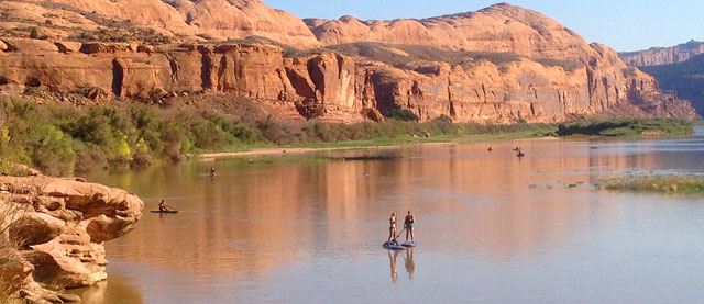
Paddle Boarding on the Colorado River
While our area is known for its family oriented whitewater trips on the Fisher Towers section of the Colorado River, there are wilder single and multi-day trips available in Westwater Canyon. Additionally, canoes, kayaks, and paddle boards are the perfect way to explore the calm water segments of the Colorado. Individuals or groups may raft the river on their own or with a professional river outfitter.

