Moab Area Motorcycle Trail Riding
The Moab area offers tremendous opportunities for motorcycle trail riding, no matter what type of bike you’re on. And if you don’t have your own gear, local guides can show beginners the ropes — or show experts new lines on local favorites.
While the Slickrock Trail is one of Moab’s most famous and popular mountain biking trails, motorcyclists were the group that actually first put it on the map. The loop isn’t for beginners — sustained challenges include steep climbs and descents, and sun exposure — but beginners can always try their hand at the Slickrock Practice Loop, which is shorter and just as hard. The full loop is roughly 10 miles.
The Sovereign Trail System is located within Utahraptor State Park, which was designated because of its importance in both dinosaur and human history. Trails here are for experts or very confident intermediate riders looking to test their skills, and offer unique views of the landscape just north of Moab. Popular trails include Sovereign (3 miles) and Cedar Mountain (1 mile).
For adventure motorcyclists, we recommend Hurrah Pass and Chicken Corners, Onion Creek, and the Shafer Trail.
Recommended Trails
-
The Ride:
Also with cooperation from BLM, motorcyclists marked Slickrock Trail in 1969. The loop scales many hills of barren rock, with views down to the Colorado River and up to the La Sal Mountains. Since then, Slickrock has become world renowned for bicycling. To avoid crowds, it’s much better to ride Slickrock early in the week, and early in the morning. Despite heavy traffic, the area is in good shape thanks to the staff of Sandflats Recreation Area. The small entry fee will get you a detailed map of Slickrock and the surrounding 4WD trails. Although Slickrock might look like Mars, it can feel like Venus. Avoid the afternoon heat, and carry extra water.Further Info:
Grand County – Sandflats -
The Ride:
Similar to Slickrock, Sovereign is very popular among mountain bikers, so be prepared to share the trail. Sovereign Singletrack connects Archview Resort with lower Klondike Bluffs Road. The middle of it runs parallel to Saltwash Singletrack, which is recommended for northerly travel. Both singletracks wiggle through boulder fields and scale ledges. When approaching a switchback, stay on the outside of the turn so you can cut to the inside at the apex. If it’s too tight, ride the nearby Sovereign ATV Loop or Fallen Peace Officer Trail. All these routes were developed by a local nonprofit, Ride with Respect, which was blessed with support from the Utah division of Forestry, Fire, & State Lands.Further Info:
Ride with Respect updates an extensive map of Sovereign Trail System, which is available at the MIC and local shops). Beyond Sovereign, the BLM and national-park trails are reserved for non-motorized use. Ride with Respect -
The Ride:
The White Wash Sand Dunes, as well as a peninsula of slickrock east of the dunes, is the only area around Moab that’s open to cross-country travel. There are a few special requirements, such as whip flags and portable toilets. For details, see our page on ATV riding. While ‘play’ riders might be content at White Wash, trail riders could explore north toward Crystal Geyser, and south toward Tenmile Canyon. This wet canyon was an oasis for early Native Americans, and it’s a modern oasis for wildlife. If you ride Tenmile, please keep its significance in mind. Also, desert bighorn sheep roam this area. The sheep feel safer when they are uphill of people, so it’s our responsibility to give them plenty of room. With sign supplies from Utah State Parks & Recreation, staff of the BLM have spent many days marking this trail system. Nevertheless, it’s in the way-backcountry, so self-sufficiency is vital. -
The Ride:
Although it’s a small mountain range, the La Sals provide a summertime escape for people and animals, alike. Above Moab, the national forest includes a small network of rugged roads across Brumley and Dorry creeks. For motorized singletrack, one must travel to the backside of the La Sals, onto land owned by Utah’s School & Institutional Trust Lands Administration (SITLA). Although the agency’s primary mandate is to raise funds for education, fortunately SITLA allows public access. The Trust Lands Singletrack and an ATV loop called Trail 16 are short, but sweet. For the sake of wildlife, hunting, and safety, please do not ride the singletrack within three hours of sunrise or sunset. Like Sovereign Trail, Ride with Respect has invested thousands of hours of work toward these trails. Please tread lightly, and avoid muddy conditions.
Moab Motorized Travel Routes & More Information
Along with the proper gear, groups should bring travel maps and possibly guide books. Although most of the graded roads and featured trails have directional signs, conditions are subject to change. In the event of an emergency, maps can show your options to evacuate. The government-agency maps and most commercial maps indicate which types of travel are permitted for each route. Be aware that motorcycles are not permitted on many singletrack trails, especially those closer to town.
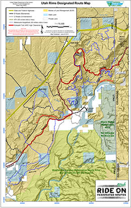
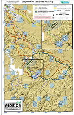
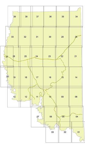
On public lands, motorized and even bicycle travel is limited to designated routes. The Bureau of Land Management (BLM) provides up-to-date designated route maps. Likewise, the U.S. Forest Service (USFS) provides up-to-date motor vehicle use maps. Commercial maps include Moab Classic and Moab East/West by Latitude 40, which are available at the Moab Information Center (Main & Center Streets in Moab). Guide books include ATV Trails Guide and Backroads & 4-Wheel Drive Trails. These books are available at the Moab Information Center, and can also be purchased in advance online from Canyonlands Natural History Association.
4WD trails are the perfect way for most motorcyclists to explore the canyon country. These primitive roads offer spectacular scenery, with difficulty that ranges from moderate to extreme. Their width provides room to pass, and provides an alternate line for riders to choose. Most of the routes used during Jeep Safari are marked, and extend from Moab in every direction. Originally blazed for uranium mining, these iconic trails made Moab a top 4WD destination, worldwide. For details, see our page on 4-Wheeling.
Riders seeking a longer-distance, or less-rugged, experience can utilize the network of graded, dirt roads. They are generally maintained, but of course wash outs and other hazards can occur. If your motorcycle is street-legal, you can follow graded roads all the way to towns like Green River, Monticello, and even Fruita, CO. Kokopelli’s Trail is dual-sport friendly, except for the rocky hill above Onion Creek and the non-motorized section below Cisco. Even ‘in the middle of nowhere,’ you could encounter oncoming traffic, so be careful around blind corners.
Note that, to ride the roads in national parks, your motorcycle must be street-legal and a permit is required. (Click here for permit information.) While Canyonlands and Arches are known for routes like White Rim, Elephant Hill, and Eye Of The Whale, the national parks have a mission of preservation. All kinds of use in these parks are regulated, so please be on your best behavior. For more information, visit Canyonlands or Arches.
At the most primitive end of the spectrum, motorized singletrack is available for riders seeking the confines of a narrow trail. These routes typically require a high degree of balance and coordination. Also they lend themselves to lighter-weight motorcycles with a smoother power band and low gearing. Unless you particularly value singletrack, then stick to the 4WD trails for a greater sense of freedom.
For example, motorized singletracks are shared with non-motorized users, and motorcyclists should yield to them. However pulling off the singletrack could easily damage plants and biological soil crust (the black and craggy dirt that’s actually alive). So you’ll need to pass by either leaning over the trail’s edge, or finding a barren surface such as slickrock to pull over. In the desert, singletrack is a scarce commodity, so please help to keep the “single” in singletrack.
If narrow trails sound like your idea of fun, there are a half-dozen small networks of motorized singletrack to choose from. Each of them requires a map, but here’s an overview:
Discover More Moab
Scenic Drives in Moab, Utah
- 5 min read
Moab is a gateway to some of the most spectacular drives in the American West. Within an hour of town, a single tank of gas can take you from canyon floors to alpine meadows, along…
The Perfect Five-Day Moab Itinerary
- 8 min read
Five-Day Moab Itinerary Are you looking for the perfect Moab itinerary? We've got it. If you're planning a trip to Moab, you're probably here to see the two nearby…
Cool & Unique Places to Stay in Moab
- 4 min read
These aren’t just places to rest your head—they’re front-row seats to dark skies, remote vistas, and the kind of immersive experiences that make every sunrise…
Back From Beyond: Real Rescue Stories from Moab’s Great Outdoors
- 3 min read
Learn more about the podcast here. You can listen wherever you find your podcasts! Moab, UT — When most people think of Moab, they picture world-class adventure…
Beyond the Town: Top Day Trips from Moab
- 3 min read
Welcome to Moab, the adventure capital of Utah! Renowned for its iconic red rock landscapes, world-class trails, and stunning desert scenery, there are plenty of things to do near…
Best Trails for Night Hikes & Stargazing in Moab
- 5 min read
When the sun slips behind the red rock horizon, Moab doesn’t go to sleep—it comes alive. The dramatic landscapes that draw visitors during the day transform into a…
Family-Friendly Restaurants in Moab: Where to Eat After the Trails
- 4 min read
After a day spent exploring Moab’s red rock trails, splashing in the Colorado River, or bouncing along backcountry roads, most families are looking for one thing: a great…
Things To Do In Moab: Free Science and Culture Talks
- 3 min read
Every year, spring through fall, the Canyonlands Natural History Association hosts experts to speak on Moab science, culture, ecology, and history. These talks are free, and are…