

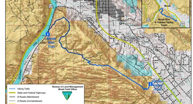
Moab Rim Trail
- Difficulty
- Difficult
- Distance
- 3 ml
- Duration
- 2 hr
- Ascent
- 900 ft
- Descent
- 900 ft
Highlights:
Good views of the Colorado River, Moab Valley, and the Behind the Rocks area.
Description:
From the parking area, follow the 4-wheel-drive vehicle route up the slickrock ramps of Kayenta sandstone. After about 1.4 miles, the route reaches a viewpoint of the Moab Valley. Follow the vehicle route south and then down through a slickrock area located between two large domes of Navajo sandstone. At the base of the slickrock area, the route continues along a wash bottom and then up a large sand hill. From the top of the sand hill, the route branches twice to the left. The first spur on the left leads to a view point high above Spanish Valley. The second spur route ends after 200 yards at another view point. Ahead to the south, the view is dominated by a long ridge of massive sandstone fins. From the intersection, the main route drops down into a wash and then climbs in an easterly direction to its terminus just below the pass to Hidden Valley. (Note: The Moab Rim Trail is a shared use trail. You may encounter jeeps, mountain bikes, dirt bikes or ATVs on the route.) On Kane Creek Boulevard, 2.6 miles northwest of its intersection with US Highway 191 in Moab.