
- Attractions
- Activities
- Lodging + Campgrounds
- Area Info
- Services
- Transportation

Dead Horse Point State Park
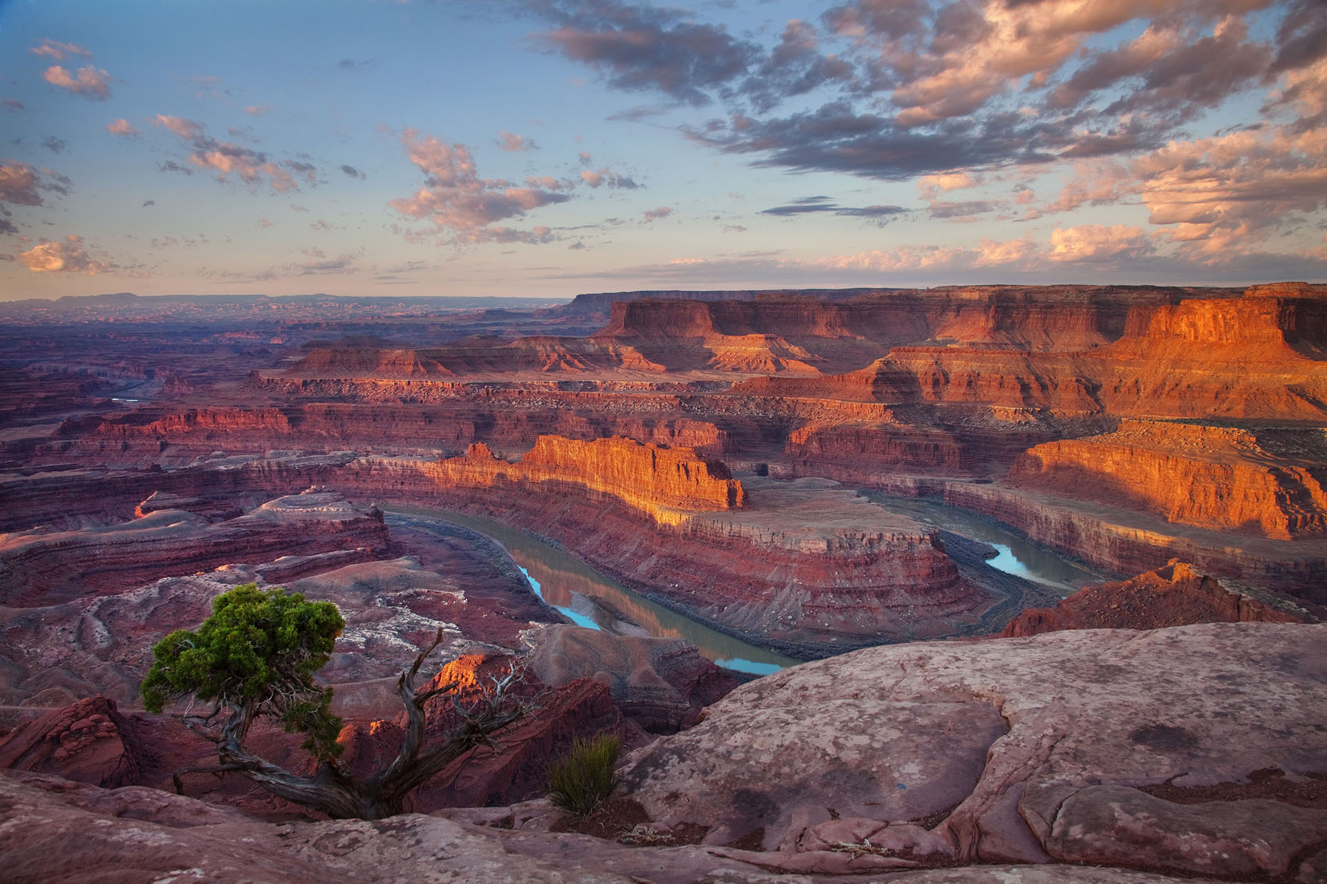
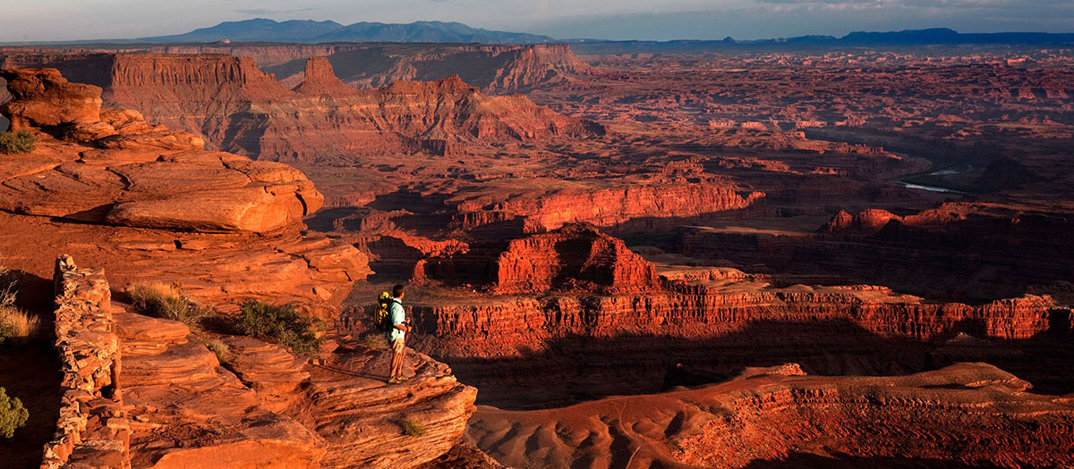
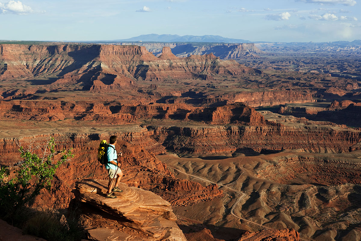
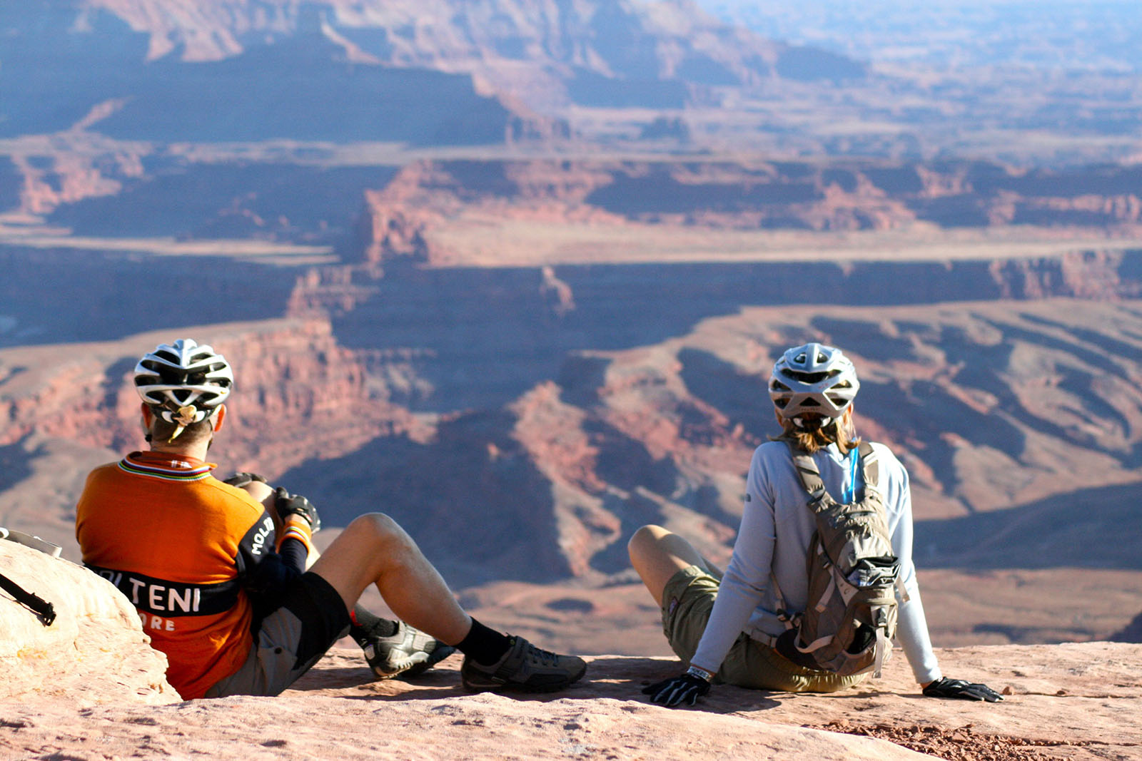
The view from Dead Horse Point is one of the most photographed scenic vistas in the world.
32 miles (51.5 km) from Moab, Dead Horse Point State Park is one of Utah’s most spectacular state parks. The view from Dead Horse Point is one of the most photographed scenic vistas in the world. Towering 2,000 feet above the Colorado River, the overlook provides a breathtaking panorama of Canyonlands’ sculpted pinnacles and buttes. Millions of years of geologic activity created the spectacular views from Dead Horse Point State Park. Deposition of sediments by ancient oceans, freshwater lakes, streams and wind blown sand dunes created the rock layers of canyon country. Igneous activity formed the high mountains that rise like cool blue islands from the desert below.
The legend of Dead Horse Point states that in the late 1800’s the point was used as a corral for wild mustangs roaming the mesa top. Cowboys herded them across the narrow neck of land and onto the point. The neck was then fenced off with branches and brush. One time, for some unknown reason, horses were left corralled on the waterless point where they died of thirst within view of the Colorado River 2,000 feet below.
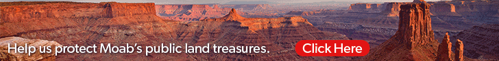
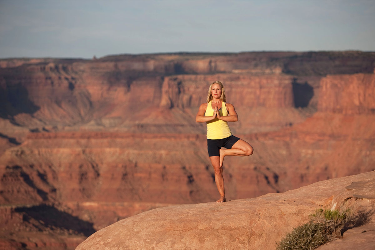
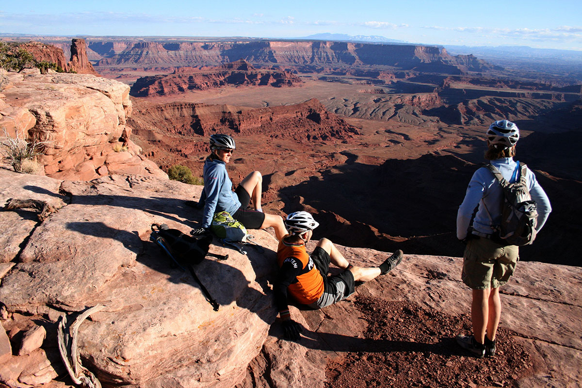
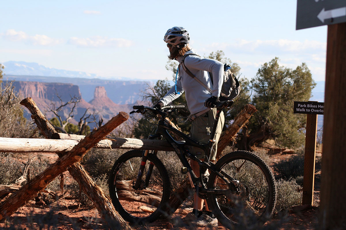
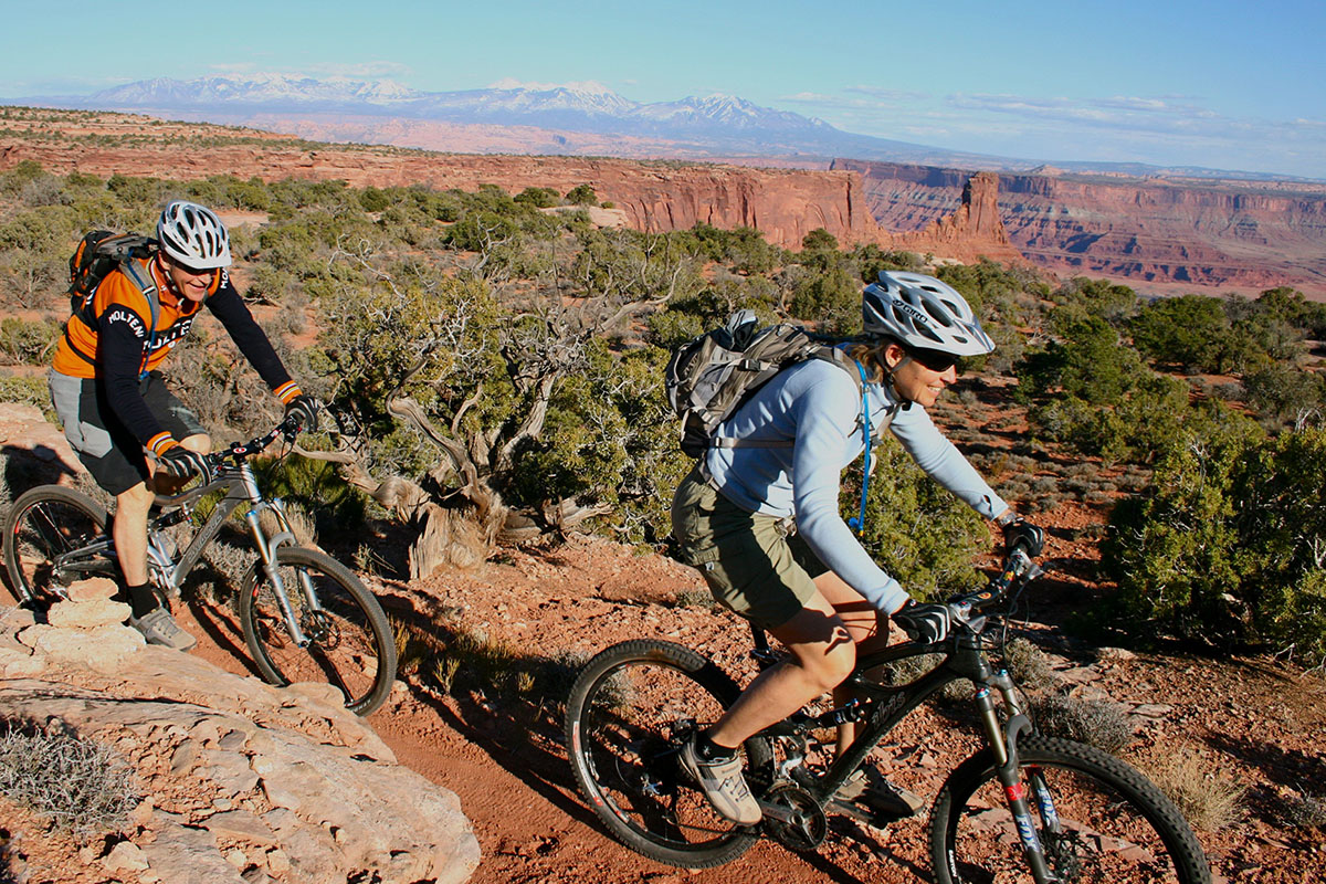
There are miles of pet-friendly developed hiking trails in the park, including a paved trail which provides easy access to some of the most scenic views. Mountain Bikers will love the new Intrepid Trail System at Dead Horse Point. With slickrock sections, looping singletrack, sandy washes, and incredible scenery, the Intrepid Trail System provides a great taste of what Moab mountain biking is all about. This is the perfect ride for families and offers spectacular views of the Colorado River and Canyonlands National Park.
Mailing Address
Dead Horse Point State Park
P.O. Box 609
Moab, UT 84532
Visitors Center GPS Coordinates
38.487767, -109.735997
Website
Mailing Address
Dead Horse Point State Park
P.O. Box 609
Moab, UT 84532
Visitors Center GPS Coordinates
38.487767, -109.735997
Website
Eight miles of pet friendly hiking trails in the park include two joining loops around the rim and several spurs to beautiful viewpoints.
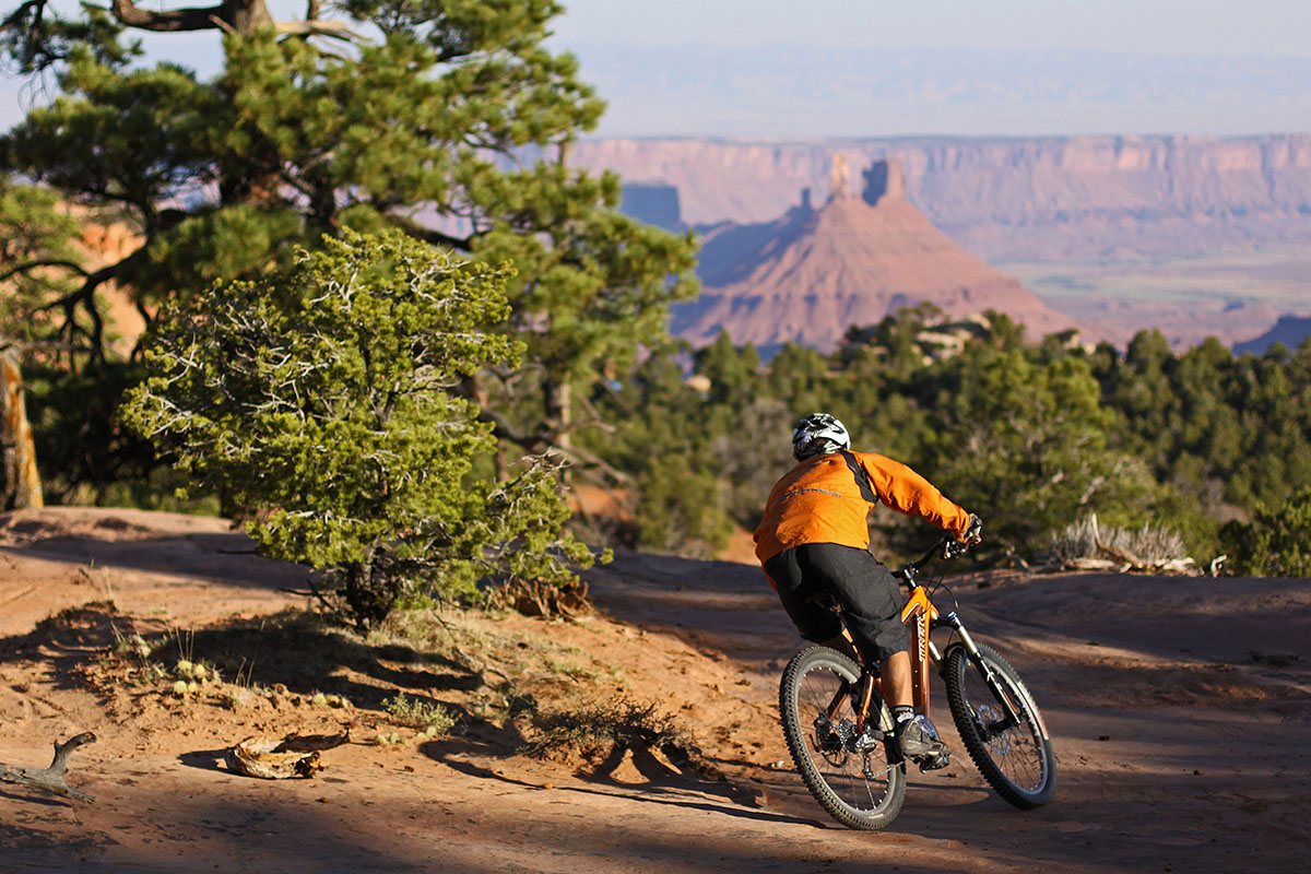
The Intrepid Trail System has three hiking and biking loops ranging from one to nine miles with varying degrees of difficulty.
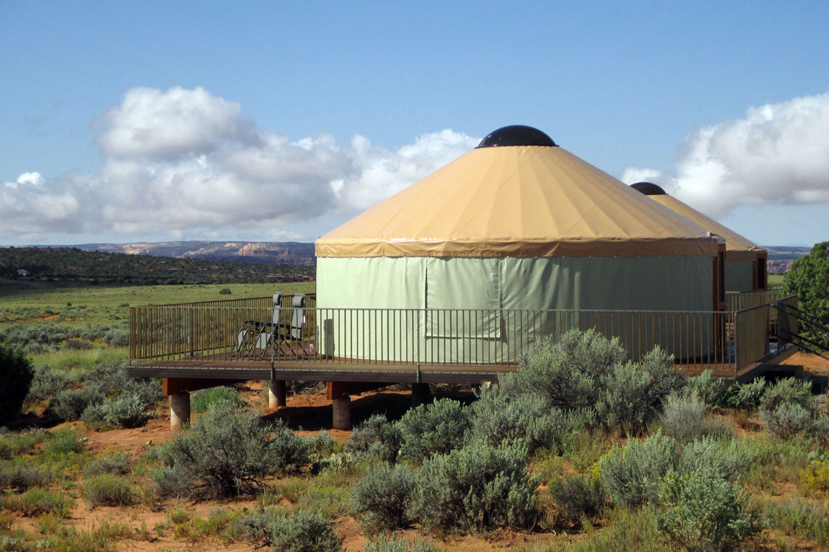
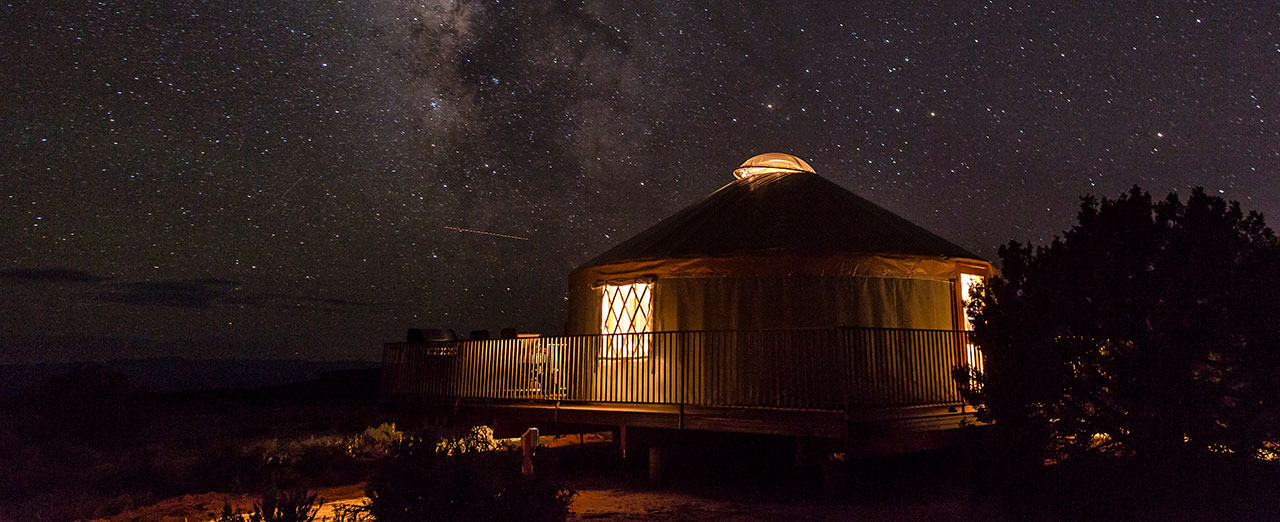
Nine yurts are available for overnight use and are available by reservation. Open year-round.
Dead Horse Point’s combination of breathtaking scenery and easy accessibility has made it a must-see for visitors to the Moab area.
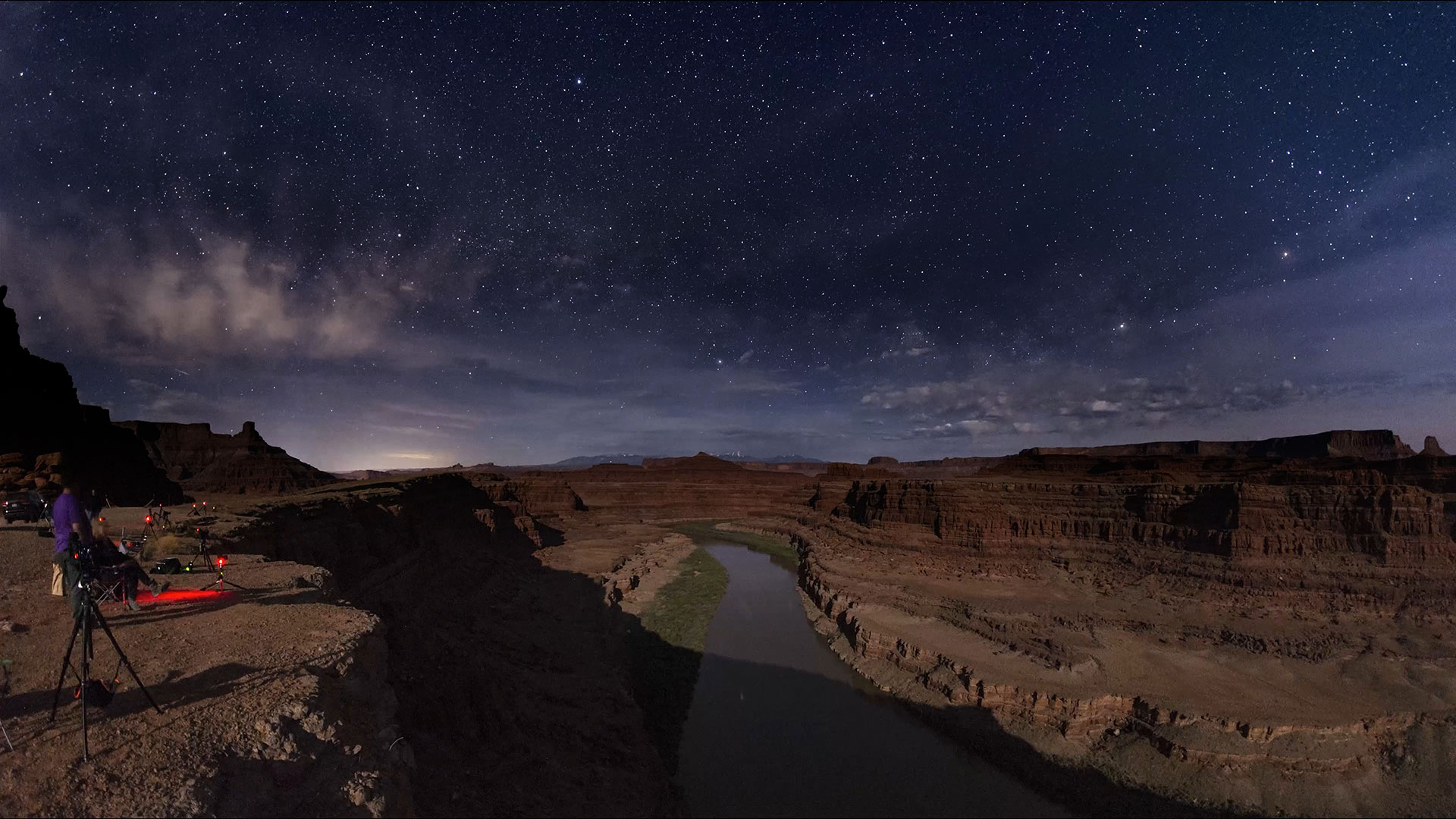
Dead Horse Point State Park, recognized as an International Dark Sky Park in 2016, is one of the most active and accessible areas to stargaze in the Moab area. Its high plateau location, mountains far in the distance and cities out of sight yields a nearly full view of celestial sphere. Park staff routinely provide programs celebrating the night sky, from walks under the full moon to gazing through telescopes at objects millions of light years away. Whether you want to enjoy by yourself or join a ranger, Dead Horse Point State Park is a premier spot to see the skies our ancestors wondered over and survived with.
Download Dead Horse Point State Park’s Dark Sky Brochure to learn more.
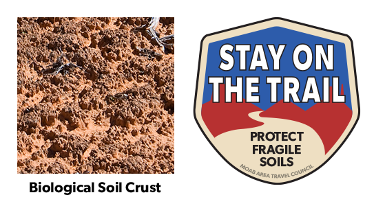
Your help is crucial in preserving our trails and protecting the fragile soil that sustains the desert ecosystem. The biological soil crust, also known as cryptobiotic soil, serves as the foundation for desert plant life. This unique black, knobby crust is composed of diverse living organisms and plays a vital role in maintaining the delicate balance of the desert environment.
However, this soil crust is exceptionally delicate and can take several decades to regenerate. Even a single footstep can cause irreparable damage that can persist for years, impacting the entire ecosystem. We urge you to stay on designated roads, routes, and trails to ensure the preservation of this fragile life. In areas where hiking trails are not established, it is advisable to hike on sandy washes or bare rock surfaces to minimize the impact on the soil.
By remaining vigilant and adhering to these guidelines, you contribute to the long-term sustainability of the desert ecosystem and help safeguard its natural beauty for generations to come. Let’s work together to keep all of our trails open and protect the invaluable biological soil crust.
For a more optimal web experience, please view our site on Microsoft's recommended browser, Edge. You can download it here.