- Attractions
- Activities
- Lodging + Campgrounds
- Area Info
- Services
- Transportation

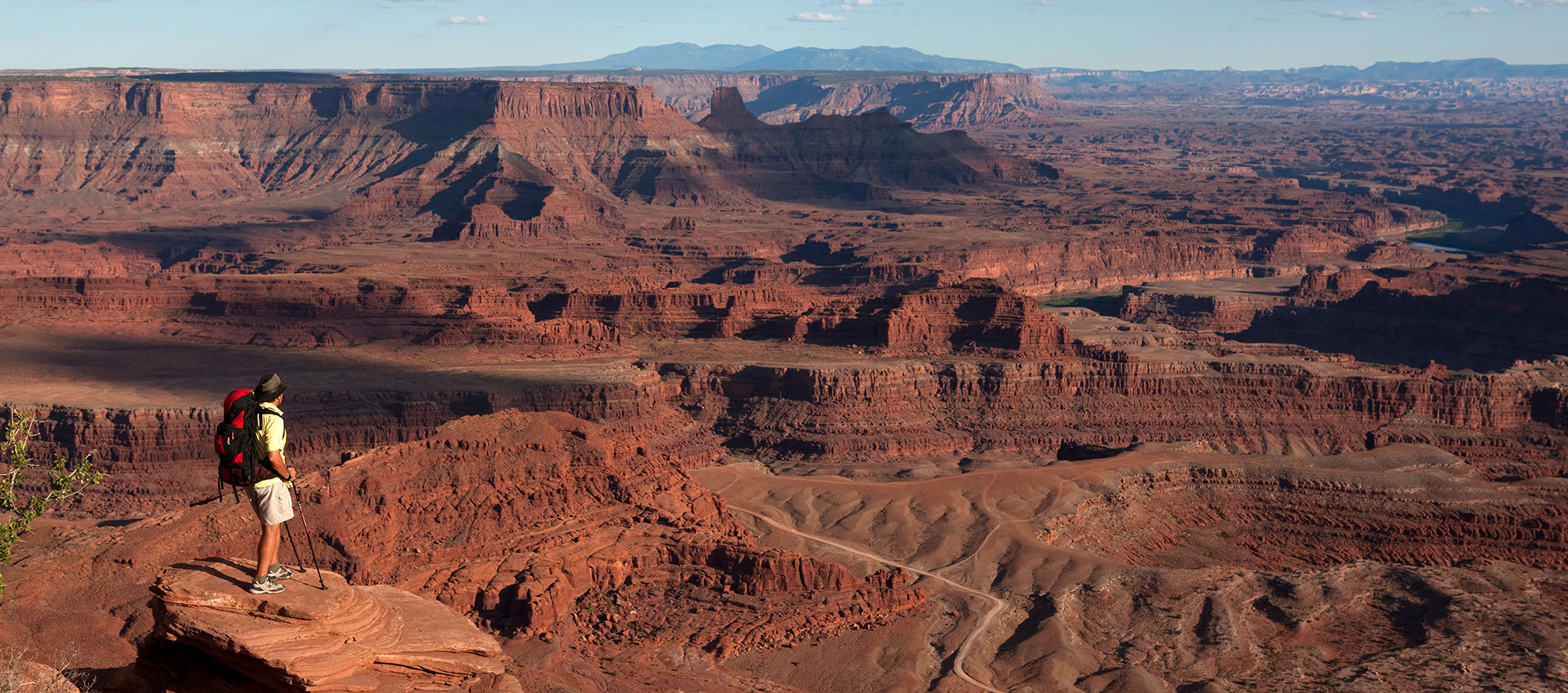
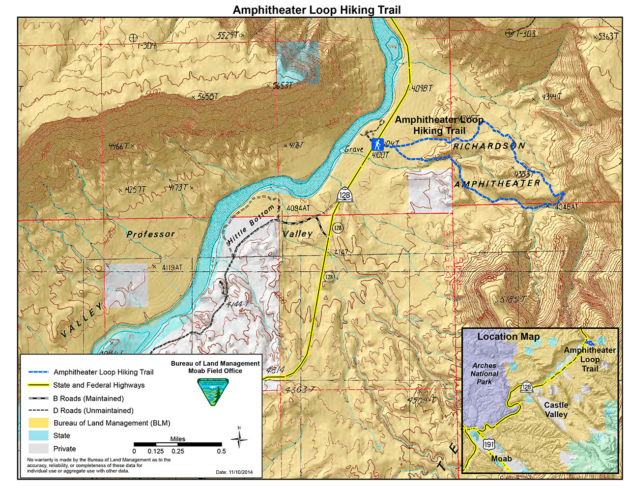
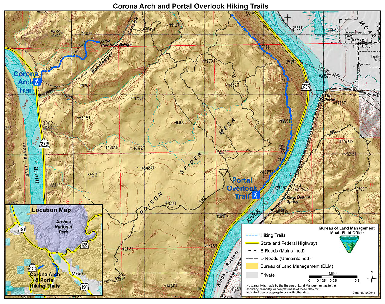
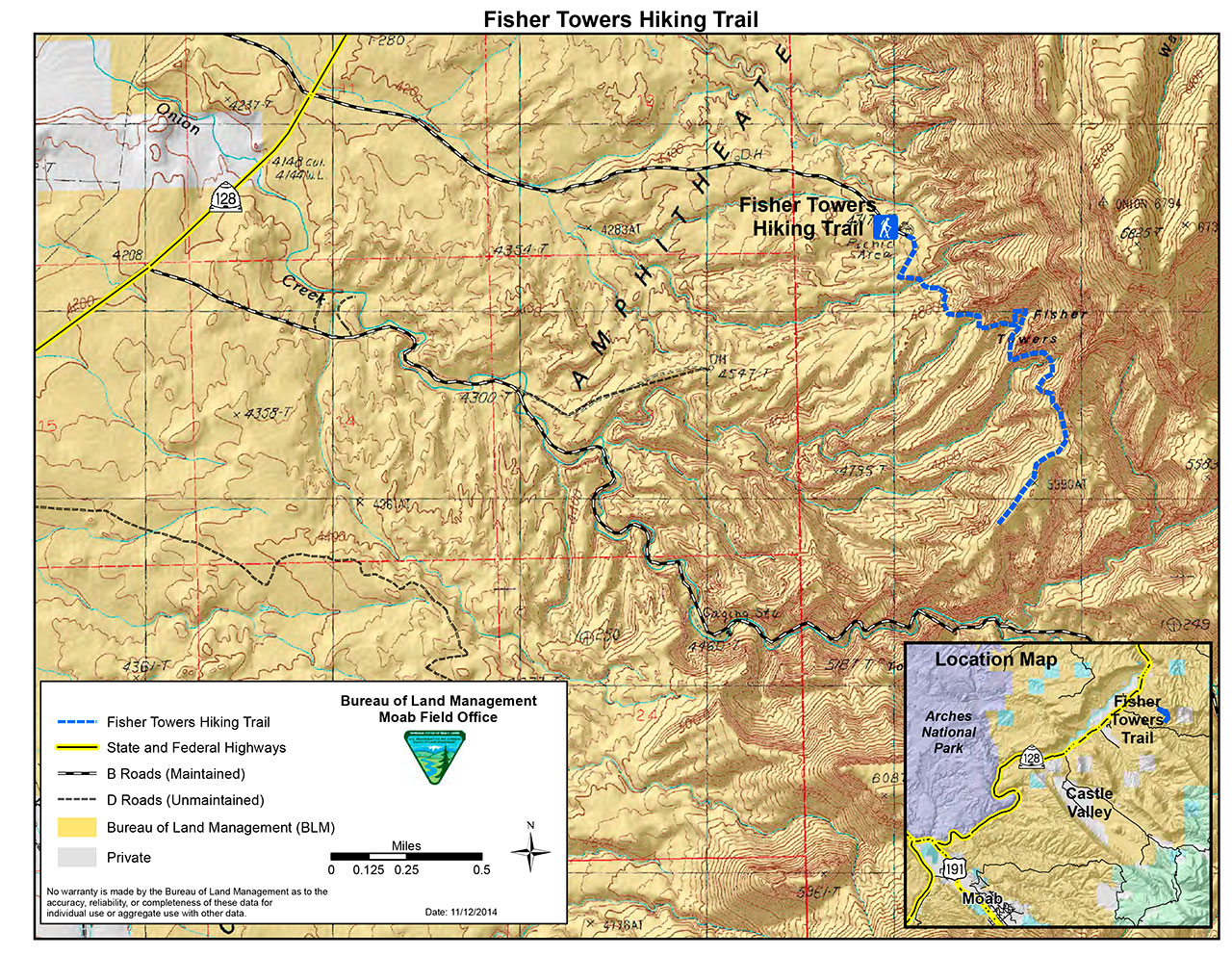
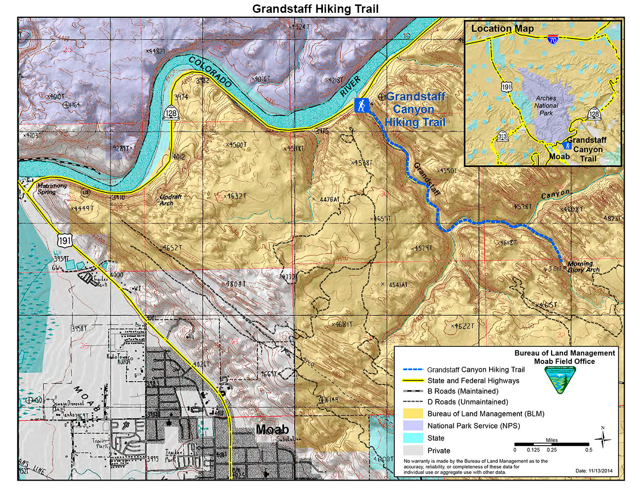
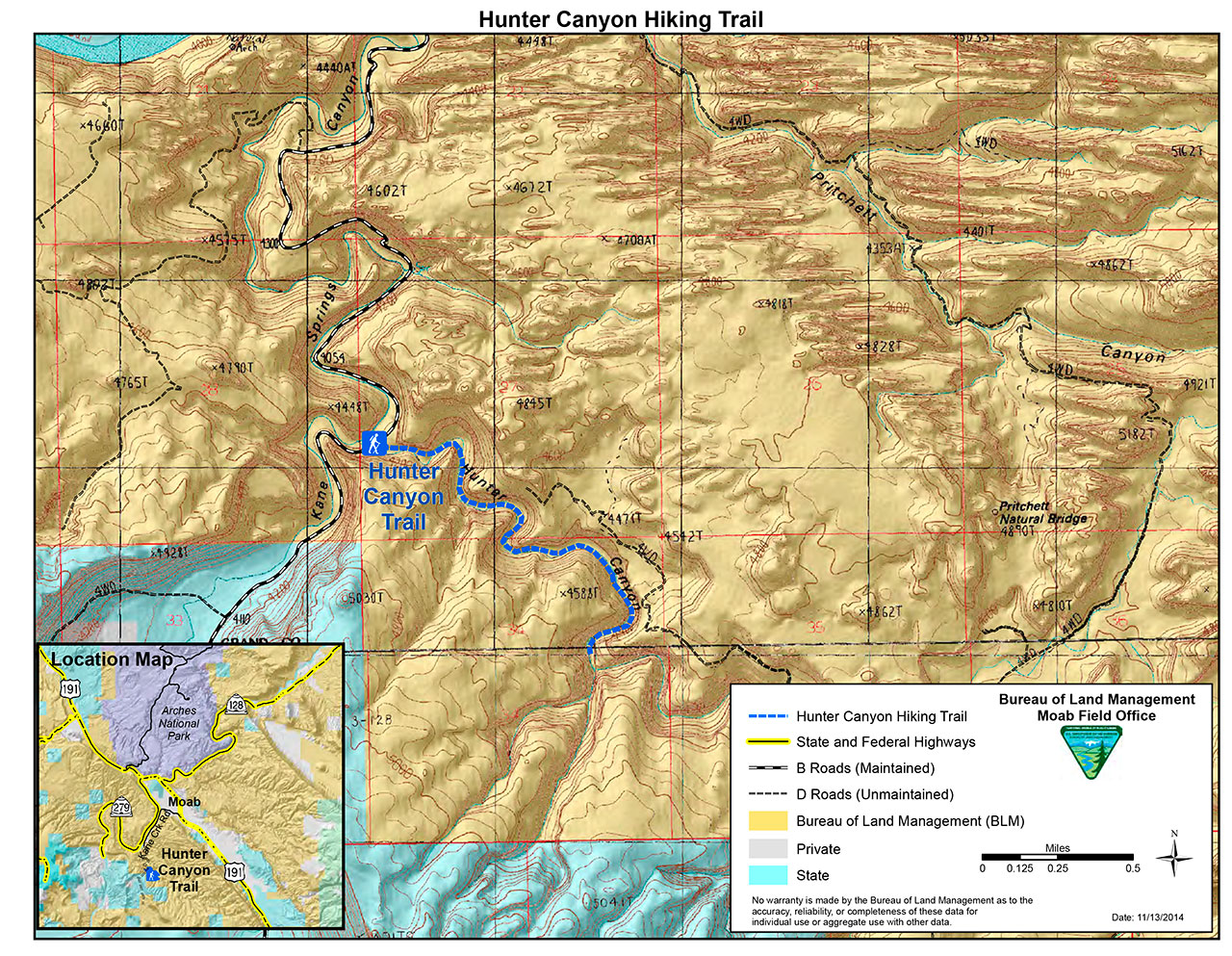
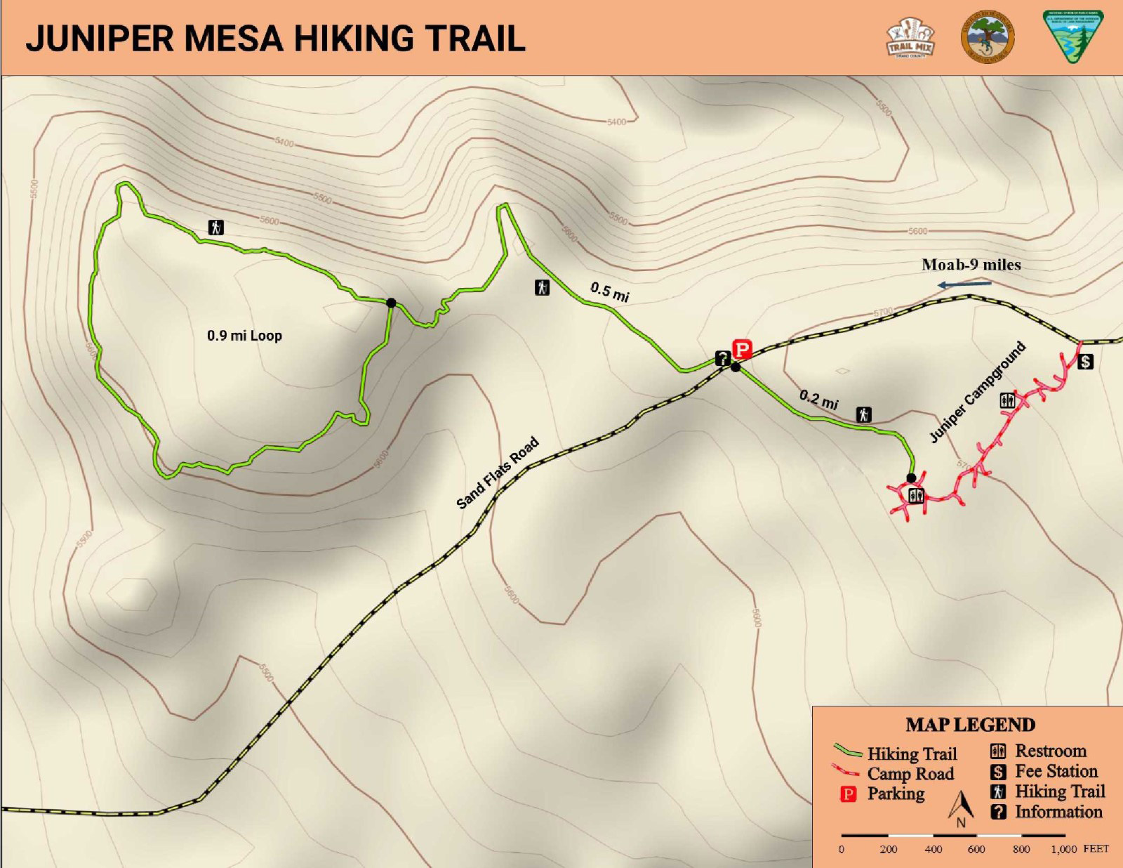
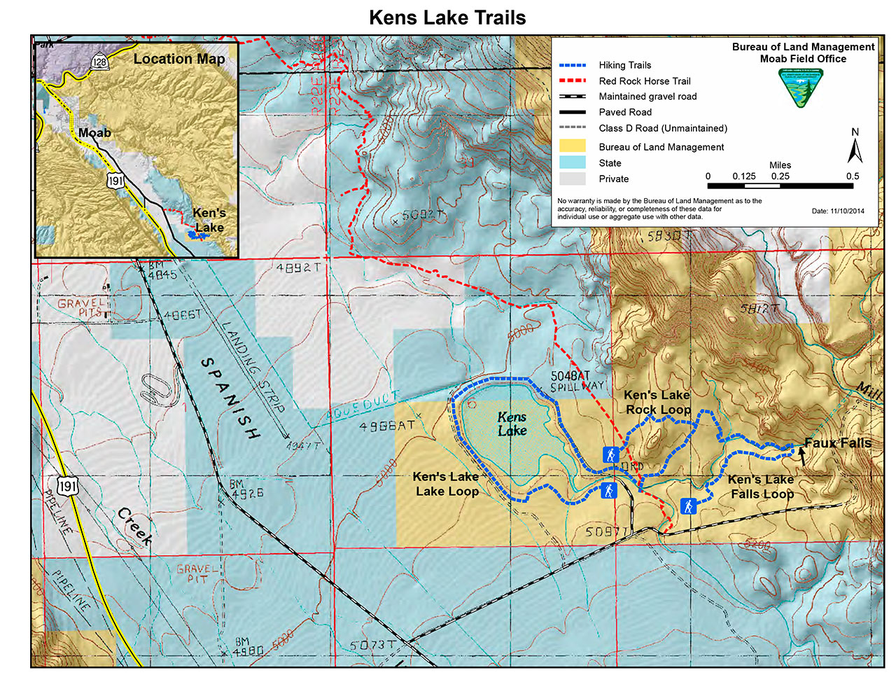
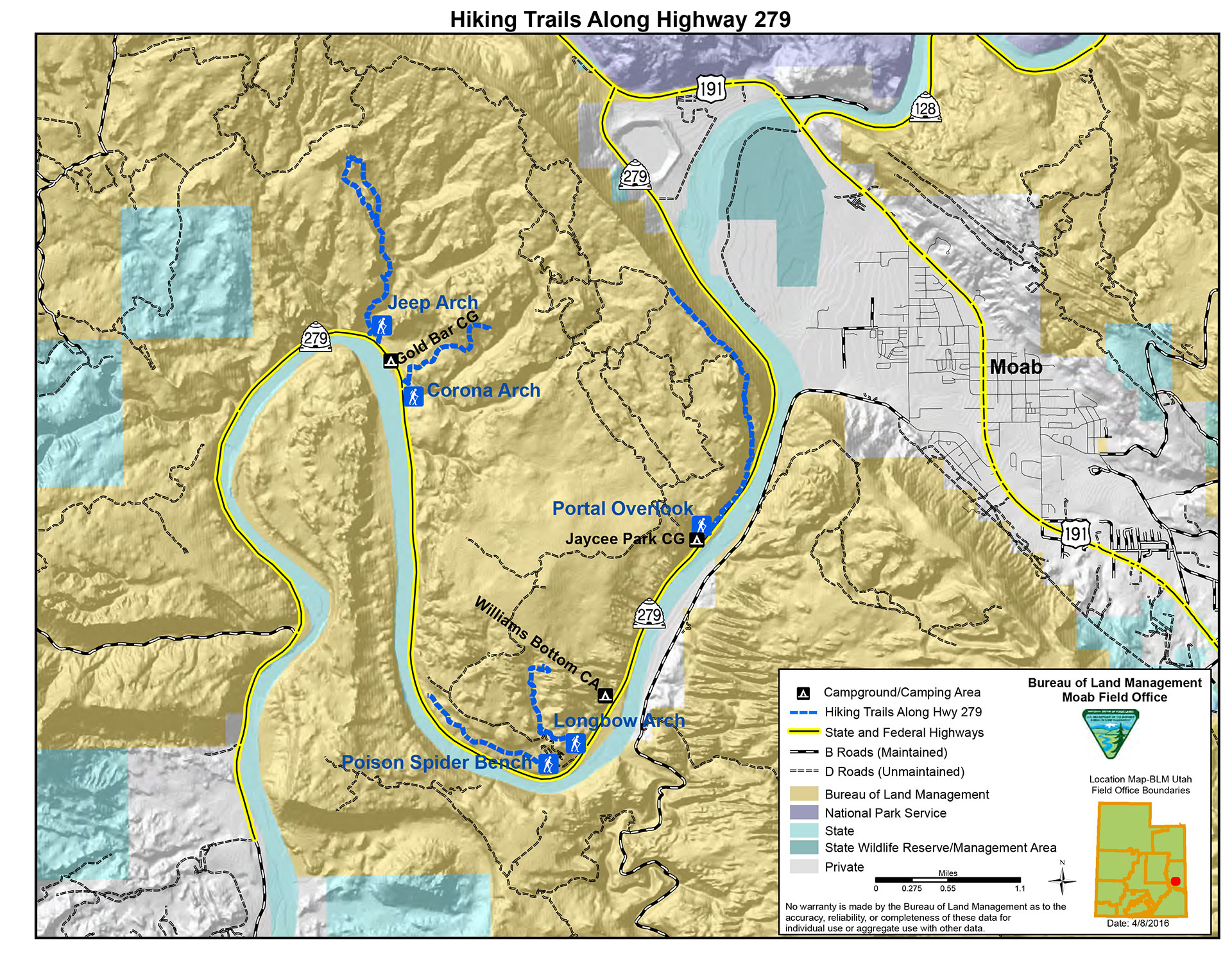
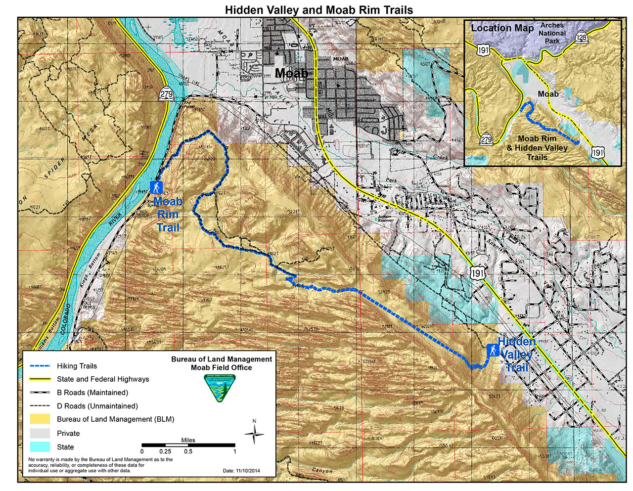
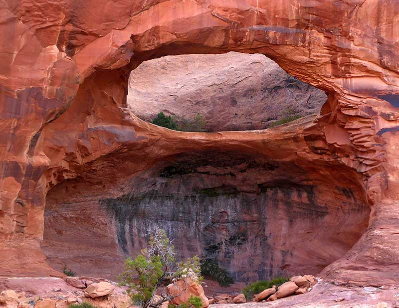
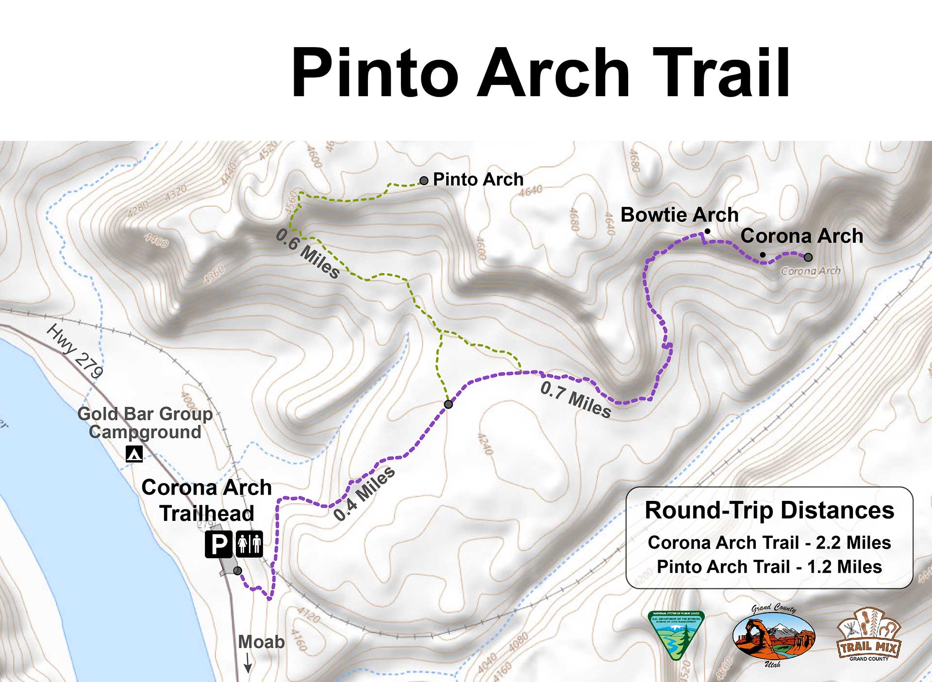
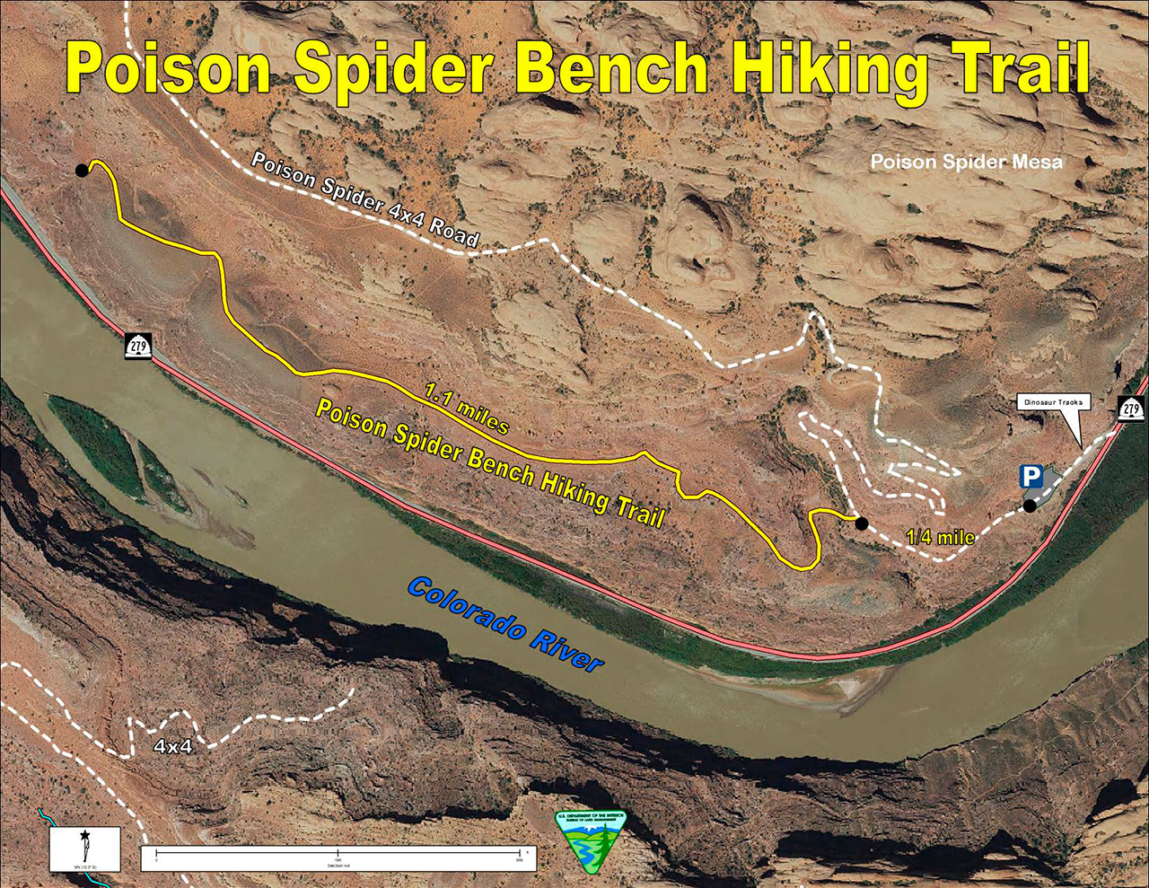
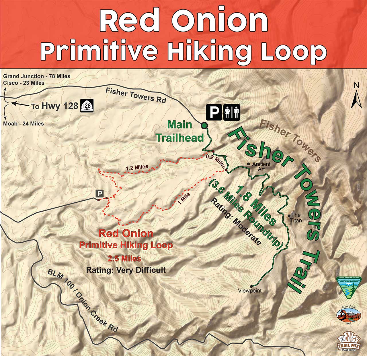
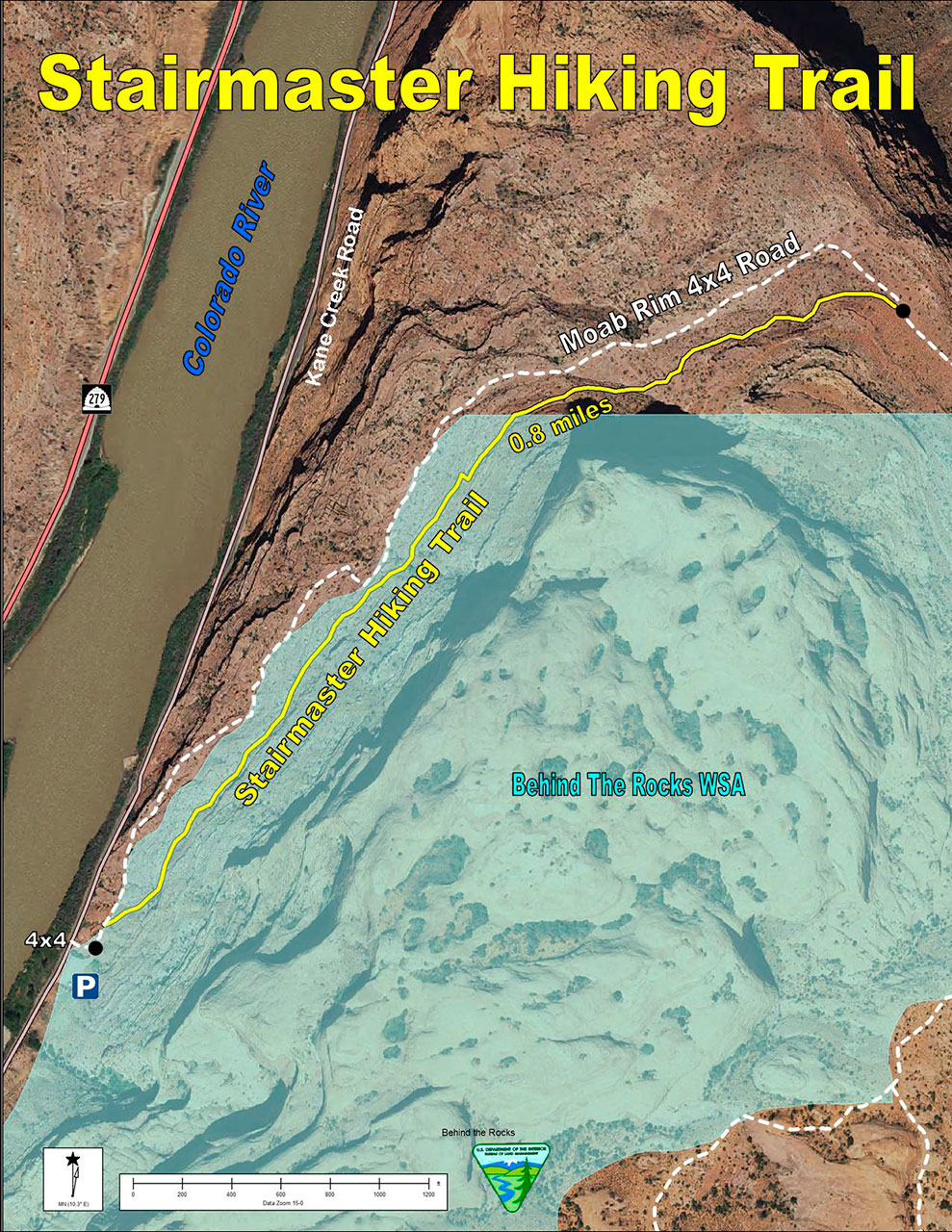
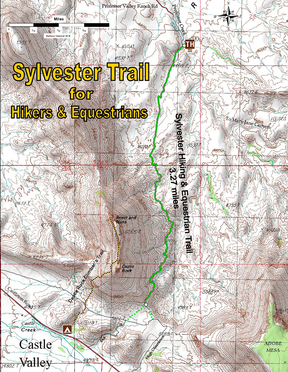
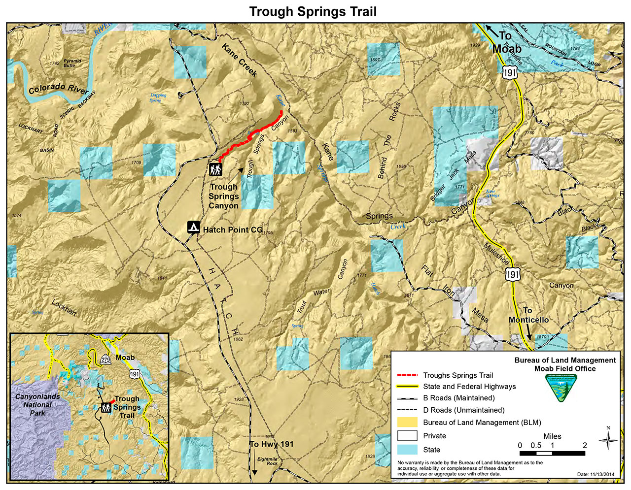
Moab Area Hiking Trails
From cool stream-side hikes to spectacular sandstone arches, the Moab area is full of exciting day-hikes outside of the national parks. All of the trails on this page are on Bureau of Land Management land and most are pet friendly. What follows is just a taste of what Moab has to offer outside of the national parks.
Moab Trail Ambassadors
Moab’s Trail Ambassadors station themselves at popular trailheads to help spread messages about responsible recreation and safety.
Moab Outdoor Adventure Guide
The Moab Outdoor Adventure Guide (available for free at the Moab Information Center) is a comprehensive guide to adventures and activities that are available on the public lands surrounding Moab.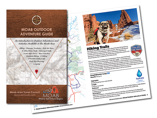
This is a high desert environment. Bring one gallon per person, per day.
Tennis or running shoes with rubbery soles are adequate for short slickrock and stream hikes.
Sun hat, sunscreen, and sunglasses
There are many pet-friendly trails and accommodations to choose from in the Moab area. By taking a few precautions and observing local rules and regulations, traveling with your pet can be a very rewarding experience.
NATIONAL PARKS
Activities with pets are very limited within the National Parks of southern Utah. Pets are prohibited from the backcountry as well as on trails. Pets must be leashed at all times when outside a vehicle and may be walked only on roads or in parking lots. Pets may accompany visitors in campgrounds.
OTHER PUBLIC LANDS
Generally, pets may accompany you as you hike on public land in Canyon Country outside of the national parks. (Check out our Hiking Page for details on some popular pet friendly Moab area hikes.)
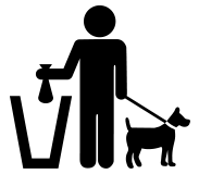
Clean Up After Your Pet
Bring plastic bags, litter, or bedding. Wherever you stay, don’t forget to clean up after your pet. It’s both common sense, and courteous to the places you’re visiting.
Research and Obey Local Laws
In Moab City all dogs must be kept on a leash, in Grand County all dogs must be kept under restraint, no owner shall fail to exercise proper care and control of his or her animals to prevent them from becoming a public nuisance.
Pet Friendly Trails and Places
All of the trails on this page are pet friendly. In town, Moab’s Bark Park is an off-leash dog park located at 100 East 300 South on the southeast corner of the intersection. This is a great place to bring your dog so they can exercise, run, and play, unleashed. (Please remember to clean up after your dog.)
Identification
Make sure the identification tags on your pet’s collar are up to date and fastened securely to the collar. An updated rabies vaccine is required for all dogs and cats in the state of Utah.
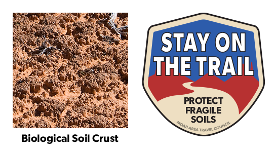
Help to keep all of our trails open. Protect this fragile, but crucial, soil by remaining on designated roads, routes and trails at all times.
Biological soil crust, also known as cryptobiotic soil, is the foundation of desert plant life. This black, knobby crust is made up of many different living organisms and plays a vital role in maintaining the desert ecosystem. However, this sensitive soil is extremely fragile and can take decades to grow. Even a footstep can damage the crust for decades, having lasting impacts on the desert environment. Please stay on the trials. Help to protect this fragile life by remaining on designated roads, routes, and trails at all times. Where hiking trails are not established, hike in sandy washes or on bare rock.
For a more optimal web experience, please view our site on Microsoft's recommended browser, Edge. You can download it here.