×
attractions activities lodging + campgrounds area info services transportation events submit an event moab snapshot contact search Visit Utah

Fishing Near Moab

Introduction

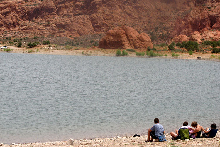
Are you a fishing enthusiast? If so, let’s talk about your preferences. When it comes to trout or catfish, Moab has something for everyone. If you’re up for the challenge, head to the sandy beaches along the Colorado River, where catfish abound and anglers can test their skills. On the other hand, if you prefer the tranquility of beautiful lakes and streams, the nearby La Sal Mountains offer fantastic trout fishing opportunities.

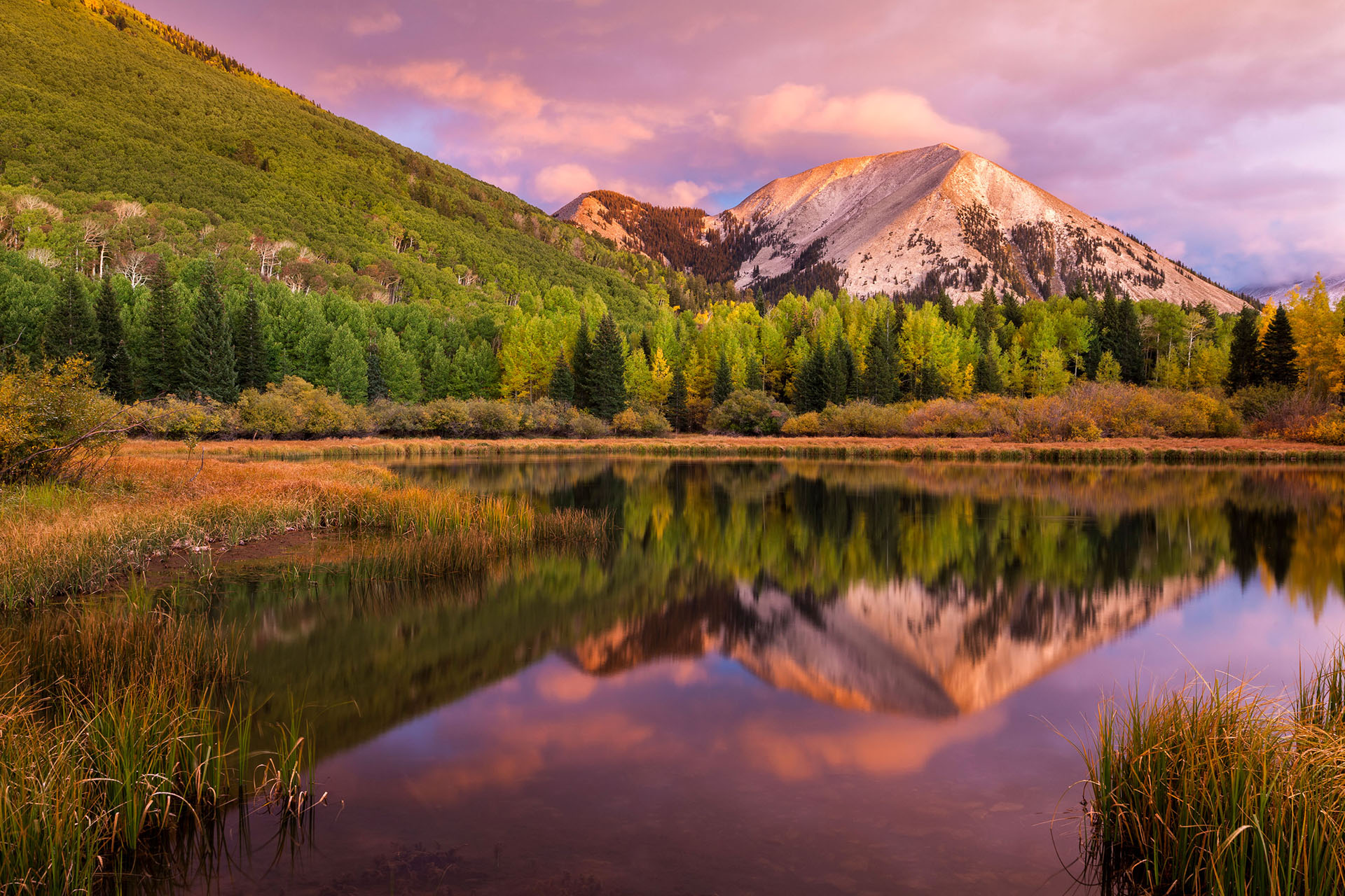
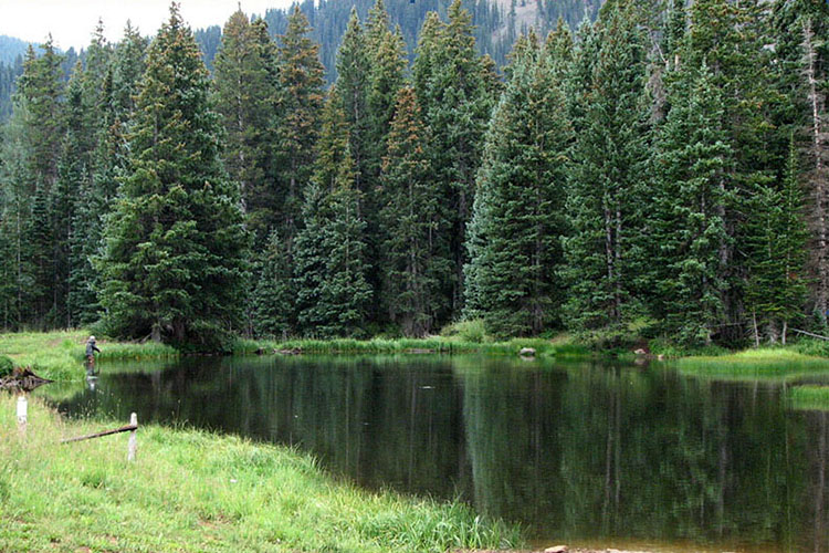
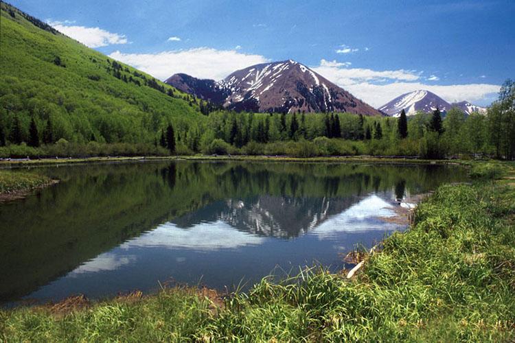
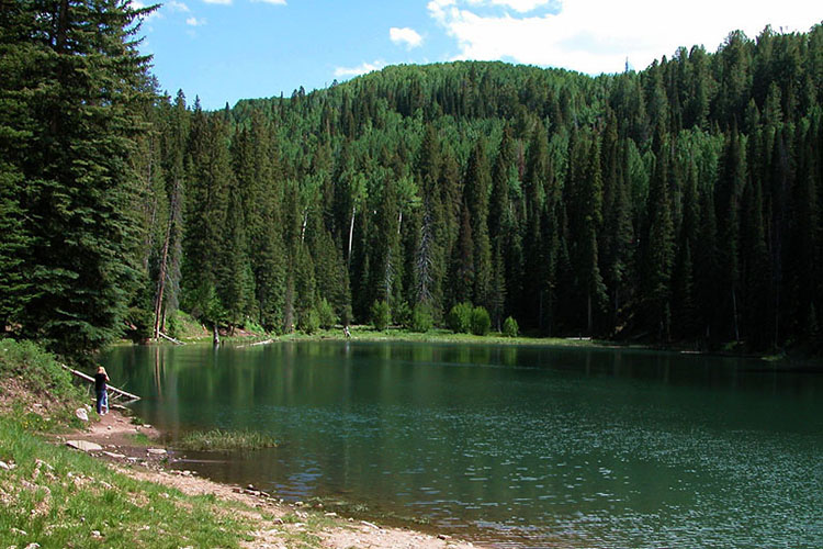
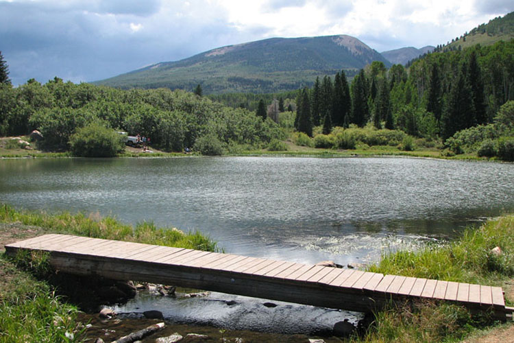
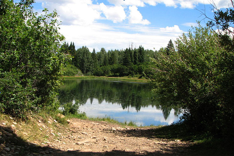
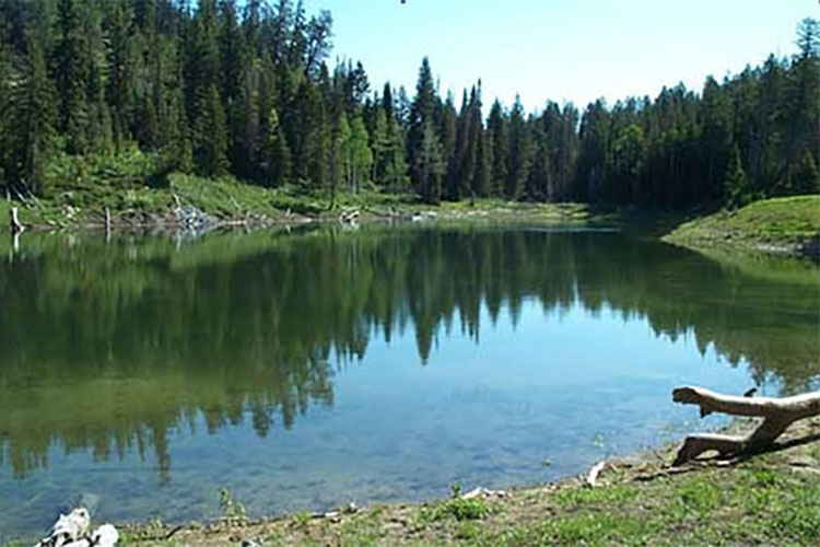
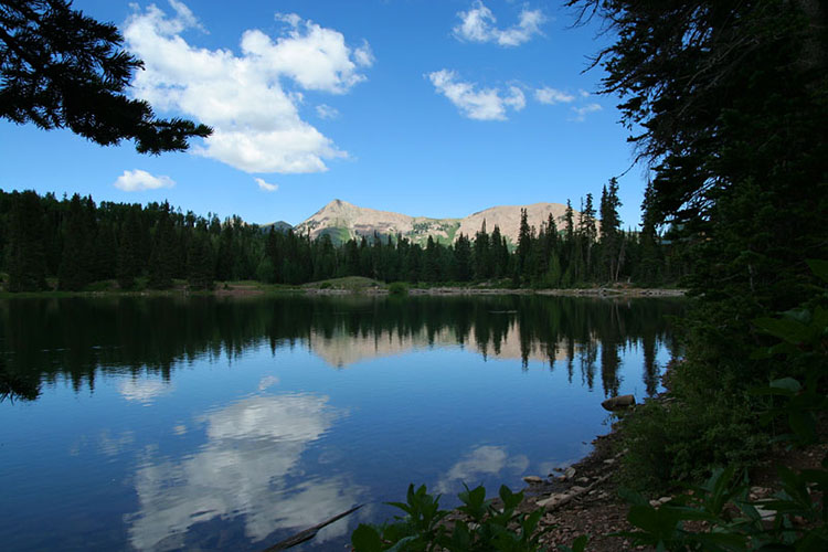
Picture yourself surrounded by whispering pines, quaking aspens, and the soothing sound of bubbling brooks. Nature’s symphony plays harmoniously as you embark on a family outing in the forest, creating an unforgettable experience. Just a few miles southeast of Moab, the La Sal National Forest beckons with its abundance of lakes and streams, perfect for recreational angling.

Imagine yourself in this serene setting, where eight lakes ranging from 2 to 5 acres in size are nestled amidst towering fir and spruce trees, along with tall quaking aspens that create a picturesque landscape. In the summer months, two-wheel drive vehicles can easily access these lakes. However, please note that occasionally, wet weather conditions can render some roads impassable, so it’s essential to plan accordingly.

Indulge your love for fishing and immerse yourself in the beauty of Moab’s natural surroundings. Whether you’re seeking the thrill of catfish fishing along the Colorado River or the tranquility of trout fishing in the stunning La Sal Mountains, the fishing opportunities here are abundant and sure to satisfy your angling desires.

Game Fish

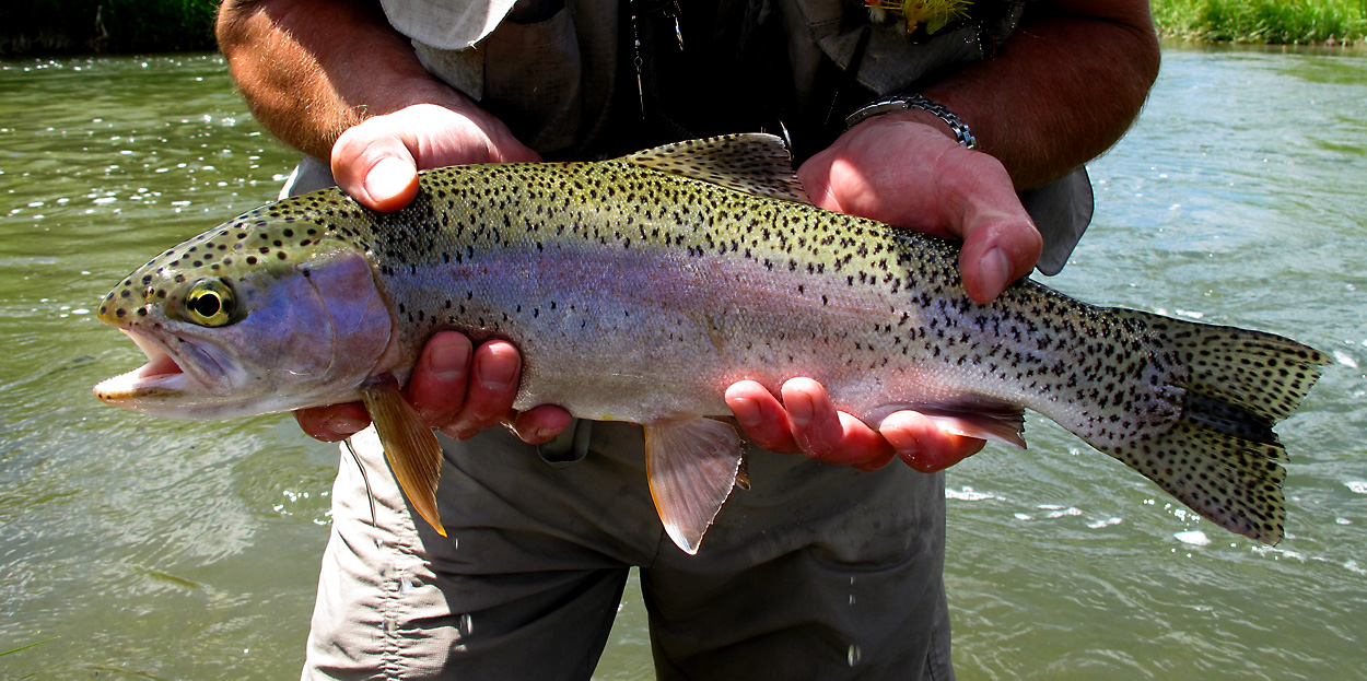
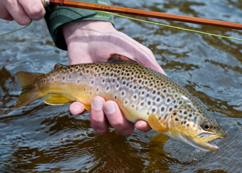
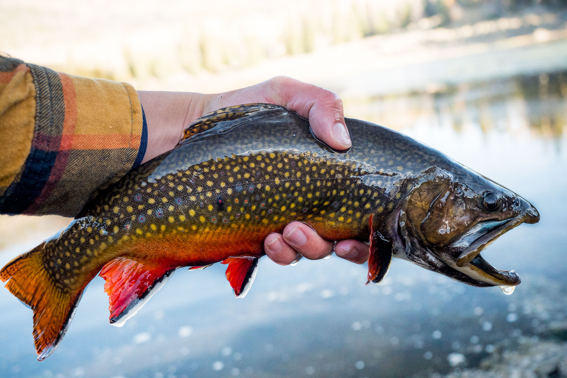
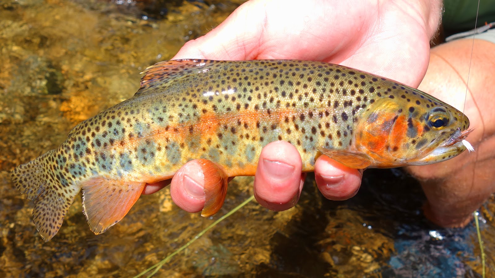
Game fish within these lakes include Rainbow, Brown, Cutthroat and Brook trout. While the Utah Division of Wildlife Resources stock these lakes annually, several have enough natural reproduction to provide an angler with both planted and native fish.

Rainbow Trout

These spring spawners are scrappy fighters, with fishing being its best during May and June in the large reservoirs and from July to September in the high mountain lakes. Bait includes worms, cheese and salmon eggs. These trout are identified by the irregular black spots that densely cover the head, body and fins. Their sides are silver in color with a pinkish band on the adult fish.

Brown Trout

Fall spawners that provide excellent stream fishing with artificial lures. Flies are often used for evening fishing. Fishermen consider them to be the smartest, most difficult to catch of the trout specie. Most brown trout are covered with black spots along their sides, back and dorsal fin with each spot surrounded by a light halo. Frequently, the spots near the lateral line are red. Unlike brook and rainbow trout, the tails of brown trout have few if any spots.

Brook trout

These Fall spawners are found in small lakes with the best fishing being from June to September. Baits include dark flies in the evening, worms and artificial lures. Brooks are often brightly colored with lateral pink and yellow spots, dark wavy marks on green back, and lower fins with white and black front edge.

Cutthroat Trout

Spring spawners readily found in small lakes and can be caught using files and artificial lures. Best fishing occurs during the cool weather of October. Cutthroats are identified by the lack of spots on head and red slash under the lower jaw in adults. The dorsal, pelvic and anal fins may be tipped with red.

Lakes in the La Sal Mountains

Medicine Lake

Medicine Lake

  • Elevation: 10,000 ft
  • Size: 2 acres
  • Miles from Moab: 48 miles (approx)
  • Vehicle: High Clearance
  • Map: LINK
  • Directions: Drive 22 miles south of Moab on Hwy 191 to La Sal Junction. Turn left onto Utah Hwy 46 which goes thru La Sal. Drive east 12.9 miles, and turn left onto Canopy Gap road (a.k.a. Two Mile Road). Go approximately 2 miles, turn left (at the signed junction) onto La Sal Pass road (F.S. Road 73). After about 1 mile you’ll come to a “Y” junction. Stay right. Continue approximately 6.5 miles where you will pass the turnoff for Beaver Lake. Continue on F.S Road 73 approximately 1 mile thru a deep cut bank. Immediately turn left on a small road (F.S. Road 238). It is 4WD due to some hills and rocky stretches and ends in a meadow after about a mile.
  • Camping Info: Low-impact primitive camping is permitted, as well as small controlled camp fires, although stoves are preferred.

Warner Lake

Warner Lake

  • Elevation: 9,200 ft
  • Size: 5 acres
  • Miles from Moab: 30 miles (approx)
  • Vehicle: 2WD
  • Map: LINK
  • Directions: From Moab take US 191 south 6.8 miles to La Sal Mtn. Loop Road sign (Old Airport Rd.). Turn left onto Old Airport Rd. and go 0.6 miles to “T” intersection and another LaSal Mtn. Loop Road sign (Spanish Valley Dr.). Turn right onto Spanish Valley Dr. and then 0.6 miles to a “Y” intersection. Bear left and continue approximately 14 miles to campground sign. Turn right at sign and proceed 8 miles on dirt road to the Lake and Campground.
  • Camping Info: There are 20 camp sites in an aspen grove with tables and grills. Vault toilets are available. No hookups. A group area accommodates up to 50 campers, and a small cabin sleeps up to 4. Open: Jun-Oct; fee charged. Reservations: tele: 1-877-444-6777 or link: www.recreation.gov.

Oowah Lake

Oowah Lake

  • Elevation: 8,800 ft
  • Size: 4 acres
  • Miles from Moab: 25 miles (approx)
  • Vehicle: High Clearance
  • Map: LINK
  • Directions: From Moab, go south on US 191 6.8 miles, then east on Old Airport Road 0.6 miles to Spanish Valley Drive. Turn right onto Spanish Valley Drive and go 0.6 miles to a “Y” intersection. Bear left and continue on the LaSal Mountain Loop Road approximately 12.5 miles to the Oowah Lake Sign. Turn right and continue 3 miles to lake and campground.
  • Camping Info: 11 campsites (RV & tent only) on small but scenic Oowah Lake. Vault-toilets, tables, and grills. No hookups. Open: Jun-Oct; first-come, first serve; $5/night fee.

Hidden Lake

Hidden Lake

  • Elevation: 8,400 ft
  • Size: 3 acres
  • Miles from Moab: 34 miles (approx)
  • Vehicle: 2WD
  • Map: LINK
  • Directions: Take Scenic Byway 128 along the Colorado River to the Castle Valley junction approximately 16 miles. Turn Right, pass through Castle Valley, and continue on toward Gateway, (past the Loop Road turn-off). When the pavement ends , continue 2 miles to a Y, turn right toward Gateway for 2.5 miles to a fork with signage indicating Don’s Lake 1 ½ miles ahead. Turn right and follow this road approximately ¼ mile then turn right on the dirt road by the vault toilet.
  • Camping Info: While there are no amenities such as picnic tables and grills, there are many areas that can be used for RV as well as tent camping.

Don’s Lake

Don’s Lake

  • Elevation: 8,800 ft
  • Size: 3 acres
  • Miles from Moab: 35.5 miles (approx)
  • Vehicle: 2WD
  • Map: LINK
  • Directions: Take Scenic Byway 128 along the Colorado River to the Castle Valley junction approximately 16 miles. Turn Right, pass through Castle Valley, and continue on toward Gateway, (past the Loop Road turn-off). When the pavement ends , continue 2 miles to a Y, turn right toward Gateway for 2.5 miles to a fork with signage indicating Don’s Lake 1 ½ miles ahead. Turn right, drive the 1 ½ miles and take a left turn into Don’s Lake (immediately past the vault toilet).
  • Camping Info: No amenities, but several camping areas can be found for both RV and tent camping along side the road between Hidden and Don’s lakes.

Blue Lake

Blue Lake

  • Elevation: 10,000 ft
  • Size: 4 acres
  • Miles from Moab: 30 miles (approx)
  • Vehicle: 4WD
  • Map: LINK
  • Directions: From Moab, go south on US 191 6.8 miles, then east on Old Airport Road 0.6 miles to Spanish Valley Drive. Turn right onto Spanish Valley Drive and go 0.6 miles to a “Y” intersection. Bear left and continue on the LaSal Mountain Loop Road approximately 12 miles to the Geyser Pass Road turnoff. After 4.5 miles on County Road 126 (aka Geyser Pass Road) you will come to a parking lot. Continue one mile to a fork where CR #126 bears left and continue another 2.5 miles on to another fork. Stay right on CR 126 approximately 1 mile, then turn left on the Blue Lake road (Forest Service Road #721) for approximately 1.5 miles. Note: The road to Blue Lake requires 4WD and is very bumpy and travel is slow.
  • Camping Info: Low-impact primitive camping is permitted, as well as small controlled camp fires, although stoves are preferred.

Dark Canyon Lake

Dark Canyon Lake

  • Elevation: 10,000 ft
  • Size: 5 acres
  • Miles from Moab: 35 miles (approx)
  • Vehicle: High Clearance
  • Map: LINK
  • Directions: From Moab, go south on US 191 6.8 miles, then east on Old Airport Road 0.6 miles to Spanish Valley Drive. Turn right onto Spanish Valley Drive and go 0.6 miles to a “Y” intersection. Bear left and continue on the LaSal Mountain Loop Road approximately 12 miles to the Geyser Pass Road turnoff. After 4.5 miles on County Road 126 (aka Geyser Pass Road) you will come to a parking lot. Continue one mile to a fork where CR #126 bears left and continue another 2.5 miles on to another fork. Stay right on CR 126 approximately 7 miles to the Dark Canyon Lake turnoff on the left, then 0.5 miles to the lake.

Ken’s Lake

Ken’s Lake

  • Elevation: 5,050 ft
  • Size: 82 acres
  • Miles from Moab: 10 miles (approx)
  • Vehicle: Passenger Car
  • Map: LINK
  • Directions: From Moab, go south on US 191 6.8 miles, then east on Old Airport Road 0.6 miles to Spanish Valley Drive. Turn right onto Spanish Valley Drive and continue approximately three miles to the Ken’s Lake turnoff.
  • Hiking and horseback trails originate at the campground. Boating on the reservoir is limited to non-motorized craft.
  • Camping: Number of sites: 31. Fee: $12.00 per site. Picnic tables, vault toilets, grills, graveled roads, and trash receptacles. There is no drinking water at the campground. Campsites are available on a first-come, first served basis. Camping at all sites is limited to 14 days within a 30 day period.

Colorado River

If catfish is your preference, the Colorado River offers miles of accessible shore line and many sandy beaches from which anglers can try their luck. Chicken livers, grasshoppers, worms and stink bait are popular baits for cat fishing. Crawdads, shrimp and clams can also be used. Channel Catfish were first introduced into the Colorado River near Moab, Utah in 1919 by active sportsman and public figure, Horace Stone Rutledge. They have deeply forked tails with a rounded anal fin with 24-29 rays and scattered black spots along their back and sides. They have a small, narrow head. The back is blue-gray with light blue to silvery-gray sides and a white belly. Larger channels lose the black spots and also take on a blue-black coloration on the back, shading to white on the belly. The best time to catch catfish is late in the evening and early morning right before the sun comes up. Catfish also like to hang out in holes where the water is a little deeper. Again, anywhere the current is a little slower and a place where food might gather is great place to find catfish.

Recipes

  • Pan Fried Whole Trout
  • Trout Amandine
  • Foil Baked Trout
  • Fried Catfish
  • Pancake Fried Catfish
  • Catfish & Kraut Sandwiches

For a more optimal web experience, please view our site on Microsoft's recommended browser, Edge. You can download it here.