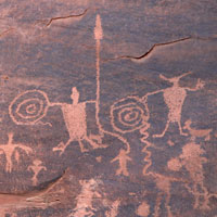
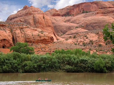
×
attractions activities lodging + campgrounds area info services transportation events submit an event moab snapshot contact search Visit Utah

scenic byways

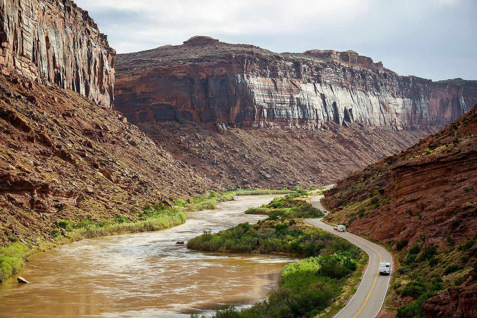
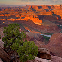
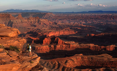
Moab’s Scenic Byways

Every trip to Moab should include a drive along at least one byway

Introduction

The Moab area is blessed with three State Scenic Byways. State Scenic Byways help recognize, preserve and enhance selected roads throughout the United States based on their archeological, cultural, historic, natural, recreational and scenic qualities. Every trip to Moab should include a drive along at least one byway, although driving all three is great way to spend a relaxing day.

Utah Highway Patrol Officer Lt. Tyler Roberts explains Utah’s new law (5/2019) on Lane Filtering for motorcycles. Moab has some of the most scenic highways and byways in the west – share the road and drive safe!

Upper Colorado River Scenic Byway (U-128)

Length:

44.0 mi / 70.8 km

Time to Allow:

2 hours This spectacular route along the Colorado River gorge begins at the Colorado River Bridge on the north end of Moab. For the first 13 miles (20.9 km) it parallels the Colorado River within a narrow section of the gorge, providing breathtaking views of the surrounding red sandstone cliffs. Popular attractions along this portion of the route include viewpoints of the river, public camping areas, and Grandstaff Canyon, which contains a delightful hiking trail to Morning Glory Natural Bridge. At 13 miles (20.9 km) the gorge widens as the highway proceeds past Castle and Professor Valleys, which have been the shooting locations for many western films including Wagon Master and Rio Grande, along with numerous television commercials. The Moab to Monument Valley Film Commission has a museum at the lodge located at Mile Marker 14. Admission is free. After 24.7 miles (39.8 km) the highway passes a viewpoint for one of the grandest views in the west, the red rock spires of the Fisher Towers set against the often snow covered peaks of the La Sal Mountains. After leaving the valley, the road winds farther up the river gorge until arriving at the site of historic Dewey Bridge at 29.8 miles (48 km). Unfortunately Dewey Bridge was destroyed in April 2008 by a brush fire. The road then follows the northern bank of the river for a few more miles before exiting the Colorado River gorge. At this point the highway proceeds across open desert toward the ghost town of Cisco at 44 miles (70.8 km). Cisco was founded as a water refilling station for steam locomotives along the main line of the Denver and Rio Grande Western Railroad. After another 5 miles (8 km) the route intersects Interstate 70.

Mile-By-Mile Travel Log

Potash-Lower Colorado River Scenic Byway (U-279)

Length:

17.0 mi / 27.4 km

Time to Allow:

1 hours This Scenic Byway provides great views of the Colorado River, ancient rock art and dinosaur tracks. A late afternoon start is rewarding as the sunset on the reddish-orange sandstone cliffs along the route is especially beautiful on the return drive to Moab. This byway begins 4.1 miles (6.6 km) north of Moab, where Potash Road (U279) turns off of Highway 191. After 2.7 miles (4.3 km) Potash Road enters the deep gorge of the Colorado River. At the 4 mile (6.4 km) point, look for rock climbers on the cliffs along the section of Potash Road, locally referred to as Wall Street.
At 5.1 miles (8.2 km) several petroglyph panels are visible on cliffs on the right side of the highway. Marked pull-offs on the left side of the road provide parking to view these panels. An interpretive sign provides additional information. At 5.9 miles (9.5 km) the Poison Spider Trail Parking will be on the right. A kiosk on the end of the parking lot, near the vault toilet, will have a map for a short trail to dinosaur tracks and rock art. Trailhead parking for the trail to Corona and Bowtie Arches is available at 9.9 miles (15.9 km). Corona Arch, with an opening of 140 by 105 feet, is also known as Little Rainbow because of its resemblance to Rainbow Bridge at Lake Powell.
Look for Jug Handle Arch, adjacent to the highway, at 13.5 miles (21.7 km). Shortly beyond Jug Handle Arch, the canyon widens and the sheer cliffs below Dead Horse Point State Park become visible in the distance. The paved highway ends at the Intrepid Potash Mine where potash, a mineral often used as a fertilizer, is extracted by flushing large volumes of water through an extensive system of underground tunnels and then evaporating the water in ponds. From the end of the byway drivers with high clearance vehicles can continue on a dirt road to Canyonlands National Park.

Dead Horse Point Mesa Scenic Byway (U-313)

Length:

35.0 mi / 56.3 km

Time to Allow:

2 hours minimum, but several additional hours are recommended to enjoy the state and national parks. Dead Horse Mesa Scenic Byway, on Utah Highway 313, takes you through miles of incredible red rock canyon country. To reach the byway, head north from Moab on US- 191. After about 9 miles (14.5 km), look for the “Dead Horse Point State Park” sign and turn left (west) onto SR-313. This is the start of the byway. After a series of hairpin curves as you begin to ascend the plateau, the road mellows out allowing you to appreciate the scenery. At about 14.6 miles (23.5km) from the beginning of SR-313 a fork to the left leads to Dead Horse Point State Park. Note that a fee is required to proceed to the viewpoints. The view from Dead Horse Point is one of the most photographed scenic vistas in the world. Towering 2,000 feet above the Colorado River, the overlook provides a breathtaking panorama of Canyonlands’ sculpted pinnacles and buttes.
After leaving Dead Horse Point State Park, backtrack to Highway 313, turn left, and head toward the Island in the Sky District of Canyonlands National Park, ultimately ending at Grandview Point. This section of the park sits atop a massive 1500 foot mesa – quite literally an Island in the Sky. 20 miles (32.2 km) of paved roads lead to many of the most spectacular views in canyon country.
Dead Horse Point is one of Utah’s most spectacular state parks. Towering 2,000 feet above the Colorado River, the park provides a breathtaking panorama of Canyonlands’ sculpted pinnacles and buttes.

For a more optimal web experience, please view our site on Microsoft's recommended browser, Edge. You can download it here.