- Attractions
- Activities
- Lodging + Campgrounds
- Area Info
- Services
- Transportation


Staff Directory
Ben Fredregill
Director
435-259-1340
bfredregill@grandcountyutah.net
Accomplished and results-driven Business Leader with broad expertise satisfying organization creation and business development with strategic planning and execution, initiative design and implementation, fiduciary implementation and management, team creation and development, process design and implementation and continuous improvement.
Sky White
Assistant Director
435-259-4444
swhite@grandcountyutah.net
I am a relationship-oriented, mission-driven professional with extensive experience in supporting my team’s focus on company strategy, project management, and key initiatives. I have a proven track record of efficient and effective project management and collaboration with key stakeholders enabled by strong interpersonal skills, strong organizational skills, verbal communication skills, and analytical skills. I can work independently and under pressure, while also being able to meet time sensitive deadlines through strong decision-making, tenacity, and good judgment.
Melissa Stocks
Assistant Marketing Director | Social Media & Industry Partnerships
435-259-8825
socialmedia@discovermoab.com
Melissa manages and implements a comprehensive marketing plan that strategically increases quality visitation and supports Grand County’s local tourism economy. She coordinates the development of marketing initiatives, advertising, social media, website, and collateral materials. Melissa also represents Grand County in domestic and international professional shows; develops and maintains a positive relationship with the business community and maintains public awareness of tourism issues, advertising opportunities, and public relations. A Peruvian girl, who moved in 2017, she fell in love with the landscape and the community of Moab. Consequently, Melissa likes to go hiking, camping, fishing, walking downtown at night, and watching the stars along with her husband and puppy. She is a Board Member of the Grand County, UT League of Women Voters organization. In 2021 Melissa won the U.S. Travel Association’s Educational Seminar for Tourism Organizations (ESTO) Destiny Award for the Best Advocacy and Grassroots Campaign.
Bega Metzner
Film Commission Director
435-260-0097
bmetzner@grandcountyutah.net | filmmoab.com
Born and raised in New York City by her director father and photographer mother, Bega Metzner was a child of the industry. She started her formal career on a film set working as a PA (Production Assistant) where she met a costume designer who quickly whisked her away into the world of wardrobe – a world she worked and traveled in for over 20 years. Bega quickly worked her way up from shopper to set costumer to assistant designer, and soon took off on her own as a costume designer and stylist for film, commercials, and editorial print ads. During this time, she spent her downtime in Moab, Utah, a place she first fell in love with (and drank the water from matrimony springs) while on a photoshoot in 1989. When Bega decided she wanted to live full-time in Moab, she started working for the Moab to Monument Valley Film Commission as the assistant director, taking on the role of Director in December of 2016. After 6 years as a Moab City employee Bega is now a joyful member of the Grand County Economic Development team as the Film Commissioner. Bega continues to act as the liaison between any type of media production and the area she represents – Moab to Monument Valley.
Join Museum staff & Utah State Parks staff to mark the opening of “A Moab Prison Camp: Japanese American Incarceration in Grand County” a new temporary exhibition at the Moab Museum. Doors open at 7 pm and Megan Blackwelder, Vice President of the Moab Museum Board of Trustees and Southeast Utah Regional Manager for the Utah Division of State Parks, will introduce the exhibit. About the Exhibition:
A Moab Prison Camp: Japanese American Incarceration in Grand County introduces the local and national story of Japanese American incarceration during WWII. Following the bombing of Pearl Harbor in 1941, President Franklin D. Roosevelt signed Executive Order 9066 authorizing the wartime incarceration of over 120,000 Japanese Americans, a majority of whom were US Citizens, in detention facilities across the country. The Moab Isolation Center, located north of Moab at Dalton Wells, played a brief but significant role in the web of Japanese-American incarceration facilities: a former Civilian Conservation Corps camp was transformed into a temporary prison camp for so-called “troublemakers” from other camps. In this exhibit, a tale of injustice and resilience unfolds via stories and objects, introducing the national context with the Smithsonian’s Righting a Wrong poster exhibition and research conducted by Utah State Parks.
This exhibit unpacks the nuanced terminology used during that era and following, inviting visitors to confront the usage of words like “relocation” versus “incarceration” and wrestle with the gravity of terms such as “concentration camp.” Through compelling narratives curated collaboratively with descendants and partners, A Moab Prison Camp illuminates the resilience and resistance exhibited by those imprisoned in Moab. It offers a broader exploration of the Japanese-American experience during this tumultuous period in US history.
Curious what goes on behind the scenes at the Moab Museum? Interested in seeing local archives, oral histories, and paper collections? Join us upstairs at the Moab Museum for a peek behind the scenes. Volunteer Mindy Lammert will be showcasing a sampling of Grand County people & places from the region’s past using the Moab Museum archives. Museum staff will be on hand to give a tour of the Museum archives, orient visitors to the Mike Ford Research Library, and provide information about the Museum’s new offsite Collections Storage Facility.
Regular admission applies. Admission is always free for Museum Members.
Accessibility: The Museum archives are housed upstairs and are not ADA accessible. Visitors needing accessibility accommodations who interested in accessing archives may reach out to mary@moabmuseum.org and the requested archival materials will be set up in a mobile ADA accessible workstation downstairs.
Join us at the Moab Museum on Saturday, February 17th for the free public exhibition opening of A Moab Prison Camp: Japanese American Incarceration in Grand County. From 10 am-2 pm, we will be hosting a Scan and Share event in the Museum gallery. Staff from the Utah Historical Society will be here in the Museum’s galleries to help gather stories or artifacts related to the Moab Isolation Center at Dalton Wells where Japanese Americans were incarcerated during WWII.
About the Exhibition:
A Moab Prison Camp: Japanese American Incarceration in Grand County introduces the local and national story of Japanese American incarceration during WWII. Following the bombing of Pearl Harbor in 1941, President Franklin D. Roosevelt signed Executive Order 9066 authorizing the wartime incarceration of over 120,000 Japanese Americans, a majority of whom were US Citizens, in detention facilities across the country. The Moab Isolation Center, located north of Moab at Dalton Wells, played a brief but significant role in the web of Japanese American incarceration facilities: a former Civilian Conservation Corps camp was transformed into a temporary prison camp for so-called “troublemakers” from other camps. In this exhibit, a tale of injustice and resilience unfolds via stories and objects, introducing the national context with Smithsonian’s Righting a Wrong poster exhibition and research conducted by Utah State Parks.
This exhibit unpacks the nuanced terminology used during that era and following, inviting visitors to confront the usage of words like “relocation” versus “incarceration” and wrestle with the gravity of terms such as “concentration camp.” Through compelling narratives curated collaboratively with descendants and partners, A Moab Prison Camp illuminates the resilience and resistance exhibited by those imprisoned in Moab. It offers a broader exploration of the Japanese-American experience during this tumultuous period in US history.

Responsible Recreation Training for Moab Businesses
Grand County Economic Development is partnering with local businesses to help educate visitors about responsible recreation practices in the Moab area. From our iconic national parks, Arches and Canyonlands, to the vast expanse of public lands that extends well beyond these borders, the Moab area stands as a testament to the magnificence of Nature’s Masterpiece. Our rugged landscapes are a true treasure, yet they also reveal a surprising vulnerability. Even unassuming desert potholes cradle a vibrant array of creatures, each as exceptional as the grand landscape that envelopes them. The living biocrust that delicately covers our desert terrain stands as a cornerstone of a thriving ecosystem, deserving of our utmost care.
At the heart of the Moab Steward Business Training Program lies a mission to educate front-facing personnel about responsible and respectful recreation practices, and to empower them to impart this wisdom to the public. The program’s unwavering dedication to safeguarding our environment resonates strongly. They firmly believe that every individual possesses the capacity to contribute to a sustainable future for our planet. In this rallying call, they extend an open invitation to all Moab businesses, urging them to unite in the shared endeavor of preserving these natural marvels for generations to come.
Partnering businesses will receive:
Moab businesses can participate by:
For more information contact Anna Sprout at asprout@grandcountyutah.net.
Poop in Moab
How to Properly Dispose of Human Waste in the Moab Area
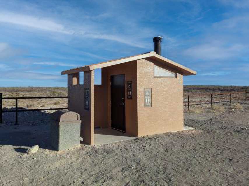
Whenever possible, use developed toilet facilities (see map below for vault toilet locations.) When developed facilities are not available, all solid waste should be packed out in approved waste bags. Human waste is a serious health issue in the backcountry. To make carrying out human waste easy and safe, the use of a W.A.G. bag (Waste Alleviation and Gelling Bags) is recommended. W.A.G. Bags are spill proof, puncture proof and zipper closed. W.A.G. Bags must be disposed of in W.A.G. Bag equipped locations in Moab.
When hiking, backpacking, biking, driving where toilet facilities are not available, the most convenient and sustainable option is purchasing a W.A.G. Bag: a double-walled, self-closing human waste container complete with crystals or gels to neutralize the dangerous pathogens in human waste, allowing direct disposal into approved W.A.G. Bag Disposal Bins after use. W.A.G. bags tuck easily into a pack, and one bag is good for about three to four uses.
W.A.G. Bags can be purchased at the following locations in Moab:
Do not dispose of W.A.G. Bags in regular trash cans. In order to reduce exposure to biohazards, it is a priority for our local solid waste handler to reduce the amount of human waste that is handled by their staff members and introduced to various types of equipment. W.A.G. Bags should be brought directly to any of the disposal bins listed below.
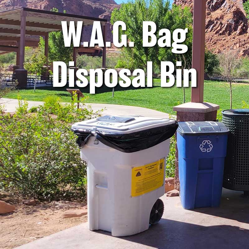
W.A.G. Bag Disposal Bin – At 5 convenient locations in Moab (see below).
Grand County Transit Hub
Intersection of Highways 191 and 128 (“River Road”)
Available 24/7
Lions Park
Intersection of Highways 191 and 128 (“River Road”)
Available 24/7
SE Utah Health Department
575 Kane Creek Blvd, Moab, UT 84532
435-259-5602
Available 24/7
Wastewater Reclamation Facility
1070 W 400 N, Moab, UT 84532
435-259-5577
7:00 AM – 5:00 PM Monday-Friday
Moab Transfer Station
2295 S Hwy 191 (3 Miles South of Moab)
435-259-6314

A groover is a portable toilet that is recommended for day use river trips, and mandatory for overnight trips. Groovers are cleaned at an RV dump station or other sewage facility.
What can be put in a Groover?
The following webpages contain useful information regarding the use and cleaning of Groovers:
Whenever possible, please use a vault toilet. Vault toilets are waterless toilets that collect waste in an underground tank or vault. These non-flush toilets are commonly found in remote areas like campgrounds, trailheads, national parks and on forest lands.
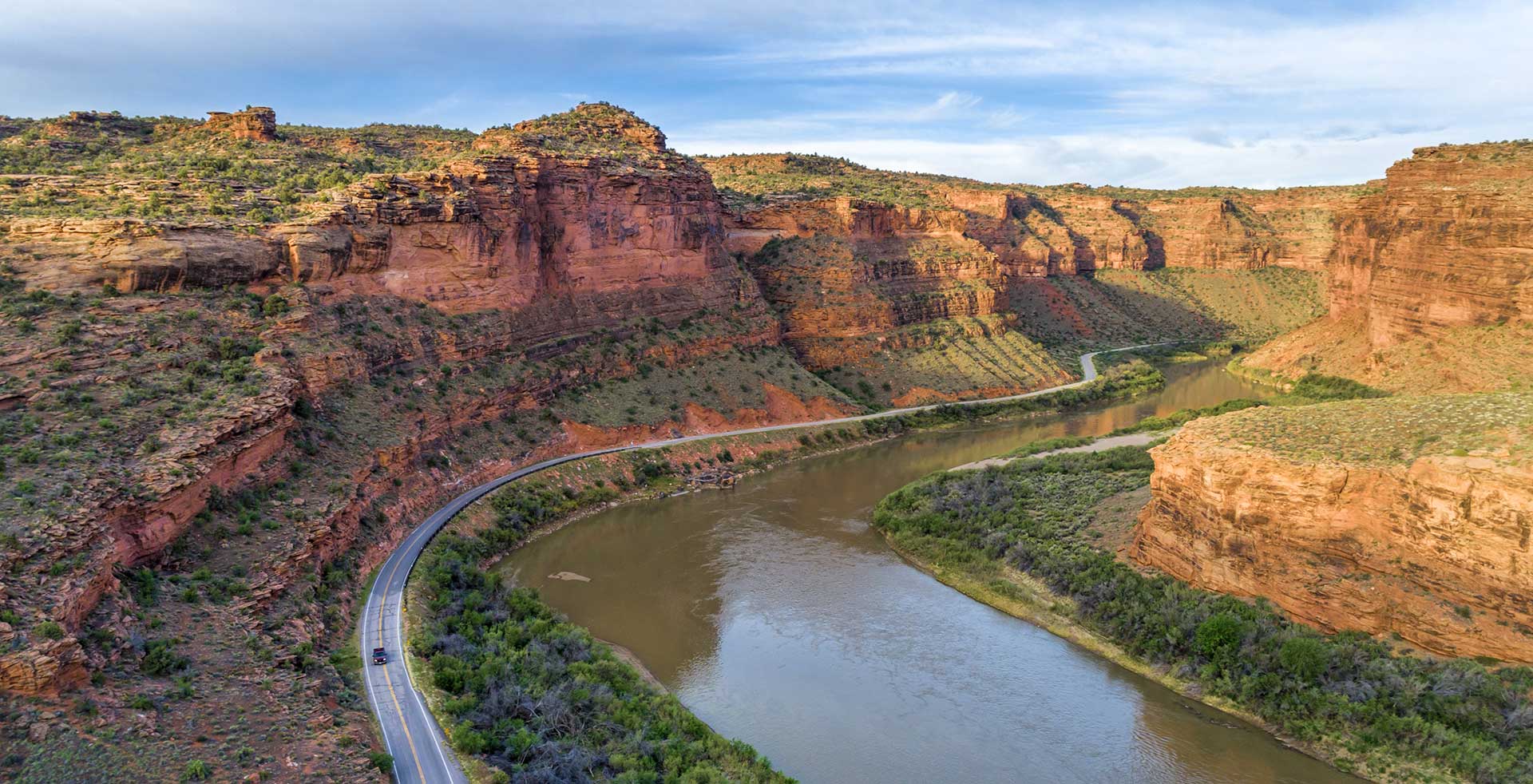
Scenic Byway U-128
Every twist and turn holds something new.
This spectacular route along the Colorado River gorge begins at the Colorado River Bridge on the north end of Moab. Spending a day exploring this section of the river gorge will provide you with jaw dropping scenery and take you to the sixth-longest natural rock span in the United States, world famous movie locations, beautiful picnic and bouldering areas, a Film Heritage Museum, a large variety of hiking trails including one that goes to the breathtaking Fisher Towers, historical points of interest, guided horseback riding opportunities, outdoor dining, a brand new mercantile (opening in 2020) and a ghost town.
Utah State Route 128 (U-128) is a 44.6-mile-long (71.7 km) state highway north of Moab. The entire length of the highway has been designated the Upper Colorado River Scenic Byway, as part of the Utah Scenic Byways program. This road also forms part of the Dinosaur Diamond Prehistoric Highway, a National Scenic Byway. Residents of Moab frequently refer to SR-128 as “the river road”, after the Colorado River, which the highway follows.
The highway was originally constructed to connect rural cities in eastern Utah with Grand Junction, Colorado, the largest city in the region. Part of the highway was merged into the Utah state highway system in 1931; the rest was taken over by the state and assigned route number 128 in 1933. Today, the highway is used as a scenic drive for visitors to the area.
The highway crosses the Colorado River at the site of the Dewey Bridge, listed on the National Register of Historic Places. This bridge was the longest suspension bridge in Utah until April 2008 when it was destroyed by a fire.
To begin this tour, set your odometer to 0 at the intersection of US-191 and U-128.
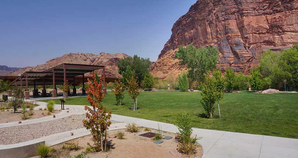
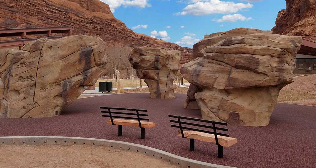
This scenic park is located on the banks of the Colorado River just north of Moab on U-128 at the intersection with US 191. It’s a lovely facility with a paved parking area and big shade trees along the riverbank. There’s a footbridge over the Colorado River that connects paved trails that go north-south along US 191 and east-west along U-128 and the river through red rock canyons. Restrooms and picnic areas are available. Facilities are wheelchair-accessible.
Lions Park also contains Moab Boulder Park. Moab is a very, very difficult place to get going when you’re a beginner at climbing, and this park really bridges the gap from beginners to help them get out on the cliffs. Along with three custom-made boulders that were color-matched to blend with Moab’s surrounding red rocks, the park also includes a thick rubber surface beneath the climbing rocks to help cushion the inevitable falls.
Continuing down U-128, the drive parallels the Colorado River within a narrow section of the Colorado River gorge, providing breathtaking views of the surrounding red sandstone cliffs. Popular attractions along this portion of the route include viewpoints of the river, public camping areas, and Grandstaff Canyon, which contains a delightful hiking trail to Morning Glory Natural Bridge.
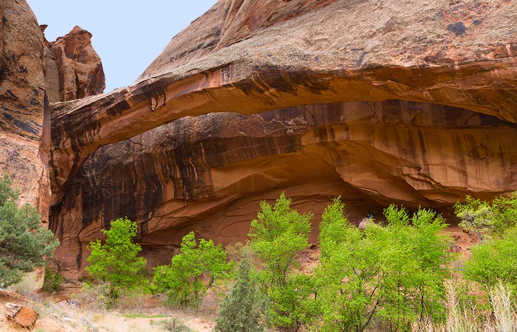
Grandstaff Canyon was named after William Grandstaff, an African American prospector and rancher who grazed his cattle here during the late 1800s. It is a lovely canyon, cut into the Navajo Sandstone by a small, perennial stream that begins about six miles from the southern shore of the Colorado River. The trail winds along the stream through an oasis of cottonwood and willow trees, cut off from the desert above by towering sandstone cliffs. Like all good hikes, this one also has a reward at the end. Morning Glory Natural Bridge spans the head of one of Grandstaff’s side canyons at the end of the trail. According to Bureau of Land Management statistics, Morning Glory is the sixth largest natural bridge in the United States.
Grandstaff Canyon was named after William Grandstaff, an African American prospector and rancher who grazed his cattle here during the late 1800s. It is a lovely canyon, cut into the Navajo Sandstone by a small, perennial stream that begins about six miles from the southern shore of the Colorado River. The trail winds along the stream through an oasis of cottonwood and willow trees, cut off from the desert above by towering sandstone cliffs. Like all good hikes, this one also has a reward at the end. Morning Glory Natural Bridge spans the head of one of Grandstaff’s side canyons at the end of the trail. According to Bureau of Land Management statistics, Morning Glory is the sixth largest natural bridge in the United States.
Big Bend Bouldering Area has something for every age and ability. Located right off the highway, literally across the street from the Colorado River, it is hard to find a more scenic location for bouldering. It’s not unusual to have beginners working next to world-class climbers. Bring a comfortable chair and watch the show or work the routes yourself.
At 13 miles (20.9 km) the gorge widens as the highway proceeds past Castle and Professor Valleys, which have been the shooting locations for many western films including Wagon Master and Rio Grande, along with numerous television commercials.
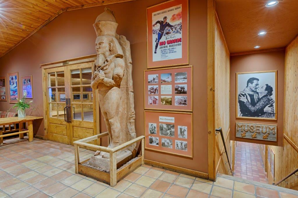
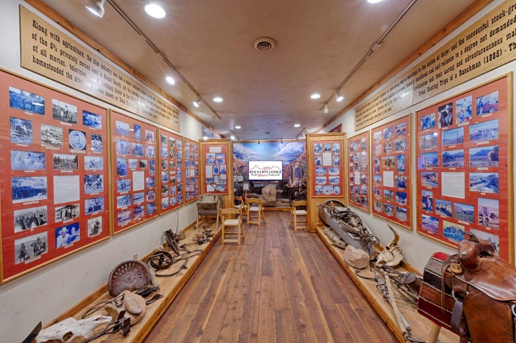
Red Cliffs Lodge, on the banks of the mighty Colorado River, is home for the Moab Museum of Film & Western Heritage. The lodge is built on the old George White Ranch, a key location for nine of the big Westerns including Rio Grande, Cheyenne Autumn, Ten Who Dared, The Comancheros, and Rio Conchas. The late George White was founder of the Moab to Monument Valley Film Commission, the longest ongoing film commission in the world. In the museum one can learn more about film locations, how the sets are built, and how the filming process is managed on nature’s own sound stage. On display in the museum are production photographs, movie posters, autographed scripts, props from the many pictures filmed in the area, and displays about the western ranching heritage.
Dozens of movies have used the ranch and surrounding area as the set and backdrop for their films. From Disney to Spielberg and from westerns to sci-fi, Moab has been the scenic choice for some of Hollywood’s greatest movies. Red Cliffs has hosted some of its biggest stars; John Wayne, Maureen O’Hara, Rock Hudson, Henry Fonda, Roger Moore, Burt Reynolds, Jason Patrick, Johnny Depp and many, many more.
During the season, Red Cliffs Lodge offers an outdoor lunch on the banks of the Colorado River. (Open to the public as well as guests.)
Castleton Tower is a 400-foot (120 m) Wingate Sandstone tower standing on a 1,000 foot Moenkopi-Chinle cone above the northeastern border of Castle Valley. The Tower is world-renowned as a subject for photography and for its classic rock climbing routes, the most famous of which is the Kor-Ingalls Route featured in the famous guidebook “Fifty Classic Climbs of North America”. In 1964, Chevrolet filmed a commercial for the Impala convertible perched atop the tower.
Adjacent to Castleton Tower is The Rectory, a thin 200 foot (61 m) wide, and 1,000 foot (305 m) long north-to-south butte with 200 ft vertical Wingate Sandstone walls tower standing on a 1,000 foot Moenkopi-Chinle base. The Jon Bon Jovi music video Blaze of Glory was filmed at The Rectory. The Australian band Heaven also filmed their Knockin’ on Heaven’s Door music video on top of The Rectory.
Note: There are great views of these formations from the Sylvester Trail (below).
Opening to the public in Spring 2020, on the property of Sorrel River Ranch, JJ’s Mercantile will provide everything from gifts, groceries and gear for the guests of the resort, campers, locals and those passing through. Stop by for hot coffee, tantalizing pastries, fresh baked bread, tasty sandwiches and salads artfully prepared from JJ’s open kitchen and ready to go.
From the Professor Valley Ranch Road turn-off on the right, drive 2.2 miles (3.5 km) on a well graded road to the trailhead.
The Sylvester Trail is in the Onion Creek area and follows open desert through the Professor Valley drainage and features beautiful views of the surrounding terrain. The trail is named after Dr. Sylvester Richardson, who with his wife Mary Jane, were among the first settlers in the valley back in the 1880’s. Sylvester’s nickname was ‘Professor’ for which the valley is named.
From the parking area, follow the trail which is relatively flat and easy. The trail will cross a dry wash several times before it begins to ascend a bench on the right. The trail weaves along this bench gradually ascending. The rock formations include the Preacher, The Nuns, Rectory and Castleton Tower. Once the trail passes the foot of Castleton Tower, it will begin to descend slightly.
When you reach a dirt 4×4 road, the Sylvester Trail ends and you return the way you came. 6.9 miles (11.1 km) round-trip. (The trail is shared with equestrian users and there is no shade, so avoid on hot days.)
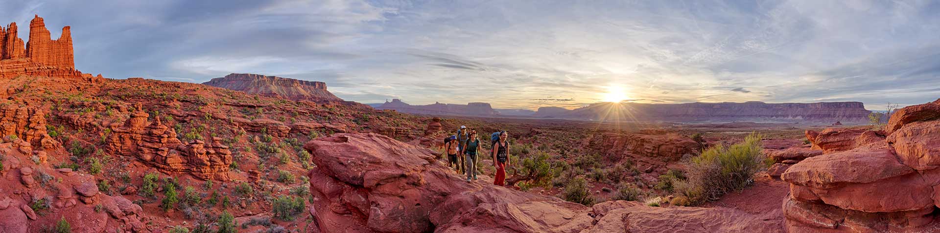
Turn right on the well graded dirt road, then travel 2.2 miles (3.5 km) to the trailhead. The Fisher Towers trail is a world class experience. The views of Castle Rock and the shear sandstone cliffs of the Colorado River are stunning. This is an out and back hike will take you by 3 amazing formations, The Kingfisher, Echo Tower and The Titan. This area is popular with rock climbers so keep an eye up on the rocks. The trail descends into the canyons in several places which brings the overall elevation gain to about 1000 feet. The best picture taking time is probably when the afternoon sun is looking over your shoulder at the towers but alas that is also the most unforgiving time on a hot summer day so be sure to bring plenty of water.
Turn left into Hittle Bottom Parking Area – The trail starts across the street and features broad sweeping views and solitude. 2.8 mile loop.
This is a foray into the heart of the Richardson Amphitheater, near the Colorado River, in an area of beautiful rock formations. The Amphitheater Loop Trail is approximately 4 miles (6.4 km) from the Fisher Towers Trailhead and both trails can be walked in a single day. The Amphitheater Loop Trail makes a lovely walk, and climbs approximately 250 feet in elevation to afford a stunning view of the Colorado River corridor. Along the way, you can see interesting sandstone formations in the Moenkopi and Cutler sandstone layers.
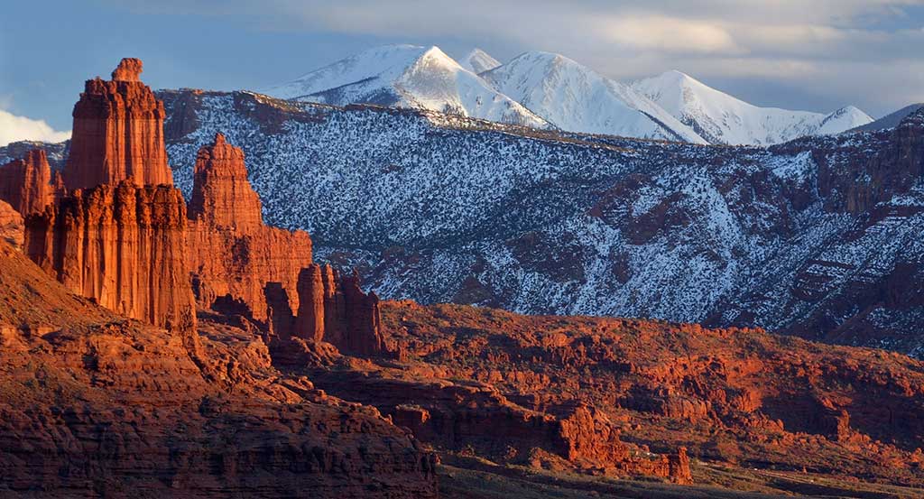
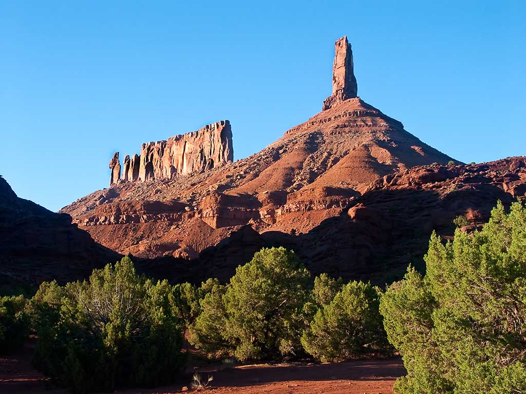
The roadside viewpoint on the left provides one of the grandest views in the west, the red rock spires of the Fisher Towers set against the often snow covered peaks of the La Sal Mountains.
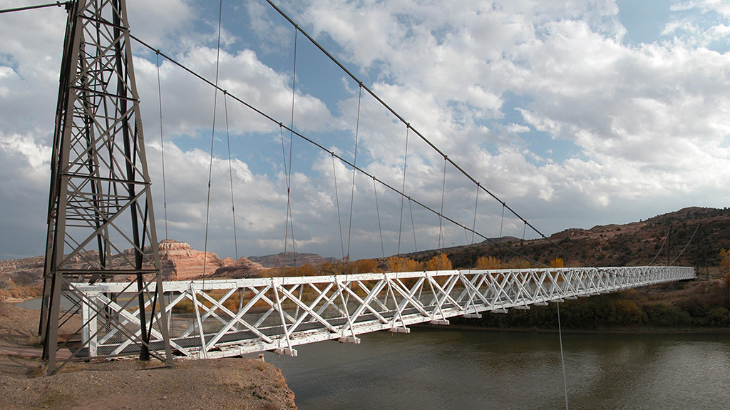
Historic Dewey Bridge, before it was destroyed by fire in 2008.
Dewey Bridge, built in 1916, originally carried U-128 across the Colorado River. The bridge featured an all wood deck measuring 502 feet (153 m) long, 10.2 feet (3.1 m) wide from support to support and 8 feet (2.4 m) wide from rail to rail. The bridge also consisted of two metal towers, a run of seven cables on each side of the bridge deck, and cable anchors. The bridge was designed to support the weight of six horses, three wagons, and 9,000 pounds (4,100 kg) of freight.
On the day of its completion, it was the second-longest suspension bridge west of the Mississippi River. The longest was the Cameron Suspension Bridge, also built by the Midland Bridge Company, who used the same base plans for both bridges. Dewey Bridge remained the longest suspension bridge in Utah until it was destroyed by fire in 2008. The remains of the bridge and a historical marker remain on the site.
The town started in the 1880s as a saloon and water-refilling station for the Denver and Rio Grande Western Railroad. As work crews and, later, travelers came through, stores, hotels and restaurants sprang up to accommodate them. Nearby cattle ranchers and sheepherders in the Book Cliffs north of town began using Cisco as a livestock and provisioning center. Around the turn of the 20th century, over 100,000 sheep were sheared at Cisco before being shipped to market. After oil and natural gas were discovered, people began traveling more and Cisco continued to grow. The town’s decline coincided with the demise of the steam locomotive. A declining economy crashed when Interstate 70 was built, bypassing Cisco. After another 5 miles (8 km) the route intersects Interstate 70.
Moab locals have it figured out. They know the best rides, the best routes, the best places to hike and camp and eat—and a few other important things about the right way to enjoy the desert. While the Utah desert seems like a rugged place, you might be surprised to learn its environment is more sensitive than you might expect. To make sure everybody has the chance to enjoy our little slice of paradise for generations to come, residents of Moab are taking steps toward sustainability with the Moab First Sustainable Tourism Program. When you visit Moab, do it like a local by keeping the following tips in mind.
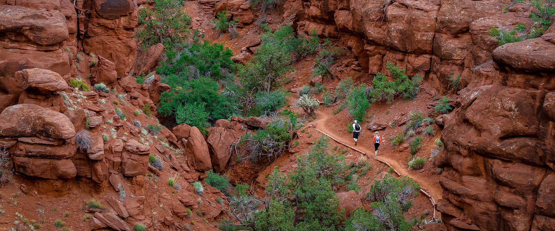
Stay on the Trail
While the desert soil may look unassuming, it’s actually teeming with life. Biological soil crust (also known as cryptobiotic soil) is a major part of the desert ecosystem, and helps prevent erosion as well as trap nitrogen and other plant-friendly nutrients in the soil. Cryptobiotic soil is also incredibly sensitive, and can take decades to recover from even a few footsteps breaking through the crust. When you visit Moab, make sure to stay on established trails and roads—and if established routes aren’t available, do your best to walk through dry creek beds or on bare rock.
Leave No Trace
Most people with a conscience already know not to litter up the great outdoors, but there’s more to Leave No Trace than just packing out all your trash and recyclables. Due to high use, human waste is a serious health issue at dispersed camping sites. All solid waste must be packed out in approved waste bags or portable toilet systems. These may be purchased at the Moab Information Center and local outdoor retailers. When picking a campsite, use a pre-existing spot rather than placing your tent on top of vegetation, and make sure to stay at least 300 feet from water to avoid scaring animals away from critical sources of hydration. And speaking of wildlife, make sure to give them plenty of room in general—keep pets leashed, and teach children never to chase, approach, or pick up wild animals.
Respect the Rocks
Moab and the surrounding areas are home to an incredible number of ruins, artifacts, and ancient rock art. While it can be tempting to get up close and personal, make sure to admire from a distance—and look, but don’t touch. We want to keep these pieces of ancient history around for many years to come—so stay out of ruins, leave any artifacts you find in place, and encourage others to do the same, so everyone can appreciate the wonder of ancient civilizations well into the future.
Bring Your Own Bags
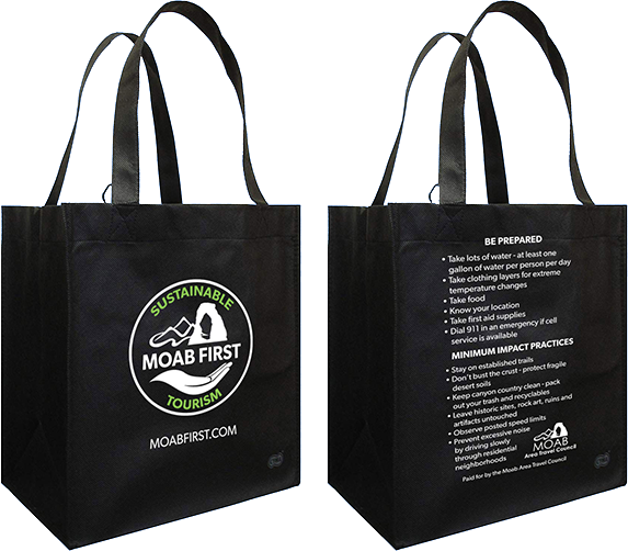
Starting in January 2019, the city of Moab enacted a ban on single-use plastic bags. It’s part of Moab’s efforts to help curb the use of disposable plastic products. Besides being a major litter problem, plastic bags also tend to make their way into waterways and oceans where they can harm animals, as the plastic bits don’t biodegrade even as they become divided into tiny pieces. Remember to bring your own reusable bags for any grocery or souvenir shopping, or pick one up at a local shop.
Drive Electric
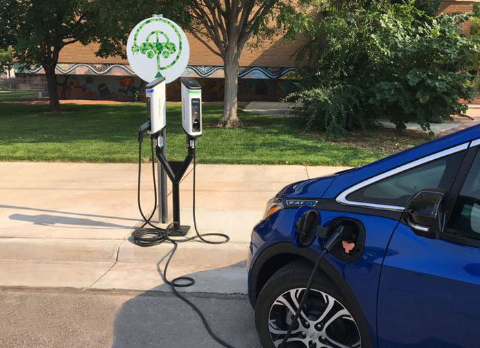
As part of its new sustainability strategy, Moab now features 10 electric-vehicle charging stations located throughout the city, as well as four additional Tesla supercharging stations that can charge Tesla vehicles halfway in about 20 minutes. A recent study by the Utah Department of Transportation estimates an average of 13,000 vehicles at the intersection of Moab’s Main and Center streets—if even a small fraction of those cars were electric, we could save hundreds of thousands of pounds of air pollution every year.
Eat & Shop Local
Another great way to visit Moab like a local is supporting local businesses that have made a commitment to sustainability. Keep an eye out for businesses with a Green to Gold sign—the Green to Gold program is a city-sponsored initiative encouraging establishments to take simple steps to reduce their environmental impact. In the summer of 2018 alone, Green to Gold businesses in Moab saved over 850,000 kWh—the same amount of energy used by 136 cars over the course of an entire year, or the annual CO2 emissions from 68 homes.
With these six tips in mind, you’ll be helping the cause of keeping Moab an amazing destination (and an amazing place to live) for years to come. For more helpful Moab insider info or to start planning your trip, visit doitlikealocalmoab.com
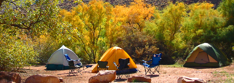
Bureau of Land Management Campgrounds

Elevation
Sites
RV Length
Group Sites
Picnic Tables
Boat Launch
Horse Corral
Hwy 128, 6.2 miles from Hwy 191 – Payment by cash, check or Credit Card ROK at Big Bend Campground.
Hwy 128, 6.6 miles from Hwy 191 – Payment by cash, check or Credit Card ROK at Big Bend Campground.
Hwy 128, 6.9 miles from Hwy 191 – Payment by cash, check or Credit Card ROK at Big Bend Campground.
Hwy 128, 7.4 miles from Hwy 191 – Payment by cash, check or Credit Card ROK at Big Bend Campground.
Hwy 128, 8.1 miles from Hwy 191 – Payment by cash, check or Credit Card ROK at Big Bend Campground.
Hwy 128, 21 miles from Hwy 191, then 0.7 miles southeast on gravel road. Has corral for up to 8 horses. Payment by cash, check or Credit Card ROK at Hittle Bottom Campground.
Hwy 128, 21.5 miles from Hwy 191 then 1 mile northwest on graded road. Payment by cash, check or Credit Card ROK at Hittle Bottom Campground.
Hwy 128, 21.5 miles from Hwy 191 – Dirt Road access. Payment by cash, check or Credit Card ROK at Hittle Bottom Campground.
Hwy 128, 22.5 miles from Hwy 191 – Payment by cash, check or Credit Card ROK.
Hwy 128, 28.7 miles from Hwy 191 – Payment by cash, check or Credit Card ROK at Hittle Bottom Campground.
Utah 313, 12 miles from Hwy 191 – Payment by cash, check or Credit Card ROK.
Kane Creek Rd, 2.8 miles from Hwy 191 – Payment by cash or check.
Kane Creek Rd, 7.8 miles from Hwy 191 – Dirt road access. Reservable only through Recreation.gov.
The Ledge A, B, C, D, & E Campgrounds
Kane Creek Rd, 10 miles from Hwy 191 – Access to the Ledge Campground is down a tight, steep switchback and over several creek crossings on a gravel/dirt road. It is not recommended for vehicles over 22′ or vehicles pulling long trailers. – Payment by cash or check.
8.5 miles south of Moab off Hwy 191, then follow signs south on Spanish Valley Drive. Ken’s Lake Campground is now reservable via Recreation.gov.
16 mi north of Moab on Hwy 191, then approximately 1 mi on the graveled Mill Canyon Road (turn left at first “Y” on road). Large graveled parking area suitable for large RVs and/or trailers. Campsites 1-4 and 7-10 cash, check, scan and pay. Campsites 5 and 6 reservation only through Recreation.gov.
22 mi north of Moab on SR 191, take the graveled Road 143 and past the metal toilet (stay left at first “Y” on road). This campground also has the option to pay using the Recreation.gov mobile app.

Within 20 miles of Moab, camping is only allowed in developed campgrounds.
Primitive camping is available in certain areas outside of Moab (see map & legend below): These regulations apply to all primitive sites:

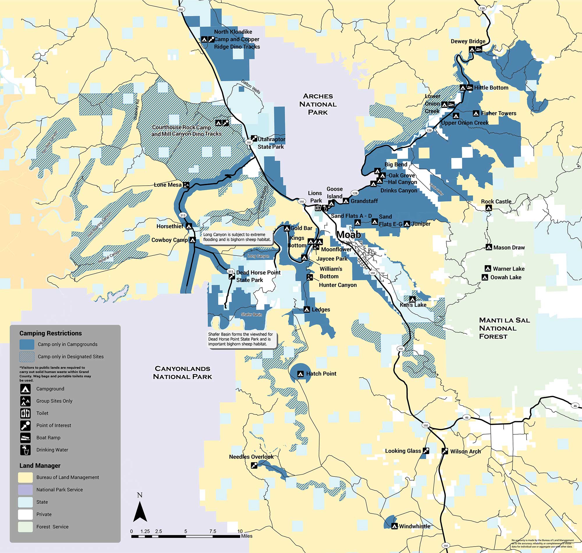
The areas with designated sites (marked with green hatch lines) are summarized below:
There are several areas in which no sites are designated and camping is not allowed (orange). The Shafer Basin, which forms the viewshed of Dead Horse Point State Park and is important bighorn sheep habitat, has no sites. Long Canyon, which is subject to extreme flooding and is also important bighorn habitat, has no sites. No camping is allowed in the Mill Creek area immediately east of the city of Moab, or on the west side of Spanish Valley. No camping is allowed within one mile of developed recreation sites in the Canyon Rims Recreation Area. If you have any questions about primitive camping restrictions please contact the Moab BLM Office at (435) 259-2100.
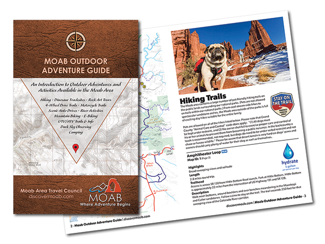
Introducing the Moab Outdoor Adventure Guide—a comprehensive resource showcasing the diverse range of adventures and activities awaiting you on the public lands surrounding Moab. Whether you’re drawn to hiking, off-road driving, river activities, scenic byways, dark sky observing, mountain biking, e-biking, rock art tours, camping, dinosaur trails, or exploring with your furry companions, this guide is your ultimate companion.
The Moab Outdoor Adventure Guide is now available, free of charge, at the Moab Information Center located at the corner of Main and Center Streets in Moab. For your convenience, an ebook version is also available for download. To access the guide online and embark on your virtual exploration, simply Click here.
This comprehensive guide is designed to lead you on the right path, ensuring you make the most of your Moab adventure. Discover the countless possibilities and make memories that will last a lifetime. Get your copy of the Moab Outdoor Adventure Guide today and let the excitement begin!
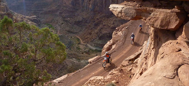
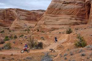
Moab Area Motorcycle Trail Riding
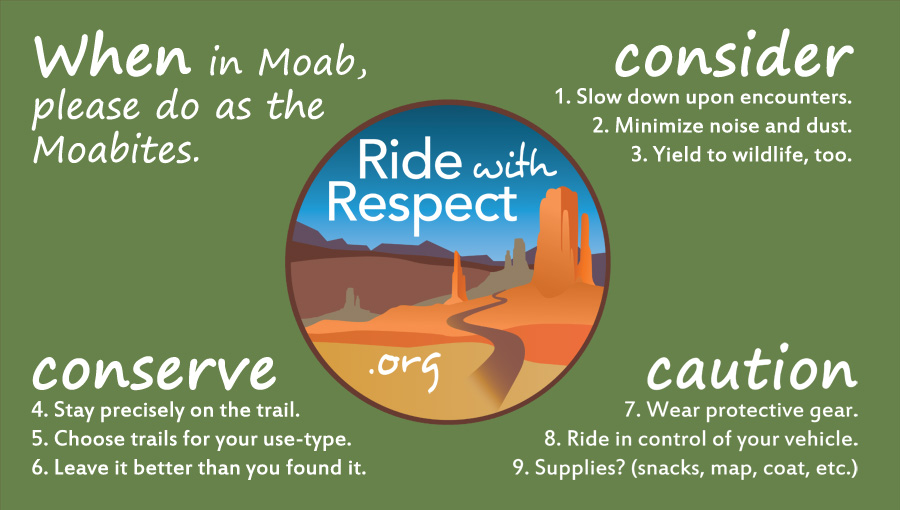
The Moab area offers tremendous diversity for motorcycle trail riding. From graded roads to singletrack trails, you can choose a new adventure for each day of your visit… and your next visit. With that sense of freedom comes a responsibility to respect yourself, others, and the land itself. So please remember to ride within your ability, stay precisely on the designated roads and trails, and yield to people or animals. This will help to keep Moab accessible and enjoyable for generations.
Motorcycling takes a lot of rider training, vehicle maintenance, and trip planning. In Moab, a handful of guiding and rental services can assist you to make the most of your visit. If choosing to go out with your own group, be prepared. Most trails are very remote, and cellular coverage is spotty. Even in spring and fall, temperatures can reach above 100F and below 32F. Low humidity calls for bringing extra water, such as 4 quarts/liters per person. Storms cause drainages that are normally dry to become impassable, and cause clay-based dirt that is normally dusty to become extremely muddy.
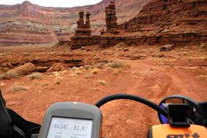
Lockhart Basin, a remote 4WD trail, offers views up to Canyon Rims Recreation Area. Photo courtesy of Dave Walker
Kokopelli Trail, which is very popular for bicycling, uses many 4WD trails to reach Colorado. Photo courtesy of RwR
Along with the proper gear, groups should bring travel maps and possibly guide books. Although most of the graded roads and featured trails have directional signs, conditions are subject to change. In the event of an emergency, maps can show your options to evacuate. The government-agency maps and most commercial maps indicate which types of travel are permitted for each route. Be aware that motorcycles are not permitted on many singletrack trails, especially those closer to town.
On public lands, motorized and even bicycle travel is limited to designated routes. The Bureau of Land Management (BLM) provides up-to-date designated route maps. Likewise, the U.S. Forest Service (USFS) provides up-to-date motor vehicle use maps. Commercial maps include Moab Classic and Moab East/West by Latitude 40, which are available at the Moab Information Center (Main & Center Streets in Moab). Guide books include ATV Trails Guide and Backroads & 4-Wheel Drive Trails. These books are available at the Moab Information Center, and can also be purchased in advance online from Canyonlands Natural History Association.
4WD trails are the perfect way for most motorcyclists to explore the canyon country. These primitive roads offer spectacular scenery, with difficulty that ranges from moderate to extreme. Their width provides room to pass, and provides an alternate line for riders to choose. Most of the routes used during Jeep Safari are marked, and extend from Moab in every direction. Originally blazed for uranium mining, these iconic trails made Moab a top 4WD destination, worldwide. For details, see our page on 4-Wheeling.
Riders seeking a longer-distance, or less-rugged, experience can utilize the network of graded, dirt roads. They are generally maintained, but of course wash outs and other hazards can occur. If your motorcycle is street-legal, you can follow graded roads all the way to towns like Green River, Monticello, and even Fruita, CO. Kokopelli’s Trail is dual-sport friendly, except for the rocky hill above Onion Creek and the non-motorized section below Cisco. Even ‘in the middle of nowhere,’ you could encounter oncoming traffic, so be careful around blind corners.
Note that, to ride the roads in national parks, your motorcycle must be street-legal and a permit is required. (Click here for permit information.) While Canyonlands and Arches are known for routes like White Rim, Elephant Hill, and Eye Of The Whale, the national parks have a mission of preservation. All kinds of use in these parks are regulated, so please be on your best behavior. For more information, visit Canyonlands or Arches.
At the most primitive end of the spectrum, motorized singletrack is available for riders seeking the confines of a narrow trail. These routes typically require a high degree of balance and coordination. Also they lend themselves to lighter-weight motorcycles with a smoother power band and low gearing. Unless you particularly value singletrack, then stick to the 4WD trails for a greater sense of freedom.
For example, motorized singletracks are shared with non-motorized users, and motorcyclists should yield to them. However pulling off the singletrack could easily damage plants and biological soil crust (the black and craggy dirt that’s actually alive). So you’ll need to pass by either leaning over the trail’s edge, or finding a barren surface such as slickrock to pull over. In the desert, singletrack is a scarce commodity, so please help to keep the “single” in singletrack.
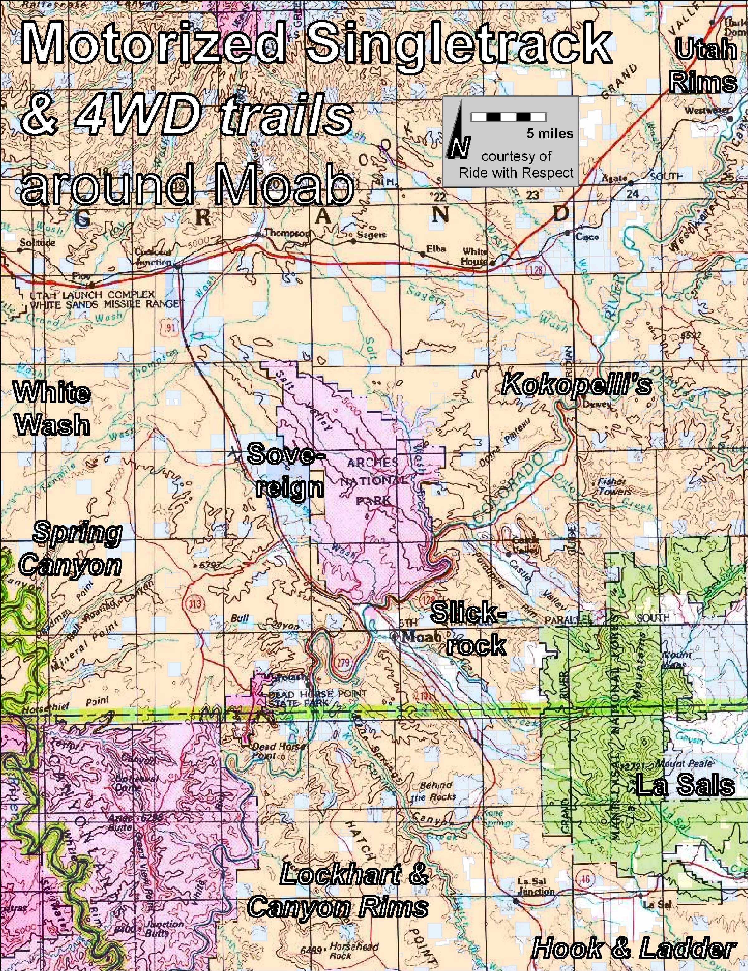
If narrow trails sound like your idea of fun, there are a half-dozen small networks of motorized singletrack to choose from. Each of them requires a map, but here’s an overview:
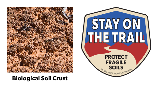
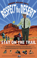
Help to keep all of our trails open. Protect this fragile, but crucial, soil by remaining on designated roads, routes and trails at all times.
Biological soil crust, also known as cryptobiotic soil, is the foundation of desert plant life. This black, knobby crust is made up of many different living organisms and plays a vital role in maintaining the desert ecosystem. However, this sensitive soil is extremely fragile and can take decades to grow. Even a footstep can damage the crust for decades, having lasting impacts on the desert environment. Please stay on the trials. Help to protect this fragile life by remaining on designated roads, routes, and trails at all times. Where hiking trails are not established, hike in sandy washes or on bare rock.
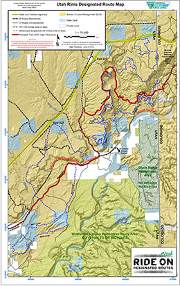
Utah Rims Designated Route Map
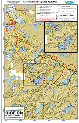
Labyrinth Rims Designated Route Map including White Wash Sand Dunes
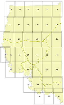
For detailed maps of Moab’s entire Motorized Travel Routes click here.
Utah State Parks & Recreation enforces several important rules regarding vehicle registration, equipment, youth certification, and safety gear. For an overview see our ATV page. For the latest up-to-date regulations it is critical to visit ohv.utah.gov.
Need somewhere to to park your vehicle or trailer overnight? Although the city of Moab does not have any public long-term parking areas, these companies provide safe, secure storage.
Moab’s roads and trails are famous because they offer a combination of challenge and scenery that cannot be found elsewhere. Please remember that riding on public lands is a privilege, not a right. Protect this privilege by staying on designated roads and trails. Cross-country travel damages plant and soil resources, and leaves ugly long-lasting scars. Enjoy your recreational activity in the Moab area while staying on roads and trails.
In conclusion, a handful of motorized-singletrack areas complement the many 4WD trails that put Moab on the map, so to speak. Plan ahead, or utilize one of the town’s many outfitters. As the budgets of land managers have dwindled, it’s now key for motorcyclists to become trail stewards. You can even pitch in through a club like Ride with Respect, or volunteer directly through a land manager like BLM.
Above all, practice an outdoor ethic. Have a blast, but keep an eye out for your safety, for other visitors, and for the surrounding landscape. This combination of fun, challenge, camaraderie, and sheer beauty draws many people back to Moab time and time again.
*NOTE* Utah State Parks & Recreation enforces several important rules regarding vehicle registration, equipment, youth certification, and safety gear. For an overview see our ATV page. For the latest up-to-date regulations, it is critical to visit ohv.utah.gov.