- Attractions
- Activities
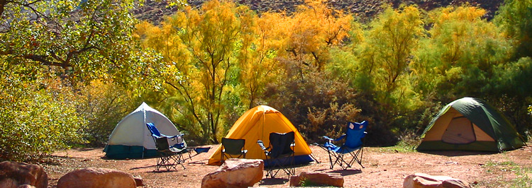
- Lodging + Campgrounds
- Area Info
- Services
- Transportation

Bureau of Land Management Campgrounds

Elevation
Sites
RV Length
Group Sites
Picnic Tables
Boat Launch
Horse Corral
Hwy 128, 6.2 miles from Hwy 191 – Payment by cash, check or Credit Card ROK at Big Bend Campground.
Hwy 128, 6.6 miles from Hwy 191 – Payment by cash, check or Credit Card ROK at Big Bend Campground.
Hwy 128, 6.9 miles from Hwy 191 – Payment by cash, check or Credit Card ROK at Big Bend Campground.
Hwy 128, 7.4 miles from Hwy 191 – Payment by cash, check or Credit Card ROK at Big Bend Campground.
Hwy 128, 8.1 miles from Hwy 191 – Payment by cash, check or Credit Card ROK at Big Bend Campground.
Hwy 128, 21 miles from Hwy 191, then 0.7 miles southeast on gravel road. Has corral for up to 8 horses. Payment by cash, check or Credit Card ROK at Hittle Bottom Campground.
Hwy 128, 21.5 miles from Hwy 191 then 1 mile northwest on graded road. Payment by cash, check or Credit Card ROK at Hittle Bottom Campground.
Hwy 128, 21.5 miles from Hwy 191 – Dirt Road access. Payment by cash, check or Credit Card ROK at Hittle Bottom Campground.
Hwy 128, 22.5 miles from Hwy 191 – Payment by cash, check or Credit Card ROK.
Hwy 128, 28.7 miles from Hwy 191 – Payment by cash, check or Credit Card ROK at Hittle Bottom Campground.
Utah 313, 12 miles from Hwy 191 – Payment by cash, check or Credit Card ROK.
Kane Creek Rd, 2.8 miles from Hwy 191 – Payment by cash or check.
Kane Creek Rd, 7.8 miles from Hwy 191 – Dirt road access. Reservable only through Recreation.gov.
The Ledge A, B, C, D, & E Campgrounds
Kane Creek Rd, 10 miles from Hwy 191 – Access to the Ledge Campground is down a tight, steep switchback and over several creek crossings on a gravel/dirt road. It is not recommended for vehicles over 22′ or vehicles pulling long trailers. – Payment by cash or check.
8.5 miles south of Moab off Hwy 191, then follow signs south on Spanish Valley Drive. Ken’s Lake Campground is now reservable via Recreation.gov.
16 mi north of Moab on Hwy 191, then approximately 1 mi on the graveled Mill Canyon Road (turn left at first “Y” on road). Large graveled parking area suitable for large RVs and/or trailers. Campsites 1-4 and 7-10 cash, check, scan and pay. Campsites 5 and 6 reservation only through Recreation.gov.
22 mi north of Moab on SR 191, take the graveled Road 143 and past the metal toilet (stay left at first “Y” on road). This campground also has the option to pay using the Recreation.gov mobile app.


Within 20 miles of Moab, camping is only allowed in developed campgrounds.
Primitive camping is available in certain areas outside of Moab (see map & legend below): These regulations apply to all primitive sites:

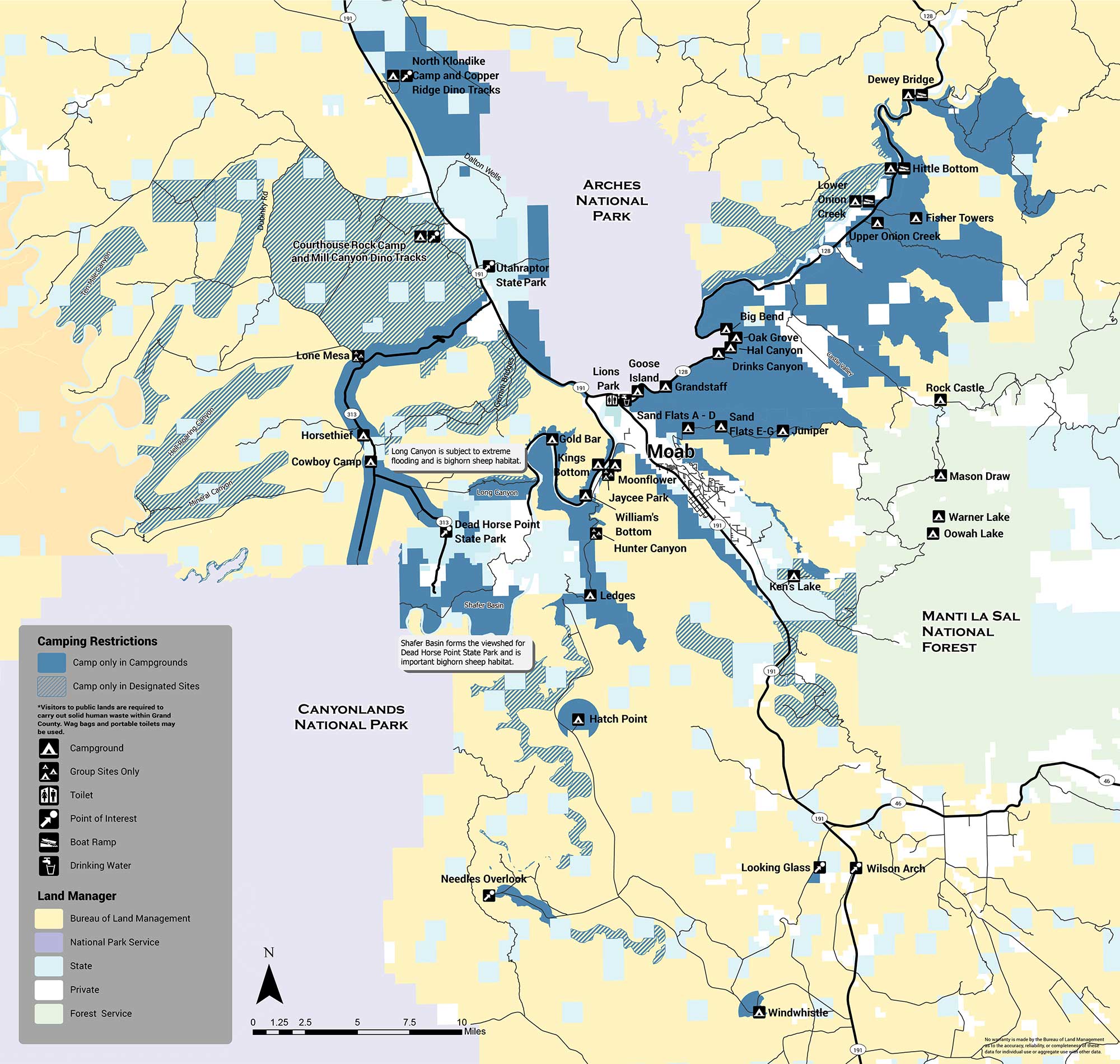
The areas with designated sites (marked with green hatch lines) are summarized below:
There are several areas in which no sites are designated and camping is not allowed (orange). The Shafer Basin, which forms the viewshed of Dead Horse Point State Park and is important bighorn sheep habitat, has no sites. Long Canyon, which is subject to extreme flooding and is also important bighorn habitat, has no sites. No camping is allowed in the Mill Creek area immediately east of the city of Moab, or on the west side of Spanish Valley. No camping is allowed within one mile of developed recreation sites in the Canyon Rims Recreation Area. If you have any questions about primitive camping restrictions please contact the Moab BLM Office at (435) 259-2100.
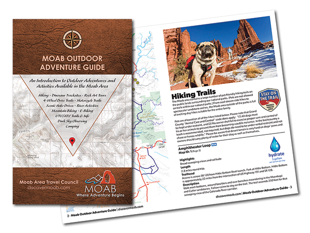
Introducing the Moab Outdoor Adventure Guide—a comprehensive resource showcasing the diverse range of adventures and activities awaiting you on the public lands surrounding Moab. Whether you’re drawn to hiking, off-road driving, river activities, scenic byways, dark sky observing, mountain biking, e-biking, rock art tours, camping, dinosaur trails, or exploring with your furry companions, this guide is your ultimate companion.
The Moab Outdoor Adventure Guide is now available, free of charge, at the Moab Information Center located at the corner of Main and Center Streets in Moab. For your convenience, an ebook version is also available for download. To access the guide online and embark on your virtual exploration, simply Click here.
This comprehensive guide is designed to lead you on the right path, ensuring you make the most of your Moab adventure. Discover the countless possibilities and make memories that will last a lifetime. Get your copy of the Moab Outdoor Adventure Guide today and let the excitement begin!
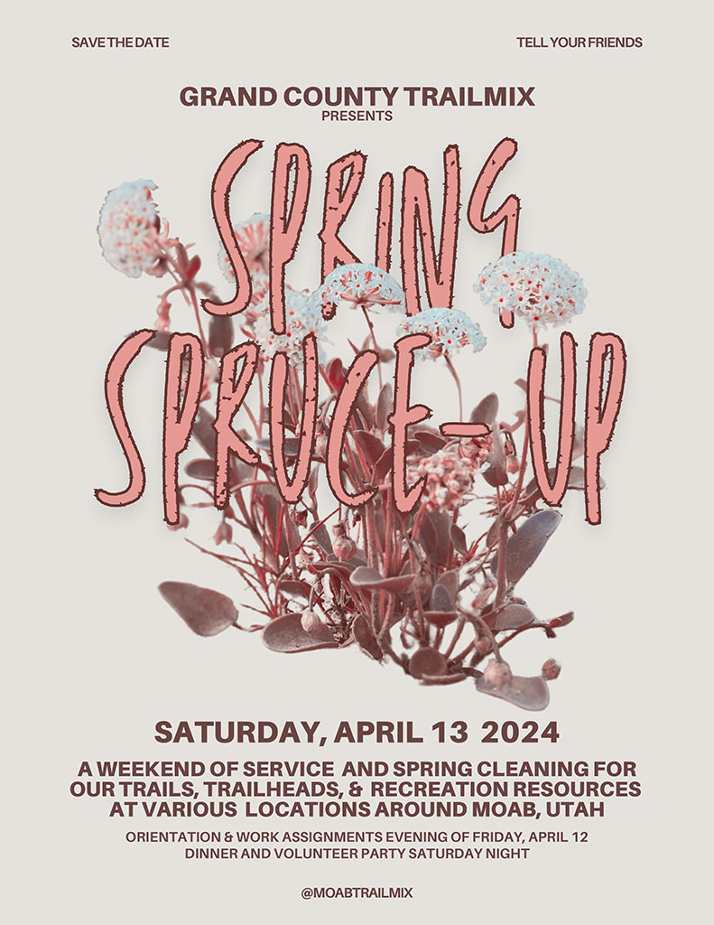
Trail Mix invites the public to participate in the Moab Spring Spruce-Up inaugural volunteer event held to maintain, build, and clean up non-motorized trails and other highly-impacted areas in Grand County to help offset impacts in the 2024 season.
Volunteers will be working on equestrian, hiking, mountain biking, and climbing approach trails throughout Grand County. The event is all day Saturday, April 13 with a variety of work projects followed by a volunteer appreciation party with drinks, food, and music. Orientation and registration will be the evening of Friday, April 12. Colin Topper, chair of the TrailMix committee, said of the event: “Moab is known for our world-class non-motorized recreation. Grand County’s TrailMix is dedicated to making sure these trails are well-built and accessible to everyone. Last year, we had a great response from Moab visitors and residents alike who wanted to contribute to the improvement and maintenance of our trails in Grand County. If you’d like to spend a beautiful April weekend getting dirty and making a difference for the trails you love, please join us at Spring Spruce-Up!”
Interested volunteers can pre-register for the event at grandcountyutah.net/1284/Spring-Spruce-Up. Registration for specific projects will take place from 5pm to 7pm on Friday, April 12 at the MARC (111 E 100 N, Moab UT). Volunteer projects will run from 9am-3pm on Saturday, April 15, with a breakfast from 7am-8:45 am beforehand at the MARC. Participants will have the opportunity to make their own brown-bag lunch. At 9am, participants will board a shuttle van for transportation to their respective volunteer project location. Volunteers will be returned to the MARC around 3pm. Later Saturday evening from 5pm-6pm there will be a social and snack hour for volunteers to get to know each other and relax after a long day of volunteering. At 6pm, there will be a celebration for all volunteers including live music, food, drinks, raffle prizes, games, and more!
Projects for Moab Spring Spruce-Up will be led by Trail Mix, the City of Moab, Grand County Active Transportation and Trails, Grand County Weeds, Friends of Anonymous Park, Rim to Rim Restoration, and Backcountry Horsemen Canyonlands Chapter. All volunteers must register prior to participating in the event. Participants under the age of 18 will need to bring a parent or guardian to sign activity waivers.
For a complete event schedule and more information, visit the grandcountyutah.net/1284/Spring-Spruce-Up or email moabtrailmix@gmail.com
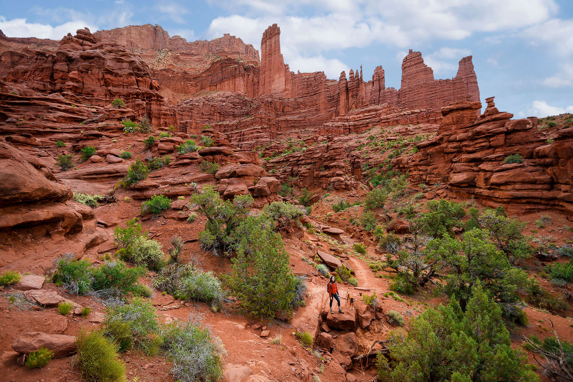
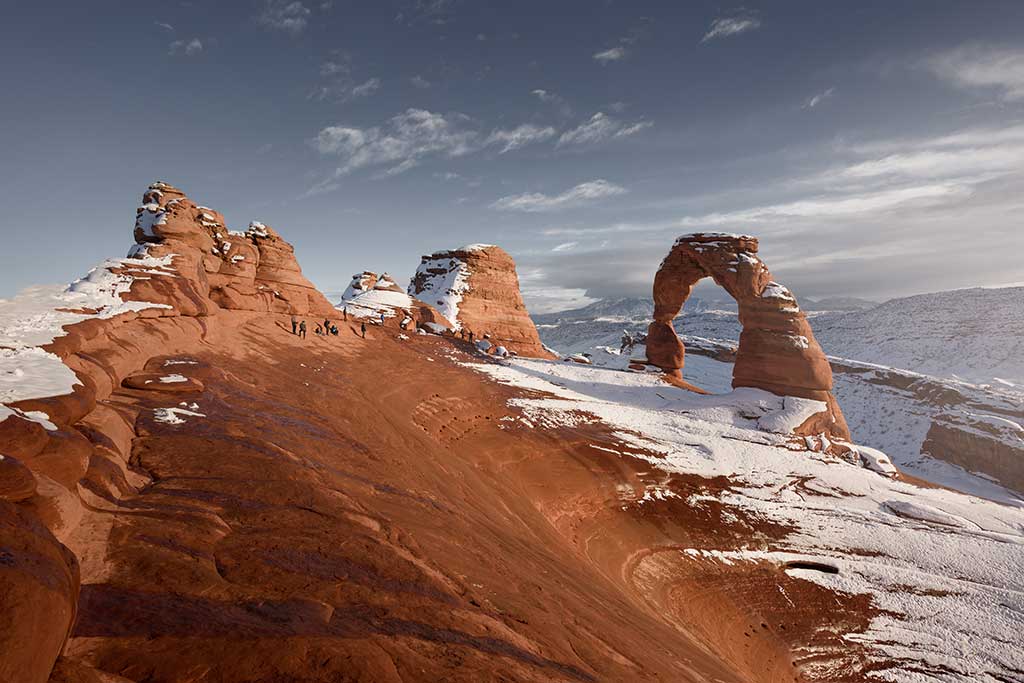
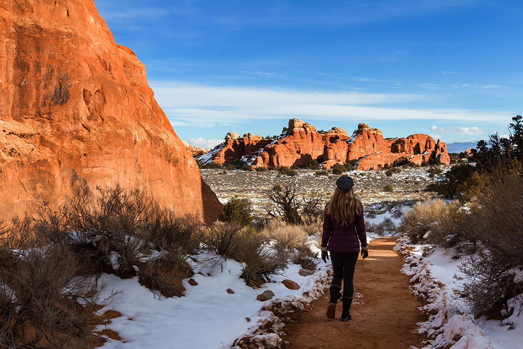
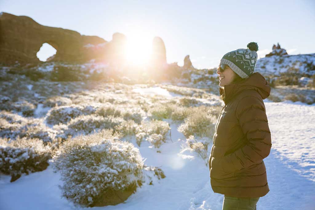
Winter hiking in Moab offers a unique experience, transforming the iconic red rock landscapes into a winter wonderland. As the temperatures drop, the crowds thin out, providing hikers with a more serene and intimate exploration of the stunning terrain. Trails like the Delicate Arch take on a different allure as they become dusted with snow, creating a picturesque contrast against the red sandstone formations. The crisp winter air adds a refreshing element to the adventure, and the snow-covered canyons offer a tranquil backdrop for those seeking a peaceful escape.
Be Prepared
Winter hiking requires careful consideration of safety measures due to the colder conditions. It’s crucial for hikers to be well-prepared by dressing in layers to combat the cold, carrying sufficient water, and wearing appropriate footwear for potentially icy or snowy trails. Since daylight hours are shorter in winter, planning hikes with ample time for daylight is essential to avoid navigating trails in the dark. Additionally, informing someone about the chosen trail and expected return time is a prudent precaution. Checking weather forecasts before embarking on a winter hike helps anticipate any sudden changes in conditions. Carrying essentials such as a map, compass, and a fully charged phone aids navigation. Moab’s winter landscape is awe-inspiring, but prioritizing safety ensures that hikers can fully enjoy the experience while minimizing potential risks associated with winter conditions.
Check Weather Conditions
Always check the weather forecast before heading out. Winter conditions can change rapidly, and it’s crucial to be prepared for cold temperatures, snow, and possible storms.
Layer Clothing
Dress in layers to regulate body temperature. Use a moisture-wicking base layer, insulating layer for warmth, and a waterproof and windproof outer layer to protect against the elements.
Protect Extremities
Wear insulated and waterproof boots to keep your feet warm and dry. Don’t forget warm gloves or mittens, a hat, and consider using gaiters to keep snow out of your boots.
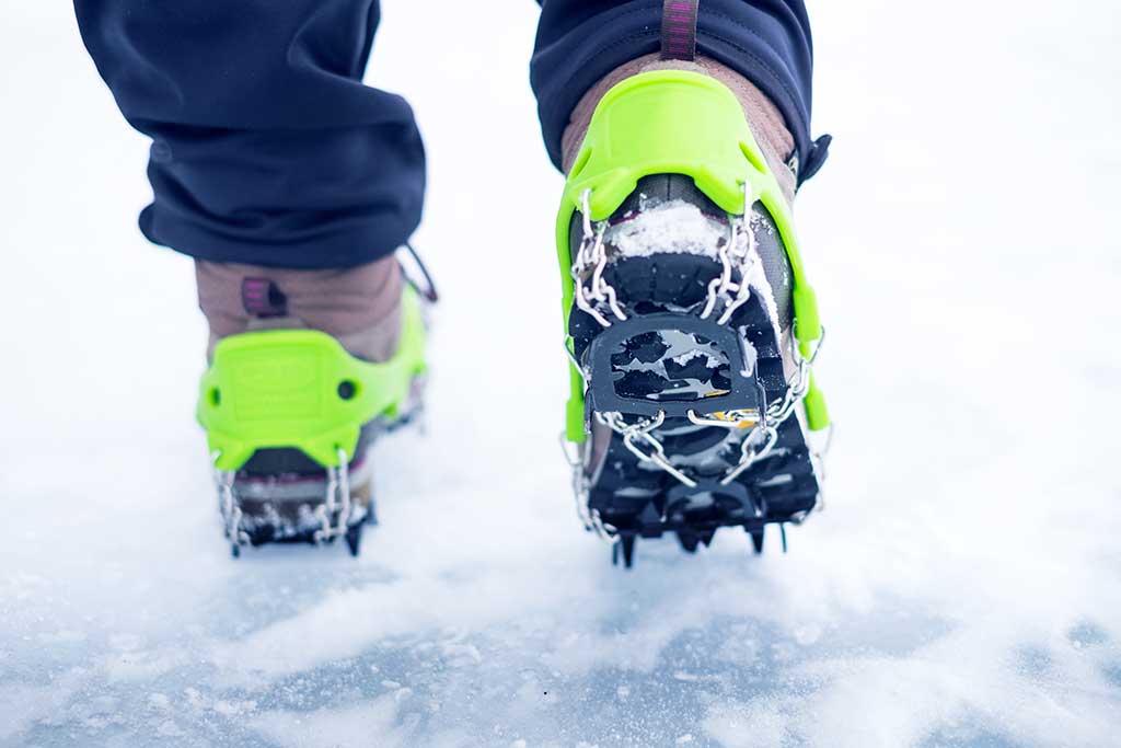
Use Traction Aids
Carry traction devices like crampons or microspikes to provide better grip on icy or snow-covered trails. This is especially important on steep or uneven terrain. Traction devices are available at gear shops in Moab, such as GearHeads Outdoor Store and Moab Gear Trader.
Carry Essential Gear
Pack essential winter gear, including a map and compass, a headlamp or flashlight, a multi-tool, a first aid kit, extra food, and a thermos with hot drinks. Consider carrying a lightweight emergency shelter.
Moab Nightlife

After a full day of hiking, biking, rafting, 4-wheeling or sightseeing, take some time to relax in the town of Moab. Moab has a surprising variety of nighttime activities that are sure to please every visitor.