- Attractions
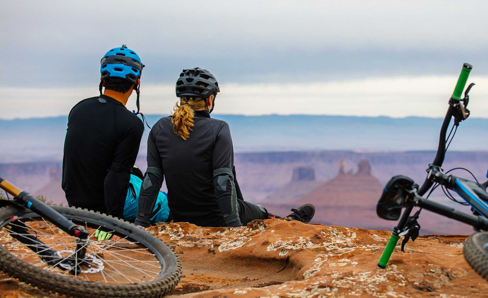
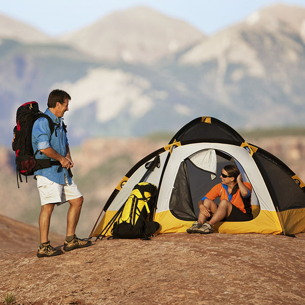
- Activities
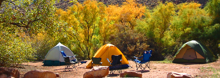
- Lodging + Campgrounds
- Area Info
- Services
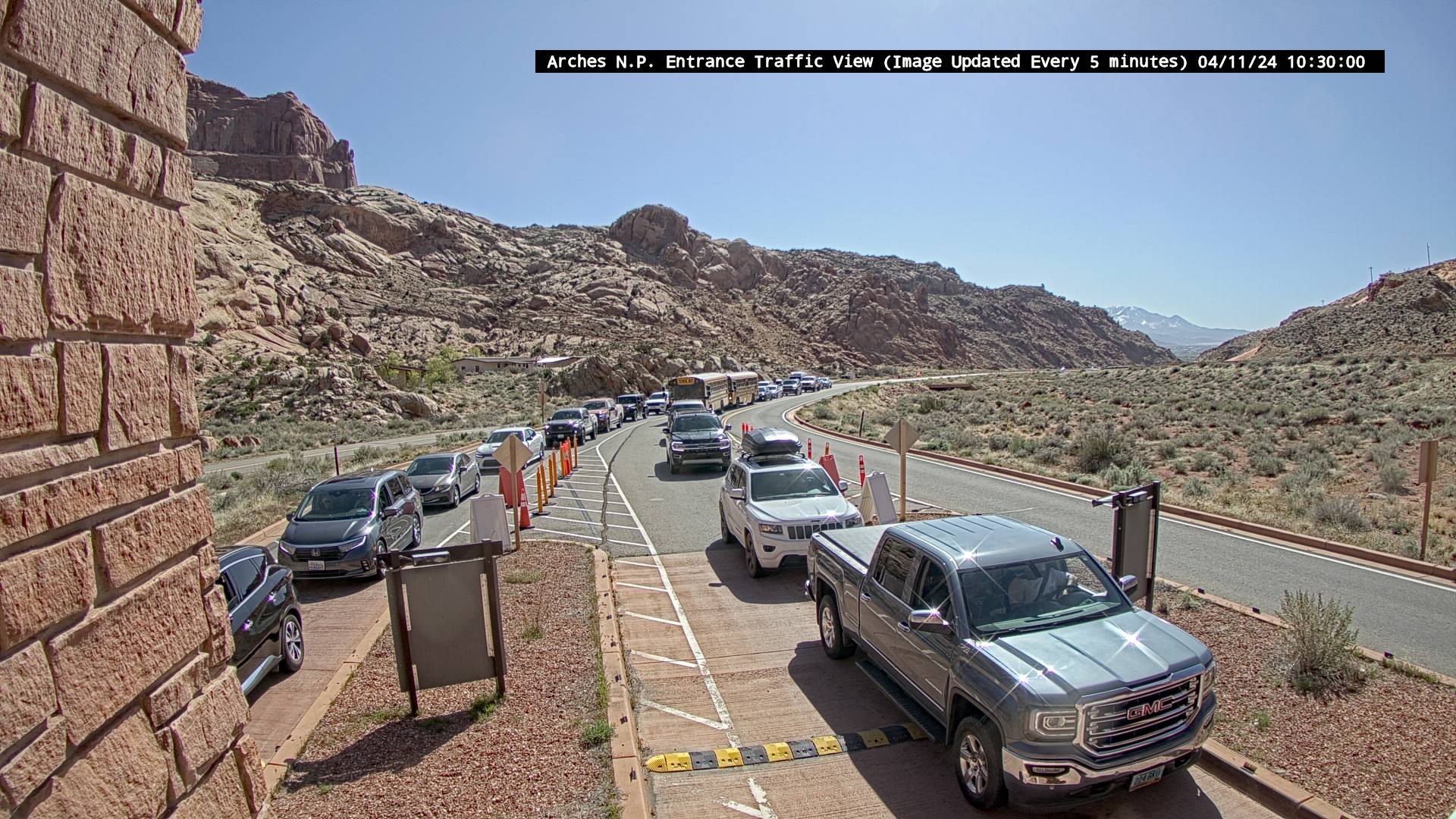
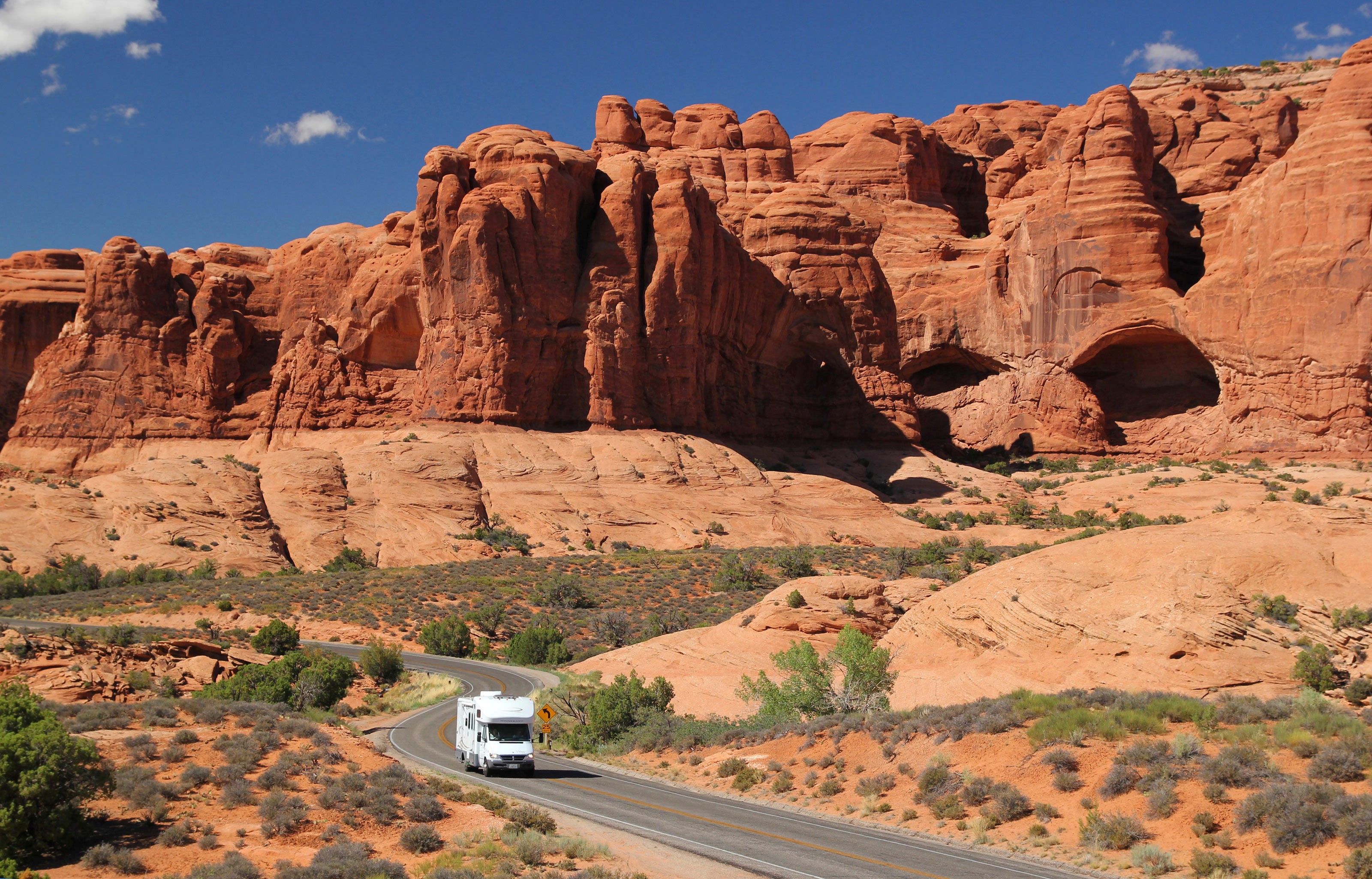
- Transportation


Moab Shower Facilities

Numerous businesses in Moab allow visitors to use their shower facilities. This list is kept as up-to-date as possible, but please check with the individual business for current availability and prices.
DOWD FLATS
2701 S. Highway 191
$4.00
435-231-0800
LAZY LIZARD HOSTEL
1213 S Highway 191
$4.00
435-259-6057
MOAB CYCLERY (9am-5pm only)
391 S Main St
$8.00
435-259-7423
MOAB RECREATION & AQUATIC CENTER
374 Park Avenue
$12.00
435-259-8226
MOAB RIM CAMPARK
1900 S Hwy 191
$5.00
435-259-5002
OK RV PARK
3310 Spanish Valley
$7.00
435-259-1400
SUN OUTDOORS ARCHES GATEWAY
1773 N Highway 191
$8.00
435-259-4469
SUN OUTDOORS MOAB DOWNTOWN
555 S. Main St
$6.00
435-259-6848
Canyonlands National Park Camping
Island in the Sky District
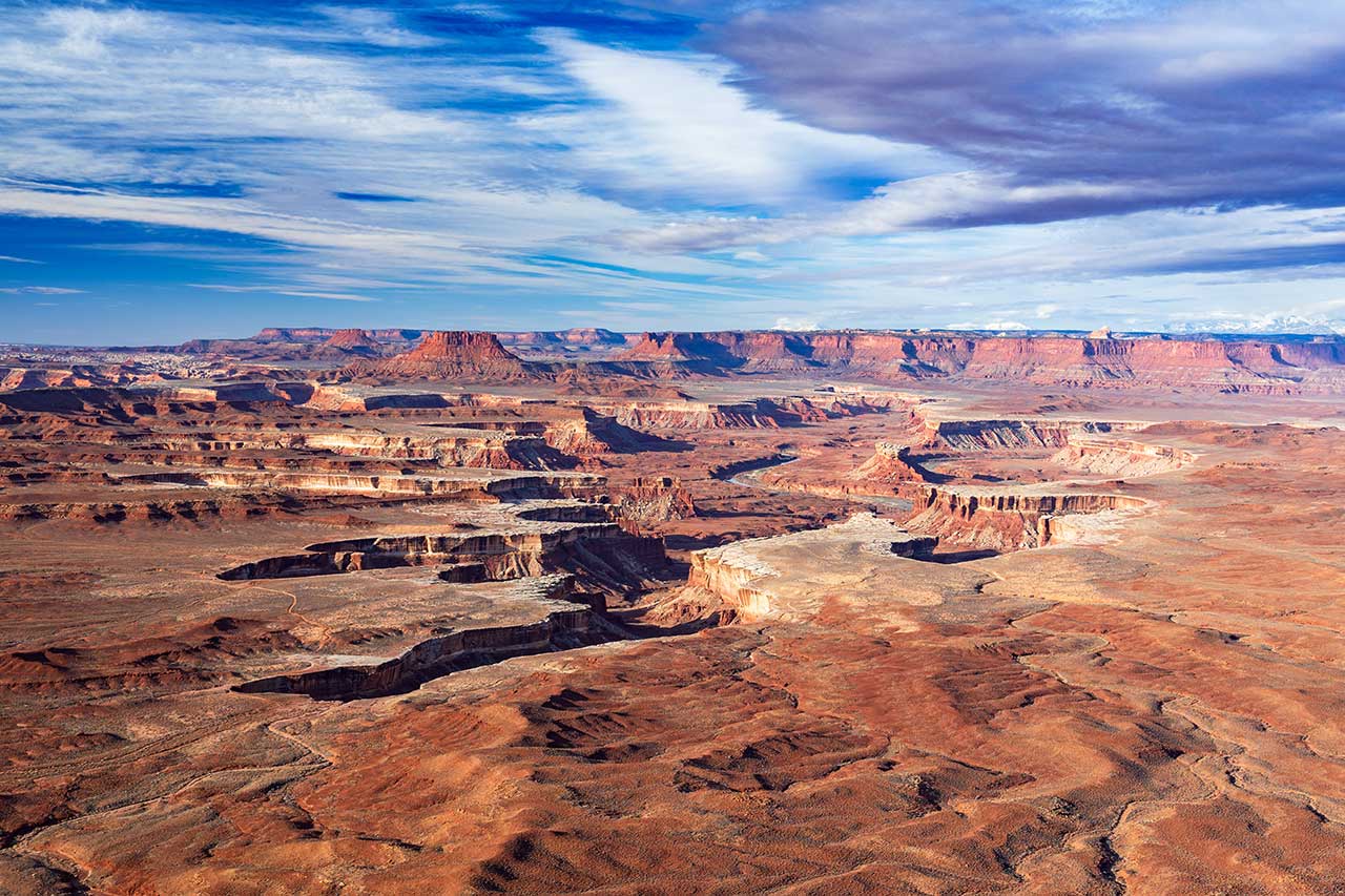
Canyonlands National Park preserves 337,598 acres of colorful canyons, mesas, buttes, fins, arches, and spires in the heart of southeast Utah’s strikingly beautiful high desert. Water and gravity have been the prime architects of this land, sculpting layers of rock into a breathtakingly rugged landscape.
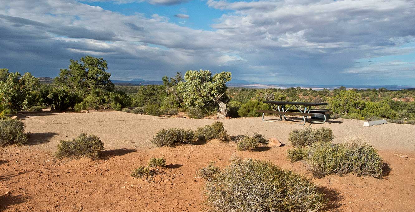
The Island in the Sky District of Canyonlands National Park sits atop a 1,500 foot mesa and is, quite literally, an island in the sky. With views over 100 miles in any direction the resulting panoramas encompass thousands of square miles of ruggedly beautiful canyon country. With the Willow Flat Campground located within the park, along with BLM and state park campgrounds nearby, there’s plenty of camping to choose from.
Find your ideal campground below, or see the nearby hotels in Moab.
Elevation
Sites
RV Length
Group Sites
Picnic Tables
Drinking Water
Directions Turn on UT 313, approximately 10 miles north of Moab or 22 miles south of I-70. Follow the road 22 miles to the entrance to Canyonlands National Park – Island in the Sky district. Continue on the park road approximately 7 miles. Make a right turn toward Upheaval Dome, and follow signs to the campground. Get Directions
Fees $15 per night
The Willow Flat Campground is only a short walk from one of the most sublime viewpoints in Canyonlands National Park, the Green River Overlook. One of the most photographed vistas in the park, the Green River Overlook provides a stunning view of the meandering path the Green River has carved into the landscape over countless millennia. Because it is the only campground located within the Island in the Sky District, sites fill quickly spring through fall.
Located just 10 miles from the Island in the Sky District of Canyonlands National Park is Dead Horse Point State Park. Towering 2,000 feet directly above the Colorado River, Dead Horse Point State Park provides a breathtaking panorama of the sculptured pinnacles and buttes of Canyonlands National Park. This park is one of Utah’s most spectacular state parks and, best of all, you can make reservations at either of its two campgrounds.
Directions Turn on UT 313, approximately 10 miles north of Moab or 22 miles south of I-70. Follow the road 14.6 miles and turn left at the sign for Dead Horse Point State Park. Continue 4.5 miles to the park entrance station. Follow signs to the campground. Get Directions
Campsite Reservations Campsites tend to be reserved weeks ahead of time during busy times, so book early. Reserve Your Campsite Today
Fees $35-$40 per night
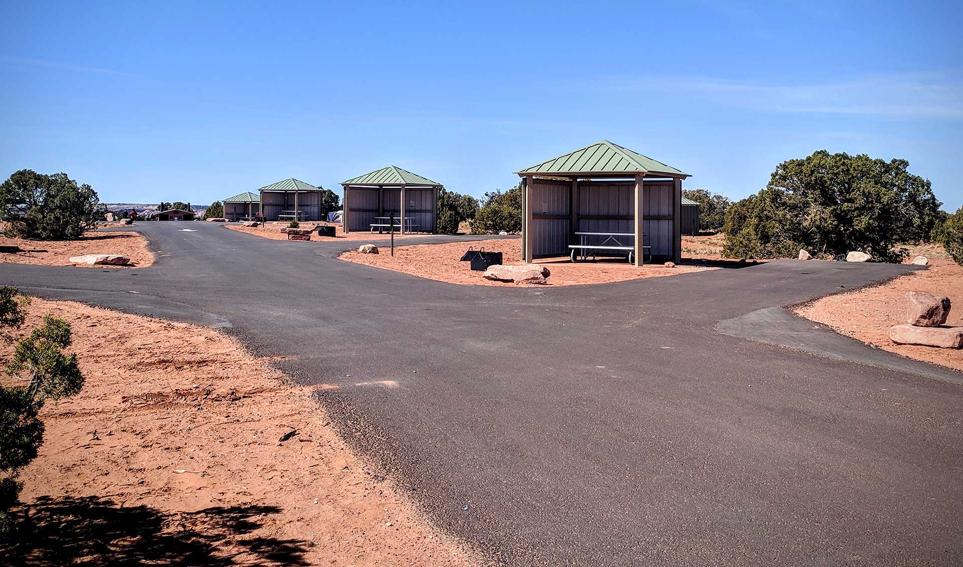
New in 2018, the Wingate Campground sits atop the mesa with far reaching views to the area’s mountain ranges and deep canyons. This campground contains thirty-one (31) campsites, twenty (20) of which have electrical hookups that support RV or tent campers while eleven (11) are hike-in tent only sites. All sites have fire-pits, picnic tables under shade shelters, and access to bathrooms with running water and dish washing sinks. RV sites will accommodate vehicles up to 56′ and there is a dump station at the entrance to the campground.
Directions Turn on UT 313, approximately 10 miles north of Moab or 22 miles south of I-70. Follow the road 14.6 miles and turn left at the sign for Dead Horse Point State Park. Continue 4.5 miles to the park entrance station. Follow signs to the campground. Get Directions
Campsite Reservations Campsites tend to be reserved weeks ahead of time during busy times, so book early. Reserve Your Campsite Today
Fees $35-$40 per night
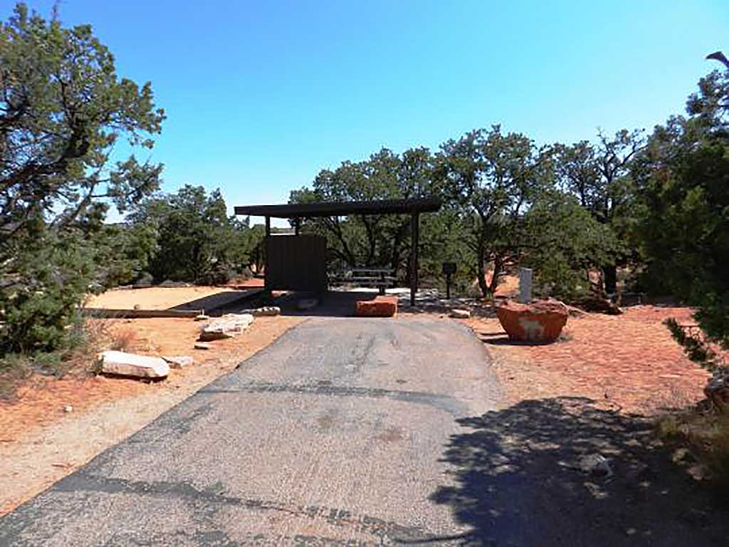
Nestled within a grove of junipers, the Kayenta Campground at Dead Horse Point State Park offers a peaceful, shaded respite from the surrounding desert. All 21 campsites offer lighted shade structures, picnic tables, fire rings, and tent pads. All sites are also equipped with RV electrical hookups (20/30/50 AMP). Modern restroom facilities are available, and hiking trails lead directly from the campground to various points of interest within the park including the West Rim Trail, East Rim Trail, or the Visitor Center.
Directions From the center of Moab (at Center and Main) head north on Hwy. 191 to Hwy. 313. Turn left (west) on Hwy 313 and drive 12 miles. You will see the campground sign on the right. Turn on the gravel road and you will see the campground entrance on your left. Get Directions
Fees $20 per night
Less than 10 miles from the Island in the Sky District of Canyonlands is a large BLM campground named Horsethief Campground. Campsites are tucked in the pygmy pinyon-juniper forest on the mesas above Moab, yet offer great views. Individual sites are available on a first-come, first-served basis.
Arches National Park Camping
Elevation
Sites
RV Length
Group Sites
Picnic Tables
Drinking Water
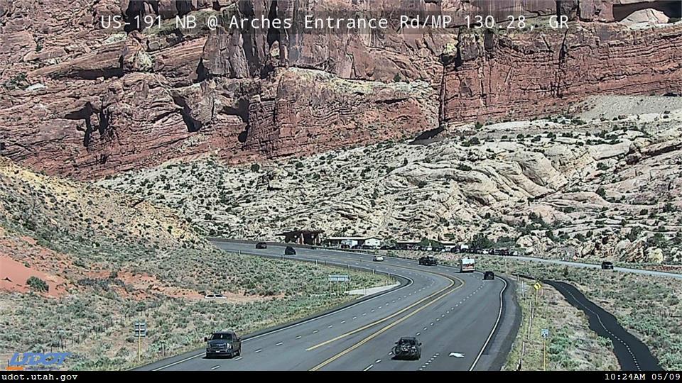
Directions To get here, take Arches Entrance Rd 18 miles into the park. Get Directions
Campsite Reservations Campsites may be reserved March 1st through October 31st. Campsites tend to be reserved months ahead of time, so book early. Fees start at $25 per night. Reserve Your Campsite Today
Fees Starting at $25 per night
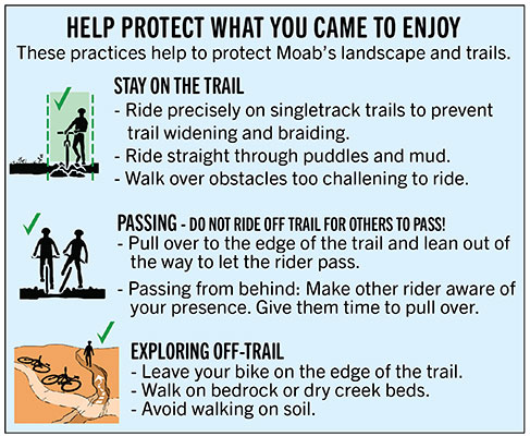
Do your part in preserving and protecting Moab’s natural spaces with these four easy tips:
Respect the Rocks – Ancient ruins, artifacts, and rock art sites are common attractions in the areas surrounding this town. Take a moment to appreciate the history and culture they represent, but without touching or defacing these pieces of ancient history.
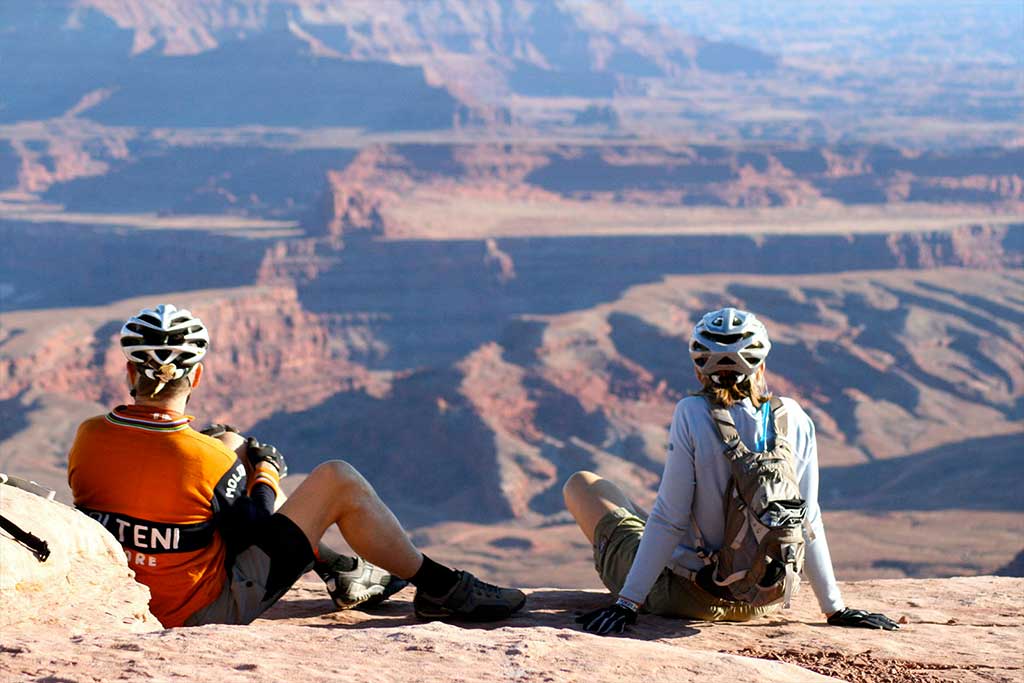
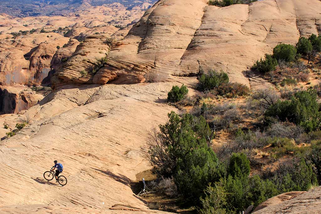
E-Bike Guide to Moab
The Moab area offers thousands of miles of excellent riding for e-bikes. These miles are primarily regulated as motorized routes; however, due to the capabilities of e-bikes in sand and added power for steep climbs, e-bikes are capable of enjoying new terrain that mountain bikes don’t generally venture to.
These routes are just a few of the lesser known options that are great on an e-bike.
Equipment NOTE: The routes on this page have been tested on a Class 1 eMTB with 27.5” x 2.8” tires and a 504 WH battery.

All information courtesy of Moab Trail Mix.
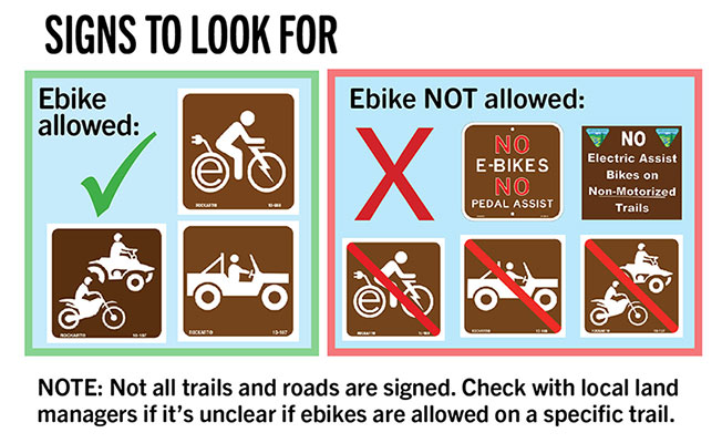
Rules and regulations concerning e-bikes, current as of November 25, 2020.
Note: In the Moab/Grand County area, the classes of e-bikes are not a factor. These rules apply to all e-bikes.
e-bikes (Class 1 only) are allowed on trails open to regular bicycles.
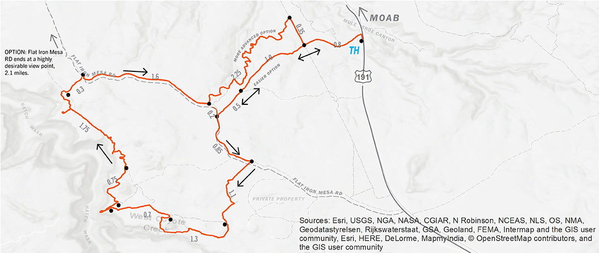
If an escape from the crowds and scenic landscapes are what you’re looking for, this is the ride for you. You’ll be following along the top of a canyon with steep walls comprised of the Wingate sandstone formation. Many of Moab’s most scenic viewpoints are on this route.
From trailhead (TH), follow the 4X4 road north, parallel the highway into a wash, once in the wash the road turns left (west) and climbs out of the wash. Continue on this road west for 2.1 miles. At the T intersection turn left, and follow Flat Iron Mesa Rd. for 0.85 miles, turn right onto the Flat Iron Mesa 4×4 route signed with “FI” on signposts. From here, the trail makes a loop heading south, turning west, then heading north along the rim of Hatch Wash.
After 6.2 miles on the Flat Iron 4×4 route, you’ll intersect Flat Iron Mesa Rd. once again.
OPTION: Turning left, and continuing for 2.1 miles, northwest will take you to the end of Flat Iron Mesa Rd and a stunning overlook of the confluence of Kane Creek Canyon and Hatch Wash Canyon.
To return to the trailhead, turn right (southeast) and continue for 1.8 miles on Flat Iron Mesa Rd. to the first road you pedaled out on. Turn left (east) and follow the road back to the trailhead.
ADVANCED OPTION: Turn left after 1.6 miles for an added 2.25 miles on an advanced 4×4 road. After 2.25 miles, turn right (south) on the Gas Line Rd. and continue for 0.35 miles. Turn left (east) to return to the TH.
BEGINNER OPTION ROUTE: Start the route from the same Trailhead, but once to Flat Iron Mesa Road, turn right (north) and continue for 4.3 miles to the end of the road at Kane Creek Overlook. The return route is reversed.
From Center St. and Main St. in Moab, drive south on Highway 191 for 18 miles. Just after crossing over Mule Shoe Canyon, turn right and park at the entrance of the 4×4 road.
Note: This trailhead is not signed along HWY 191. If struggling to find TH, you can start the route on Flat Iron Mesa Rd at its intersection with HWY191
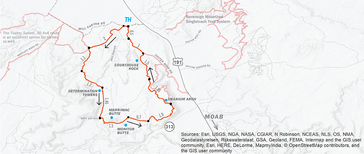
The Seven Mile Rim route takes you through the rolling slickrock canyons of Tusher Canyon, past the tall desert towers of Determination Towers, along and between Monitor and Merrimac buttes, climbs Seven Mile Rim to a stunning view looking out into Arches National Park and the La Sal Mountains, before descending past Uranium Arch and Courthouse Rock back to the Trailhead. Use caution as this area has many alternative roads. Carry proper equipment for navigation.
From trailhead (TH), ride west for 0.1 mile, turn left and follow signs labeled 7R from here. Continue 2 miles to intersection of Tusher Canyon Rd., turn left (south). Continue up the canyon for 1.1 miles. Turn left (east), following signs marked “7R” and “M&M”. After 1.2 miles you will leave Tusher Canyon, and see Determination Towers to your south, turn right at this intersection following the sign to “7R”. Traveling south, past the Determination Towers, continue for 1.45 miles. You’re now at a strange four way intersection near Wipeout Hill, and just west of the Merrimac Butte.
Take the second left that heads to the south side of the Merrimac Butte. Continue east around the southern base of the Merrimac Butte for 1 mile. Continue through the middle of the two buttes, heading northeast, for 0.5 mile. Turn right (east), and continue straight for 0.7 mile, this stretch will have a few roads intersecting your path, however, continue straight until the T intersection. At T, turn left (north), in approximately 1500 feet stay right and continue on this road east, for 1.9 miles. This road primarily climbs east then turns north near the top of Seven Mile Rim. After 1.9 miles, turn left (west), to descend 0.3 mile to Uranium Arch. Once past the arch, continue north on roads marked “M&M” or “HWY 191” for 3.1 miles. Your final slickrock descent will take you past the east side of Courthouse Rock before intersecting the Cotter Mine Road. Turn left (northwest), on Cotter Mine Rd and continue for 1.5 miles to the Trailhead. There are many alternative roads in this last 3 mile section. By continuing north you will make your way to the Cotter Mine Road.
From Center St. and Main St. in Moab, drive north on Highway 191 for 16 miles. Turn left onto Mill Canyon Rd. and proceed for 0.6 miles to the Mill Canyon, Tusher Canyon Trailhead.
Note: Tusher Canyon (west side of loop), during dry periods of the year can be difficult on an ebike with narrower tires due to sand. If on an ebike with tires narrower than 2.5”, riding this route in the opposite direction is advised.
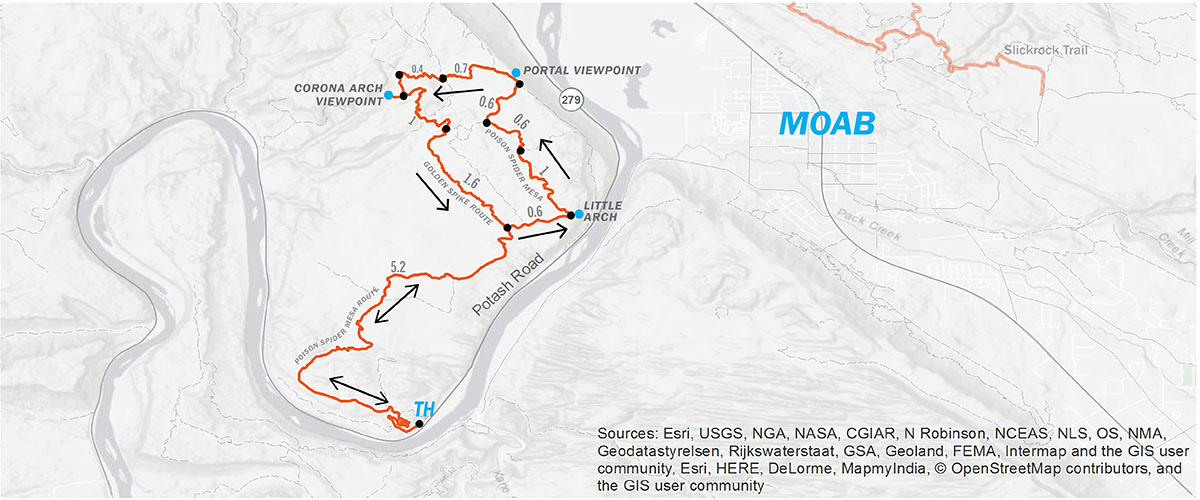
From trailhead (TH), ride up the Poison Spider Mesa 4×4 road for 5.3 mi. This first section of the route will be retraced upon your return. Turn right at the Golden Spike/Poison Spider Mesa intersections. Proceed on Poison Spider Mesa for 2.8 miles to the top of the Portal Viewpoint.
Note: Portal Singletrack and Goldbar Rim Singletrack are non-motorized routes not open to e-bikes.
Heading northwest continue on the Portal Connector Road for 0.7 miles downhill toward the intersection of Golden Spike and Where Eagles Dare (WED). Follow route for WED for 0.4 miles (west), at the first intersection turn left (south), and continue for 0.25 miles.
OPTION: At this intersection turning right (west), will take you to the viewpoint of Dragonfly Canyon and Corona Arch.
To continue the route turn left (east), and continue on WED for 1 mile to the southern intersection of WED and Golden Spike. Turn right (south), on Golden Spike and continue for 1.6 miles back to the Poison Spider/Golden Spike intersection. This is the section of road you came out on. Continue straight, south, for 5.3 miles back to the Poison Spider Trailhead.
From Center St. and Main St. in Moab, drive north on Highway 191 for 4.1 miles, turn left on Potash Rd. Highway 279. Proceed for 5.9 miles, turn right onto Poison Spider Mesa Road., proceed up the hill and park at the trailhead.
CAUTION: POISON SPIDER MESA HAS MANY ALTERNATIVE ROUTES AND DEAD END ROADS. IT IS HIGHLY RECOMMENDED YOU CARRY A MAP AND GPS UNIT WHILE EXPLORING THIS AREA. POISON SPIDER MESA IS CLIFFED OUT ON ALL SIDES AND THE JEEP ROAD IS THE ONLY WAY ON AND OFF THE MESA FOR EBIKES.
With the most iconic Moab views, and fun purpose built singletrack this is a must do. Entry fee is required, map included upon entry of park.
Visitor Center Phone: 435-259-2614
Website: stateparks.utah.gov/parks/dead-horse/
One of the most unique experiences you will ever have on two wheels. Other great options within Sand Flats include Hells Revenge and Fins and Things. Fee required at booth, map included upon entry.
Phone: 435-259-2444
Website:
sandflats.org
Intermediate-advanced singletrack
20+ miles – Many loop options
Located on Sovereign Utah State Lands 12 miles north of Moab. These trails traverse fun terrain with many loop options making it easy to ride as long as you like.
Trail Description: mtbproject.com/trail/231528/sovereign
"Electric assisted bicycle" means a bicycle with an electric motor that:
ON FEDERAL PUBLIC LANDS in the Moab area, BLM and Forest Service, e-bikes are allowed on all open motorized roads and motorized trails. E-bikes are NOT allowed on designated non-motorized mountain bike trails.
Policy updates issued by the BLM on October 22, 2019 state that e-bike use is prohibited on existing designated non-motorized bicycle trails unless authorized by the local BLM District Manager. The BLM Moab Field Office is currently exploring options to expand e-biking recreation opportunities in the area. This process involves environmental assessments and public comment periods to investigate what impacts e-bikes may have on other user groups, wildlife, and trail conditions. Please respect the current regulations as this process takes place.
ON UTAH STATE PUBLIC LANDS, SITLA, Sovereign, and Utah State Parks, e-bikes are classified as non-motorized and are categorized by three classes.
We all share our right to enjoy public lands. Please use them respectfully and within the laws that govern them.
Moab trails feature steep sandstone and stretches of sand that can drain your battery faster than riding on hard-packed trails. Plan your mileage with this in mind. Keep a close eye on your battery consumption, and adjust your ride and power settings accordingly.
Know your route and bring accurate maps. The most accurate and frequently updated maps for the Moab area are the Latitude 40, Moab East and Moab West maps, and National Geographic North and South Moab maps. These maps have the most accurate road and trail info and also highlight popular OHV routes that are great for e-bikes. Do not rely solely on the information on this page for navigation.
Always plan for adverse, changing conditions. Flash floods can affect most the trails in the area leaving you on the wrong side of a creek for minutes or hours.
Desert weather can be unpredictable. Fast moving thunder and lightning storms, along with heavy rains and even unexpected snow showers can hit with little notice.
High daily temperatures in summer months (June-August) are consistently over 100 degrees Fahrenheit (38 Celsius). Heat stroke and heat exhaustion are common in summer months. To help avoid this life threatening issue, ride in the early morning or in the evening and rest during the hottest part of the day.
E-bikes have more power than traditional mountain bikes, are lighter than motorcycles and seem capable of going just about anywhere. It is the rider’s responsibility to respect the desert and the laws of our public lands to preserve our right to enjoy them into the future. Limiting your impact reduces the amount of maintenance required to keep trails open. Stay precisely on the designated routes and don’t widen or ride off the trail for any reason. Respect trail signage, info kiosks, and other amenities found at trailheads.
Decomposition in the desert is slow. Please pack out all trash, including garbage, food waste, human waste and toilet paper. Trash does not disappear, other humans must remove it!
All information courtesy of Moab Trail Mix.
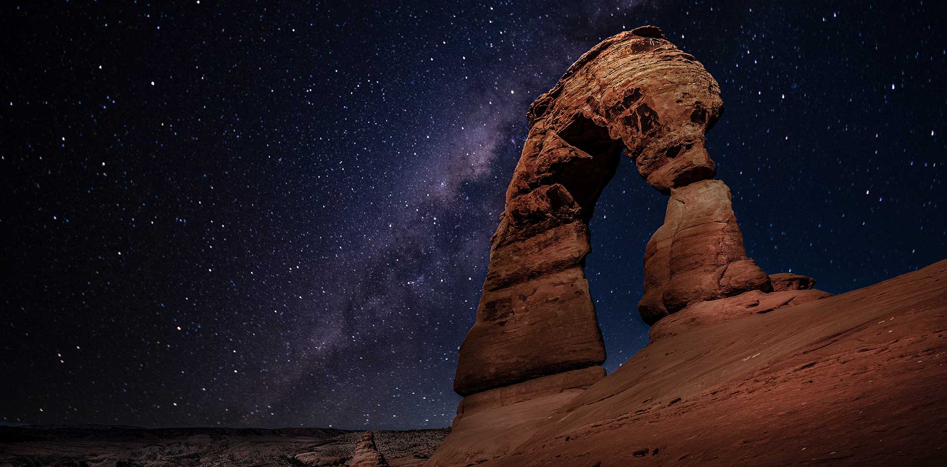
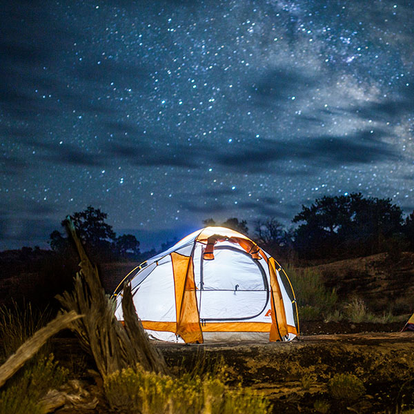
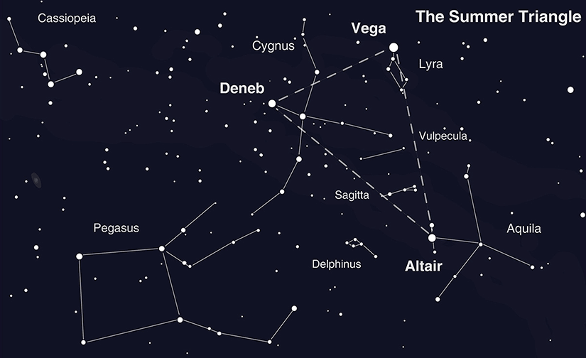
Summer Stargazing in Moab’s Dark Sky Parks
While you’re sure to experience epic views of unique rock formations and panoramic vistas during the day, these scenes set the stage for a completely different kind of breath-taking beauty at night. Here in the deep darkness of the desert, you’ll be able to escape the light pollution of cities and see more stars than ever before.
Utah currently has the most certified International Dark Sky Parks anywhere in the world, and the Moab area is proud to call three of them home. In fact, the public lands surrounding Moab have some of the darkest skies remaining in the contiguous 48 United States. Read on to get the full scoop on where to go and how to maximize your stargazing experience.
As few as one in ten Americans live in areas where they can see the estimated 2,500 stars that should be visible under normal conditions, which means many visitors have never seen the Milky Way or experienced the splendor of a true star-filled sky. At the following Dark Sky Parks, the naked eye is sufficient to witness a wealth of stars. Under the right conditions, binoculars may even reveal the rings of Saturn!
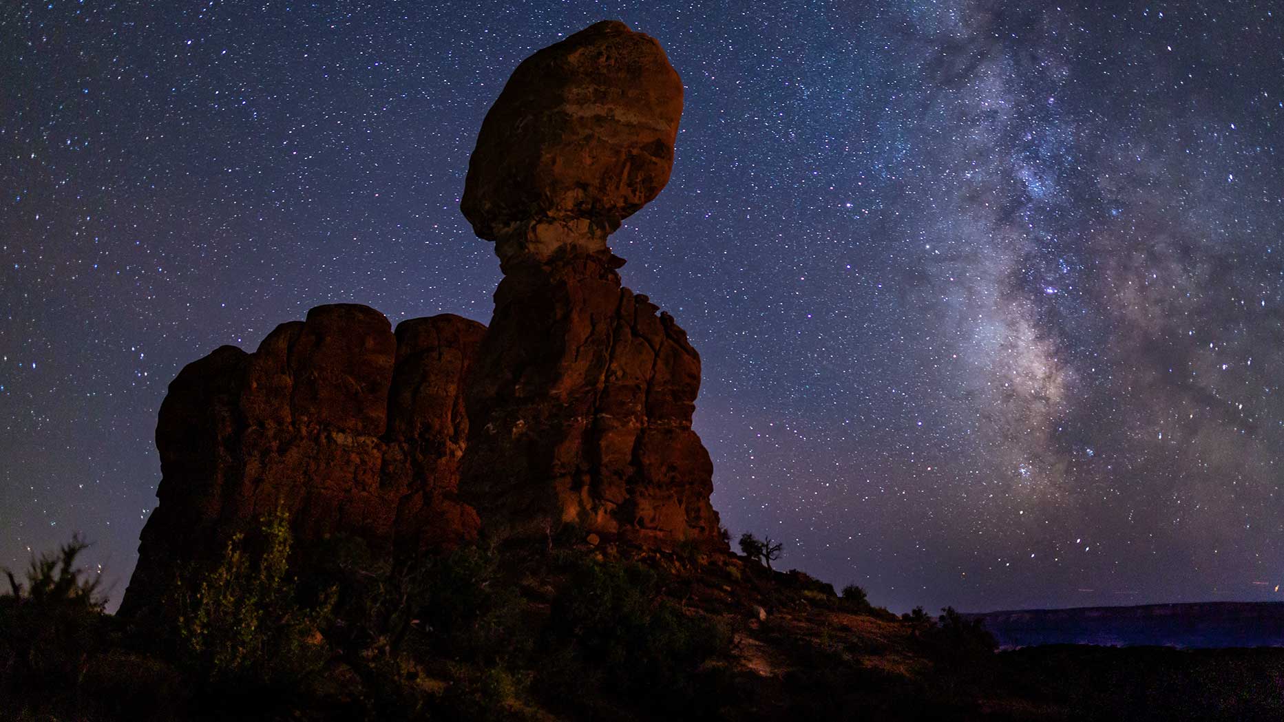
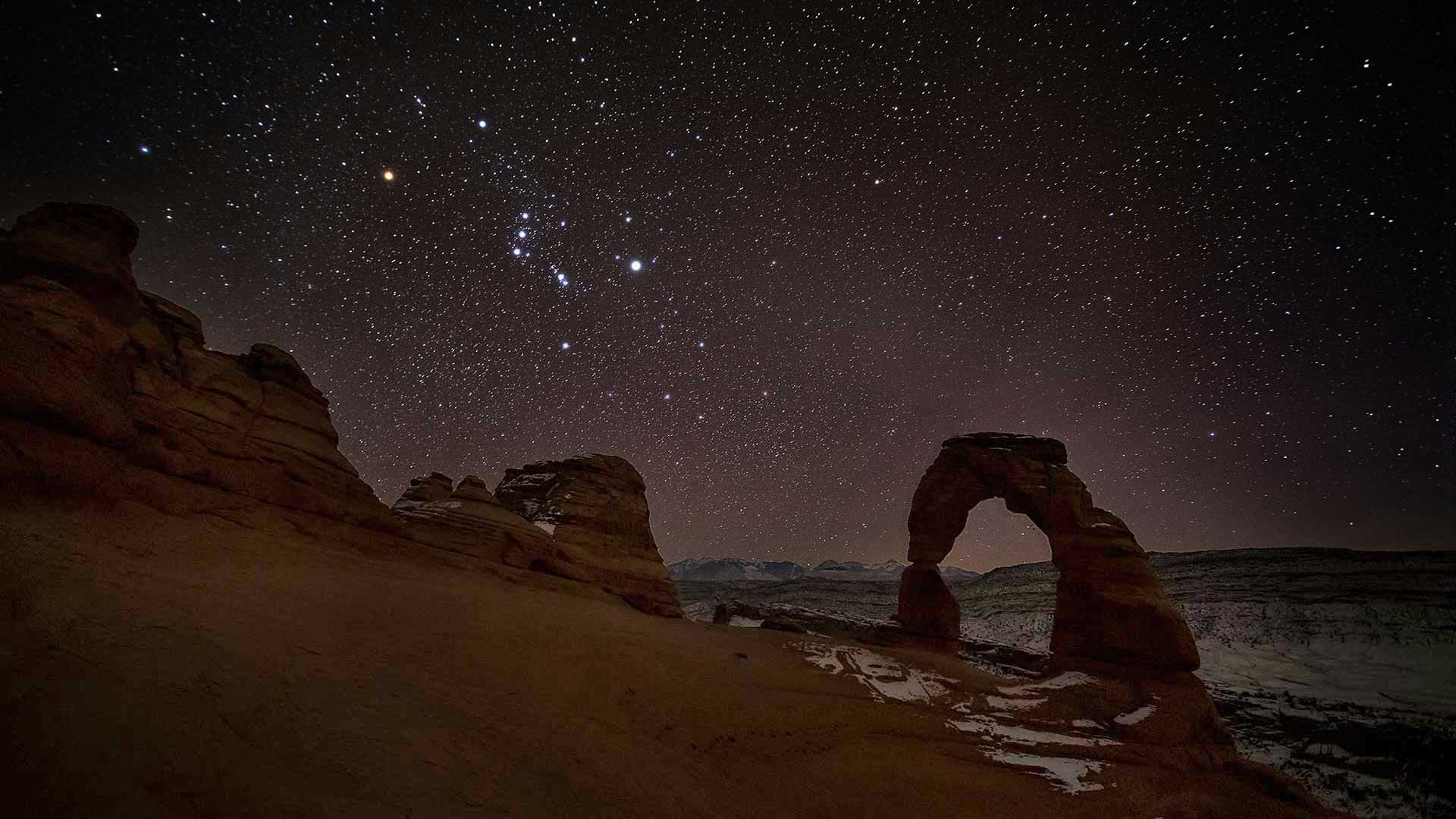
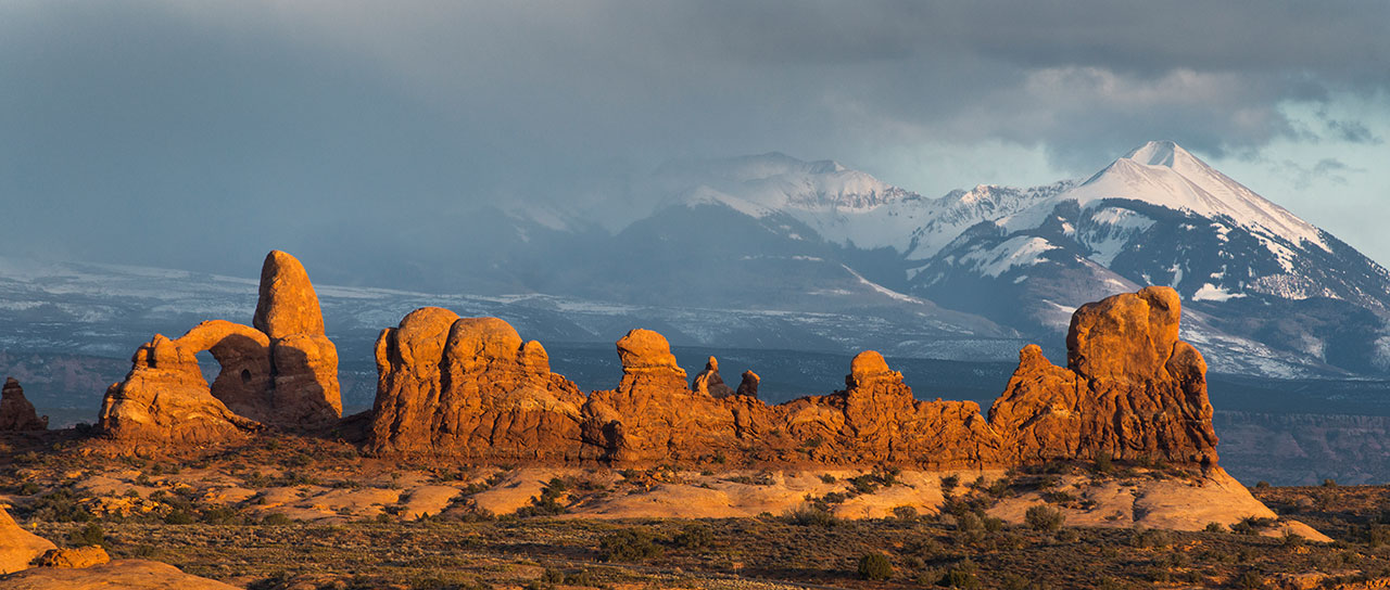
Arches National Park
Arches National Park received its International Dark Sky Park designation in 2019. On a clear night, you can see an incredible number of stars just about anywhere in the park. Areas off the main park road with few obstructions of the sky are best. A few easy-to-access options include Balanced Rock Picnic Area, The Windows, Garden of Eden Viewpoint and a dedicated stargazing area at Panorama Point. The farther north you drive away from the lights of Moab, the darker the sky will be. Be sure to check at the visitor center for more information and to find out about opportunities to attend ranger-led stargazing events and programs.
Canyonlands National Park
Night skies at Canyonlands National Park are so pristine the International Dark-Sky Association designated Canyonlands as a Gold-Tier International Dark Sky Park in 2015, which is the highest designation for darkness. Efforts to preserve natural darkness at Canyonlands began several years ago with a focused effort to revamp and replace lighting with "night-sky friendly" bulbs and fixtures. Today, nearly 100 percent of the lights in the park are "night-sky friendly." Visitors enjoy attending night sky programs at the Island in the Sky and Needles districts, where rangers use story-telling and telescopes to showcase the wonders of the universe.
Dead Horse Point State Park
Dead Horse Point State Park, the first Utah state park to be recognized as an International Dark Sky Park in 2016, is one of the most active and accessible areas to stargaze in the Moab area. Its high plateau location, mountains far in the distance and cities out of sight, yields a nearly full view of the celestial sphere. Park staff routinely provide after-dark programs celebrating the night sky, from hikes under the full moon to gazing through telescopes at objects millions of light years away. Whether you want to enjoy by yourself or join a ranger, Dead Horse Point State Park is a premier spot to see the night skies at their best.
Arches National Park
The world’s largest concentration of natural sandstone arches.
Arches National Park’s Twitter page is a great source of up-to-the-minute park information. Check it out here.
Mailing Address
Arches National Park P.O. Box 907 Moab, UT 84532Visitors Center GPS Coordinates
38.616391, -109.620345Website
www.nps.gov/archMailing Address
Arches National Park P.O. Box 907 Moab, UT 84532Visitors Center GPS Coordinates
38.616391, -109.620345Websites
www.nps.gov/arch/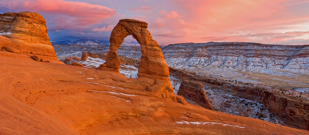

Please note that food is not available within the park. The closest restaurants are either in the town of Moab, at Dead Horse Point State Park, or at the dinosaur museum at the intersection of Highways 191 and 313 (entrance fee is not required to access the restaurant).
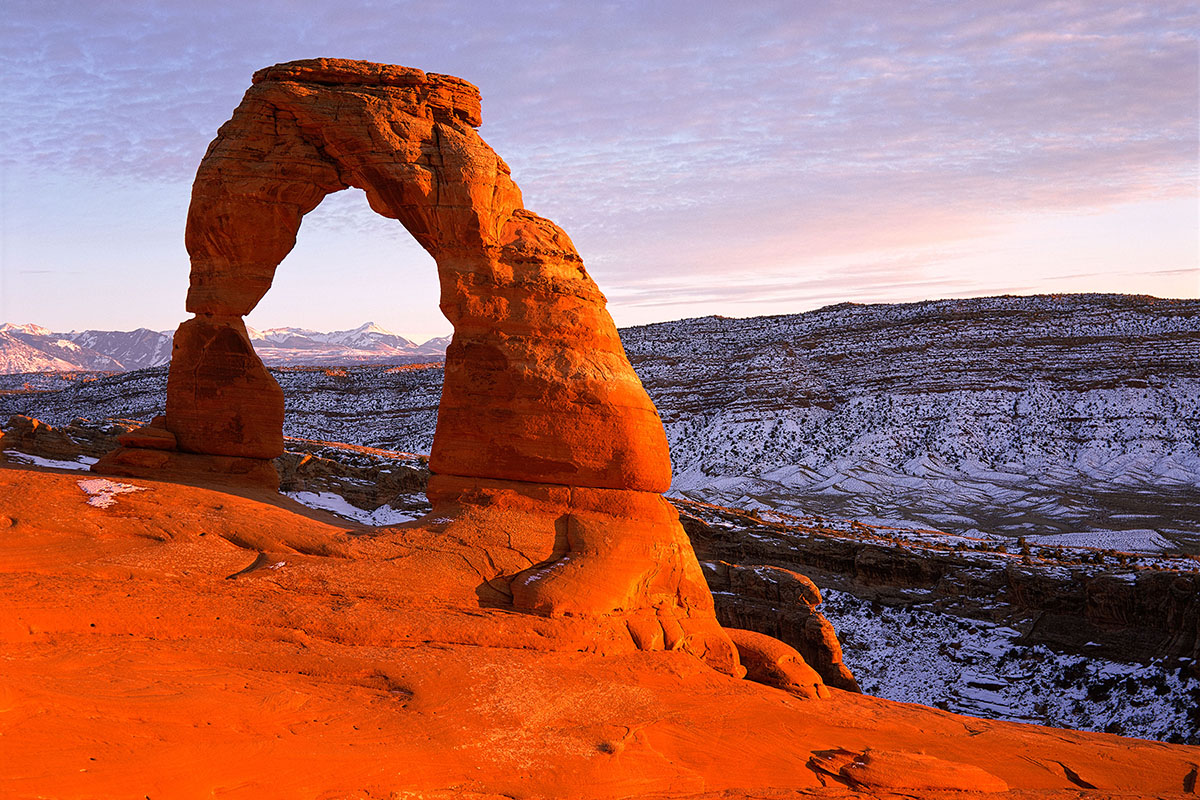
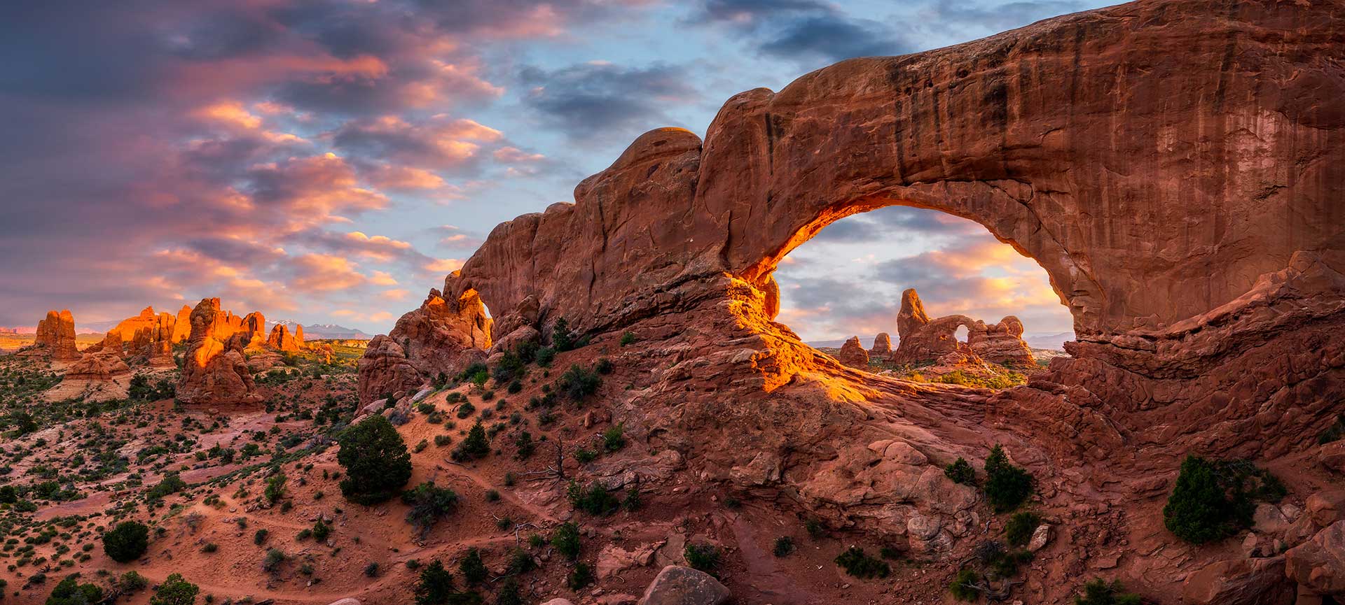
People come from all over the world to visit Arches National Park, and visiting Delicate Arch is on the top of many visitors’ to-do lists. In a park with over 2,000 stone arches, this particular free-standing arch has become a widely recognized symbol of the state of Utah and one of the most famous geologic features in the world. The light opening beneath the arch is 46 feet high and 32 feet wide, making it the largest free-standing arch in the park.
Learn More About Delicate Arch Hiking Trail
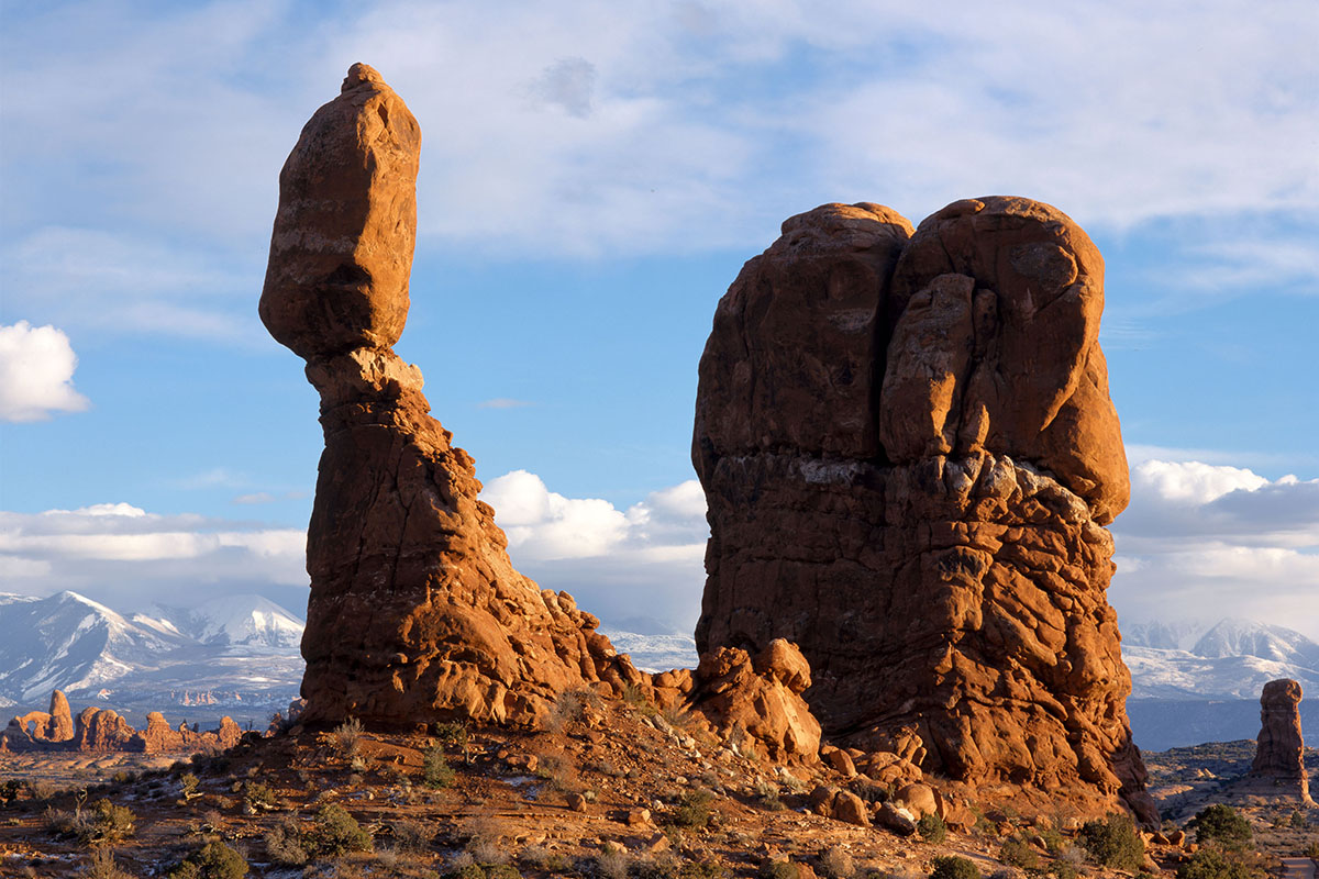
A short paved trail leads visitors to the base of Balanced Rock. The landform’s total height is 128 feet, with the huge balanced rock rising 55 feet above its base.
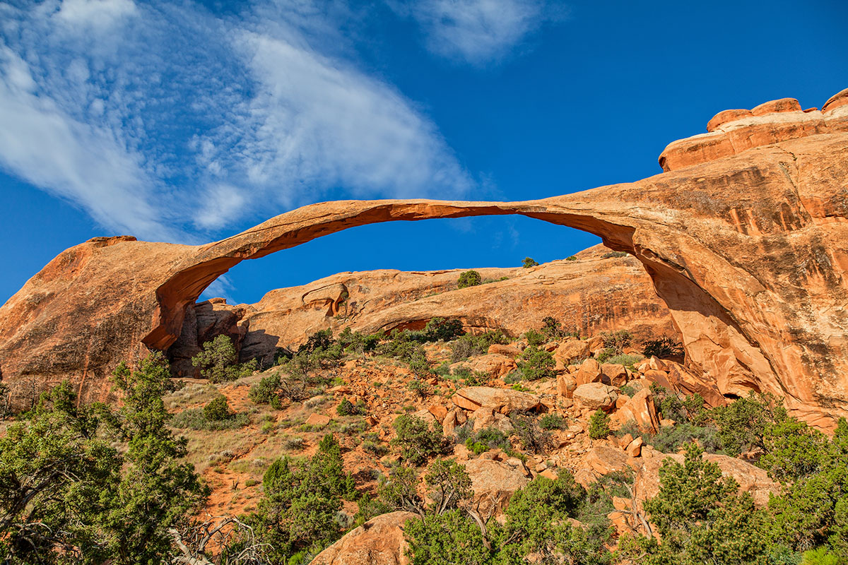
The longest natural rock span in the world, this arch’s opening is 306 feet wide – 6 feet longer than a football field. A nine story building would easily fit beneath this thin span. In 1991, a massive slab of rock fell from its underside, resulting in an even thinner ribbon of rock.
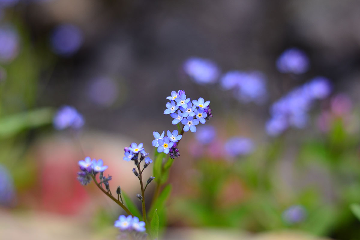
April and May bring a variety of desert wildflowers to Arches.
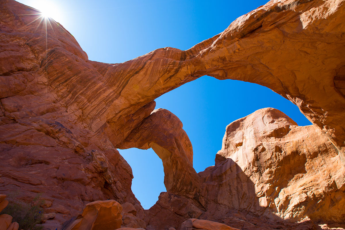
Located in the Windows Section of Arches National Park, Double Arch was used as a backdrop for portions of the 1988 movie “Indiana Jones and the Last Crusade”. Numerous other movies have been filmed in Arches National Park, including Thelma and Louise in 1991.
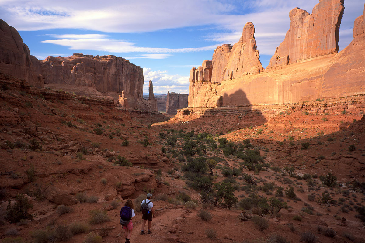
From Park Avenue parking area, the trail descends steeply into a spectacular canyon and continues down the wash to Courthouse Towers. If you have a shuttle driver, you can begin at one point and be picked up at the other. For round-trip hiking, retrace your steps along the trail rather than walk along the park road.
Winter brings a blanket of pristine snow to Arches, providing dramatic contrast to the surrounding red rocks.
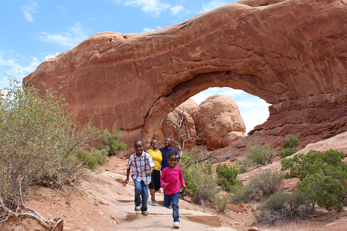
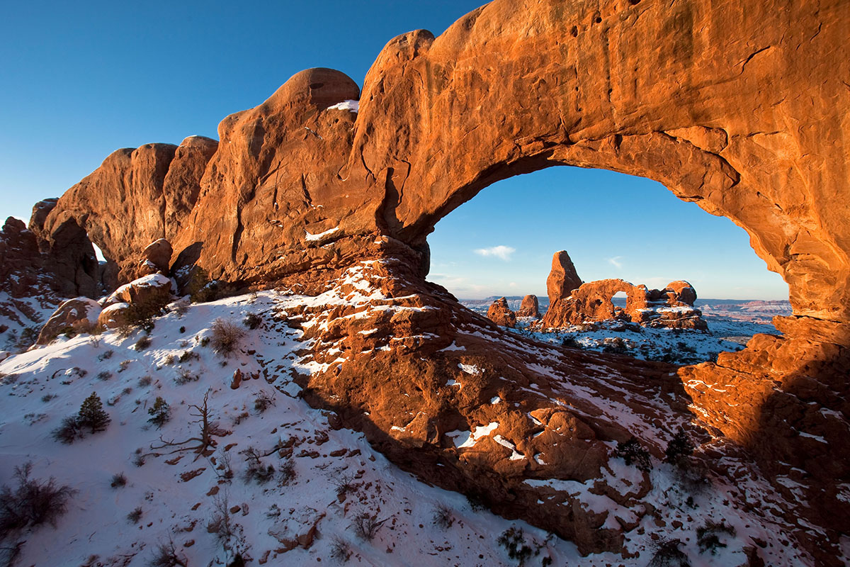
There are many family friendly hikes in Arches, including the hike to Turret Arch in the Windows Section.
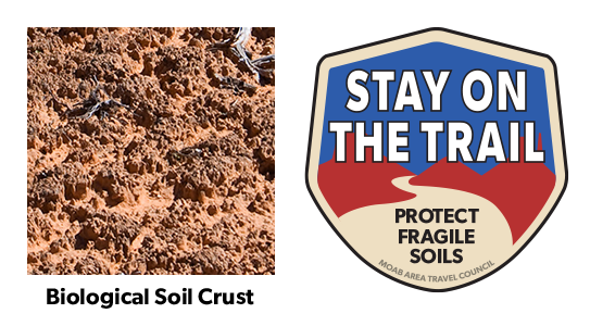
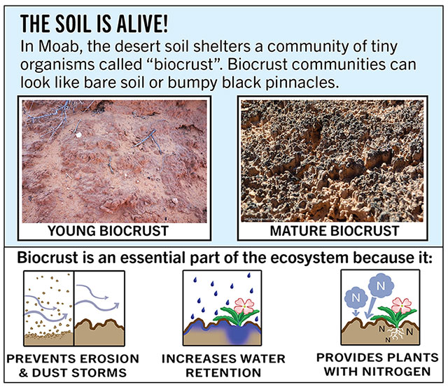
Your help is crucial in preserving our trails and protecting the fragile soil that sustains the desert ecosystem. The biological soil crust, also known as cryptobiotic soil, serves as the foundation for desert plant life. This unique black, knobby crust is composed of diverse living organisms and plays a vital role in maintaining the delicate balance of the desert environment.
However, this soil crust is exceptionally delicate and can take several decades to regenerate. Even a single footstep can cause irreparable damage that can persist for years, impacting the entire ecosystem. We urge you to stay on designated roads, routes, and trails to ensure the preservation of this fragile life. In areas where hiking trails are not established, it is advisable to hike on sandy washes or bare rock surfaces to minimize the impact on the soil.
By remaining vigilant and adhering to these guidelines, you contribute to the long-term sustainability of the desert ecosystem and help safeguard its natural beauty for generations to come. Let’s work together to keep all of our trails open and protect the invaluable biological soil crust.
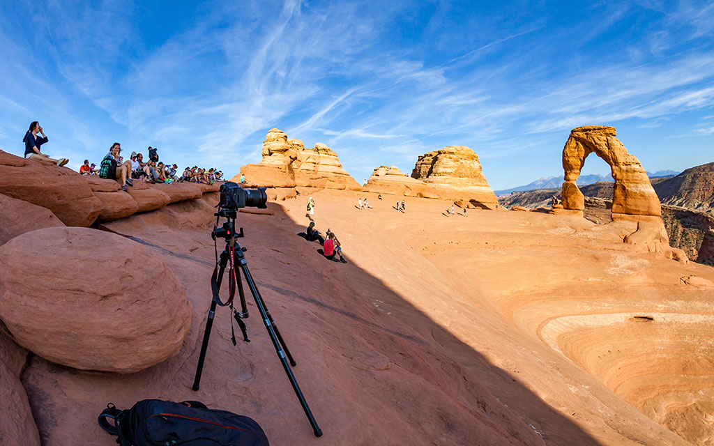
Try not to limit your creativity by simply capturing images of iconic places using the same composition as countless photographers before you. Arches National Park contains thousands of arches and vast expanses of breathtaking scenery just waiting for you to introduce your own personal style and interpretation. For those seeking solitude, Arches has much to offer beyond its iconic places. For example, consider a hike to Double O Arch, returning via the Primitive Trail, for some of the most spectacular scenery in the park. Just remember to bring enough memory cards to capture all of the great views!
| Early Morning | Late Afternoon |
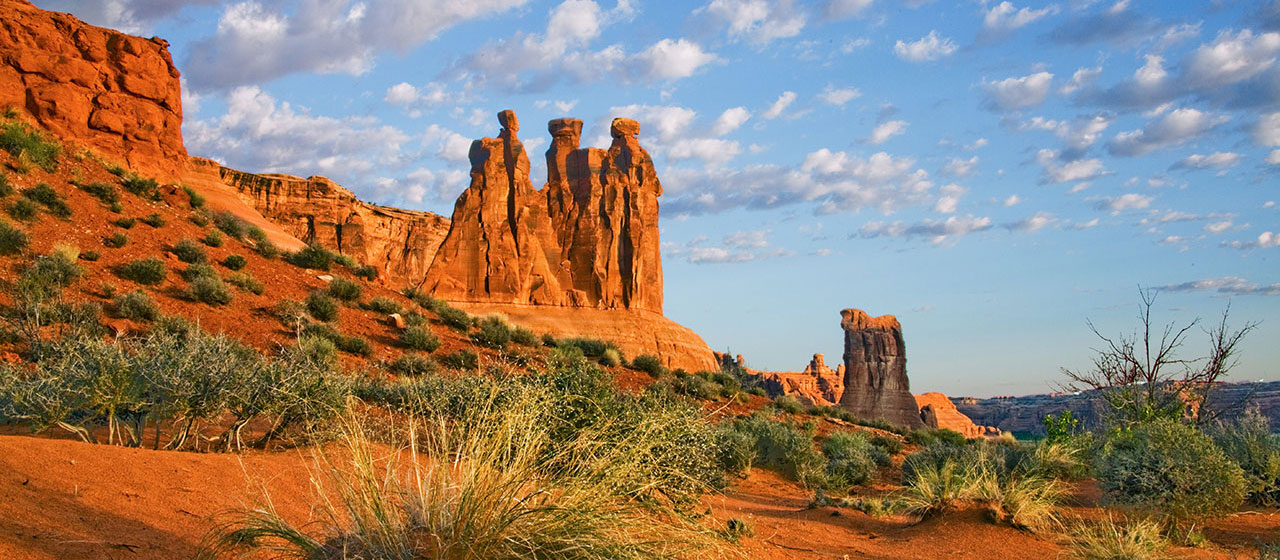
| Moab Fault | Park Avenue |
| The Three Gossips | Courthouse Towers |
| Sheep Rock | Petrified Dunes |
| The Great Wall | Balanced Rock |
| Turret Arch | The Garden of Eden |
| The Spectacles | North and South Windows |
| Double Arch | Delicate Arch (at end of main trail) |
| Cache Valley | Fiery Furnace |
| Wolfe Ranch | Skyline Arch |
| Landscape Arch | Fins in Devil Garden |
| Double O Arch | Tower Arch |
Canyonlands Natural History Association
Canyonlands Natural History Association (CNHA) is a nonprofit organization assisting the National Park Service in its educational, interpretive and scientific programs throughout southeast Utah. Known as a "cooperating association," CNHA’s goals include enhancing visitors’ understanding and appreciation of public lands by providing a selection of quality, educational materials for sale in many vistor centers. Twenty percent of these sales is returned to the National Park Service and other federal land management agencies.
CNHA operates the bookstore at Arches Visitor Center.
Friends of Arches and Canyonlands Parks
The Friends of Arches and Canyonlands Parks: Bates Wilson Legacy Fund provides direct support to Arches and Canyonlands national parks and Natural Bridges and Hovenweep national monuments in order to enhance existing projects in these spectacular areas, and to conserve the land and its cultural treasures for present and future generations to enjoy.
This mission honors the legendary work of Superintendent Bates Wilson, who came to Arches in 1949, inspiring and leading the effort that resulted in the establishment of Canyonlands National Park in 1964. The Friends Group offices are in the Rock House behind Arches Visitor Center, where Bates once lived with his family.
State Park, National Park & Forest Campgrounds
Elevation
Sites
RV Length
Group Sites
Picnic Tables
Boat Launch
Drinking Water
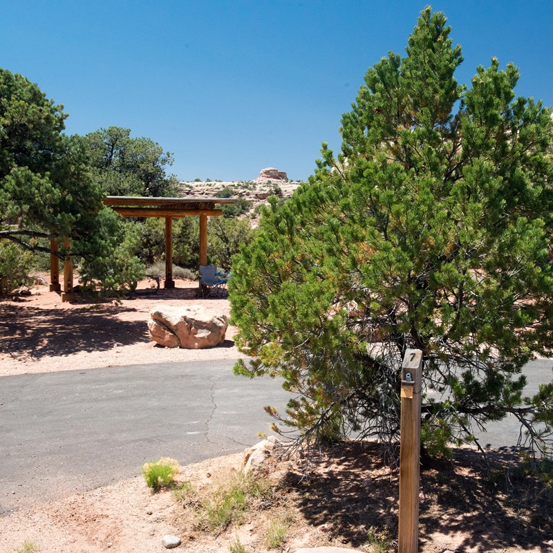
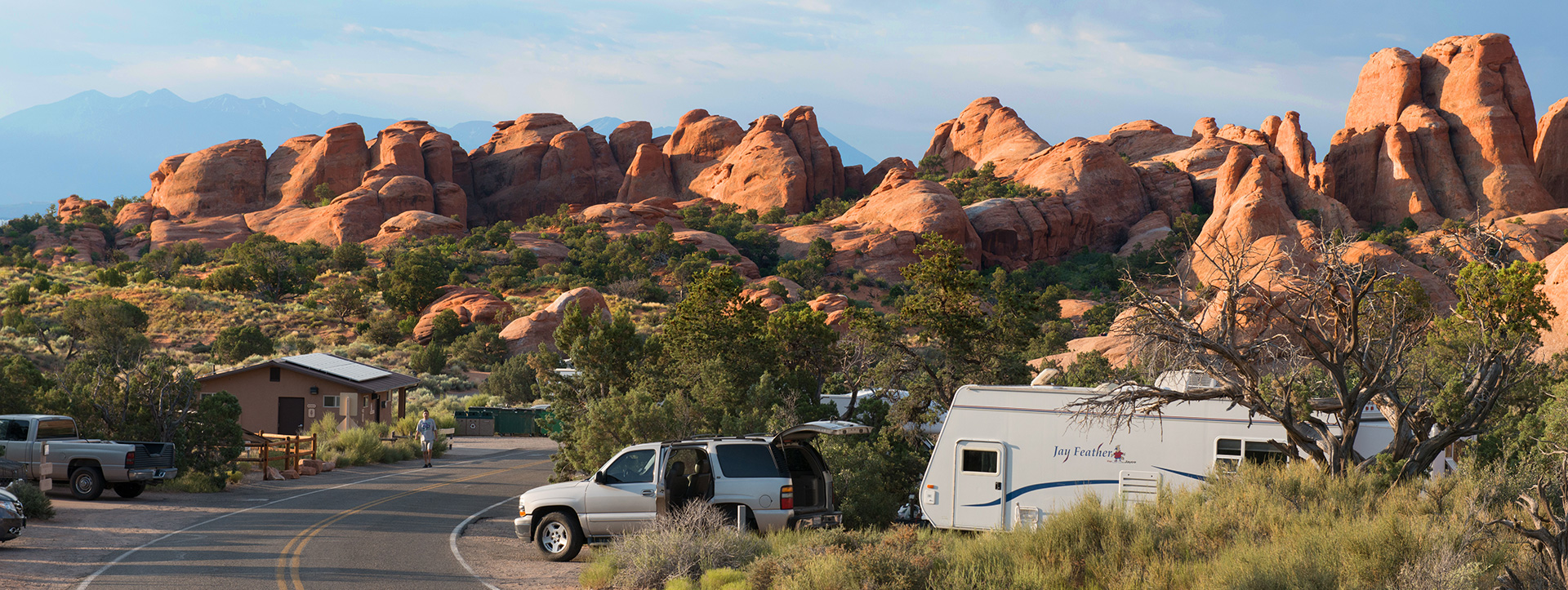
Arches – Devils Garden Campground
End of 18 mile paved scenic drive
Info: 435-719-2299
Reservations: 877-444-6777 or visit recreation.gov
Dead Horse Point State Park
9 miles north of Moab on Hwy 191, then 22 miles west on Hwy 313
Info: 435-259-2614
Reservations: 800-322-3770 or visit: utahstateparks.com
Oowah Campground
Location: South on Hwy 191 for 8 miles to La Sal Mountain Loop Road sign. Turn left and follow Loop Road signs for 13.4 miles, then 3 miles on a dirt road. (Lat/Long: 38.501959,-109.273287)
Warner Lake Campground
Location: South on Hwy 191 for 8 miles to La Sal Mountain Loop Road sign. Turn left and follow Loop Road signs for 14.8 miles, then 5 miles on a dirt road. (Lat/Long: 38.519942 -109.276368)
Info: 435-259-7155
Reservations: 877-444-6777 or visit recreation.gov
Mason Draw Campground
Location: South on Hwy 191 for 8 miles to La Sal Mountain Loop Road sign. Turn left and follow Loop Road signs for 19.8 miles, then .3 miles on a dirt road. (Lat/Long: 38.542714 -109.302917)

Bureau of Land Management Campgrounds
Elevation
Sites
RV Length
Group Sites
Picnic Tables
Boat Launch
Horse Corral
Hwy 128, 6.2 miles from Hwy 191 – Payment by cash, check or Credit Card ROK at Big Bend Campground.
Hwy 128, 6.6 miles from Hwy 191 – Payment by cash, check or Credit Card ROK at Big Bend Campground.
Hwy 128, 6.9 miles from Hwy 191 – Payment by cash, check or Credit Card ROK at Big Bend Campground.
Hwy 128, 7.4 miles from Hwy 191 – Payment by cash, check or Credit Card ROK at Big Bend Campground.
Hwy 128, 8.1 miles from Hwy 191 – Payment by cash, check or Credit Card ROK at Big Bend Campground.
Hwy 128, 21 miles from Hwy 191, then 0.7 miles southeast on gravel road. Has corral for up to 8 horses. Payment by cash, check or Credit Card ROK at Hittle Bottom Campground.
Hwy 128, 21.5 miles from Hwy 191 then 1 mile northwest on graded road. Payment by cash, check or Credit Card ROK at Hittle Bottom Campground.
Hwy 128, 21.5 miles from Hwy 191 – Dirt Road access. Payment by cash, check or Credit Card ROK at Hittle Bottom Campground.
Hwy 128, 22.5 miles from Hwy 191 – Payment by cash, check or Credit Card ROK.
Hwy 128, 28.7 miles from Hwy 191 – Payment by cash, check or Credit Card ROK at Hittle Bottom Campground.
Utah 313, 12 miles from Hwy 191 – Payment by cash, check or Credit Card ROK.
Kane Creek Rd, 2.8 miles from Hwy 191 – Payment by cash or check.
Kane Creek Rd, 7.8 miles from Hwy 191 – Dirt road access. Reservable only through Recreation.gov.
The Ledge A, B, C, D, & E Campgrounds
Kane Creek Rd, 10 miles from Hwy 191 – Access to the Ledge Campground is down a tight, steep switchback and over several creek crossings on a gravel/dirt road. It is not recommended for vehicles over 22′ or vehicles pulling long trailers. – Payment by cash or check.
8.5 miles south of Moab off Hwy 191, then follow signs south on Spanish Valley Drive. Ken’s Lake Campground is now reservable via Recreation.gov.
16 mi north of Moab on Hwy 191, then approximately 1 mi on the graveled Mill Canyon Road (turn left at first “Y” on road). Large graveled parking area suitable for large RVs and/or trailers. Campsites 1-4 and 7-10 cash, check, scan and pay. Campsites 5 and 6 reservation only through Recreation.gov.
22 mi north of Moab on SR 191, take the graveled Road 143 and past the metal toilet (stay left at first “Y” on road). This campground also has the option to pay using the Recreation.gov mobile app.
Within 20 miles of Moab, camping is only allowed in developed campgrounds.
Primitive camping is available in certain areas outside of Moab (see map & legend below): These regulations apply to all primitive sites:

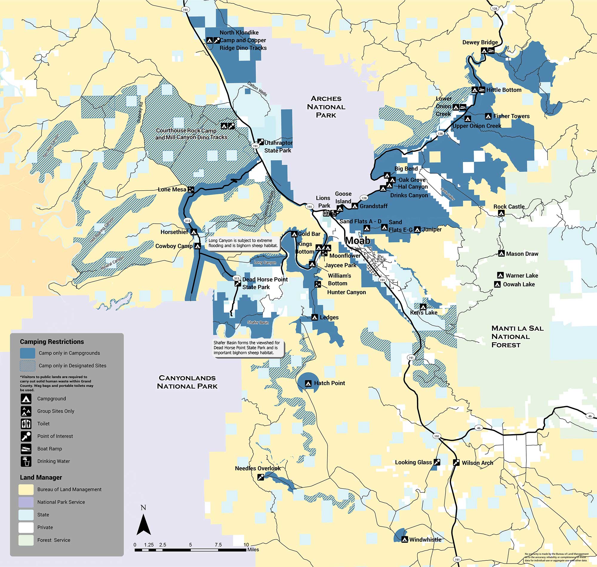
The areas with designated sites (marked with green hatch lines) are summarized below:
There are several areas in which no sites are designated and camping is not allowed (orange). The Shafer Basin, which forms the viewshed of Dead Horse Point State Park and is important bighorn sheep habitat, has no sites. Long Canyon, which is subject to extreme flooding and is also important bighorn habitat, has no sites. No camping is allowed in the Mill Creek area immediately east of the city of Moab, or on the west side of Spanish Valley. No camping is allowed within one mile of developed recreation sites in the Canyon Rims Recreation Area. If you have any questions about primitive camping restrictions please contact the Moab BLM Office at (435) 259-2100.
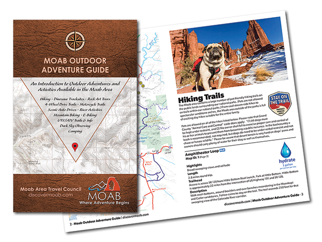
Introducing the Moab Outdoor Adventure Guide—a comprehensive resource showcasing the diverse range of adventures and activities awaiting you on the public lands surrounding Moab. Whether you’re drawn to hiking, off-road driving, river activities, scenic byways, dark sky observing, mountain biking, e-biking, rock art tours, camping, dinosaur trails, or exploring with your furry companions, this guide is your ultimate companion.
The Moab Outdoor Adventure Guide is now available, free of charge, at the Moab Information Center located at the corner of Main and Center Streets in Moab. For your convenience, an ebook version is also available for download. To access the guide online and embark on your virtual exploration, simply Click here.
This comprehensive guide is designed to lead you on the right path, ensuring you make the most of your Moab adventure. Discover the countless possibilities and make memories that will last a lifetime. Get your copy of the Moab Outdoor Adventure Guide today and let the excitement begin!
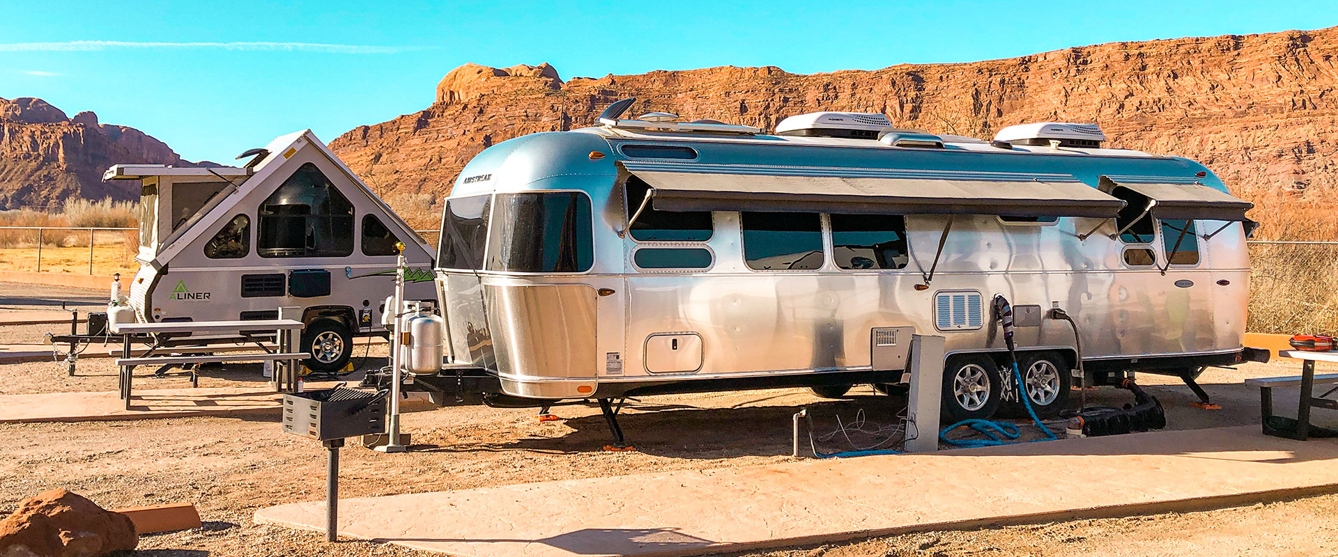
Commercial Campgrounds
RV Hookups
Tent Sites
Cabins/Glamping Sites
RV Length
Glamping
Dump Station
Laundry
Pool
Hot Tub
Internet Access
Playground
Group Sites
Pets
Campfires Allowed
Open All Year

Campgrounds
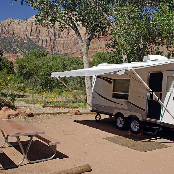
Commercial (privately owned) campgrounds generally have many conveniences such as showers, running water, RV hook-ups, flush toilets, and more. They also generally accept reservations. This list includes all commercial campgrounds in the Moab area.
Click here for a list of campgrounds…
BLM campgrounds are located in extremely scenic locations and are very well-maintained. Many BLM campsites are suitable for RVs, although hook-ups are not available. There are many Bureau of Land Management (BLM) campgrounds on the public lands surrounding Moab, although most fill daily during mid-March-May and Sept-October. Please note that most individual campsites are available on a first come – first served basis only and No reservations are accepted. Plan to arrive earlier in the day. Starting March 1, 2021, Ken’s Lake Campground will be reservable via recreation.gov. Some campgrounds have reservable group sites through recreation.gov.
Click here for a list of campgrounds…
Campgrounds within the State Parks, National Parks & National Forests generally have less amenities than privately owned campgrounds (no showers, etc.), however they are often located within exceptionally scenic areas.
Click here for a list of campgrounds…
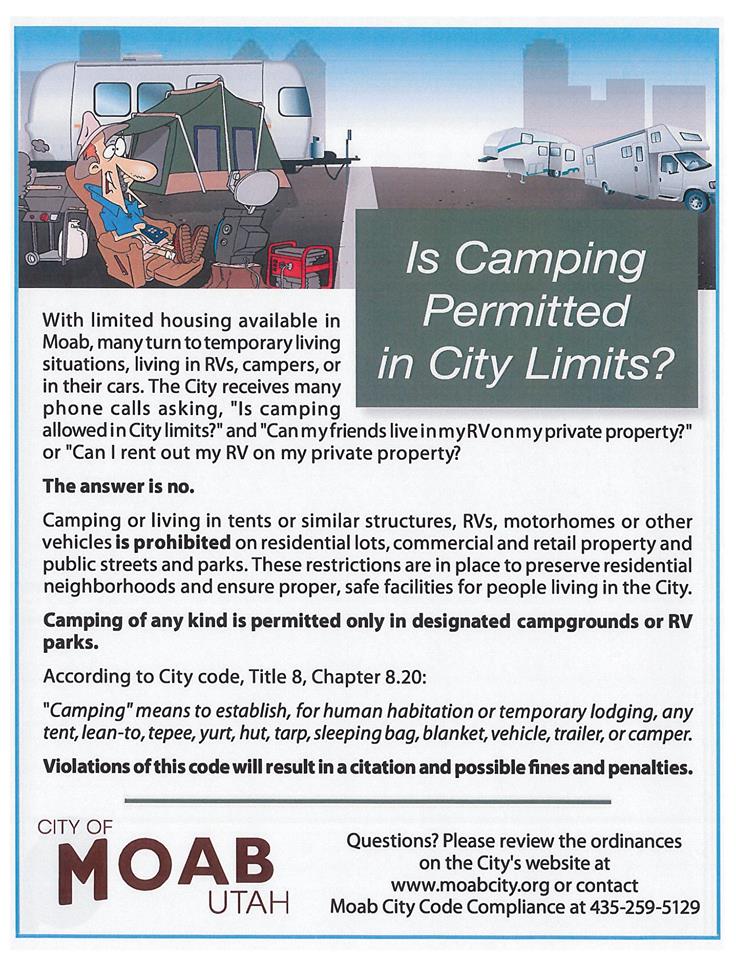
It is illegal to camp inside city limits unless you are in a designated campground. Moab police officers do enforce the city code that prohibits camping. At the very least you may be awakened in the middle of the night and asked to move, but they may also issue citations. Illegal campsites discovered in city limits will be dismantled and removed, including all property associated with the campsite.
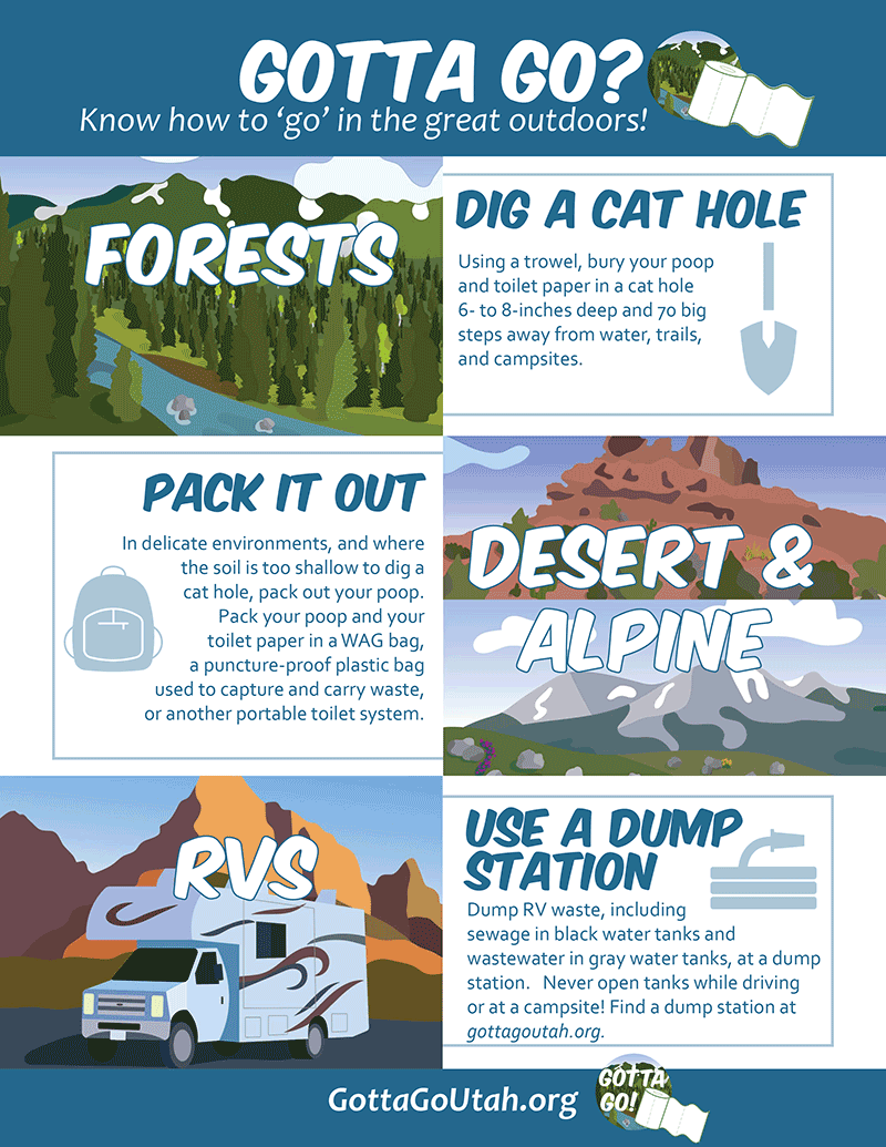
With recreation increasing on Utah’s public lands every year, improper disposal of human waste can lead to:
Recyclables:
Community Recycling Center
1000 East Sand Flats Rd
435-259-8640
8:00 AM – 5:00 PM (Monday – Friday)
8:00 AM – 12:30 PM (Saturday)
Closed Sunday
All other trash:
Moab Transfer Station
2295 S Hwy 191 (3 Miles South of Moab)
435-259-6314
8:00 AM – 4:00 PM (Monday – Friday)
8:00 AM – 12:00 PM (Saturday)
Closed Sunday
Our forests are threatened by invasive tree-killing insects and diseases that can hitchhike on firewood. Pests like the emerald ash borer, gypsy moth, and Asian longhorned beetle don’t move far on their own – but they can travel hundreds of miles in a single day in a bundle of contaminated firewood. Once transported to uninfested areas, these insects and diseases can emerge and start new damaging outbreaks.